Hikes in Zion National Park

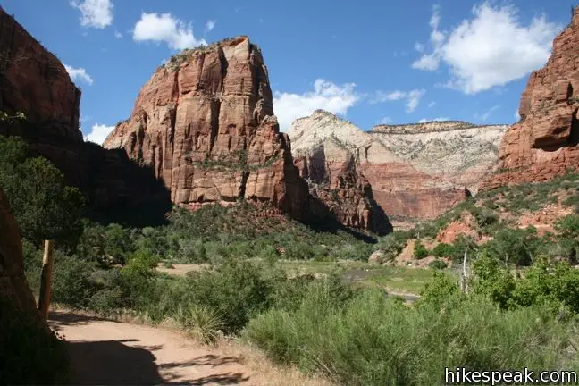
Created in 1919, Zion National Park is Utah’s first national park. Today the park protects 229 square miles of canyon country and receives close to three million visitors each year. Zion National Park sits on a meeting point of the Mojave Desert, Great Basin, and Colorado Plateau, culminating in distinct geologic features and immense natural diversity. The tall sandstone walls of Zion Canyon are nothing short of extraordinary.

Highlights of Zion National Park

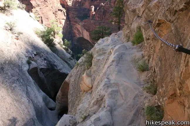
  • This 5.2-mile hike takes a world famous route up the east rim of Zion Canyon, ascending to a towering slab of sandstone jutting into the center of the canyon with thousand foot drop-offs and expansive views.
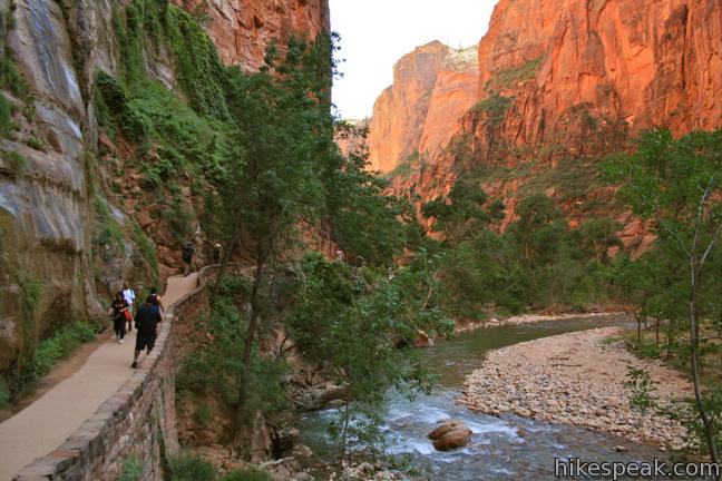
  • This popular 1.8-mile hike bordering the Virgin River ends at the bottom of the "Narrows" north of Zion Canyon.
  • This 1-mile hike visits a scenic viewpoint looking west over Zion Canyon.
  • This 3.5-mile lollipop loop reaches a panoramic overlook on the side of Zion Canyon.
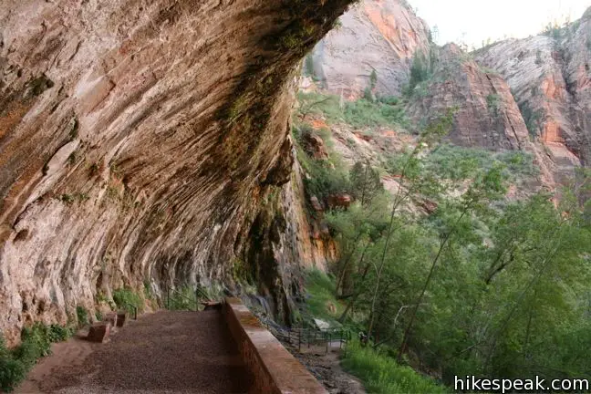
  • This 0.4-mile hike visits an alcove in the sandstone wall of Zion Canyon where water seeps out of the rock, nourishing hanging gardens and plentiful vegetation.
  • This 3.3-mile hike ascends the east rim of Zion Canyon above Weeping Rock, and then crosses dramatic cliffs to reach a hanging canyon housing a small natural arch.
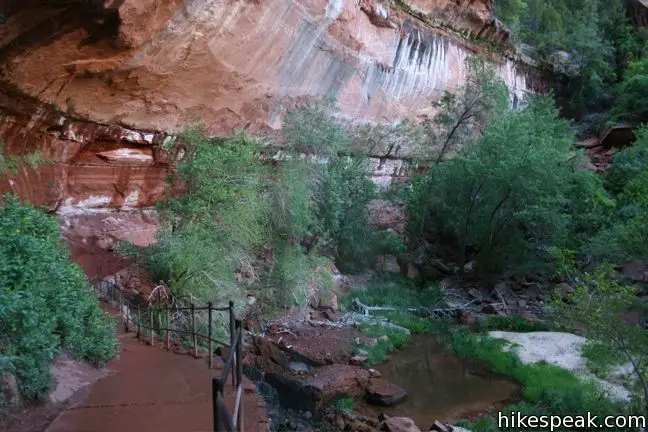
  • This 2.4-mile loop visits three tiers of enchanting pools by incorporating the Lower, Middle, and Upper Emerald Pools Trails.

Hiking Zion National Park

Most visits to Zion National Park are concentrated in a 15-mile stretch of Zion Canyon, where the Virgin River has carved dramatic orange walls out of the sandstone. To help preserve this popular canyon, traffic is restricted to park shuttles from mid-March through mid-November. Nine stops established throughout the canyon make it easy to get to and from each trailhead. The shuttles run from around 7 a.m. to 11 p.m. Waiting time is usually less than ten minutes.

Zion National Park has a entrance fee, which is $35 per vehicle, $30 per motorcycle,
and $20 per person on a bike or walking into the park (as of 2019). Each entry is valid for a week. Annual America the Beautiful Federal Recreational Lands passes may also be used.

Campgrounds are located at the south end of Zion Canyon. Drinking water is available near most trailheads in Zion Canyon, which is important because summer temperatures are typically into the 100s. It is actually possible to hike in the shade for most of the day within the deep trench of Zion Canyon, which can be helpful on those hot days.

Zion National Park gives visitors much to explore and appreciate.

Zion National Park Hikes

This collection of trails in Zion National Park lists hikes from north to south. The table may also be sorted alphabetically or by distance to help you pick your next hike. Each trail links to its own report complete with photos, GPS maps, elevation profiles, directions, and all the other information needed to locate and enjoy these hikes. You can also view hikes around Zion National Park on the Hike Finder Map.

TrailDescriptionDistance Location
Zion Riverside Walk200Riverside Walk
This popular out and back hike bordering the Virgin River ends at the bottom of the "Narrows" north of Zion Canyon.
1.8 miles
60 feet
37.2852,
-112.9477
Zion Weeping Rock210Weeping Rock
This out and back hike visits an alcove in the sandstone wall of Zion Canyon where water seeps out of the rock, nourishing hanging gardens and plentiful vegetation.
0.4 miles
100 feet
37.2709,
-112.9385
Zion Canyon220Hidden Canyon
This out and back hike ascends the east rim of Zion Canyon above Weeping Rock, and then crosses dramatic cliffs to reach a hanging canyon housing a small natural arch.
3.3 miles
850 feet
37.2709,
-112.9385
Zion Angels Landing230Angels Landing
This out and back hike takes an incredible route up the east rim of Zion Canyon ascending to a towering slab of sandstone jutting into the center of the canyon. The expansive views and thousand foot drop-offs have made this trail world famous.
5.2 miles
1,500 feet
37.2592,
-112.9513
Zion Emerald Pools240Emerald Pools
This loop visits three tiers of enchanting pools by incorporating the Lower, Middle, and Upper Emerald Pools Trails.
2.4 miles
350 feet
37.25095,
-112.9580
Zion Patriarchs250Court of the Patriarchs
This brief walk heads up a short rise in the center of Zion Canyon to offer a nice view of the surrounding sandstone peaks.
0.1 miles
40 feet
37.2370,
-112.9606
Zion Canyon Overlook260Canyon Overlook Trail
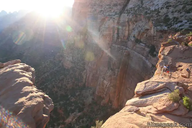
This short hike visits a scenic viewpoint looking west over Zion Canyon.
1 mile
150 feet
37.2134,
-112.9406
Zion Watchman Trail270Watchman Trail
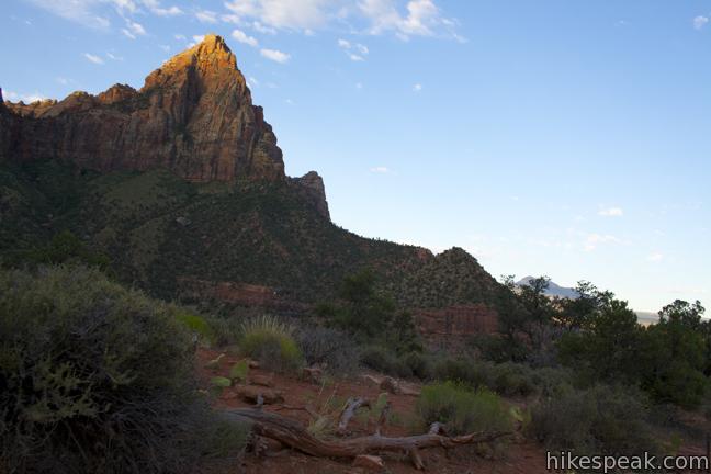
This lollipop loop reaches a panoramic overlook on the side of Zion Canyon.
3.5 miles
500 feet
37.20128,
-112.986415
View Utah trails and campground in a larger map
Or explore hikes around Zion National Park on the Hike Finder Map
hikespeak
Watchman Trail Zion National Park hike
The closest trail to the south entrance of Zion Nation Park, and one of the best introductions to Zion, is Watchman Trail. This 3.5-mile lollipop loop climbs 500 feet to a rocky bench on the east side of Zion Canyon. The destination serves up stunning views of a nearby tower named The Watchman and several standout rock formations on the walls of Zion Canyon. From the Zion National Park... Read more.
OK! Add to trails I’ve hiked
OK! Add to trails I want to hike
Tagged with · Desert Canyons · National Parks · Zion Canyon
Distance: 3.5 miles · Elevation change: 500 feet
By: Published: Last updated: December 31, 2017
Canyon Overlook Trail Zion National Park hike
Rarely is a mile-long hike as action packed and rewarding as Canyon Overlook Trail. The overlook sits on the rim of Pine Creek Canyon, which adjoins Zion Canyon to provide massive views of thousand-foot tall sandstone bluffs. There are ravines and overhangs along the short trail that will keep you entertained along the way. This excellent hike is appealing to all, especially those with... Read more.
OK! Add to trails I’ve hiked
OK! Add to trails I want to hike
Tagged with · Desert Canyons · National Parks · Zion Canyon
Distance: 1 mile · Elevation change: 150 feet
By: Published: Last updated: December 31, 2017
Riverside Walk Zion National Park trail river narrows hike
Riverside Walk accesses the notorious narrows north of Zion Canyon, making it one of the most popular trails in Zion National Park. To the end of the trail (at the start of the narrows) and back is a 1.8-mile hike over a level walkway bordering the Virgin River. Those looking to escape the Utah summer heat can leave the trail at any of several river access points to take a refreshing swim. ... Read more.
OK! Add to trails I’ve hiked
OK! Add to trails I want to hike
Tagged with · Creeks · Desert Canyons · National Parks · Zion Canyon
Distance: 1.8 miles · Elevation change: 60 feet
By: Published: Last updated: December 31, 2017
Moab Campgrounds Utah Bureau of Land Management Camping Areas
If you are visiting Arches or Canyonlands and are planning to camp, you should know that camping within these national parks is quite limited. Fortunately, the Bureau of Land Management operates over two dozen developed campgrounds (with over 400 individual sites) outside these parks around the city of Moab. Each of the BLM campgrounds are first-come first-serve, so it is best to arrive... Read more.
By: Published: Last updated: February 10, 2020
Utah Hikes Negro Bill Canyon Trail Morning Glory Bridge hike Colorado River Moab Utah Hike
This 4.65-mile round trip hike starts above the banks of the Colorado River east of Moab, Utah, and travels up a scenic canyon alongside a much smaller stream. The trek terminates at a stunning 243-foot long natural bridge, the sixth largest natural rock span in America. The level dirt trail to Morning Glory Bridge ascends just 300 feet and offers plenty of serenity along the way. ... Read more.
OK! Add to trails I’ve hiked
OK! Add to trails I want to hike
Tagged with · Bureau of Land Management · Creeks · Desert Canyons · Free Trails · Moab · Natural Bridges
Distance: 4.65 miles · Elevation change: 300 feet
By: Published: Last updated: February 10, 2020