Trails and campgrounds across America

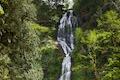
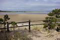
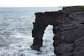
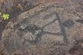
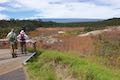
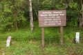
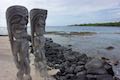
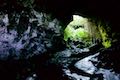
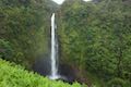
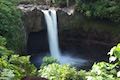
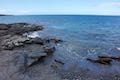
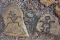
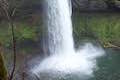
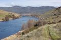
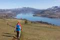
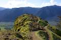
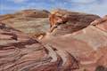
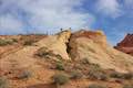
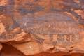
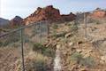
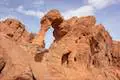
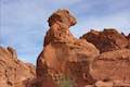
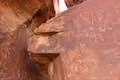
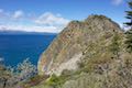
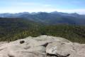
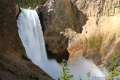
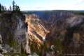
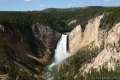
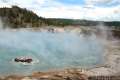
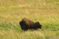
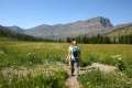
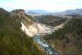
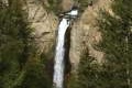
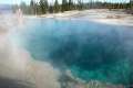
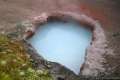
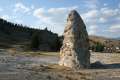
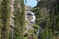
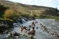
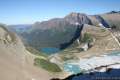
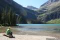
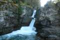
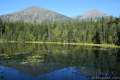
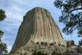
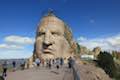
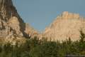
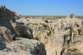
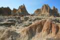
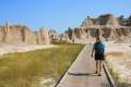
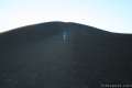
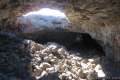
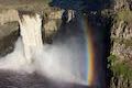
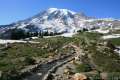
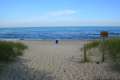
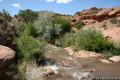
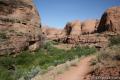
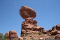
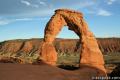
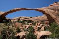
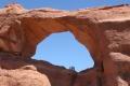
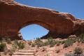
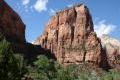
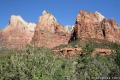
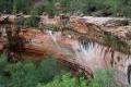
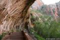
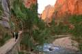
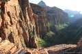
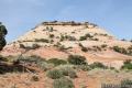
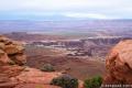
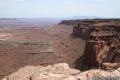
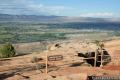
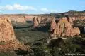
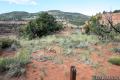
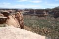
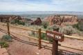
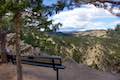
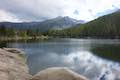
Most of the trails on hikespeak.com are in California, but if you’re traveling to another state, there are lots of cool places to visit. Pick a state above to begin exploring. You will find information on some of America’s exceptional national parks: Arches, Badlands, Canyonlands, Glacier, Hawai‘i Volcanoes, Indiana Dunes, Mount Rainier, Rocky Mountain, Yellowstone, and Zion.

Select a States

Hiking in America

Trails and attractions outside California

  • Maple Ridge Loop
  • Munson Creek Falls
  • Clay Myers State Natural Area at Whalen Island
  • Oceanside Tunnel Beach
  • Holei Sea Arch
  • Hawaii Petroglyphs Trail
  • Sulphur Banks Steaming Bluff Loop
  • Kipukapuaulu Trail Hawaii
  • Pu'uhonua O Honaunau National Historical Park
  • Kaumana Caves Hike
  • Akaka Falls Hike
  • Rainbow Falls
  • Waipio Lookout Hawaii
  • Waipio Valley Hike
  • Kiholo Bay Wainanalii Lagoon Hike
  • Kalahuipua'a Trail and Fishponds Loop
  • Puako Petroglyph Archeological District
  • Scouters Mountain Hike
  • Alder Island Hike Lincoln City
  • Camassia Natural Area
  • Canemah Bluff Hike
  • Trail of Ten Falls Silver Falls State Park
  • South Falls Silver Falls State Park
  • Round Lake Loop & Pothole Falls
  • Deschutes River Trail Loop
  • Dog Mountain Hike
  • Coyote Wall Hike
  • Hamilton Mountain Trail
  • Beacon Rock Trail
  • Hood River Pipeline Trail
  • Trillium Lake Trail
  • Old Salmon River Trail
  • Mirror Lake Trail
  • Catherine Creek Arch
  • Catherine Creek Wildflower Trail
  • George Himes Trail
  • Vista House
  • Angel's Rest
  • Tualatin Hills Nature Park
  • Holman Lane – Wildwood Trail – Birch Trail Loop
  • Dogwood Trail - Alder Trail Loop
  • Wild Cherry Trail Loop Forest Park
  • Wild Cherry Trail - Alder Trail Loop
  • Trillium Trail
  • Tryon Creek State natural Area
  • Tumalo Falls
  • Tumalo Falls Loop
  • Benham Falls
  • Trail of the Molten Land Bend
  • Trail of the Whispering Pines Bend
  • Lava Butte Hike Bend
  • Black Butte Trail
  • West Metolius River Trail
  • Clear Lake Loop
  • Terwilliger Hot Springs
  • Saddle Mountain Hike
  • Beaver Falls Hike
  • Ecola State Park Hike
  • Cape Meares State Park Hike
  • Cape Kiwanda
  • Cape Lookout Trail
  • Lava River Cave Hike Bend
  • Marquam Nature Park
  • Shevlin Park Loop Trail
  • Archie Briggs Canyon Trail
  • Pilot Butte Bend
  • Head of the Metolius River Trail
  • Scenic Drive
  • Calico Hills Trail
  • Lost Creek Canyon
  • Willow Springs Loop
  • Calico Tanks Trail
  • Red Spring Boardwalk
  • White Domes Trail
  • Fire Wave Hike
  • Rainbow Vista Trail
  • Mouse's Tank Trail Petroglyph Canyon
  • Valley of Fire Road
  • Petrified Logs Trail
  • Elephant Rock Hike
  • Balancing Rock Trail
  • Atlatl Rock Trail
  • Cave Rock Trail
  • Forest Loop Trail
  • Pond Trail and Marsh Trail Loop
  • Ravine Trail Vernal Pool Trail and Oak Trail Loop
  • High Line Trail
  • Green Lake State Park
  • Beaver Lake Snowshoe
  • Clark Reservation State Park
  • North County National Scenic Trail
  • Tinker Falls
  • Labrador Hollow Boardwalk
  • Rock Lake
  • Sawyer Mountain
  • Grassy Pond
  • Buttermilk Falls
  • Cascade Mountain
  • Uncle Tom's Trail
  • North Rim Trail
  • Lookout Point Yellowstone
  • Point Sublime
  • The brink of the Upper Falls on the Grand Canyon of the Yellowstone River
  • Artist Point Grand Canyon of the Yellowstone River
  • Inspiration Point on the Grand Canyon of the Yellowstone River
  • Porcelain Basin of Norris Geyser Basin
  • Back Basin of Norris Geyser Basin
  • Old Faithful Geyser
  • Fountain Paint Pot Trail
  • Midway Geyser Basin
  • Biscuit Basin Loop Walkway
  • Lamar Valley Bison
  • Pebble Creek Trail
  • Mud Volcano Area
  • Calcite Springs Overlook Trail
  • Yellowstone Tower Fall
  • Monument Geyser Basin
  • West Thumb Geyser Basin
  • Yellowstone Riddle Lake
  • Artists' Paintpots Trail
  • Mammoth Hot Springs
  • Yellowstone Wraith Falls
  • Boiling River Trail
  • Glacier Overlook
  • Highline Trail Glacier National Park
  • Grinnell Lake Trail Glacier National Park
  • Saint Mary Falls Trail Virginia Falls Glacier National Park
  • Johns Lake Trail Glacier National Park
  • Window Trail
  • Crazy Horse Volskmarch
  • Rankin Ridge Nature Trail
  • Cliff Shelf Nature Trail
  • Notch Trail
  • Door Trail
  • Window Trail
  • Inferno Cone Craters of the Moon
  • Lava Cave Craters of the Moon
  • Palouse Falls
  • Skyline Trail Mount Rainier
  • Mount Fremont Lookout Trail
  • Naches Peak Loop Trail
  • Silver Falls Trail Mount Rainier
  • Lava Canyon Trail
  • June Lake Trail
  • Ape Cave Lava Tube
  • Trail of Two Forests
  • Guler Ice Cave
  • Latourell Falls
  • Wahclella Falls
  • Punchbowl
  • Multnomah Falls
  • Multnomah-Wahkeena Loop
  • Ponytail Falls
  • Lower Oneonta Falls
  • Spencer Butte Eugene
  • Powell Butte Hike
  • Wildwood Trail to Pittock Mansion
  • Lower Macleay trail to Stone House
  • Lower Macleay Park to Pittock Mansion
  • Dune Succession Trail
  • Mill Creek Moab hiking
  • Morning Glory Bridge Moab hiking
  • Balanced Rock Arches National Park
  • Delicate Arch Trail Arches National Park
  • Double Arch Trail Arches National Park
  • Landscape Arch Trail Arches National Park
  • Skyline Arch Trail Arches National Park
  • Window Arch Trail Arches National Park
  • Angels Landing Hike Zion
  • Watchman Trail Hike Zion
  • Patriarchs Viewpoint Zion
  • Hike Zion Emerald Pool
  • Hike Zion Hidden Canyon
  • Hike Zion Weeping Rock
  • Hike Zion Riverside Walk
  • Canyon Overlook Trail Hike Zion
  • Canyonlands hike Aztec Butte
  • Grand View Point Canyonlands
  • Canyonlands hike Mesa Arch Trail
  • murphy point
  • Upheaval Dome Canyonlands hike
  • Whale Rock Canyonlands hike
  • Canyonlands hike Overlook Trail
  • Canyonlands Island in the sky overlooks
  • Colorado National Monument Window Rock
  • Colorado National Monument Canyon Rim Trail
  • Colorado National Monument Alcove Nature
  • Colorado National Monument Ottos Trail
  • Colorado National Monument Canyon
  • Colorado National Monument Coke Ovens
  • Colorado National Monument Devils Kitchen Trail
  • Colorado National Monument Overlook
  • Colorado National Monument Balanced Rock
  • Rattlesnake Gulch Trail Eldorado Canyon State Park
  • Bear Lake Trail
  • Emerald Lake Trail

Still searching?

hikespeak
Marquam Nature Park Loop Hike West Hills Southwest Portland Oregon Marquam Trail
Marquam Nature Park is walking distance from downtown Portland, but is tucked away and remains less well known than other parks in the West Hills. Marquam Nature Park provides ample woodland solitude, despite its proximity to downtown. Explore this underused parcel of the West Hills near OHSU on a multi-trail loop hike. To see most of the park, combine Shelter Loop Trail, Marquam Trail,... Read more.
By: Published: Last updated: September 9, 2019
Shevlin Loop Trail Bend Oregon Hike Shevlin Park Tumalo Creek
Shevlin Loop Trail explores pine forests along Tumalo Creek in Shevlin Park, which is just four miles west of downtown Bend. This pleasant woodland trail is mostly easy with a few rolling sections along the bluffs that border the creek. The loop is 4.75 miles long and explores much of Shevlin Park's 647 acres. The hike has 240 feet of elevation change and crosses lovely Tumalo Creek at two... Read more.
OK! Add to trails I’ve hiked
OK! Add to trails I want to hike
Tagged with · Bend · Cascade Range · Creeks · Free Trails · Shevlin Park · Tumalo Creek
Distance: 4.75 miles · Elevation change: 240 feet
By: Published: Last updated: January 11, 2018
Archie Briggs Canyon Trail Bend Oregon Hike Deschutes River Trail Overlook
Archie Briggs Natural Area presents views over a dramatic stretch of the Deschutes River north of Bend. The river makes a sweeping curve beneath tall cliffs of volcanic rock and is backed by grand mountains like Black Butte and Mount Jefferson. Gaze down the canyon from atop cliffs on the south side of the curve in the river by an intersection of Deschutes River Trail and Archie Briggs... Read more.
OK! Add to trails I’ve hiked
OK! Add to trails I want to hike
Tagged with · Archie Briggs Natural Area · Awbrey Butte · Bend · Cascade Range · Deschutes River · Free Trails
Distance: 1.25 miles · Elevation change: 325 feet
By: Published: Last updated: December 21, 2017
Pilot Butte Trail Bend Oregon Hike Pilot Butte Nature Trail Pilot Butte State Park
Pilot Butte is the biggest landmark in the city of Bend. This extinct cinder volcano is visible from almost everywhere in the city and its summit surpasses expectations with knock-out views of over Bend toward high desert landscapes and snowcapped Cascade Mountains. An extraordinary collection of mountains that includes Mount Hood, Mount Jefferson, Three Fingered Jack, the Three Sisters... Read more.
OK! Add to trails I’ve hiked
OK! Add to trails I want to hike
Tagged with · Bend · Buttes · Free Trails · Pilot Butte State Park · Summits
Distance: 1.8 miles · Elevation change: 475 feet
By: Published: Last updated: January 9, 2018
Head of the Metolius Springs Metolius River Headwaters Deschutes National Forest Central Oregon Hike
Gaze north from the observation site at the end of Head of the Metolius Trail and you'll have a beautiful (if traditional) view of a river flowing through a pine forest toward Mount Jefferson. Look in the other direction to see something surprising. The river springs to live all at once from a gushing source. The trail to Head of the Metolius in Deschutes National Forest is a quarter mile... Read more.
OK! Add to trails I’ve hiked
OK! Add to trails I want to hike
Tagged with · Camp Sherman · Cascade Range · Deschutes National Forest · Free Trails · Sisters
Distance: 0.5 miles · Elevation change: 35 feet
By: Published: Last updated: December 21, 2017
Scenic Drive Red Rock Canyon National Conservation Area Las Vegas Nevada Scenic Loop Road Red Rock Canyon
Scenic Drive is a picturesque loop road through Red Rock Canyon National Conservation Area. The road offers a memorable drive or bike ride with access to numerous trails and overlooks. Scenic Drive is 12.5 miles long if you drive straight through and about 13 miles long if you pull off at each of the various overlooks. A few things to know from the start: Scenic Drive is a one-way road.... Read more.
By: Published: Last updated: August 21, 2019
Calico Hills Red Rock Canyon National Conservation Area Las Vegas Nevada Calico I and Calico II Hike Calico One to Calico Two
The whimsically concocted concentration of vibrant red-orange Aztec sandstone known as the Calico Hills is a must-see destination in Red Rock Canyon National Conservation Area. After leaving the visitor center, the Scenic Drive heads straight to the Calico Hills, passing three overlooks and trailheads, Calico I, Calico II, and Sandstone Quarry (the start of Calico Tanks Trail). You could... Read more.
OK! Add to trails I’ve hiked
OK! Add to trails I want to hike
Tagged with · Bureau of Land Management · Las Vegas
Distance: 2.1 miles · Elevation change: 200 feet
By: Published: Last updated: June 12, 2021
Willow Springs Loop Pictographs Red Rock Canyon National Conservation Area Las Vegas Nevada Lost Creek Canyon Willow Springs Picnic Area Hike
Willow Springs Loop explores an area off the northwest side of the Scenic Drive through Red Rock Canyon National Conservation Area. While it is bordered by steep mountains, the loop actually crosses easy terrain along Red Rock Wash. Visit pictographs left behind by Native American's near Willow Springs Picnic Area and meander through desert landscapes. A spur to Lost Creek Waterfall, a... Read more.
OK! Add to trails I’ve hiked
OK! Add to trails I want to hike
Tagged with · Bureau of Land Management · Desert Canyons · Las Vegas · Pictographs · Waterfalls
Distance: 1.33 miles · Elevation change: 165 feet
By: Published: Last updated: September 9, 2019