Valley of Fire State Park

Valley of Fire is Nevada’s first state park, founded in 1935 to preserve vibrant red sandstone landscapes and other colorful formations in Southeastern Nevada. The park covers approximately 42,000 acres in the desert northeast of Las Vegas near Lake Mead. Valley of Fire State Park is just one hour’s drive from the Las Vegas Strip.

Highlights of Valley of Fire State Park

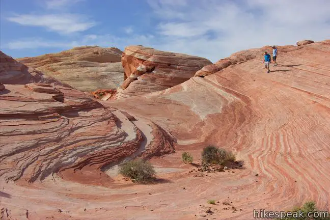
  • This is a real place! Explore the unbelievable stripes on this slickrock formation.
  • This loop is a must-do with incredible scenery around every turn.
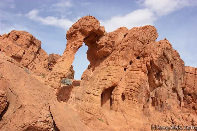
  • With an odd natural arch for a trunk, Elephant Rock is a whole different animal.
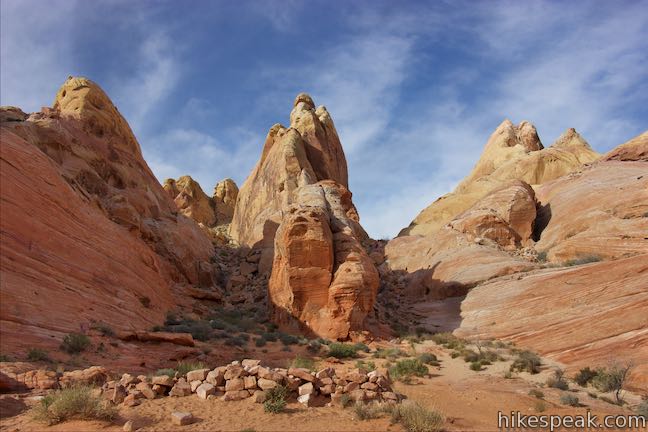
  • See landscapes of just about every color from this hike off White Domes Road.
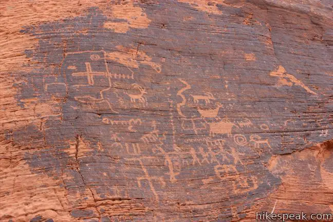
  • Admire petroglyphs in abundance on the trail to Mouse's Tank.
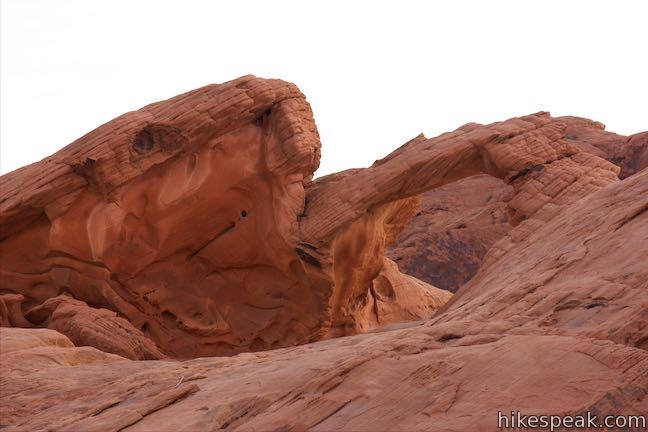
  • See Arch Rock on Scenic Loop Road along with other formations bordering the scenic roads in Valley of Fire State Park.
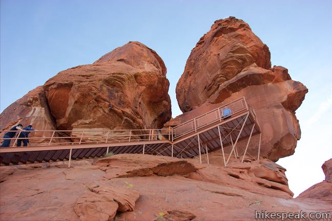
  • March up a flight of stairs to get up close to a collection of petroglyphs carved into a boulder above the desert floor.
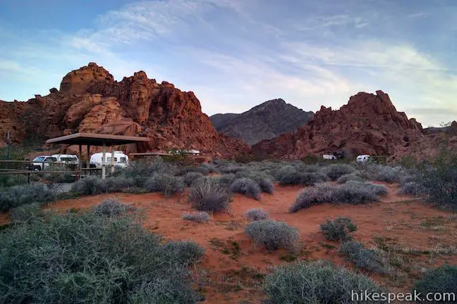
  • Camp up against ridges of red sandstone at this well appointed campground that even has hot showers.

Inside Valley of Fire State Park, visitors can camp between fiery rock formations and explore exciting short hiking trails. One special destination is the Fire Wave, which has orange and white striped rocks that beg to be photographed. White Domes Trail goes through a dynamic landscape, with fascinating formations around every turn, as well as an old film set. Petroglyph Canyon Trail puts the park’s human history on display, showing hikers an abundance of Native America rock art. As if that weren’t enough, the park has natural arches like Elephant Rock as well as petrified logs.

The amazing red sandstone in Valley of Fire State Park took a long time to create. The process started 250 million years ago when an ocean that covered this area retreated and disappeared. Red sands deposited and compacted into sandstone and the sea became a plain. Geologic faults and erosion contorted the landscape to what it is today.

Valley of Fire State Park has a $10 entrance fee per vehicle (price as of 2019). The fee is reduced when entering on a bike. An additional fee is charged to stay at the campgrounds.

Valley of Fire Highway (Valley of Fire Road) travels through the park from west the east between the park’s two entrances. The west entrance gets the most traffic and motorists may have to wait in line to enter the park. White Domes Road passes many natural wonders and is one of the Scenic Drives in Valley of Fire State Park.

Hikes in Valley of Fire State Park

Explore short to moderate hikes in Valley of Fire State Park. The trails below are listed from north to south and can also be sorted alphabetically or by distance to help you pick your next hike. Each trail links to its own report complete with photos, maps, directions, and all the other information needed to locate and enjoy these trails.

TrailDescriptionDistance Location
Fire Wave Hike170Fire Wave Trail
This hike leads to a sensational striped creation where a slickrock depression is painted in waves of orange and beige.
1.5 miles
175 feet
36.4882,
-114.52875
White Domes Trail175White Domes
This short loop is impressive from start to finish as it explores colorful, intricate rock formations, passes and old film set, and slips through a narrow slot canyon.
1.1 miles
150 feet
36.4859,
-114.5329
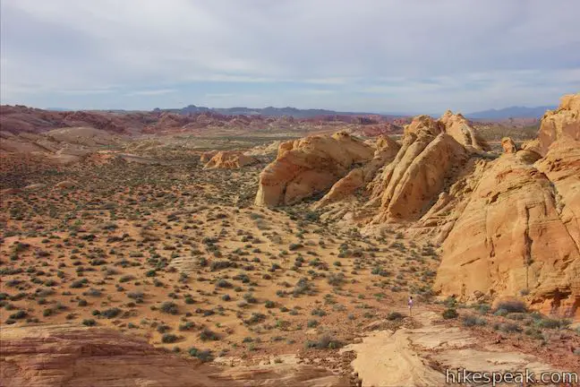
Rainbow Vista Trail180Rainbow Vista
This hike goes through sandstone formations to summit a short crest with 360-degree views over multi-colored landscapes and the hike can be extended down to Fire Canyon Overlook.
0.7 - 1.5 miles
60 - 150 feet
36.45083,
-114.51535
Mouse's Tank Trail Petroglyph Canyon190Petroglyph Canyon Trail to Mouse's Tank
This out and back hike travels past an enormous amount of petroglyphs to a natural basin formed in the sandstone.
0.75 miles
25 feet
36.441,
-114.5165
Balancing Rock Trail200Balancing Rock
This brief hike, which begins next to the Valley of Fire State Park Visitor Center, approaches a rock formation that appears to stand with a bit of magic.
0.25 miles
10 feet
36.42987
-114.51446
Elephant Rock Hike210Elephant Rock
This short hike at the east entrance of Valley of Fire State Park leads to a sandstone formation resembling an elephant with a unique natural arch for a trunk.
0.3 miles
50 feet
36.4289
-114.458175
Atlatl Rock Trail220Atlatl Rock
Step right up a flight of stairs to a platform in front of a group of petroglyphs on the side of a boulder.
0.1 miles
50 feet
36.42306,
-114.550535
Petrified Logs Trail230Petrified Logs Loop
This short hike gets close to petrified logs on the desert floor passing panels that explain how wood is petrified.
0.3 miles
45 feet
36.42266
-114.5413
hikespeak
Chimney Beach Trail Lake Tahoe Nevada Chimney Beach Hike Humboldt-Toiyabe National Forest
Before your visit to Lake Tahoe goes up in smoke, take a hike to Chimney Beach - where a standing-on-its-own fireplace and chimney serve as an unsual landmark for a lovely little cove. The brick chimney is all that's left of an old cabin built in the sand between boulder-strewn points on the east shore of Lake Tahoe. If curiosity about the chimney draws you to Chimney Beach, the beautiful... Read more.
OK! Add to trails I’ve hiked
OK! Add to trails I want to hike
Tagged with · Beaches · Carson City · Free Trails · Ruins · South Lake Tahoe
Distance: 1.1 miles · Elevation change: 215 feet
By: Published: Last updated: September 11, 2024
Cave Rock Trail Lake Tahoe Nevada Overlook Hike
Gaze out from Route 50 as it travels along the southeast side of Lake Tahoe and you'll find nice views of the lakeshore and its surrounding mountains. Seven miles up from the state border in South Lake Tahoe, Nevada Route 50 slips through a tunnel in a tall pointed ridge of volcanic rock. The road itself is scenic, but the sight of Cave Rock should have you speculating how superb things must... Read more.
OK! Add to trails I’ve hiked
OK! Add to trails I want to hike
Tagged with · Free Trails · Glenbrook · South Lake Tahoe · Summits
Distance: 0.9 miles · Elevation change: 165 feet
By: Published: Last updated: September 11, 2024
Scenic Drive Red Rock Canyon National Conservation Area Las Vegas Nevada Scenic Loop Road Red Rock Canyon
Scenic Drive is a picturesque loop road through Red Rock Canyon National Conservation Area. The road offers a memorable drive or bike ride with access to numerous trails and overlooks. Scenic Drive is 12.5 miles long if you drive straight through and about 13 miles long if you pull off at each of the various overlooks. A few things to know from the start: Scenic Drive is a one-way road.... Read more.
By: Published: Last updated: August 21, 2019
Calico Hills Red Rock Canyon National Conservation Area Las Vegas Nevada Calico I and Calico II Hike Calico One to Calico Two
The whimsically concocted concentration of vibrant red-orange Aztec sandstone known as the Calico Hills is a must-see destination in Red Rock Canyon National Conservation Area. After leaving the visitor center, the Scenic Drive heads straight to the Calico Hills, passing three overlooks and trailheads, Calico I, Calico II, and Sandstone Quarry (the start of Calico Tanks Trail). You could... Read more.
OK! Add to trails I’ve hiked
OK! Add to trails I want to hike
Tagged with · Bureau of Land Management · Las Vegas
Distance: 2.1 miles · Elevation change: 200 feet
By: Published: Last updated: June 12, 2021
Willow Springs Loop Pictographs Red Rock Canyon National Conservation Area Las Vegas Nevada Lost Creek Canyon Willow Springs Picnic Area Hike
Willow Springs Loop explores an area off the northwest side of the Scenic Drive through Red Rock Canyon National Conservation Area. While it is bordered by steep mountains, the loop actually crosses easy terrain along Red Rock Wash. Visit pictographs left behind by Native American's near Willow Springs Picnic Area and meander through desert landscapes. A spur to Lost Creek Waterfall, a... Read more.
OK! Add to trails I’ve hiked
OK! Add to trails I want to hike
Tagged with · Bureau of Land Management · Desert Canyons · Las Vegas · Pictographs · Waterfalls
Distance: 1.33 miles · Elevation change: 165 feet
By: Published: Last updated: September 9, 2019