Nicholas Flat Trail – Willow Creek Trail Loop to Ocean Vista in Leo Carrillo State Park

At the west end of Malibu where Mulholland Highway meets PCH, you’ll find Leo Carrillo State Park. Well known for its beaches and surfing, this park has offerings for hikers too, like the trek up Nicholas Flat Trail to an oak-wrapped grassland with a small pond, which is 7 miles round trip or more. For a shorter hike, combine the bottom of Nicholas Flat Trail with Willow Creek Trail, for a 2.05-mile hike to an ocean vista. The trails go up opposite sides of a coastal ridge. While ocean views are almost always present, once the trails meet on the ridge top, a short trail will take you to the biggest perspective of the Pacific. This short hike in Leo Carrillo State Park (which can be paired with a day at the beach) has 620 feet of elevation change and provides rewarding coastal exercise.
Begin from a parking area within Leo Carrillo State Park just off Pacific Coast Highway. The day use lot is between the park’s campground and its popular beach. An underpass beneath PCH can be used to quickly reach the sand, but walk in the opposite direction to the northeast side of the parking lot toward the park entrance. You will meet the road into the park just across from the signed start of Camp 13 Trail. This 0.6-mile long trail passes along the east side of the campground. More importantly, it reaches a kiosk at the start of Nicholas Flat Trail and Willow Creek Trail after just 0.05 miles.
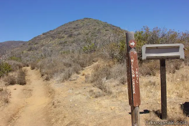
Take the short walk up Camp 13 Trail to the junction in front of the wooden trail kiosk. On the far left is the unmarked continuation of Camp 13 Trail. The other two trails are marked and form the loop to Ocean Vista. Nicholas Flat Trail ascends to the left, taking the ridge for three miles all the way up to Nicholas Flat. The other trail is Willow Creek Trail, which wraps around the ridge to a smaller canyon on the far side. Willow Creek Trail ventures up the canyon to meet Nicholas Flat Trail at a junction on the top of the ridge. A spur leaving this junction ascends to Ocean Vista, a scenic viewpoint atop the crest at the end of the ridge. You may hike this loop in either direction. Nicholas Flat Trail offers a slightly shorter ascent, while Willow Creek Trail has more ocean views. If you don’t mind delaying looking at the ocean, consider beginning with Nicholas Flat Trail.
Nicholas Flat Trail heads north, slowly rising above Camp 13 Trail. The campground is stretched out along the bottom of the broad canyon. Sycamores shade the campground and the banks of Arroyo Sequit. Mulholland Highway traveling along the ridge on the far side of the canyon.
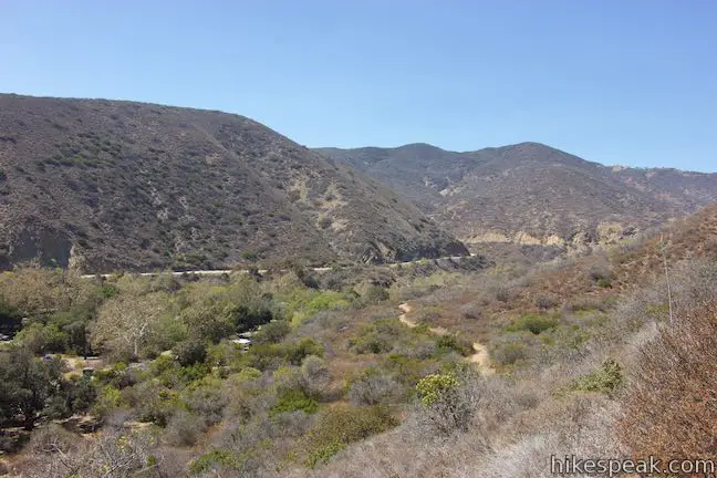
After 0.3 miles, Nicholas Flat Trail rounds a draw in the terrain and continues up the side of the ridge through chaparral. After the draw, you are positioned for nice views out the end of the canyon toward the ocean. The single track then makes its way up a tapered area on the side of the ridge with a couple wide switchbacks.
Eventually, Nicholas Flat Trail doubles back to the south and rises to a marked 4-way junction, 0.9 miles up Nicholas Flat Trail and 0.95 miles from the trailhead. The next leg of Nicholas Flat Trail continues to the left, following the top of the ridge up to Nicholas Flat. Straight ahead, Willow Creek Trail descends the east side of the ridge. This is the return route. First, bear right and take a spur up to Ocean Vista to bag the hike’s big view.
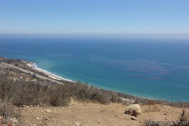
This short trail is just 300 feet long (gaining the final 45 vertical feet). The trail ends at a small clearing at the high spot at the end of the ridge. Enjoy a big view over the Malibu coast and the ocean beyond. An inviting beach extends southeast toward Point Dume. During the whale migration, this would be a fine position to take with a pair of binoculars.
After enjoying the Ocean Vista, turn around and return to the 4-way junction. Bear right down Willow Creek Trail to begin the second half of the loop. This trail weaves down the east side of the ridge into a narrower and more rugged canyon. As you descend, you can look across the canyon toward sandstone formations beneath the higher mountains to the north. After a trio of switchbacks in the first quarter mile, Willow Creek Trail points south toward the mouth of the canyon.
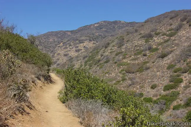
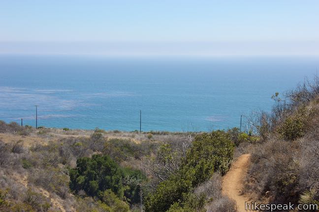
Enjoy head-on ocean views until you exit the canyon after 2/3 of a mile on Willow Creek Trail. The single track curves to the right around the end of the ridge. Without the terrain of two ridges to frame the view, you get broader ocean views as the trail gradually descends from two hundred feet above sea level.
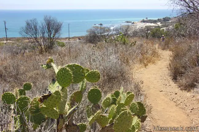
Pass through a few patches of prickly pear cactus to return to the trail junction at the kiosk where the loop began. Bear left down Camp 13 Trail to hike back to the trailhead parking area. The hike to the Ocean Vista between Nicholas Flat Trail and Willow Creek Trail (sometimes called Leo Carrillo Scenic Loop) covers 620 vertical feet in just over two miles.
Dogs and bikes are not allowed on this hike. An entrance fee is required to park in the day use area (which is $12 per vehicle as of 2016). Free parking is also available along Pacific Coast Highway.
Want to hit the beach? Walk across the parking area toward the creek bed at the bottom of the canyon and find the walkway leading under PCH to the coast. Head west along the coast to find nice swimming beaches and fun caves to explore at low tide (below lifeguard station number four).
Woolsey Fire Update: Leo Carrillo State Park has reopened following the November 2018 Woolsey Fire. Check the Leo Carrillo State Park website for additional visitor information.
Directions to the Trailhead
- Take PCH west through Malibu to the park entrance.
- From Santa Monica, it is 28 miles to Leo Carrillo State Park (If you reach Mulholland Highway, you've gone a little too far).
- Drive into the park.
- Go past the entrance booth.
- Turn left into the large day use parking area.
Trailhead Location
Trailhead address: 35000 West Pacific Coast Highway, Malibu, CA 90265
Trailhead coordinates: 34.04687, -118.93308 (34° 02′ 48.73″N 118° 55′ 59.08″W)
View Santa Monica Mountains in a larger map
Or view a regional map of surrounding Los Angeles trails and campgrounds.
Nicholas Flat Trail


Ocean Vista


Willow Creek Trail


 | Nicholas Flat via Nicholas Flat Trail This scenic 7 to 7.6-mile hike ventures from the coast in Leo Carrillo State Park up into the mountains to a grassy flat with a small pond. |
 | Nicholas Flat via Malibu Springs Trail This scenic 7-mile round trip hike ascends 1,425 feet to meadows and a pond on Nicholas Flat in Leo Carrillo State Park. |
 | Arroyo Sequit This 2.05-mile loop winds around the upper reaches of a canyon carved by the East Fork of Arroyo Sequit and has grand views of the Santa Monica Mountains. |
 | Charmlee Wilderness Park This 3.25-mile loop is one of several possible hikes in this bluff-top park with ocean views over Malibu. |
 | Zuma Canyon This 2.8-mile hike leaves a coastal Malibu neighborhood to explore rustic Zuma Canyon. |
 | Sandstone Peak This 6.25-mile loop summits the tallest peak in the Santa Monica Mountains. |
 | The Grotto This 3-mile out and back hike visits a remote grotto in the Santa Monica Mountains National Recreation Area. |
 | More trails in the Santa Monica Mountains Explore other destinations in the range. |
 | Leo Carrillo State Park Campground This coastal Malibu campground offers 135 sites with easy beach access and nearby trails. |
 | More campgrounds around LA Check out a few other places to camp in Los Angeles County. |
Willow Creek Trail on trails.lacounty.gov
Trails of Leo Carrillo State Park and Arroyo Sequit on venturacountytrails.org
Nicholas Flat Trail - Willow Creek Trail Loop on calihike.blogspot.com
Nicholas Flat Trail - Willow Creek Trail Loop on outdoorproject.com
Common Questions about Nicholas Flat Trail – Willow Creek Trail Loop to Ocean Vista in Leo Carrillo State Park
- Is the trail open?
- Yes. You should expect to find that Nicholas Flat Trail - Willow Creek Trail Loop is open. There are no recent reports of trail closures. If you discover that the trail is closed, please help your fellow hikers by reporting a closure.
- Do I need a permit for this hike?
- Yes. State Park Entrance Fee.
- How much time does this hike take?
- It takes approximately 1 hour 15 minutes to hike Nicholas Flat Trail - Willow Creek Trail Loop. Individual hiking times vary. Add extra time for breaks and taking in the views.
- How long is this hike?
- The hike to Nicholas Flat Trail - Willow Creek Trail Loop is a 2.05 mile loop with 620 feet of elevation change.
- Are dogs allowed on this trail?
- No, dogs are likely not allowed on Nicholas Flat Trail - Willow Creek Trail Loop. The trail is primarily open to hikers.
- Are there ocean views on this hike?
- Yes, Nicholas Flat Trail - Willow Creek Trail Loop offers views of the ocean.
- What mountain range is this trail in?
- Nicholas Flat Trail - Willow Creek Trail Loop is located in the Santa Monica Mountains.
- Where is the trailhead located?
- The trailhead for Nicholas Flat Trail - Willow Creek Trail Loop is located in Malibu, CA.
Trailhead Address:
35000 West Pacific Coast Highway
Malibu, CA 90265
Trailhead Coordinates:
34.04687, -118.93308 - What are the driving directions to the start of the hike?
To get to the trailhead: Take PCH west through Malibu to the park entrance. From Santa Monica, it is 28 miles to Leo Carrillo State Park (If you reach Mulholland Highway, you've gone a little too far). Drive into the park. Go past the entrance booth. Turn left into the large day use parking area.
View custom Google Maps directions from your current location.
- Are there other trails near Nicholas Flat Trail - Willow Creek Trail Loop?
- Yes, you can find other nearby hikes using the Hikespeak Hike Finder Map.

Go the extra miles...
Submit a rating of this hike to go with your comment. Contribute to the average trail rating.