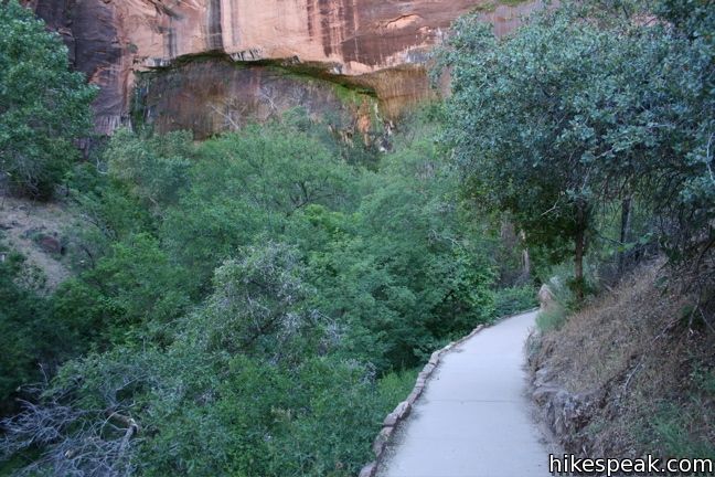
Why is the rock crying? This natural wonder is the result of water that passes from the surface down through the sandstone over the course of thousands of years to this exit in the rock face. Your journey will be much shorter, as Weeping Rock can be visited via a paved 0.4 mile round trip trail. This is one of the shortest hikes in Zion and is a quick trek from the Weeping Rock shuttle stop on Zion Canyon Scenic Drive.

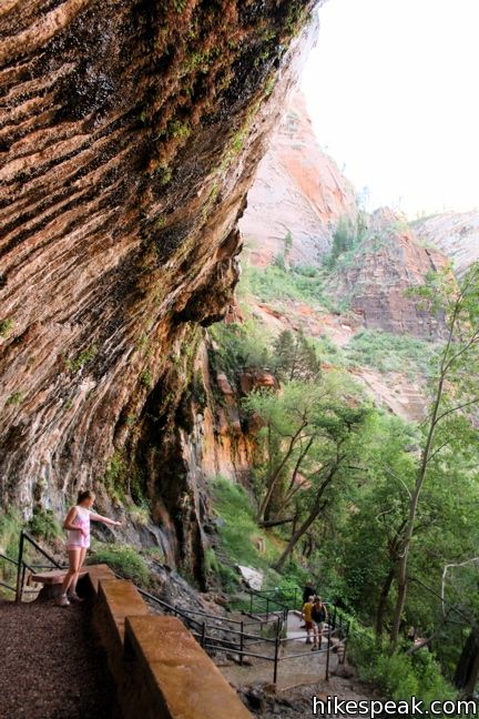
Take the bridge over Echo Canyon Creek to the trailhead information panel and turn left. From here, the trail gradually rises 100 feet up a lush slope shaded by Maples and Cottonwoods. After 0.2 miles, the trail dead ends beneath an arch-shaped overhang in the wall of the canyon. Prepare to get sprinkled on as you climb a set of stairs and cross to the back of the overhang. Use the railing and mind your step on the slippery surface.

Take a moment to linger and watch the rock weep. Water falls from the rock like raindrops, nourishing diverse vegetation below. After a spring storm, momentary waterfalls can form off the rock. The year round source of water creates “hanging gardens” where mosses, ferns, and columbines (among others) thrive on the vertical surface. Small panels along the trail detail some of the plant-life nourished by Weeping Rock. Look them over as you make your way back down. To hike farther, head right at the junction by the trailhead and venture up to Hidden Canyon (4.5 miles round trip), and Inspiration Point (8 miles round trip). To see even more hanging gardens, take a hike to the Emerald Pools.
To get to the trailhead: Between May and October, access to Upper Zion Canyon is restricted to shuttle traffic only. From the Zion National Park Visitor Center, ride the shuttle for approximately twenty-five minutes and get off at the Weeping Rock shuttle stop. Head east across the parking lot past the bathrooms to the trailhead.
Trailhead address: Floor of the Valley Road (Zion Canyon Scenic Drive), Zion National Park, Springdale, UT 84767
Trailhead coordinates: 37.2709, -112.9385 (37° 16′ 15.2″N 112° 56′ 18.6″W)
You may also view a regional map of surrounding Utah trails and campgrounds.
 | Hidden Canyon This 3.3-mile hike ascends the east rim of Zion Canyon above Weeping Rock, and then crosses dramatic cliffs to reach a hanging canyon housing a small natural arch. |
 | Riverside Walk This level walkway follows the Virgin River to the bottom of the narrows north of Zion Canyon, a popular place to hike and swim. |
 | Emerald Pools This 2.4-mile loop visits three tiers of enchanting pools by incorporating the Lower, Middle, and Upper Emerald Pools Trails. |
 | Angels Landing This 5.2-mile hike takes an incredible route up the east rim of Zion Canyon ascending to a towering slab of sandstone jutting into the center of the canyon. The expansive views and thousand foot drop-offs have made this trail world famous. |
 | Canyon Overlook Trail This one-mile round trip hike visits a scenic viewpoint looking west over Zion Canyon. |
 | Watchman Trail This 3.5-mile lollipop loop reaches a panoramic overlook on the side of Zion Canyon. |
 | More trails in Utah Explore other hikes in Utah outside of Zion National Park. |
 | Zion Campgrounds There are two large campgrounds at the south end of Zion canyon and another smaller campground outside Kolob Canyon. |


Worth seeing if you are there. Its a quick hike on a paved trail.
[…] the equipment / you simply don’t want to do the Narrows, check out Hidden Canyon (3.3 miles RT), Weeping Rock (0.4 miles RT) and / or part of the West Rim Trail (total of 36 miles RT) for views of Zion […]