
With an inspired name and inspiring view, Vital Link Trail presents a rewarding hike in the Verdugo Mountains near Burbank. The trail delivers a good workout too, ascending 1,275 feet in a mile and a half, with opportunities to hike even farther. The steep single track looks out over the east end of the San Fernando Valley toward the Santa Monica Mountains and the skyscraper skyline of downtown Los Angeles. At the top of the trail, you’ll earn an overview of the Verdugo Mountains with new views north toward the San Gabriels. Vital Link Trail joins Verdugo Motorway, the main trail running east to west across the dominant ridgeline in the Verdugo Mountains. If the views at the top of Vital Link Trail aren’t enough, you can carry on hiking in both directions on Verdugo Motorway, including bagging the summit of nearby Verdugo Peak.
Vital Link Trail begins in Wildwood Canyon Park, which is nestled in the bottom of a wooded canyon between steep ridges at the base of the Verdugo Mountains on the edge of Burbank. There are actually four ways to begin this hike from Wildwood Canyon Park. The most direct trail begins from the top of Wildwood Canyon Road. From here it is a half-mile hike up a wide service road to reach a sign for Vital Link Trail, a dirt single track that will take you the rest of the way up the mountain. There are three other trailheads, staggered along the west side of Wildwood Canyon that explore the ridge below Vital Link Trail. These trails can be used to lengthen the start of this hike. From the trailhead at the bottom of the ridge, at the entrance of Wildwood Canyon Park, it is a one-mile hike to the junction at the start of Vital Link Trail. Beginning there will add an extra mile round trip and another 275 feet of elevation gain to this hike.
Starting from the turnaround at the top of Wildwood Canyon Road, take the wide dirt trail that continues up the canyon. In less than a quarter mile, you will come to a hairpin turn to the left where the trail leaves the canyon bottom and begins up the ridge to the west. As you ascend, there will be widening views down Wildwood Canyon and out over Burbank. After passing a dirt turnout on the left, the trail will turn downhill temporarily and come to a junction on the right with a big yellow sign for Vital Link Trail. Turn right here to begin hiking up this steep track (the trail straight ahead is the alternate route and travels down the ridge to return to Wildwood Canyon Park).
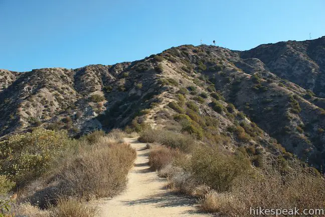
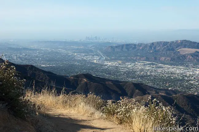
Over the next mile, you’ll gain 1,025 feet on Vital Link Trail. The trail basically runs right up the end of the ridge, with a few tight switchbacks to tackle the steepest sections of terrain. The views get bigger as you ascend too. When you need to catch your breath, look back down the ridge and across Burbank toward the Griffith Park end of the Santa Monica Mountains and the jigsaw-cut skyline of downtown Los Angeles.
After 0.3 miles on Vital Link Trail, you will come to a split. A direct path continues up the ridge to the left, while what appears to be the main trail takes a switchback to the right. The two paths come back together quite quickly, so take either route and continue up the ridge. The more gradual route is to the right, where the trail cuts temporarily back into Wildwood Canyon.
As you continue up the steep track, you’ll get ever closer to the radio towers and structures at the top of the ridge. You will see farther over the ridges to the east and west and, as you look along the main ridgeline to the east, be able to spot the communications towers at the apex of Verdugo Peak.
Keep up the thigh-burning climb until you reach the top of Vital Link Trail, where a reclined bench has been installed to facilitate a well-deserved break. Vital Link Trail delivers a good workout in a short distance and is a good training hike for longer ascents.
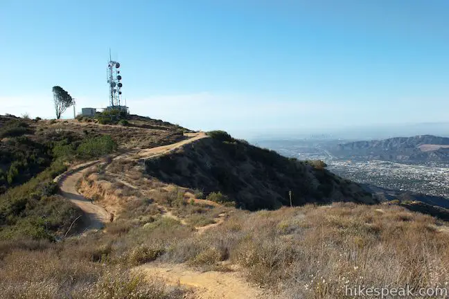
At the top, Vital Link Trail meets a wide dirt service road that connects Verdugo Motorway (Verdugo Fire Road) with the radio towers on the small summit to your right. If you’re not ready to turn around immediately after reaching the top of the trail, there’s plenty to explore among the tops of the Verdugo Mountains. Turn right and walk less than a tenth of a mile to the nearby summit with a couple communications buildings on it, gaining another 25 feet of elevation. You may also want to turn left at the top of Vital Link Trail and take the trail and a footpath a tenth of a mile west to an undeveloped crest on the ridge that offers undisturbed panoramic views.
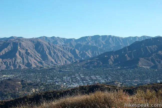
In addition to views over Burbank, the Santa Monica Mountains, and downtown LA, the area around the top of Vital Link Trail offers sweeping views north, east, and west over the Verdugo Mountains. The most impressive views are probably to the north where the San Gabriel Mountains rise up in an imposing wall.
Those with energy left in their legs may continue hiking for 1.25 miles to the 3,126-foot summit of Verdugo Peak, the highest point in this small mountain range. Turn left at the top of Vital Link Trail, walk 0.15 miles along the dirt service road to Verdugo Motorway, turn right and take the wide trail east to the communications towers at the range’s highest summit.
The base length for Vital Link Trail is 3 miles round trip with 1,275 feet of elevation gain, traveling from the top of Wildwood Canyon Road to the top of the trail near Verdugo Motorway (and back). At the top, you’ll probably at least want to check out the nearby high spots on the ridgeline, adding another 0.4 miles and 25 feet of elevation to the hike (3.4 miles and 1,300 feet). There are three alternate trailheads along Wildwood Canyon Road. Starting at the lowest trailhead will add another half mile to the hike round trip (3.9 miles and 1,575 feet). Hiking to the top of Verudgo Peak and back from the top of Vital Link Trail (1.5 miles up Vital Link Trail and 1.25 miles to the peak) will give you a 4.5-mile round trip hike with 1,525 feet of elevation gain. For something longer still, you can hike farther on Verdugo Motorway or explore one of the other side trails.
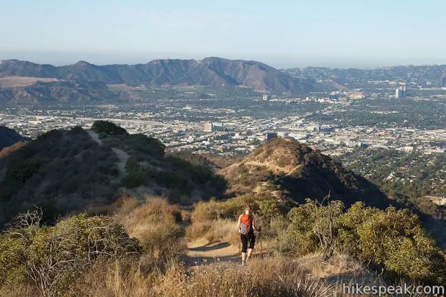
When you’re ready to head back, simply return the way you came down Vital Link Trail. There will be non-stop views facing out from the ridge as you descend! Dogs are welcome, but bikes are not permitted on Vital Link Trail. Wildwood Canyon Park is open from dawn till dusk. No fee or permit is required to hike in Wildwood Canyon Park or the Verdugo Mountains, so get out and enjoy! For more hiking in the area, check out Skyline Motorway, a couple ridges to the east, and Stough Canyon, a couple canyons to the west.
To get to the trailhead: Take the 5 Freeway to Burbank Boulevard (Exit 146B). Drive two blocks north on Burbank Boulevard to Third Street. Turn right and make the next left onto Harvard Road. Drive 1.5 miles and turn right onto Wildwood Canyon Road at the park entrance. Drive half a mile up Wildwood Canyon Road through the park, passing picnic areas and the three other trailheads. There will be parking just below the turnaround at the top of the road. Hike through the gate up the dirt trail that continues from the end of the road.
Trailhead address: 1701 Wildwood Canyon Road, Burbank, CA 91501
Trailhead coordinates: 34.209427, -118.291724 (34° 12′ 33.93″N 118° 17′ 30.20″W)
You may also view a regional map of surrounding Los Angeles trails and campgrounds.
 | Old Youth Camp Loop in Stough Canyon This 2.6-mile loop passes the ruins of an abandoned camp in the Verdugo Mountains with views across the San Fernando Valley. |
 | Skyline Motorway This 6.1 to 6.6-mile hike (or more) ascends an abandoned fire road in the Verdugo Mountains with expansive views that include the skyline of downtown Los Angeles. |
 | Hostetter Fire Road to Verdugo Peak This 7.5-mile round trip hike on the north side of the Verdugo Mountains ascends from La Tuna Canyon to the highest summit in the range. |
 | La Tuna Canyon Trail This 4.5-mile round trip hike ascends a ridge and a pair of canyons in La Tuna Canyon Park on the northwest side of the Verdugo Mountains. |
 | Beaudry Motorway Loop to Tongva Peak This 6.15-mile loop climbs 1,475 feet to the summit of Tongva Peak on the east end of the Verdugo Mountains. |
 | Las Flores Motorway to Mount Thom This 5.3-mile hike follows a wide dirt road to the summit of Mount Thom, offering panoramic views from the southeast end of the Verdugo Mountains. |
| Beacon Hill This 2.75 to 3.9-mile hike in Griffith Park climbs 500 feet to the easternmost summit in the Santa Monica Mountains. | |
 | Bee Rock This hive-shaped point on the east side of Griffith Park is reached via a 1.7 to 4-mile round trip hike. |
 | More trails in Los Angeles Explore other destinations around Los Angeles. |


This hike definitely had its challenges, but it was pretty fantastic. The park and trails are moderately busy (although the people were exceptionally friendly, so it’s just fine) but the climb up is a great workout! I started from the start of the park and worked my way up to the top where there is a marker and a bench that looks out over Burbank and LA. Nice views and I also saw a deer and a rabbit while in the park, so that was an added bonus!
Glad you enjoyed it!
The hike seemed great until the police firing squad started practicing. Alone, it would have been fine, but I had my rescue dog with me who became terrified at the repeated loud gunshots. Probably about 50 in the 20 minutes we were able to stay. If you have a relaxed dog, it’s a great hike, just be prepared for the ruckus. If you have a dog with a troubled past, take him or her elsewhere.
Hiked the Vital Link a couple of days ago and my quads are still sore. Great workout and you can get up and back in less than 1.5 hours (even if you rest as much as I did). Awesome vistas and well worth the effort.
There’s a new swing on the tree near the bench at the Plantation Lateral picnic area not far from Verdugo Peak. I learned the hard way that it’s surprisingly easy to hit your head on an unforgiving branch of that tree while swinging. It’s not a convenient location to have a head injury.