
Surrounded by neighborhoods and business on the west side of Beaverton, Tualatin Hills Nature Park’s 222 acres are a highly accessibly oasis of forests and wetlands. The relatively flat park has about twenty different trails covering 5 miles. You only need to utilize the park’s main three trails, Vine Maple Trail, Old Wagon Trail, and Oak Trail to form an easy 2.1-mile loop with just 30 feet of elevation change between its high and low points. All three trails contain sections of boardwalk offering dry passage through wet areas that surround Cedar Mill Creek. Oak Trail and most of Vine Maple Trail are paved. A spur off Vine Maple Trail leads to Lily Pond, the most pristine marshy pond in the park. Tualatin Hills Nature Park can be easily accessed by car or via the MAX light rail line that stops just outside the park.
Those driving into Tualatin Hills Nature Park will begin by the nature park interpretive center. From there, you can hike Vine Maple Trail past an early junction with Oak Trail to Lily Pond and Old Wagon Trail. Old Wagon Trail doubles back to Oak Trail, which leads back to the visitor center. Those arriving by MAX light rail should take the blue line (toward Hillsboro from downtown Portland) to the station at Merlo Road and SW 158th Avenue. Leave the platform, walk southwest down the sidewalk, and turn left onto a paved path along the edge of the park woods. Walk up to a kiosk with a map showing that you are at the north end of Oak Trail. Walk 1/8 of a mile down Oak Trail to a junction with Old Wagon Trail and join the loop described above.
The basic directions for Vine Maple Trail – Old Wagon Trail – Oak Trail Loop are:
- Walk past the nature center up the start of Vine Maple Trail (0 miles)
- Bear left at a junction with Oak Trail to stay on Vine Maple Trail (0.07 miles)
- Pass junctions on the left with Big Fir Trail, Owl Path, and Eliot Path
- Cross Cedar Mill Creek and stay to the left past Mink Path (0.4 miles)
- When the pavement ends, turn left down a short spur to Lily Pond (0.67 miles)
- Continue on unpaved Vine Maple Trail (0.7 miles)
- Turn right onto Old Wagon Trail (0.78 miles)
- Turn right to stay on Old Wagon Trail (0.9 miles)
- Turn left at a junction with Mink Path to stay on Old Wagon Trail (1.15 miles)
- Turn right onto Oak Trail (1.5 miles)
- Pass junctions on the left with a connector to Westside Trail and Tadpole Ponds Trail
- Come to the end of Oak Trail and turn left on Vine Maple Trail (2.03 miles)
- Walk back to the parking area by the nature center (2.1 miles)
Leave from nature park interpretive center by the main parking area and walk up the path between the center and a bathrooms building to the start of Vine Maple Trail. Walk about fifty yards up this wide paved trail to the first of many marked junctions. At this important intersection, Oak Trail parts to the right to head north. Unless you prefer to hike the loop in a counter-clockwise directions, stay to the left on Vine Maple Trail.
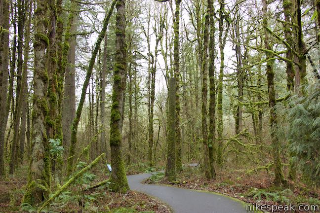
Road noise fades away as you get deeper into a mossy forest. It will only be 0.05 miles until you come to another junction. Big Fir Trail veers off to the left, connecting to a cluster of unpaved trails on the south side of the park that can be explored by extending this outing. Otherwise, stick with Vine Maple Trail. Signs along the trail highlight the park’s plants and animals. Just before the next junction, where you’ll stay to the right past Owl Path, you’ll spot a sign about lichens that describes how they live off air and rain (and particles carried in the air and water), making lichen susceptible to air pollution and a good indicators of forest air quality.
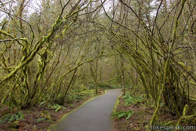
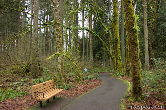
Just after Owl Path, Vine Maple Trail passes a bench and enters a forest of tall firs and bigleaf maples. A panel explains that this is one of the most mature forests in the park with 100 year old trees. Growing below the canopy are shade-loving trees like Pacific dogwoods, Pacific yews, and vine maples.
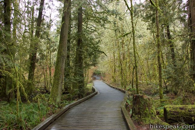
Vine Maple Trail passes through the forest, bearing right through a junction with Eliot Path to curve down to a boardwalk. The boardwalk is about 100 yards long. As you walk across, notice how the forest changes in this wetlands area. At the end of the boardwalk, a bridge spans Cedar Mill Creek and returns the trail to pavement.
Rise from the creek to a junction with Mink Path, which heads to the right. Mink Path (labeled as Creek Trail on older park maps) heads north to a junction with Old Wagon Trail, making it possible to use this trail for a shorter loop that skips Lily Pond.
Continue past Mink Trail as Vine Maple Trail heads west through forest above Cedar Mill Creek and Beaverton Creek. At about 2/3 of a mile from the start, you will come to a loop in the pavement. Ahead, Vine Maple Trail is an unpaved cinder trail. Before you continue straight on unpaved Vine Maple Trail, turn left down a short spur to Lily Pond.
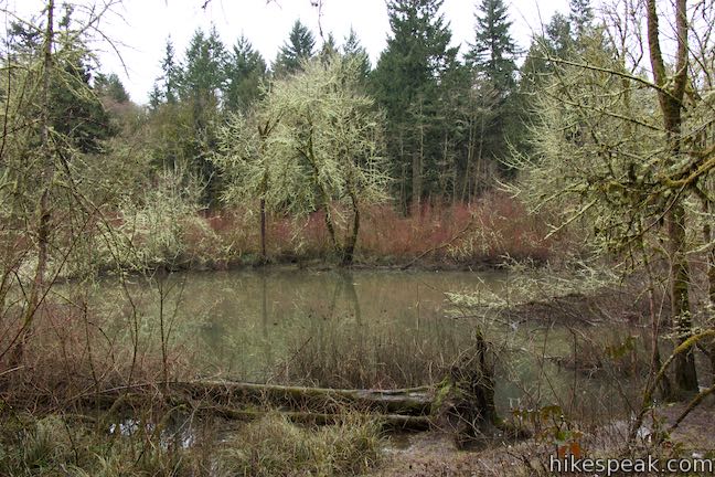
Look out over the forest-wrapped pond whose water is decorated with pond lilies that have adapted to the pond’s highs and lows. In the spring, when water levels are high, the lily pads float. They are submerged with the lake swells. When the pond shrinks, the pond lilies can stand out of the water. A panel explains how Lily Pond was created:
The Lily Pond began as an oxbow bend left behind when Beaverton Creek changed course. The creek flows into it again during floods. The most pristine and natural of the nature park’s ponds and marshes, it also has the most to lose if we allow it to be disturbed. The plants and soils are highly sensitive. Please do not step off the boardwalk.
Return to Vine Maple Trail and continue west for about 150 yards to a junction with Old Wagon Trail. Turn right here. Straight ahead, Vine Maple Trail approaches a kiosk and an access point on the west side of the park by the intersection of Vendla Park Lane and SW 170th Avenue. Hike up Old Wagon Trail to continue with the loop.
Old Wagon Trail is a dirt trail with a long section of boardwalk that begins 150 yards from Vine Maple Trail. The trail and boardwalk pass through marshy forest on the north side of the park. While on the boardwalk, make a right turn as Old Wagon Trail passes another access trail.
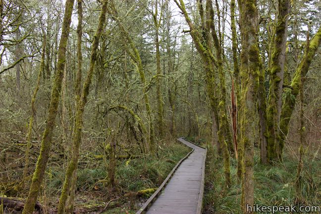
Walk above the forest floor to the end of the boardwalk and across dirt trail again to a junction with Mink Path. You could turn right to return to Vine Maple Trail, but turn left to hike another 1/3 of a mile to Oak Trail.
Crossing the north side of Tualatin Hills Nature Park, Old Wagon Trail passes a bioswale that filters runoff water from a TriMet bus garage just outside the park. Signs explain how the bioswale replicates natural filtration on water running into Cedar Mill Creek.
Spot boardwalk on Oak Trail as you approach a junction with the loop’s third trail. If you need to get to the light rail station, turn left up Oak Trail and hike 1/8 of a mile to Merlo Road. Otherwise, turn right and hike back toward the nature center on Oak Trail.
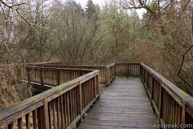
Oak Trail immediately enters an area of wandering boardwalk, crossing Cedar Mill Creek and its adjacent wetlands. After about 125 yards of boardwalk, you’ll cross an equal length of pavement to discover another boardwalk where the trail passes a seasonal pond in Cattail Marsh. Take a look at the pond and be thankful for the boardwalk’s dry passage.
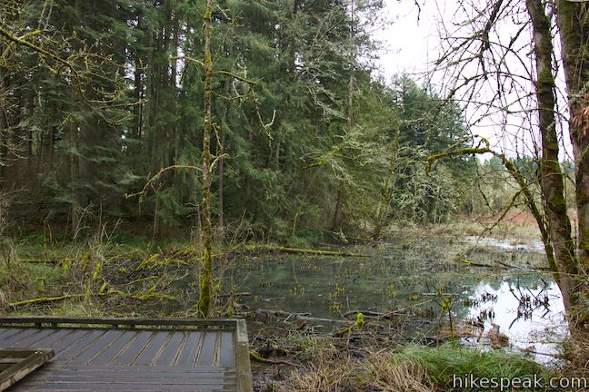
When the pavement resumes, Oak Trail rises to two junctions on the left. The first is with a connector to Westside Trail, a long regional trail bordering the park. A second junction is with Tadpole Ponds Trail. The two trails could be used to form a short loop off Oak Trail.
Proceed along Oak Trail through a forest dominated by white oaks and ponderosa pines. After just over half a mile on Oak Trail (from the Old Wagon Trail Junction), return to the junction with Vine Maple Trail where the loop began. Turn left, following the sign for the nature center, to walk a short distance back to the start and complete this 2.1-mile hike.
Note: Mink Path and a section of Old Wagon Trail were called Creek Trail on previous maps.
Dogs are not allowed in Tualatin Hills Nature Park. Bikes are allowed on the paved trails only (Oak Trail and most of Vine Maple Trail). Parking at the trailhead is free and no permit is necessary to hike in Tualatin Hills Nature Park, so get out and enjoy!
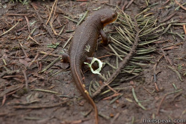
Watch where you step! Rough-skinned newts travel between the park’s forests and wetlands and can easily blend in with the soil. Also, don’t touch these newts because their skin can exude poison.
Directions to the Trailhead
- From Portland, follow Route 26 west through Forest Park.
- Drive approximately 6 miles and take exit 67 for Murray Boulevard.
- Turn left at the end of the offramp to head south on SW Murray Boulevard.
- Drive 2.1 miles and turn right onto SW Millikan Way.
- Go 0.6 miles and turn right into the park entrance.
Arriving by train:
- Take the MAX Blue Line light rail service between Portland and Hillsboro.
- Get off at the Merlo / SW 158th Station, three stops west of Beaverton Central Station.
Trailhead Location
Trailhead address: 15655 SW Millikan Way, Beaverton, OR 97006
Trailhead coordinates: 45.49825, -122.8392 (45° 29′ 53.69″N 122° 50′ 21.12″W)
View Tualatin Hills Nature Park in a larger map
Or view a regional map of surrounding Oregon trails and campgrounds.
 | Holman Lane – Wildwood Trail – Birch Trail Loop This 2.7-mile loop combines three trails in Forest Park for a refreshing woodland walk. |
 | Lower Macleay Trail to Stone House This 1.8 to 2-mile hike starts by following Balch Creek to fern-covered ruins and can finish with a loop that exits Forest Park and passes through the Willamette Heights Neighborhood in Northwest Portland. |
 | Lower Macleay Park to Pittock Mansion This 5.4-mile hike in Forest Park takes Lower Macleay Trail to the Stone House ruins and ascends Wildwood Trail to Pittock Mansion, bagging a big view over Portland. |
 | Cornell Road to Pittock Mansion This 2.5-mile hike on Wildwood Trail and Upper Macleay Trail in Forest Park goes up a wooded hillside to Pittock Mansion, a landmark with panoramic views over Portland. |
 | George Himes Trail This short lollipop loop ascends into Portland's West Hills for a woodland walk with a view of Mount Hood. |
 | Marquam Nature Park Hike through peaceful forest in a pocket of Portland's West Hills on a 1.3, 3, or 4.25-mile loop. |
 | Trillium Trail This short nature trail in Tryon Creek State Natural Area is packed with plant-identifying panels as well as benches and viewing platforms. |
 | Two-Mile Loop Combine Old Main Trail, Red Fox Trail, Cedar Trail, Middle Creek Trail, and Maple Ridge Trail in Tryon Creek State Natural Area to loop through rolling woodland and across 3 bridges. |
 | Powell Butte This 2.15-mile lollipop loop combines Mountain View Trail and Summit Lane to explore the top of Powell Butte and its big views from Southeast Portland. |
 | Trails in Oregon Explore more hikes in Oregon outside Greater Portland. |
Common Questions about Vine Maple Trail – Old Wagon Trail – Oak Trail Loop in Tualatin Hills Nature Park
- Is the trail open?
- Yes. You should expect to find that Vine Maple Trail - Old Wagon Trail - Oak Trail Loop is open. There are no recent reports of trail closures. If you discover that the trail is closed, please help your fellow hikers by reporting a closure.
- Is this trail free to access?
- Yes, Vine Maple Trail - Old Wagon Trail - Oak Trail Loop is free to access. No entrance fee, pass, or permit is required. If you discover that access rules have changed, please provide feedback on your experience.
- How much time does this hike take?
- It takes approximately 1 hour to hike Vine Maple Trail - Old Wagon Trail - Oak Trail Loop. Individual hiking times vary. Add extra time for breaks and taking in the views.
- How long is this hike?
- The hike to Vine Maple Trail - Old Wagon Trail - Oak Trail Loop is a 2.1 mile loop with 30 feet of elevation change.
- Are dogs allowed on this trail?
- No, dogs are likely not allowed on Vine Maple Trail - Old Wagon Trail - Oak Trail Loop. The trail is primarily open to hikers.
- Is this trail wheelchair accessible?
- Yes, Vine Maple Trail - Old Wagon Trail - Oak Trail Loop is designated as wheelchair-friendly.
- Where is the trailhead located?
- The trailhead for Vine Maple Trail - Old Wagon Trail - Oak Trail Loop is located in Beaverton, Oregon.
Trailhead Address:
15655 SW Millikan Way
Beaverton, Oregon 97006
Trailhead Coordinates:
45.49825, -122.8392 - What are the driving directions to the start of the hike?
To get to the trailhead: From Portland, follow Route 26 west through Forest Park. Drive approximately 6 miles and take exit 67 for Murray Boulevard. Turn left at the end of the offramp to head south on SW Murray Boulevard. Drive 2.1 miles and turn right onto SW Millikan Way. Go 0.6 miles and turn right into the park entrance.
Arriving by train: Take the MAX Blue Line light rail service between Portland and Hillsboro. Get off at the Merlo / SW 158th Station, three stops west of Beaverton Central Station.
View custom Google Maps directions from your current location.
- Are there other trails near Vine Maple Trail - Old Wagon Trail - Oak Trail Loop?
- Yes, you can find other nearby hikes using the Hikespeak Hike Finder Map.


Go the extra miles...
Submit a rating of this hike to go with your comment. Contribute to the average trail rating.