
Tenaja Falls pours over a sandstone staircase in the San Mateo Canyon Wilderness of the Santa Ana Mountains. Even through the waterfall’s setting is picturesque and remote, the hike to the waterfall is a short and easy, following Tenaja Falls Trail for 1.5 miles round trip with 275 feet of elevation change. Totaling 150 feet in height with multiple tiers, this Southern California waterfall might not compare with the beauties in Yosemite National Park, but visit during the early, rainy months of the year and Tenaja Falls is an undeniable thrill.
Tenaja Falls Trailhead is located on Tenaja Truck Trail, which delves into a remote part of the Santa Ana Mountains in Riverside County called San Mateo Canyon Wilderness. Spot a kiosk at the trailhead with a map of Tenaja Falls Trail and more information about the surrounding wilderness, part of the Trabuco Ranger District of Cleveland National Forest.
Begin up Tenaja Falls Trail (5W04), passing a self-registration station. Day hikers are asked to register for survey purposes, but do not need to carry permits. Wilderness permits are only needed for overnight trips. The hike’s first and only trail junction is 125 yards from the trailhead. San Mateo Canyon Trail parts to the left toward Fisherman’s Camp, which is 2 miles away. Proceed straight on Tenaja Falls Trail, following the sign that reads, “Tenaja Falls – 0.7 miles.”
Walk another 50 yards up the trail and hit San Mateo Creek. A slab of concrete can be used to walk across the creek. If water levels are high (which will be good news for the waterfall), look around for a place to rock hop across – being sure to avoid any poison ivy. The slab in the trail is a concrete ford, hinting at the trail’s previous function as an old road.
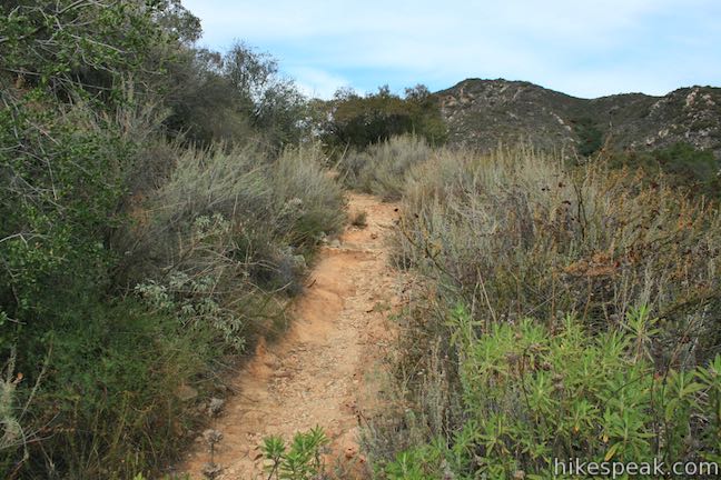
Proceed up through a riparian area along the creek. The trail is located in a V-shaped union of two canyons. Make sure to follow Tenaja Trail as it curves to left, passing Los Alamos Canyon. Tenaja Falls Trail rises up a hillside blanketed with aromatic sage. Gain nice views over Santa Mateo Canyon and the ridges above.
After half a mile of hiking, come up around curve to the left when – bam! – Tenaja Falls appears in front of you. Look across a bowl in the canyon and watch the waterfall slide, twist, and tumble down a slope of orange and gray sandstone. The top tier is just out of sight and trees hide the very bottom of the waterfall, but the middle tiers are visible, cutting a bold course down the canyon wall. Tenaja Falls is said to have 5 tiers totalling 150 vertical feet.
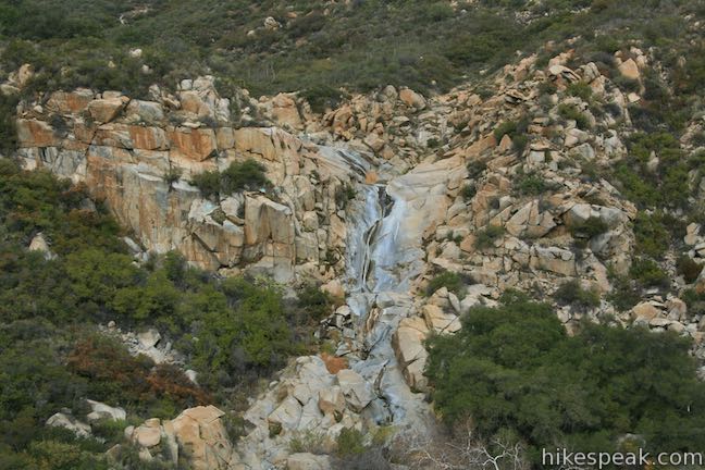
Cross a slope with steady views of Tenaja Falls – as well as the surrounding canyon and peaks. The waterfall disappears from view on the final approach of Tenaja Falls Trail. Come up alongside the brink of the falls, 3/4 of a mile from the start. A path to the right goes out to a landing that allows you to look down Tenaja Falls, or at least down the part of the waterfall where the second highest tier slides into a pool.
Continue up Tenaja Falls Trail to the edge of a oak grove bordering San Mateo Creek. Cross the creek for a perspective looking over the lip of the waterfall.
To really see Tenaja Falls, you’ll need to go off trail and carefully scramble down the exposed sandstone surrounding the waterfall. Your safety is your responsibility, so avoid doing anything dangerous and hang back if you’re uncomfortable straying off trail. The bedrock near Tenaja Falls has been polished smooth by the flow of water, so it can be very slippery. It’s best to move a distance away from the waterfall before climbing down.
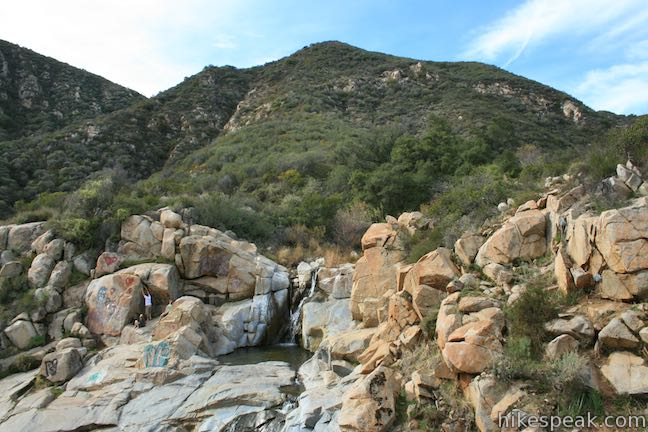
With moderate effort, is it possible to climb around the waterfall to face both of the top two tiers (the wider smooth area surrounding the middle of the waterfall seems less inviting to trek down). The top tier of Tenaja Falls is the most alluring, with a near vertical drop of over fifteen feet. The water bumps off a boulder on the way down, before plummeting into a clear pool. (The water may not be clear during the later months of the year when the flow of San Mateo Creek lessens.)
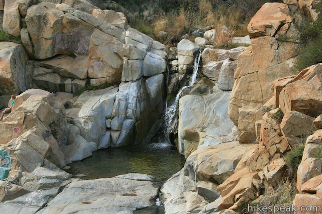
Below this excellent top tier, the water channels through grooves in the sandstone and fans out over a sloped cascade, sliding into a shallower pool where the water is less clear. Graffiti mars many sandstone outcroppings around the waterfall, but otherwise the surroundings are beautiful.
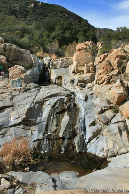
What is a tenaja? Also called a tank, a tenaja is a natural basin in an area of bedrock that holds water. Native Americans used tanks like the pools at Tenaja Falls to survive through the seasons of the year when the rain stops falling and creeks dry up.
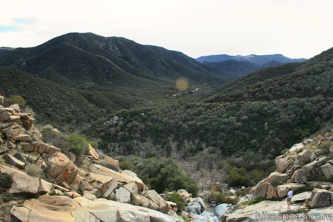
The sandstone opening at Tenaja Falls is a great place to gaze out down San Mateo Canyon, a beautiful wilderness area framed by green ridges. When you are done exploring the waterfall, return the way you came. Venturing off trail can increase this hike from 1.5 miles to about 1.75 miles round trip. For another nearby hike, check out the trail to Fisherman’s Camp.
Leashed dogs are allowed on Tenaja Falls Trail, but bikes are prohibited. No permit is needed to day hike to Tenaja Falls (wilderness permits are needed for overnight treks). A National Forest Adventure Pass is no longer required to park at Tenaja Falls Trailhead, making it free to park and hike.
To get to the trailhead: Take Interstate 15 to exit 68 for Clinton Keith Road, which is located in Murrieta north of Temecula and south of Lake Elsinore. Head west on Clinton Keith Road for 5.2 miles and then stay to the right as the road becomes Tenaja Road. Proceed for 1.7 miles and turn right to remain on Tenaja Road. After another 3/4 of a mile, make another right to stick with Tenaja Road. Drive 3.5 miles farther up Tenaja Road and turn right onto Cleveland Forest Road (7S01). After 0.9 miles, pass the similarly named Tenaja Trailhead on the left and stay to the right on the forest road, which becomes Tenaja Truck Trail. Follow this narrow paved road for 4.3 miles to a turnout on the left for Tenaja Falls Trailhead (1.5 miles after the smaller dirt turnout at the Fisherman’s Camp Trailhead).
Trailhead address: Tenaja Truck Trail & Forest Route 7S02, Murrieta, CA 92562
Trailhead coordinates: 33.5491, -117.3946 (33° 32′ 56.8″N 117° 23′ 40.6″W)
View Santa Ana Mountains in a larger map
Or view a regional map of surrounding Southern California trails and campgrounds.
 | Fisherman's Camp This 3 1/3-mile round trip hike follows an old road to an old campground with views over San Mateo Canyon in the Santa Ana Mountains. |
 | El Cariso Nature Trail This 1.35 to 1.55-mile loop examines common plants in the Santa Ana Mountains, along with uncommon views views across the mountain range, passing an old mine for more fun. |
 | Ortega Falls This 1/3-mile round trip hike visits a refreshing waterfall, cascade, and swimming hole off Ortega Highway in the Santa Ana Mountains. |
 | More hikes in Southern California Explore more trails in Orange, Riverside, San Bernardino, and San Diego counties. |
Tenaja Falls in Afoot and Afield: Orange County by Jerry Schad
Tenaja Falls on world-of-waterfalls.com
Tenaja Falls on Brian and Ashley's Hiking Blog
Tenaja Falls on californiathroughmylens.com
Tenaja Falls on nobodyhikesinla.com
Tenaja Falls on ironhiker.blogspot.com
Tenaja Falls on modernhiker.com
The official Cleveland National Forest webpage for Tenaja Falls


Go the extra miles...
Submit a rating of this hike to go with your comment. Contribute to the average trail rating.