South Dune Trail – Bloody Nose Trail – Hiedra Trail – Hazard Peak Trail Loop in Montaña de Oro State Park

Hikes in Montaña de Oro State Park travel along the coast or delve inland into canyons and up peaks. If you want a mix of hiking environments, consider this four-trail loop, which combines South Dune Trail, Bloody Nose Trail, Hiedra Trail, and Hazard Peak Trail for a 2 2/3 mile round trip hike with a little over 300 feet of elevation change. This loop can be added to the hike up Hazard Peak, adding a loop to summit hike for a just over 6.5-mile outing.
A bit about each trail:
- South Dune Trail crosses level sagebrush just inland from a row of dunes with windows on the Pacific Ocean (0.7 miles long)
- Bloody Nose Trail takes a meandering course through a charming grove of tightly-packed eucalyptus (0.35 miles long)
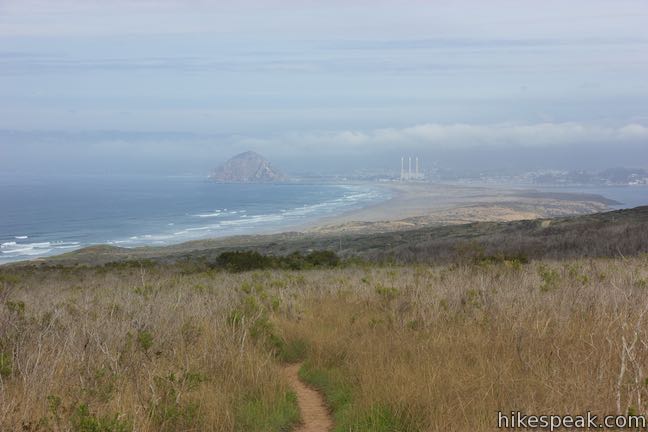
- Hiedra Trail offers postcard views of Morro Rock as it travels up a ridge along Hazard Canyon (0.5 miles long)
- The section of Hazard Peak Trail on this loop presents nice views over Spooner’s Cove and the heart of the park (1.07 miles long)
This loop crosses two large trailheads:
- Hazard Peak Parking Day Use Area at the south end of South Dune Trail and the bottom of Hazard Peak Trail
- Hazard Canyon Parking Day Use Area at the north end of South Dune Trail near the bottom of Bloody Nose Trail (and the start of Dune Trail to Hazard Canyon Reef)
These directions begin from Hazard Peak Parking Day Use Area and take the loop in a clockwise direction, starting with a level warm-up on South Dune Trail.
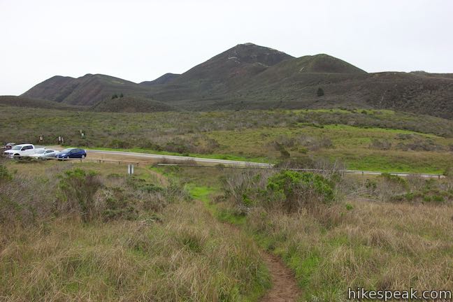
Leave from the trailhead parking area for Hazard Peak Trail, which is on the north side of Islay Canyon, 0.3 miles up Pecho Valley Road from the Spooner’s Ranch House Visitor Center by the start of the Bluff Trail. Instead of heading inland up Hazard Peak Trail, which is just across the road, take the trail at the south end of the parking area that goes toward the coast.
Come to a junction after just 250 feet. A path to the left heads toward Spooner’s Cove. Turn right to go north on South Dune Trail. The single track trail passes over packed sand. Sagebrush and other low vegetation line the trail. To your left, a row of undulating dunes stand above the ocean. Through gaps in the sand, you can peer up the coast toward the Santa Lucia Mountains.
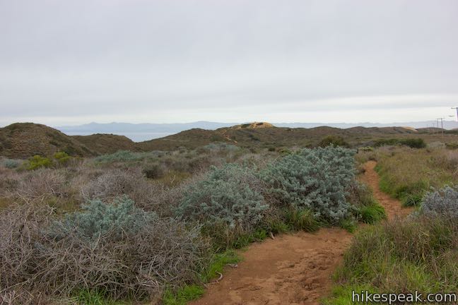
The trail crosses under a row of power lines, which is the only minimal impediment to the views. Over your shoulder, gaze down the coast by Spooner’s Cove or look inland up toward Valencia Peak.
South Dune Trail has a few unmarked junctions. After 0.37-miles, cross through an intersection with a path coming from a small parking area by the road that goes toward an opening in the dunes. In another 1/8 of a mile, bear left at a split to stay on South Dune Trail, passing another trail out to Pecho Valley Road, which runs parallel to the trail. A bit past that, bear right past a path that bypasses Hazard Canyon Parking Day Use Area and angles toward the dunes. Pass through taller brush to finish up the trail and arrive at the south end of a large parking area.
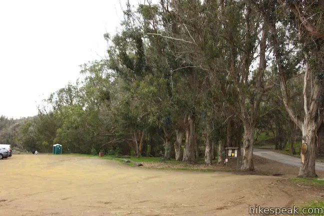
Another section of Dune Trail leaves from the north end of the lot, presenting a 1-mile round trip extension down to the beach at Hazard Canyon Reef.
To proceed with the loop, walk to the center of the lot and cross Pecho Valley Road to the inland side. Continue walking north and you will soon arrive at the start of Bloody Nose Trail. Space for a couple cars to park is available just beyond the posted trailhead. Turn right and head up Bloody Nose Trail.
Just 100 yards up Bloody Nose Trail, you will hit an ambiguous U-turn. Bypass the path proceeding straight and curve to the left to continue up the trail (the path going straight off the curve probably gets to the next junction in a shorter distance).
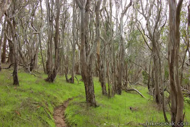
After the bend, Bloody Nose Trail narrows to a single track that rises gradually through thin, tightly packed eucalyptus trees. Enjoy the weaving course up through this interesting single-species forest.
Bloody Nose Trail eventually exits the forest into a small clearing where the trail curves to the left and meets a wide dirt road by a trail kiosk. Heading south (a hard right turn) is a wide dirt road that offers an alternative route back down to Pecho Coast Road. Bloody Nose Trail continues up the wide road to the left, going north. Hiedra Trail begins to the right of the kiosk and is marked with a trail sign. Make the turn up Hiedra Trail, 1.1 miles from the start of the hike.
Hiedra Trail rises ever so gradually, curving up around the round edge of a ridge on the south side of Hazard Canyon. Pass some logs on the right that form a natural bench and look to the left out over the ocean.
As you gaze up the coast, you’ll be struck by a beautiful perspective of Morro Rock. Three smoke stacks and the coastal city of Morro Bay lie just inland from this giant rock plug.
As Hiedra Trail rounds the bend, you’ll get a new perspective up Hazard Canyon toward Hazard Peak, one of Montaña de Oro’s finest mountains. At the end of the curve, Hiedra Trail heads south through short brush atop the ridge. Over your shoulder, the views of Morro Bay continue to wow.
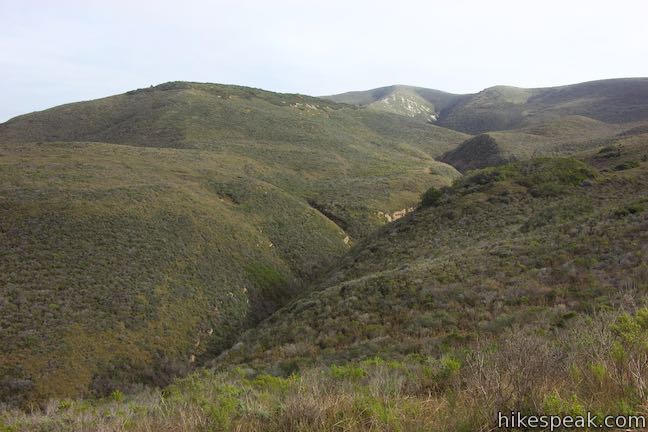
Reach a small wooded area at the top of the trail where the single track curves left and passes a bench. Pause here to gaze south over Montaña de Oro State Park. Spooner’s Cove and the area along the Bluff Trail lie down the coast below you.
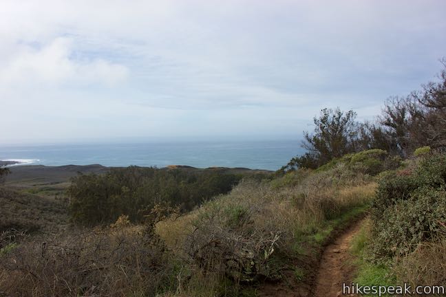
Walk another 150 feet to the end of Hiedra Trail and a T-junction with Hazard Peak Trail, 1.6 miles from the start. To the left, this trail rises 650 feet in just under two miles to the top of Hazard Peak. If you’ve got the energy for this extension, the summit is a stunner. Otherwise, continue with the loop by turning right down Hazard Peak Trail and hiking 1.07 miles down to the trailhead.
Leaving the junction, Hazard Peak Trail takes a shaded bend through a grove of tall eucalyptus trees. After the grove, the trail enters sagebrush-covered slopes and stays in this environment for the duration. Enjoy excellent views over the coast and inland up Islay Creek Canyon as you make your way down the trail.
With half a mile to go, pass a backless bench on the left that is perched above Islay Creek Canyon. Look up this canyon, which is the main gap in the mountains of Montaña de Oro State Park with Hazard Peak to the north and Oats Peak and Valencia Peak to the south.
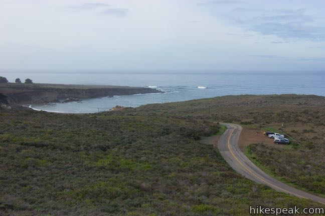
Proceed down the final stretch of the trail, gathering more coastal views as you descend to Pecho Valley Road, just across from the parking area where the loop began.
This 2 2/3-mile loop on South Dune Trail, Bloody Nose Trail, Hiedra Trail, and Hazard Peak Trail has 310 feet of elevation change. Bikes are permitted on Hazard Peak Trail (where mountain biking is popular) as well as Hiedra Trail. South Dune Trail does not allow bikes. An alternative to Bloody Nose Trail and Pecho Coast Road can be used to form a similar loop for bikes. Dogs are not allowed. No permit is required to hike in Montaña de Oro State Park and no fee is needed to park at the trailhead, so get out and enjoy!
To get to the trailhead: From San Luis Obispo, exit Highway 101 at Los Osos Valley Road and drive northwest toward Los Osos. After 11.2 miles, Los Osos Valley Road becomes Pecho Valley Road and turns sharply to the south.
Continue the final 3.2 miles to the trailhead, entering Montaña de Oro State Park and passing through a eucalyptus grove before reaching Hazard Peak Parking Day Use Area, which is on the right. South Dune Trail is on the right (west) side of the road. Hazard Peak Trail is on the left (east) side of the road. Parking can be found on both sides of the road.
Trailhead address: Pecho Valley Road, Montaña de Oro State Park, Los Osos, CA 93402
Trailhead coordinates: 35.277106, -120.884546 (35° 16′ 37.58″N 120° 53′ 04.36″W)
View Montaña de Oro State Park in a larger map
Or view a regional map of surrounding Central Coast trails and campgrounds.
 | Hazard Peak via Bloody Nose Trail, Hiedra Trail, and Hazard Peak Trail This 5.55-mile hike rises through a eucalyptus grove and views of Morro Bay to a panoramic summit in Montaña de Oro State Park. |
 | Hazard Peak Trail This 6-mile out and back hike ascends coastal ridges to a 1,076-foot summit with panoramic views that include a dynamic perspective of Morro Bay. |
 | Islay Creek Trail This easy 6-mile round trip hike follows a wide trail up a coastal canyon flanked by thousand-foot peaks, passing a small waterfall to reach an abandoned barn. |
 | Hazard Peak - Islay Creek Loop This 9.2 mile loop continues beyond Hazard Peak deeper into Montana de Oro before circling back on Islay Creek Trail. |
 | Reservoir Flats Trail This 2-mile loop delivers fine ocean and canyon views as it explores the bottom of Islay Creek Canyon in Montaña de Oro State Park. |
 | Oats Peak Trail This scenic 10.8-mile hike ventures into Montaña de Oro State Park to a panoramic summit. |
 | Valencia Peak Trail This 4.5-mile hike summits a 1,347-foot peak with stunning views over Montaña de Oro. |
 | Bluff Trail This hike of around three miles tours tide pools, beaches, and impressive cliffs along the picturesque coast of Montaña de Oro State Park. |
 | Rattlesnake Flats Trail – Badger Trail – Bluff Trail Loop This 1 2/3-mile hike offers a twist on the Bluff Trail, going along and just above the coast of Montaña de Oro State Park. |
 | Dune Trail to Hazard Canyon Reef This one-mile hike in Montaña de Oro State Park descends an oceanfront ravine to a rocky shoreline graced with engaging tide pools. |
 | Coon Creek Trail This 5-mile out and back hike ventures up a coastal canyon at the south end of Montaña de Oro State Park. |
 | Point Buchon Trail This 1 1/3 to 6.8-mile hike explores the beautiful coastline south of Montaña de Oro State Park. |
 | Morro Dunes Ecological Reserve This 2.6-mile loop serves up panoramic views over Morro Bay as it ascends 800 feet from Los Osos to Montaña de Oro State Park. |
 | More hikes in San Luis Obispo Explore other trails around San Luis Obispo including Morro Bay State Park and the Morros. |
 | Islay Creek Campground This 50-site campground is located at the heart of Montaña de Oro State Park in Islay Creek Canyon, and is a great base camp for treks in the park. |


Go the extra miles...
Submit a rating of this hike to go with your comment. Contribute to the average trail rating.