Sealy Tarns
in Aoraki Mount Cook National Park

In a park full of massive features, it might surprise you to learn that a couple small ponds are a premier hiking destination. The Sealy Tarns are located 500 meters up a steep mountainside, with mirror-like water that can reflect nearby mountains like Mount Sefton and Mount Cook. Sealy Tarns Track is not very long, but it is very steep, coming it at 5.8 kilometers round trip with 547 meters of elevation change (3.6 miles round trip with 1,795 feet of elevation change). The route uses a string of staircases to ascend to spectacular, far-reaching views over Aoraki Mount Cook National Park and the Southern Alps. A route to Mueller Hut extends above the Sealy Tarns for even loftier views. Sealy Tarns Track and Mueller Hut Route jointly make up one of the classic treks on New Zealand’s South Island.
Set out from a car park at the end of Hooker Valley Road next to White Horse Hill Campground (the start of the track is to the left in front of the campground registration booth). Walk northwest on a level track along the valley floor (if you see a sign for Hooker Valley Track, you are heading in the wrong direction). A sign at the start states that it takes 3.5 hours to reach Sealy Tarns on a round trip return trek. Mueller Hut is 3.5 hours away (one way). An early fork off Sealy Tarns Track heads to Kea Point, which is 30 minutes away and offers easy-to-reach views of Mount Sefton, Mueller Lake, and Mount Cook.
The track is gradual at first, passing through subalpine grasslands and scrub. Hit a junction with a track from Mount Cook Village after 550 meters. Unless you’re trying to walk to the village (an alternate starting point), turn right and follow the arrow for Kea Point, Sealy Tarns, and Mueller Hut. The track goes toward Mount Sefton now, a 3,151-meter tall mountain covered in jagged black rock and white ice. You will get multiple views of Mount Sefton along Sealy Tarns Track.
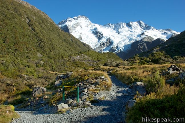
Come to a second junction, 850 meters from the start, where Sealy Tarns Track separates from Kea Point Track. Turn left and face the climb to Sealy Tarns (unless your decide to stay to the right to check out Kea Point).
Proceeding on Sealy Tarns Track, the grade tips up slightly. In another 500 meters (1.35 kilometers from the start) pass a bench with views back down the valley to the south. Have a seat if you’re tired at all, because now the climb begins. After the bench, the track hits the foot of the Sealy Range and turns steep… very steep. In Day Walks in New Zealand, Shaun Barnett wrote that, “the track ascends rapidly in a manner that stretches both legs and lungs.” This is wonderfully phrased way of saying that Sealy Tarns Track is a major workout!
Numerous wooden staircases are built into a zig-zagging course up creases the mountainside. Some of the steps are quite steep and may lead you to wonder, “At what point does a staircase become a ladder?” Improvising a game of stairs or ladder may distract you as you tackle the track’s elevation (the incredible views also help).
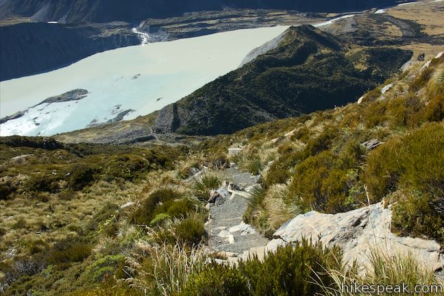
Climb out of the shrubs as the mountainside becomes rockier and tussock takes over as the dominant vegetation. Make your way up staircase after staircase, being sure to look down on Kea Point, which is located on a landing above Mueller Lake. This milky lake fills an area that was carved out by Mueller Glacier, which has since receded. Behind the lake, a wall of boulders called Mueller Lateral Moraine illustrates how large the glacier must have been. Beyond that is Hooker Valley, which contains iceberg-filled Hooker Lake. Towering over the valley is Mount Cook itself, the highest summit in New Zealand. The 3,724-meters tall mountain was named Aoraki by the Ngāi Tahu that inhabited the area before Europeans arrived and gave the mountain another name honoring the English navigator who discovered New Zealand. Today both names are used and the mountain is known as Aoraki/Mount Cook.
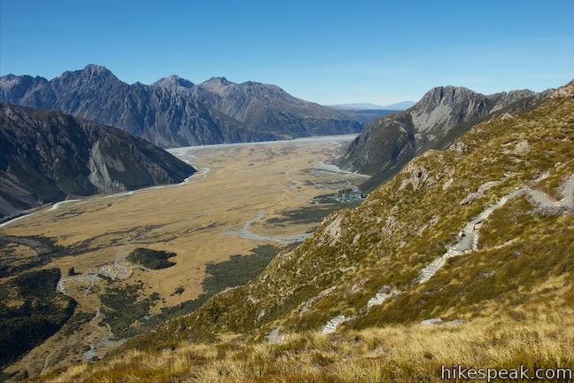
Push up Sealy Tarns Track, plotting an improbably course up the steep mountainside. Looking up, it is difficult to see very far above you. Whatever you can see is quite steep, so focus on looking out from the mountainside instead. Eventually, at 2.1 kilometers from the start, you will cross a prominent outcropping. At this point, you may be eager for a break, so walk out on the small perch and have a look around. Room is available for a few hiking parties to sit and relax. The views looking out across the valley offer a great taste of the vantage from Sealy Tarns.
In the valley below Mount Cook (Hooker Valley), you’ll see Hooker Lake, which is full of icebergs that have broken off from Hooker Glacier. You can also look down the valley to the south where Mount Cook Village clings to the lower slopes of the Sealy Range.
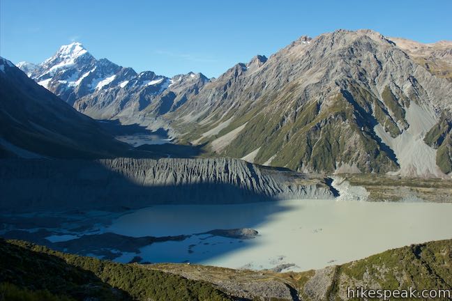
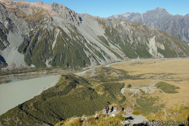
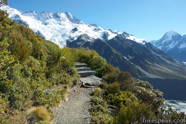
The climb is far from finished (although the grade does lessen somewhat), so continue up Sealy Tarns Track over more stairs (and/or ladders). The views continue to expand, while the campground and car park below get smaller and smaller. When the stairs finally do stop, after 2.75 kilometers of effort, you will have reached Sealy Tarns where a couple small ponds are cupped by a ledge on the mountainside. To the left, Mueller Hut Route keeps climbing up the mountainside. The terrain remains just as steep, but there are no staircases along this rough pole-guided route. Turn right for the last piece of Sealy Tarns Track, which goes along a tarn and tips up to a landing with panoramic views.
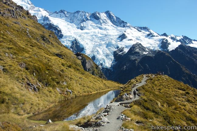
Walk past a small shallow pool (unless it’s been filled by recent rain or snowmelt) and come up to a larger tarn. The mirror-like water can treat you to reflections of Mount Sefton or Mount Cook and the sky above. The tussock-wrapped pools are a pleasant sight. Follow the track up to the rise where you can have a seat at a picnic table and observe the incredible surroundings. Mount Cook, which tops out with a pyramid of ice and snow, offers plenty to look at and is complimented by several surrounding peaks and ridges.
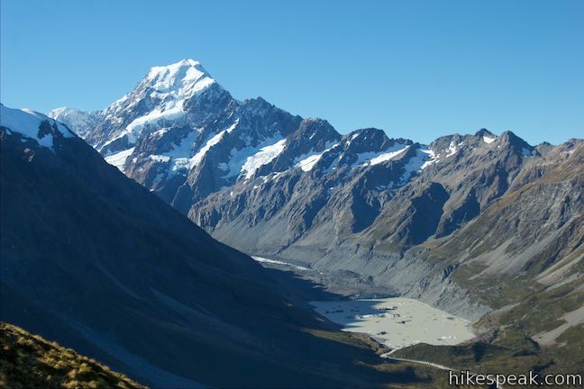
You can walk a bit farther out on the ridge to get a full view of Mount Sefton with nothing but air between you and that 3,151-meter tall mountain. From this vantage, about a third of the mountain is below you and 2/3 of its ridges and glaciers are above you. It feels like the whole mountain is right in front of you and you can watch as sections of ice tumble down walls of dark rock and see snow swept up like cloudbursts. Changes on the mountainside make noise too, like small cracks of thunder or scraping rocks.
The panoramic views from this vantage are spectacular. In the end, the tarns themselves aren’t actually as big an attraction as the views that surround them. In the right conditions, the reflections they present are quite special. Leaving Sealy Tarns, you can choose to continue another 2.35 staircase-free kilometers up to Mueller Hut (gaining another 500 meters) or head back down Sealy Tarns Track and give your legs and lung a rest. While the extension to Mueller Hut is a rewarding challenging, the hike to Sealy Tarns is fulfilling on its own. Even if you choose to hike down, you may want to walk a short distance up Mueller Hut Route to see another tarn and gain an overview of the area.
Dogs are not allowed on tracks in Aoraki Mount Cook National Park. Bikes are also forbidden on Sealy Tarns Track. No permit is required to hike to Sealy Tarn and the national park has no entry fee, so get out and enjoy!
Directions to the Trailhead
- Take State Highway 8 to State Highway 80 (Mount Cook Road), at the south end of Lake Pukaki.
- Drive north on SH 80 for 54.5 kilometers.
- Before reaching Mount Cook Village, turn right on Hooker Valley Road.
- After 2 kilometers, the road ends at White Horse Hill Campground.
- Day use parking is available in front of the campground on the left where the track begins.
Trailhead Location
Trailhead address: Hooker Valley Road, Aoraki Mount Cook National Park, Canterbury, 7999, New Zealand
Trailhead coordinates: -43.71875, 170.0926 (43° 43′ 07.50″S 170° 05′ 33.36″E)
You may also view a regional map of surrounding New Zealand tracks, campgrounds, and lodging.
 | Kea Point Track This easier 3-kilometer round trip walk goes to landing above Mueller Lake with views of Mount Sefton and Mount Cook. |
 | Mueller Hut Route Ascend past Sealy Tarns on a rough route to a famed hut for a 10.5-kilometer round trip hike with spectacular views. |
 | Mount Ollivier This 1,933-meter tall summit can be reached by ascending above Mueller Hut for even grander views. |
 | Hooker Valley Track This superb 11-kilometer round trip hike heads up Hooker Valley to an iceberg-filled lake at the end of an impressive glacier below Mount Cook. |
 | Tasman Glacier View & Blue Lakes This pair of tracks combine for a hike of 1.85 kilometers round trip (or more) with views of small emerald pools and a large milky lake below Tasman Glacier. |
 | More trails in New Zealand Explore other destinations for walking and hiking (as well camping and lodging) in New Zealand. |
 | White Horse Hill Campground This 60-site campground is surrounded by great hiking tracks and just a few kilometers from Mount Cook Village, making it an ideal place to stay during a visit to Aoraki Mount Cook National Park. |
The Department of Conservation brochure for walking and cycling in Aoraki Mount Cook National Park
A helicopoter flyover video of Sealy Tarns Track from DOC Aoraki on youtube.com
Sealy Tarns Stairway Track on nzfrenzysouth.wordpress.com
Sealy Tarns Track on rankers.co.nz
The Department of Conservation webpage for Aoraki/Mount Cook Village Walks
The Department of Conservation webpage for Aoraki Mount Cook National Park
Common Questions about Sealy Tarns in Aoraki Mount Cook National Park
- Is the trail open?
- Yes. You should expect to find that Sealy Tarns Track is open. There are no recent reports of trail closures. If you discover that the trail is closed, please help your fellow hikers by reporting a closure.
- Is this trail free to access?
- Yes, Sealy Tarns Track is free to access. No entrance fee, pass, or permit is required. If you discover that access rules have changed, please provide feedback on your experience.
- How much time does this hike take?
- It takes approximately 2 hours 30 minutes to hike Sealy Tarns Track. Individual hiking times vary. Add extra time for breaks and taking in the views.
- How long is this hike?
- The hike to Sealy Tarns Track is a 5.8 km / 3.6 mile out and back return with 547 meters / 1795 feet of elevation change.
- Are dogs allowed on this trail?
- No, dogs are likely not allowed on Sealy Tarns Track. The trail is primarily open to hikers.
- Where is the trailhead located?
- The trailhead for Sealy Tarns Track is located in Aoraki Mount Cook National Park, Canterbury.
Trailhead Address:
Hooker Valley Road
Aoraki Mount Cook National Park, Canterbury 7999
Trailhead Coordinates:
-43.71875, 170.0926 - What are the driving directions to the start of the hike?
To get to the trailhead: Take State Highway 8 to State Highway 80 (Mount Cook Road), at the south end of Lake Pukaki. Drive north on SH 80 for 54.5 kilometers. Before reaching Mount Cook Village, turn right on Hooker Valley Road. After 2 kilometers, the road ends at White Horse Hill Campground. Day use parking is available in front of the campground on the left where the track begins.
View custom Google Maps directions from your current location.
- Are there other trails near Sealy Tarns Track?
- Yes, you can find other nearby hikes using the Hikespeak Hike Finder Map.


[…] Good article on the Sealy Tarns Track by Hike Speak […]
[…] think this is from Sealy Tarns, not Mount […]