Scenic and Overlook Trails Loop
in Point Mugu State Park

Point Mugu State Park preserves a stunningly picturesque portion of the Santa Monica Mountains at the west end of Malibu. When you see park trails with names like Scenic Trail and Overlook Trail, you anticipate first class ocean views. Scenic and Overlook Trails Loop delivers the goods! This 2.7-mile hike climbs 425 feet to tremendous vistas atop a ridge west of Big Sycamore Canyon. The trek can (and should) be stretched to 3.5 miles by traveling down a ridge trail that parts from the loop to present ocean views typically reserved for exotic vacation destinations.
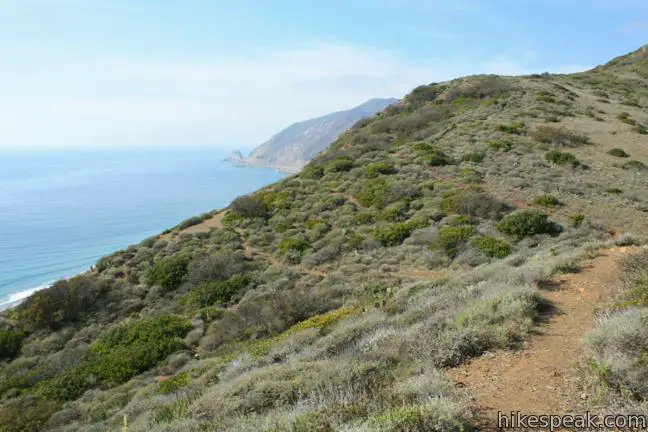
Begin the hike from the day use area at the bottom of Big Sycamore Canyon in Point Mugu State Park. Walk a quarter mile through Sycamore Canyon Campground to the start of a dirt service road named Big Sycamore Canyon Trail. Pass through the gate and shuffle forward about fifty steps to a dirt single track departing on the left dubbed Scenic Trail. Turn here and make your way across Big Sycamore Creek (which is typically dry) to the west wall of the canyon where the climb begins. Occasional wooden steeps assist the ascent up a slope dominated by coastal sage. The thigh-high vegetation allows for open views both up Big Sycamore Canyon and down on the blue waters beyond the mouth of the canyon.

Two-thirds of a mile from the start, reach the top of Scenic Trail in a saddle on a bluff, 365 feet above the surf. A sign at the junction offers an arrow to the right toward the connector to Overlook Trail. Several other paths branch off from the top of Scenic Trail. Before you continue the loop, you owe it to yourself to explore at least a couple.
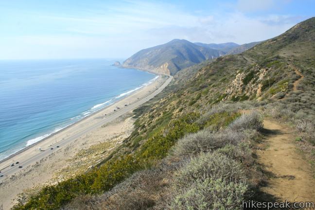
Straight head, a rugged track climbs approximately half a mile up the ridge to Ray Miller Trail. The shortest extension brings you to a viewpoint on the bluff where you will find a hitching post and a sweeping panorama along the coast toward Point Mugu. Beneath the bluff, PCH can be seen cutting across a sandy beach. Reach the landing by hiking straight from the junction for a few hundred feet, curving to the left down to the overlook.

For a bit more exercise and overwhelming ocean views, make a hard left at the top of Scenic Trail on a path that traverses the ridge framing the west side of the bottom of Big Sycamore Canyon. This 0.4-mile long bonus track gains another 75 feet and is easy to follow as it crosses the spine of a rugged undulating ridge bordered by dramatic drop-offs. To the west is a dangerously steep drop to a sandy beach running between the ridge and the rocky point that gives the state park its name. To the east, a slightly less steep slope giving way to Big Sycamore Canyon.

The trail ends atop a prominence at the end of the ridge. The towering terminus offers striking sea breezes and views to see. You have a bird’s eye perspective of the campground to the left, shaded by hearty sycamores. To the right, beneath a 400-foot bluff, a slope of sand feeds into the Pacific. Point Mugu juts into the blue water on the horizon to the west. It is a rare and stunning vista. Even if you only made a short trip to the park from Los Angeles, this trail will have you feeling like you took a vacation to a faraway paradise.

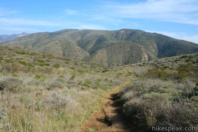
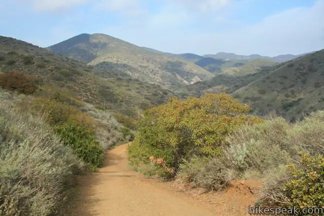
From the top of Scenic Trail, is it less than a tenth of a mile on the connector to Overlook Trail. Turn right on this wide fire road and begin hiking downhill. With the ocean views behind you, the back half of the loop serves up scintillating inland views of Big Sycamore Canyon. To the northeast, the highest peaks in the range, the Boney Mountains, make a brief appearance.

After 0.9 miles of canyon views, Overlook Trail comes to an end. Turn right on Big Sycamore Canyon Trail and hike 0.45 level miles back to the gate at the bottom of the trail to close out the loop. If you aren’t spending the night at Sycamore Canyon Campground, hike a quarter mile back to the day use parking area. If you would like a closer view of the ocean, take the path beneath the bridge and enjoy a relaxing moment on the beach.
Point Mugu State Park changes a $12 fee per vehicle to use the Big Sycamore Canyon Day Use Area (price as of 2024). Free parking can be found along PCH outside the entrance. Dogs are not allowed on the trails. Mountain bikes are allowed on Overlook Trail and Big Sycamore Canyon Trail, but not on Scenic Trail. No permit is required to hike Scenic and Overlook Trails Loop, so get out and enjoy.
To get to the trailhead: From Los Angeles, take the 10 Freeway west through Santa Monica and follow PCH northwest for 32 miles through Malibu to Point Mugu State Park. Drive 3.2 miles past Yerba Buena Road, and turn right into Sycamore Canyon Campground. Just past the park entrance station, turn left into the day use parking area.
From Oxnard, head southeast on PCH for twelve miles and turn left into Sycamore Canyon Campground.
Trailhead address: Sycamore Canyon Road, Malibu, CA 90265
Trailhead coordinates: 34.071305, -119.012668 (34° 04′ 16.69″N 119° 00′ 45.60″W)
View Santa Monica Mountains in a larger map
Or view a regional map of surrounding Los Angeles trails and campgrounds.
 | La Jolla Canyon Loop This 11.75-mile hike explores Point Mugu State Park on the west end of the Santa Monica Mountains, offering extraordinary ocean views (while still visiting La Jolla Canyon Falls). |
 | Mugu Peak This 6.5-mile hike ascends from the bottom of La Jolla Canyon to the top of a 1,266-foot peak, providing exceptional ocean and canyon views. |
 | La Jolla Canyon Falls This 1.5-mile hike visits a short seasonal waterfall in Point Mugu State Park. |
 | Sandstone Peak This 6.25-mile loop summits the tallest peak in the Santa Monica Mountains. |
 | The Grotto This 3-mile out and back hike visits a remote grotto in the Santa Monica Mountains National Recreation Area. |
 | More trails in the Santa Monica Mountains Explore other destinations in the range. |
 | Sycamore Canyon Campground This 58-site campground in Point Mugu State Park sits at the mouth of a beachfront canyon and has access to trails through the west end of the Santa Monica Mountains. |


I am looking for ocean view hiking trails with ample parking spaces for a group of hiking club. Please, help me. Thank you!
There is plenty of parking at this trailhead (and also along PCH just outside the park entrance).
My questions is Are there Restrooms and where are they located at. I planing a few hikes up there with some girls.
Thank You!
Certainly. There are restrooms next to the day use parking where the hike begins, and more within the campground that you will pass once you start hiking. There are none out on the trails beyond that though.
Thank You so Much for INFO I requested.
Few more Question there a Bill Bord there showing all the trails and threw up the Hikes is there Posting of where you are to go!
What a Good Hike for a first time there we are good for a 4 to 5 hours round trip We can’t wait for that Ocean View.,
Thanks Again
Robert.
Enjoy the hike! All major junctions are marked.
Thank You so much!
We are looking forward to this Saturday Hike Oct 13th and more in the future.
Thank you for your patience, and the in site could not have found a better Sight to log on too. Keep up the Good Work!
Point Mugu Sate Park is my after work hiking destination. I know of a couple of other hikes that have better views and variation of ecosystems.
The La Jolla Canyon to Ray Miller trail loop is one of the best day hikes in the United States. You can also do a separate trip up to the top of Mugu Peak from the same starting point. The parking lot at La Jolla is nearly always empty and can handle a large group. Most people park on PCH to avoid paying for parking.
Also consider the Chumash trail (6,500 years old) as the spectacular views are immediate and the trail steep; the trail head is across from the NBVC firing range.
La Jolla Canyon Loop is a definite favorite!
Hello,
Is this trail heavily populated? I’m looking for some good trails in the santa monica mountains that are safe to hike alone.
Thanks!!
Hi. This trail is not too crowded.
Maddy, you should bring a friend to take lots of photos of you. The view is amazing. The hikes are fun and do not get too crowded. Maddy, last Sunday I was there for my first time. I already have more dates booked to return with some friends. Maddy, I will be there Oct 27th at 7 a.m. with a group. look me up on FB – Robert Stoner, City: Rosemead Ca.
Quick question!! Is this trail still available? Im planning to go there next weekend.
Are dogs allowed on this trail?
No. Take a look at Tuna Canyon Park for a good ocean view hike with dogs.
The La Jolla segment I think it’s called has been closed for some time. There are signs for the closure in front of the main gate but NOT at the entrance to the Ray Miller Trail. Found out the hard way after seven miles in that I had to turn around and run the whole thing in reverse. Should definitely be signs on RMT. Left messages for the service to post but they haven’t done it. Also can get a bit confusing on trails as to where to go. Easy to get looped back into areas you’ve already run. I recommend bringing a map or be very familiar with trails before you go.
Can you go all the way to Thousand Oaks through Sycamore Canyon Rd? Has anyone ever tried to hike it all the way through?
If you want to avoid the $10 parking fee parking, parking on PCH it’s for the squeamish. The turn-off is between two sharp bends on the highway and each are slide areas that are closed off to parking. It’s a bit of a walk from the areas where you can park, through the slide areas (pedestrians can walk behind the barriers between the highway and the cliffs) along the highway to get to the entrance.
[…] generally followed the the Scenic and Overlook Trails Loop described by Hikespeak but our wanderings extended the trip to over 8 miles and ascending about 500 feet in my search for […]
We love riding this trail as it is has a good up hilll that gets a lot of payoff at the end. We were out there the other day and the weather was perfect. https://youtu.be/soRILoAs7pU
Is it a lot of uphill?