
You have to use some pretty colorful language when describing Rainbow Vista Trail, like vibrant, fiery, and effing extraordinary. The good news about Rainbow Vista Trail is that you get big views right from the start and any hiking you do will be picturesque. The bad news is that Rainbow Vista Trail is not as well marked as it could be and crosses sandy terrain with lots of spurious footpaths. Hikers can head to an alluring outcropping of rock with tremendous 360-degree views for a 0.7-mile round trip hike with 60 feet of elevation change. However, this crest is only a deviation off the longer trail in the area, which ventures down a canyon to the southeast for a 1.5-mile round trip hike to Fire Canyon Overlook that has 100 to 150 feet of elevation change.
Drive up White Domes Road from the Visitor Center in Valley of Fire and you might be thinking that the landscapes of red sandstone couldn’t get any more amazing. Arrive at a turnout for Rainbow Vista, step out of your car, and you’ll be blown away by the landscapes to the north painted in whites, yellows, and pinks. The views get even better once you leave the road and start hiking. A sign at the trailhead explains:
You are looking across 150 million years of time. The great maze of canyons, domes, towers, ridges, and valleys before you are carved from sand deposited during the time when dinosaurs walked the earth. This is wild, virtually untouched wilderness. It is an “Adventure in Color” for you to experience by car and on foot.
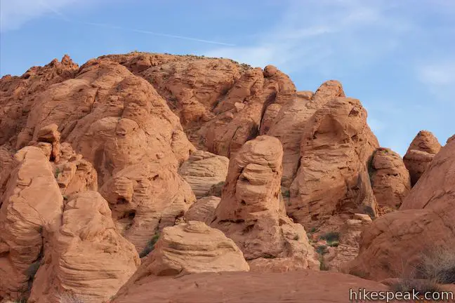
Set out east on a sandy trail between tall formations of red sandstone. Pass a monolith on your right to get a view of a large assembly of formations that look like an enlarged version of the towers of wet sand you might make when building a castle at the beach.
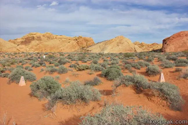
Trudge gradually downhill through the sand and come to a marked split, 0.15 miles from the start. This is the start of a loop. Ahead is an area of open desert backed by paler colored rock formations. The trail curves around both sides of this open area. The crest boasting the nice 360-degree views lies straight ahead and is a mini-summit roughly shaped like a pyramid. The easiest way to reach this viewpoint is to stay to the left at the split.
If you turn to the right, in order to continue on the longer trail, you will need to watch out for a misleading spur that dead ends. Just after turning right at the marked junction, you’ll need to veer left at what amounts to an unmarked junction to avoid taking a well-worn path that only goes a short distance to the southwest. The false path is more worn-in than the actual trail, leading many hikers (including your humble writer) to blow right past the real trail and march up to a dead end canyon with less to look at. However, if you hike up the trail to the outcropping first and then continue on to Fire Canyon Overlook, you should be able to put off the confusing junctions for the hike back when you are much less likely to get off course.
To hike to the crest, bear left at the split and head across the open area. Several paths stray across the sand, so following this part of the trail is not clear cut. Do your best to stay on trail. To your left, look northwest across White Domes Road toward three distinct ridges in the landscape, each painted with different colors. The nearest formation has tilted rocks painted cream and pink. Beyond that lies a taller ridge of red-orange sandstone. A range of blue-gray mountains rises beyond that, the Muddy Mountains.
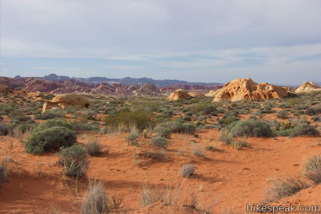
Head in the direction of the rock formations on the other side of this open desert area, aiming to the north (left) of the rock that somewhat resembles a pyramid. Look for a trail marker with a sign that has a picture of a camera on it. Head to the sign and when you get there, you’ll get a good look at the sandstone formation in front of you, which has a cross-cutting pattern similar to the Beehives.
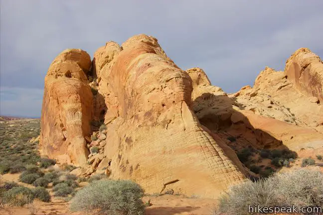
You will have hiked a quarter mile to the photo-op sign, so take in the surroundings. The trail now curves to the right and heads toward your target, a tilted rock that rises to a point.
Hit the base of the rock after another 250 feet. The most obvious thing to do is take the short trail up the steep slope and have a look around. You could also bypass the raised view and continue across the sand toward the canyon to the south, where a longer branch of Rainbow Vista Trail goes to Fire Canyon Overlook.
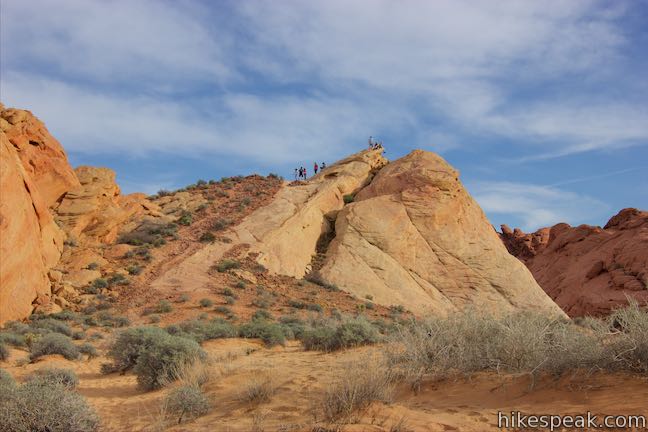
The views from the crest are too good to pass up. Leave the sand and hike up the pitched side of the rock, staying to the left of a crevice that runs up to the top. When you get up the slope, make your way up to the high point for sweeping views, just 0.35 miles from the start of the hike.
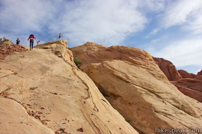
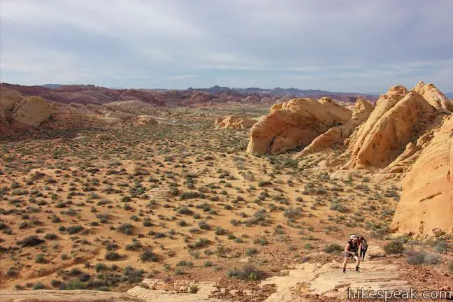
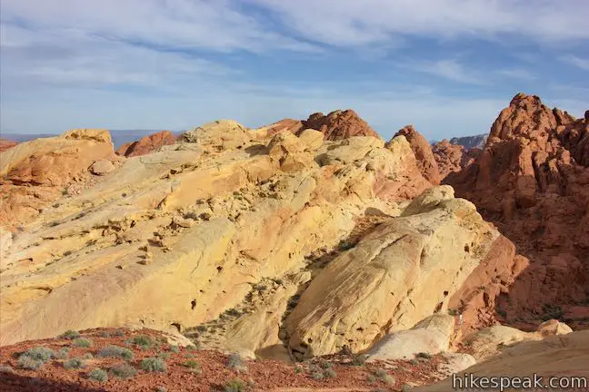
Gaze north down the trail you came up and enjoy a loftier view of the multi-colored, mutli-textured terrain visible from the trail below. Just across White Domes Road, the ridges are a hard-to-imagine mix of yellow, peach, dark red, and white. Below your vantage point to the northwest is the orange-red sand you walked across, dotted by small green brush. Farther to the west, the trailhead is partially visible through a garden of boulders.
Of course, that’s just the slice of the view that you are already familiar with. Keep turning around and the crest delivers knockout panoramas of landscapes not visible below. Look east over an area of lighter colored formations. Ridges of yellow and orange come to a crest at Silica Dome. If you’ve been to Death Valley, this view may remind you of the perspective of Manly Beacon from Zabriskie Point. Look south over a canyon where the terrain suddenly transitions from yellow back to fiery red sandstone. The longer Rainbow Vista Trail ventures down this canyon.
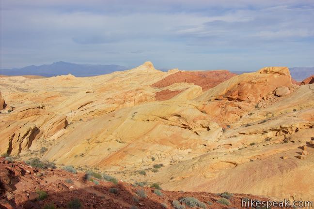
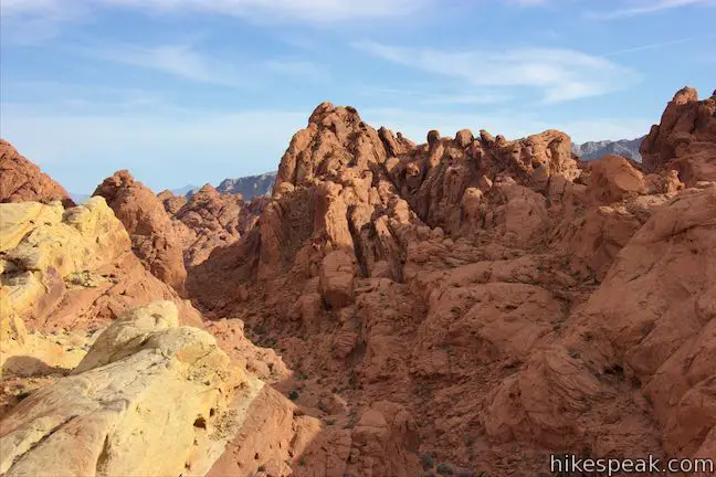
When you are ready to leave the viewpoint on the crest, you can hike back the way you came for a picturesque 0.7-mile hike with 60 feet of elevation change. Alternatively, make your way to the canyon to the south. As you step down from the highest spot, turn right to take a trail that goes down the opposite side of the crest than you came up. Make your way south between rocky ridges. Reach the desert floor and join the longer Rainbow Vista Trail. Turn left and hike down the canyon below alcove-packed formations of red sandstone.
The trail ends at Fire Canyon Overlook, which presents views over the sandstone-covered landscapes to the south and east. Turning around, you can hike about 2/3 of a mile back to the trailhead, ascending 100 feet. This hike is about 1.5 miles round trip (with 150 feet of total elevation change if you include the viewpoint on the crest).
When you return to the area of open sand that you crossed earlier, hug the left side of the opening, passing along the rock formations to the south. You will link up with a larger sandy trail and turn right just before reaching the marked trail junction where you should turn left to walk back to the trailhead. That right turn isn’t marked, making it easy to miss if you are hiking in the opposite direction (which is why many hikers end up following a path that dead ends below cliffs to the southwest).
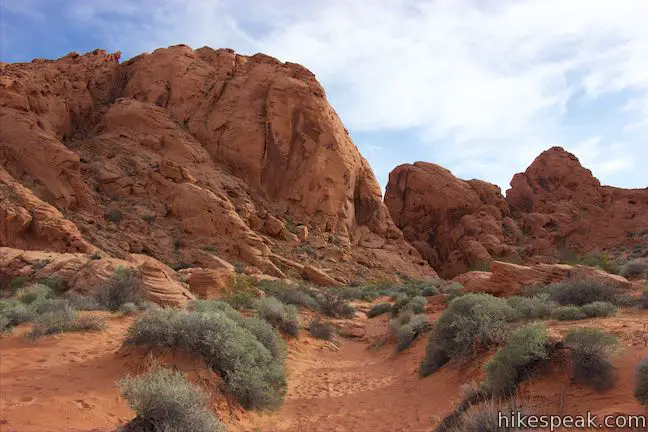
Valley of Fire State Park charges an entrance fee but no permit is required to hike in the park. You will find toilets and picnic tables at the Rainbow Vista Trailhead. Many misguided paths cross through to sand along these trails, so do your best to stay on track. Dogs are allowed on leashes.
To get to the trailhead: From Las Vegas, take Interstate 15 north for about 35 miles to exit 75 (signs for Valley of Fire State Park and Lake Mead National Recreation Area). At the end of the offramp, go southeast on Valley of Fire Highway. Reach the park’s west entrance after 14.5 miles. Drive another 3.5 miles and turn left, following a sign for the visitor center and Mouse’s Tank. Go a tenth of a mile and bear left to stay on White Domes Road, bypassing the visitor center. Drive another 1.8 miles to the Rainbow Vista Trailhead, which is on the right 0.7 miles after the Petroglyph Canyon Trailhead.
Arriving from the east, from the intersection of Route 169 and 167 near Lake Mead, drive west on Valley of Fire Highway for two miles to the park’s east entrance. Drive another 3.3 miles to the intersection by the start of White Domes Road, turn right and take this road for 1.9 miles to Rainbow Vista Trailhead.
Trailhead address: White Domes Road (Mouse’s Tank Road), Valley of Fire State Park, Overton, NV 89040
Trailhead coordinates: 36.45083, -114.51535 (36° 27′ 03″N 114° 30′ 55.25″W)
You may also view a regional map of surrounding Nevada trails and campgrounds.
 | White Domes This 1.1-mile loop is impressive from start to finish as it explores colorful, intricate rock formations, passes and old film set, and slips through a narrow slot canyon. |
 | Fire Wave This 1.5-mile hike reaches a sensational striped creation where a slickrock depression is painted in waves of orange and beige. |
 | Petroglyph Canyon Trail to Mouse's Tank This 0.75-mile hike travels down a sandy path lined with petroglyphs to a natural basin formed in the sandstone. |
 | Balancing Rock This 0.25-mile hike, which begins next to the Valley of Fire State Park Visitor Center, approaches a rock formation that appears to stand with a bit of magic. |
 | Elephant Rock This 0.3-mile hike at the east entrance of Valley of Fire State Park leads to a sandstone formation resembling an elephant with a unique natural arch for a trunk. |
 | Petrified Logs Loop This 0.3-mile hike gets close to petrified logs on the desert floor passing panels that explain how wood is petrified. |
 | Atlatl Rock Step right up to see Native American rock art on this 0.1-mile trail with stairs up a rock face to a collection of petroglyphs. |
 | Hikes in Nevada Explore more trails in Nevada and the picturesque parks around Las Vegas. |
 | Atlatl Rock Campground and Arch Rock Campground Valley of Fire State Park has great places to camp surrounded by formations of red sandstone. |


[…] Even after waiting 15 minutes on the street there was not a chance. So we hit the road and went to Rainbow Vista where it was crowded, too but just before we pulled into the parking lot someone […]
[…] formations that twist and bend into loops, arches, and cubby hole-like caves. Pull over at Rainbow Vista for the most Mars-like terrain. About 3,000 years ago, Native Americans left behind petroglyphs […]