Oso Flaco Lake Trail in Oceano Dunes State Vehicular Recreation Area

Oso Flaco Lake Trail in Oceano Dunes SVRA offers a hike with easy-going appeal. The nearly level trail takes a boardwalk over a 75-acre birdlife-boasting lake and across sand dunes to a tucked-away beach and a viewpoint overlooking the Guadalupe-Nipomo Dunes. These are the largest dunes on the coast of Southern California, but Oso Flaco Lake Trail is a short hike at just 2-miles round trip. If you chose, you could stroll double that distance down the beach at the end of the trail. Oso Flaco Lake Trail explores a rare, undeveloped gem on Southern California’s coastline. The trail is located at the southern end of San Luis Obispo County within a state recreation area and the Guadalupe-Nipomo Dunes National Wildlife Refuge.
This hike begins from Oso Flaco Lake Day Use Area, a parking lot off Oso Flaco Lake Road in Arroyo Grande. Walk around a gate and set out on a section of the road that is closed to vehicle traffic. Rest assured, you will only be walking on this paved road for less than a quarter mile, taking a straight line through a cottonwood forest.
Oso Flaco Lake appears through the trees on the left as you approach the start of the boardwalk on Oso Flaco Lake Trail. Admire the view over a smaller branch of the lake on the right before turning left to walk out on a boardwalk over the lake. Oso Flaco Lake is a shallow, freshwater lake that covers 75 acres. This rare coastal lake is a refuge for both local and migrating birds.
Walk out on the boardwalk, which pushes out over the lake and curves to the right, passing benches and a broad view south over the lake. Algae make interesting patterns in the water in front of the boardwalk. Ducks and swans drift across the calm water. Beyond the lake, you’ll see sand-covered hills rising above the surrounding brush. Tules and cattails line the calm waters of Oso Flaco Lake.
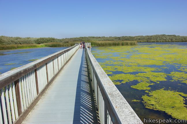
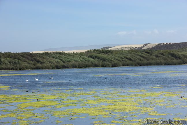
After 325 yards of over-the-water hiking, the boardwalk leaves the lake. The trail surface remains boardwalk as it slips through a dune succession forest of brush that has grown up over the sand between the lake and the ocean.
Benches are positioned at two spots along the trail about half a mile from the trailhead. One bench is joined by a panel describing the wildflowers that appear in this area during the spring. Look for sand verbena, a clustering pink ground flower that thrives on sandy landscapes. Dunes paintbrush, beach evening primrose, silver lupine, and Blockman’s leafy daisy add even more color along the trail in the spring.
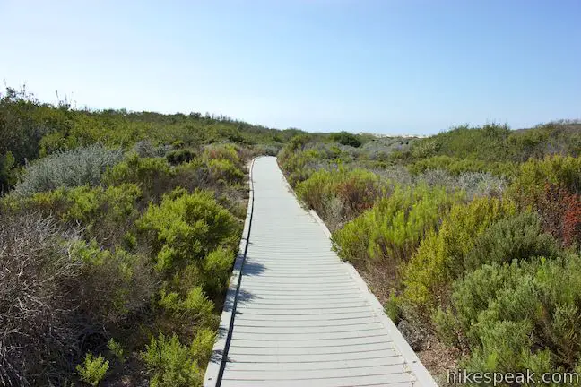
As you start to catch glimpses of the ocean, the trail comes to a junction by a small picnic site, just over 0.8 miles from the start. To the right, a spur goes north a short distance to a vault toilet at a junction with Osos Flaco Lake Road.
Proceed straight on Osos Flaco Lake Trail, which launches over a shallow rise in the dunes. On the other side, you’ll find enticing views of the ocean and come to a junction, just before the end of the boardwalk and 0.95 miles from the start. Straight ahead, the boardwalk drops into the sand and presents a path to the ocean. Before transitioning this hike into a beach stroll, turn left up a 0.05-mile spur off the end of the boardwalk that leads to a panoramic viewpoint atop a crest in the dunes.
The viewpoint presents a sweeping coastal panorama. Two panels detail the views to the north and south. To the north, you can look up the coast toward Point San Luis Lighthouse, Diablo Canyon, Port San Luis, and Avila Beach, all backed by the Irish Hills. In the other direction, you can look south over a massive sand dune landscape. Behind the mouth of the Santa Maria River (which is probably hidden by dunes), you will see the steep terrain of Devil’s Slide, a large dune feature, and coastal landmarks like Mussel Rock and Point Sal. To the west, beyond one row of dunes, is the vast Pacific Ocean. This is quite a beautiful sight!
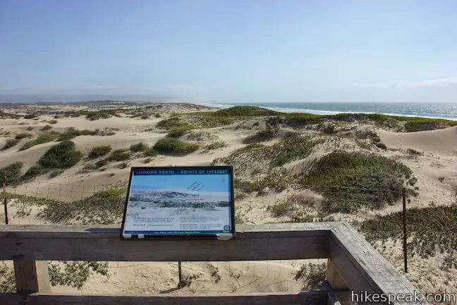
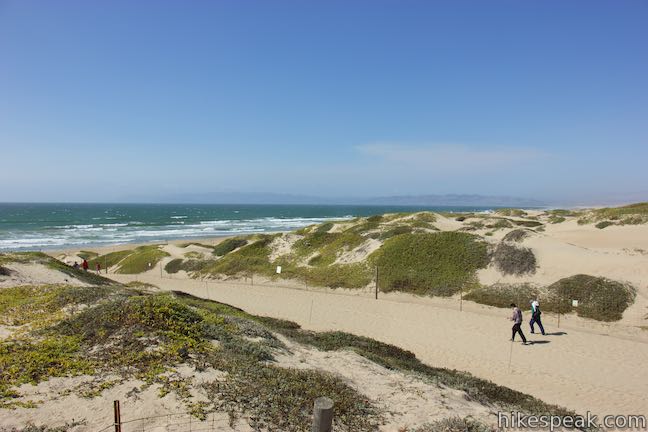
If you prefer not to walk on the sand, you could turn around at the overlook for a 2-mile round trip hike with just 25 feet of elevation change. Otherwise, return to the junction and turn left to walk down a sandy ally to the beach. You’ll probably want to shed your shoes at this point to step through the loose sand. After a tenth of a mile, you’ll be able to dip your toes in the waves washing up on shore.
To the right, the beach to the north may be closed to public access. From March through the end of September, endangered birds, western snowy plover, nest on this beach. The park closes this beach to preserve the bird’s limited habitat. Don’t be deterred by the closure. You can walk south down the beach for four and a half unobstructed miles to the mouth of the Santa Maria River. In a short distance (about a quarter mile from the end of the boardwalk), you’ll hit the mouth of Oso Flaco Creek, where a shallow stream flows down the sand toward the ocean. On the inland side of the beach, a pool in the creek offers additional sanctuary for birds on the water’s path from Oso Flaco Lake to the Pacific.
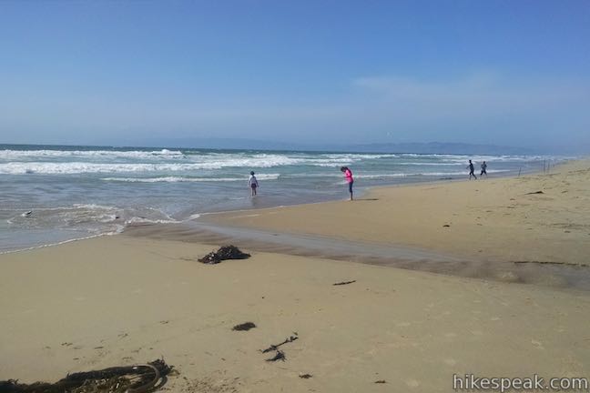
This beach can only be reached by Oso Flaco Lake Trail and it is quite secluded once you walk a short distance from the end of the trail. Even on busy weekends, you can have the beach to yourself, which is a rare thing on the California coast. The only buildings in sight are up the coast to the north around Avila Beach. When you’ve had your fill of this lovely, remote beach, return to the boardwalk and hike back the way you came.
Oso Flaco Day Use Area is open for vehicle parking from 6 a.m. to 6 p.m. A $5 per vehicle fee is charged to park in the lot. Senior citizens can park for $4 per vehicle (all prices as of 2016). Additional free parking can be found along Oso Flaco Lake Road just outside of the day use area. Dogs, horses, and bikes are not allowed on Oso Flaco Lake Trail. No permit is required for this short, easy, and scenic hike, so get out and enjoy!
To get to the trailhead: Take Highway 101 south of Arroyo Grande to exit 180 for Willow Road. Drive west for 4 miles on Willow Road and turn left onto Highway 1. Go south for 2.7 miles on CA-1 and turn right onto Oso Flaco Lake Road. Drive 3 miles down this straight road to Oso Flaco Day Use Area, which is on the right.
Trailhead address: 3030 Oso Flaco Lake Road, Arroyo Grande, CA 93420
Trailhead coordinates: 35.0288, -120.6171 (35° 01′ 43.67″N 120° 37′ 01.55″W)
View Oso Flaco Lake Trail in a larger map
Or view a regional map of surrounding Central Coast trails and campgrounds.
 | Sycamore Crest Trail This 1.75-mile hike departs from Sycamore Mineral Springs Resort and ascends the north slope of Ontario Hill, arriving at a scenic ocean perch. Extend the hike down the ridge and create a 3.25-mile one-way hike. |
 | Shell Beach Bluff Trail - Ontario Ridge Trail Loop This 2.8-mile loop explores the coast between Shell Beach and Avila Beach, on and below a 700-foot ridge. |
 | Cave Landing This half-mile round trip hike descends 100 feet to a natural rock bridge at the end of a headland east of Avila Beach. |
 | Bob Jones Bike Trail This easy 5-mile round trip hike or ride follows San Luis Obispo Creek to Avila Beach. |
 | Point San Luis Lighthouse via Pecho Coast Trail This docent-led 3.5-mile out and back hike crosses scenic coastal bluffs to reach the historic lighthouse on Point San Luis. |
 | Hi Mountain Trail This 1.4-mile long trail goes through many phases as it explores the Santa Lucia Mountains east of Arroyo Grande and makes for a 3.25-mile loop including a walk along Hi Mountain Road. |
 | More hikes in San Luis Obispo Explore other trails around San Luis Obispo including Morro Bay State Park, Montaña de Oro State Park, and the Morros. |


Are leashed dogs allowed on this walk and beach?
No. It’s a wildlife sanctuary
We had such a nice walk going to the beach on the boardwalk..on our way back however a guest let their dog poop on the paved trail, and didn’t bother picking it up. I thought dogs we not allowed on the trail…
Is fishing allowed at the lake?
Is oso flaco open,considering the rain?