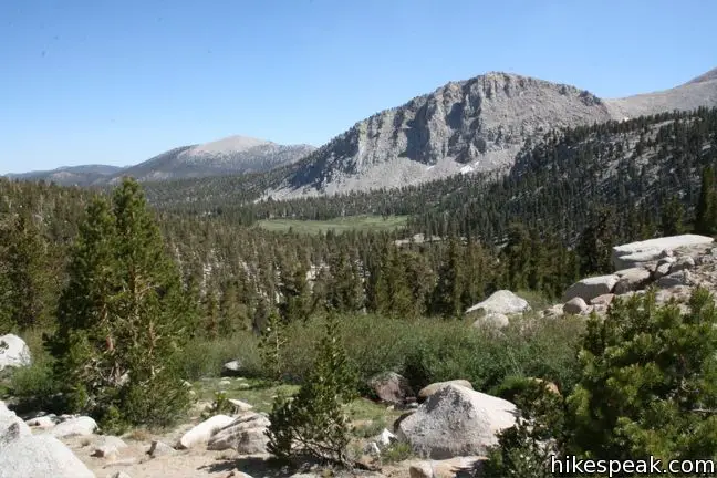
Old Cottonwood Creek Trail breaks from the popular Cottonwood Lakes Trail for a more secluded hike into Cottonwood Basin, visiting pristine meadows, alpine lakes, flowing creeks, and amber forests. The trail provides a lovely 8-mile day hike to South Fork Lake, with several options to extend to nearby lakes and peaks.
Take Cottonwood Lakes Trail from Horseshoe Meadow as it runs downhill heading north through the Golden Trout Wilderness. After about a mile, the trail crosses the South Fork of Cottonwood Creek. A log positioned over the creek provides a bridge for days when rock hopping would cause wet toes. An important unmarked junction is a few hundred feet beyond the crossing. At the mid-point of a straight run of sandy timber-lined trail, turn left and cross over the logs to join the under-maintained but still-used Old Cottonwood Creek Trail. If you are not looking for the trail, you could easily walk right past it.

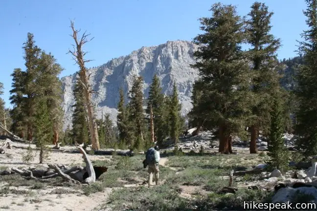
Beyond the junction, the single-track becomes easier to follow. There are fewer travelers here than on Cottonwood Lakes Trail, but it is no less picturesque. Hike through the forest of Foxtail Pines. The trees you pass might be as much as two thousand years old, and their golden red trunks glow triumphantly in the sunlight. The trail borders a babbling creek for much of its course and crosses rich forest meadows as it rises gradually northwest toward the mountains and lakes.

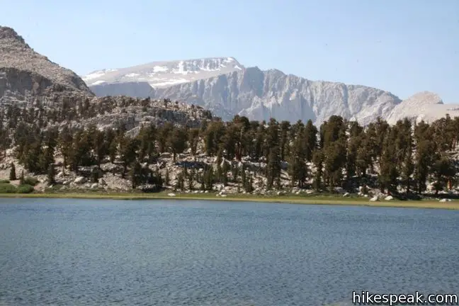
Beneath the South Fork Lakes, the trail climbs a rather steep rocky hillside, and becomes a bit hard to follow. Stay close to the creek and stick to the faint path as best as possible. Cairns positioned along the way assist with the navigation. At the top of the hill the trail remains close to the creek and then crosses it to approach South Fork Lake, which lies at 11,000 feet. Here you have a nice view of Mount Langley, whose 14,042 foot summit is the ninth tallest in California. Have a seat at water’s edge and enjoy this striking lake. Anglers can enjoy the hearty stock of Golden Trout.

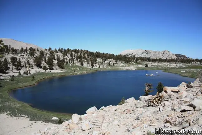
The trail continues along the south end of the lake and heads east before crowning a ridge and dropping down to Cirque Lake. Oddly, the trail fizzles out a few hundred feet from the shoreline, making it a bit tougher to find on the return. Cirque Lake lies at the base of a boulder field beneath Cirque Peak and spoils hikers with yet another crystal blue body.

This day hike will take about nine miles round trip (eight excluding Cirque Lake). Those looking to extend may climb the 12,900-foot Cirque Peak, which is a two-mile long ascent from the lake, or take the one mile connection on South Fork Trail to join Cottonwood Lakes Trail.
What you should know before you go: A free wilderness permit is required for all overnight trips into the national forest. A trail quota is also in place on Cottonwood Lakes trailhead from the end of June to mid-September. A permit may be booked in advance for a five-dollar fee or obtained the day of the hike for free at the nearby ranger station in Lone Pine (or one of the other permit offices in the Inyo National Forest). The quotas are generous for Cottonwood Lakes trailhead and those who haven’t reserved a permit will most likely be able to obtain one on the day of the hike (if you get to the ranger station early in the morning). Cottonwood Lakes Trail opens to sixty permits per day. Thirty-six of those may be reserved ahead of time for a fee of five dollars and twenty-four are saved for walk-ins.

Campfires are prohibited and backpackers must set up camp at least 100 feet from lake shores and streams. There are not garbage cans or bathrooms along the trail, so hike responsibly.
To be safe, backpackers must carry a bear canister to hold their food while camping. These can be rented in Lone Pine for five dollars. Bear Lockers are provided at the trailhead. Make sure your vehicle is bear-safe before leaving the parking lot.
Given the high elevation of the trailhead at Horseshoe Meadow, altitude sickness is prevalent in the region. Backpackers are well advised to spend a night of acclimation at one of the trailhead campgrounds or be prepared to face the symptoms (headaches, nausea, and lack of appetite) out on the trail.
Directions to the Trailhead
- It takes half an hour to ascend from the city of Lone Pine to the trailhead campgrounds.
- From Route 395 in Lone Pine, turn west at the traffic light on to Whitney Portal Road.
- After three miles, turn left on Horseshoe Meadow Road.
- Drive twenty miles up mountain switchbacks to the end of the road at Horseshoe Meadow.
- Turn right, following signs for Cottonwood Lakes and park at the trailhead.
Trailhead Location
Trailhead address: Horseshoe Meadows Road, Inyo National Forest, Lone Pine, CA 93545
Trailhead coordinates: 36.4532, -118.1699 (36° 27′ 11.5″N 118° 10′ 11.6″W)
View Eastern Sierra in a larger map
Or view a regional map of surrounding Sierra Nevada trails and campgrounds.
 | Cottonwood Lakes This trail through lake-filled Cottonwood Basin provides a 10-mile round trip day hike to Long Lake and a 7.5-miles one-way trek to New Army Pass a 12,300-foot gateway to the Eastern Sierra including nearby Mount Langley. |
 | Mount Langley This 22-mile trek travels past Cottonwood Lakes Trail over New Army Pass to a 14,042-foot summit with towering views of the Sierra. |
 | Cottonwood Pass This 7-mile round trip trail ascends 1,200 feet to an 11,200-foot pass and a junction with the Pacific Crest Trail, with access to Golden Trout Wilderness and Sequoia National Park. |
 | Cirque Peak This 12,900-foot summit can be reached via off-trail ascents from New Army Pass, Cirque Lake, and Chicken Spring Lake. |
 | Lower Soldier Lake This 19.2-mile loop crosses Cottonwood Pass and New Army Pass to visit a beautiful lake that is an ideal camping spot for backpackers heading higher and deeper into the Sierra. |
 | Sky Blue Lake This hike extends beyond Lower Soldier Lake up Miter Basin to a deep blue lake surrounded by towering peaks. |
 | More trails in the Sierra Nevada Mountains Explore other destinations in Sequoia National Park and the rest of the range. |
 | Horseshoe Meadow Campgrounds This pair of campgrounds offer 40 sites and serve as a great base for the Cottonwood Pass and Cottonwood Lakes trails. |
Horseshoe Meadow on summitpost.org
Cottonwood Lakes Trail in Sequoia National Park: Your Complete Hiking Guide by Mike White
Cottonwood Lakes Trail in The High Sierra: Peaks, Passes, and Trails by R. J. Secor
Trail and campground status page for the Mount Whitney Ranger District of Inyo National Forest
Common Questions about Old Cottonwood Creek Trail to South Fork Lakes in the John Muir Wilderness
- Is the trail open?
- Yes. You should expect to find that Old Cottonwood Creek Trail is open. There are no recent reports of trail closures. If you discover that the trail is closed, please help your fellow hikers by reporting a closure.
- Do I need a permit for this hike?
- Yes. National Forest Wilderness Permit and bear canister required for overnight trips.
- How much time does this hike take?
- It takes approximately 4 hours 30 minutes to hike Old Cottonwood Creek Trail. Individual hiking times vary. Add extra time for breaks and taking in the views.
- How long is this hike?
- The hike to Old Cottonwood Creek Trail is 8 - 9 miles (out and back) with 1150 feet of elevation change.
- Are dogs allowed on this trail?
- Yes, dogs are allowed on Old Cottonwood Creek Trail. The trail is open to hikers, dogs.
- Is Old Cottonwood Creek Trail a difficult hike?
- This hike should be considered strenuous. Hikers should be prepared for a workout covering 9 miles and 1150 feet of climbing.
- Is there a lake on this hike?
- Yes, Old Cottonwood Creek Trail visits a lake.
- Where is the trailhead located?
- The trailhead for Old Cottonwood Creek Trail is located in Lone Pine, CA.
Trailhead Address:
Horseshoe Meadows Road
Lone Pine, CA 93545
Trailhead Coordinates:
36.4532, -118.1699 - What are the driving directions to the start of the hike?
To get to the trailhead: It takes half an hour to ascend from the city of Lone Pine to the trailhead campgrounds. From Route 395 in Lone Pine, turn west at the traffic light on to Whitney Portal Road. After three miles, turn left on Horseshoe Meadow Road. Drive twenty miles up mountain switchbacks to the end of the road at Horseshoe Meadow. Turn right, following signs for Cottonwood Lakes and park at the trailhead.
View custom Google Maps directions from your current location.
- Are there other trails near Old Cottonwood Creek Trail?
- Yes, you can find other nearby hikes using the Hikespeak Hike Finder Map.


Fires are not permitted at all in the Cottonwood Lakes basin
How possible is this trail is April?
The road to the trailhead is almost for sure closed in April.