
Oats Peak is the second highest summit in Montaña de Oro State Park, a full 26 feet taller than Valencia Peak, which is probably the park’s favorite summit for hikers. Oats Peak is located a couple miles inland of Valencia Peak, sporting smaller ocean views and greater views over the Irish Hills, the canyons and ridges making up the interior of the Montaña de Oro State Park.
A pair of interwoven trails rise to the 1,373-foot summit of Oats Peak. The trails venture east from the coast along the south side of Islay Creek Canyon beneath Valencia Peak, climbing to a remote and beautiful part of Montaña de Oro State Park. Old Oats Peak Trail (which is now mostly closed) offered a 2.85-mile route to the summit. New Oats Peak Trail takes a much more gradual approach with lots of switchbacks and measures 5.4 miles each way. When the old trail was still open, hikers could combine the two routes for an 8.25-mile hike. Going up and back on the current (new) Oats Peak Trail makes for a 10.8-mile hike with 1,325 feet of elevation change and lots of panoramic views. The new trail was built with mountain bikers in mind and is very popular with riders.
Oats Peak Trail crisscrosses sections of Old Oats Peak Trail along the way. If any sections of the old trail are open, they could be used to trim the 10.8-mile round trip distance. New Oats Peak Trail offers an easy as it slowly winds up the side of the canyon and presents lots of views. The new trail is very gradual, built with ascending mountain bikers in mind. Many parts of the trail feel excessively gradual and hikers might have favored the more direct Old Oats Peak Trail (which was also perfect for the descent).
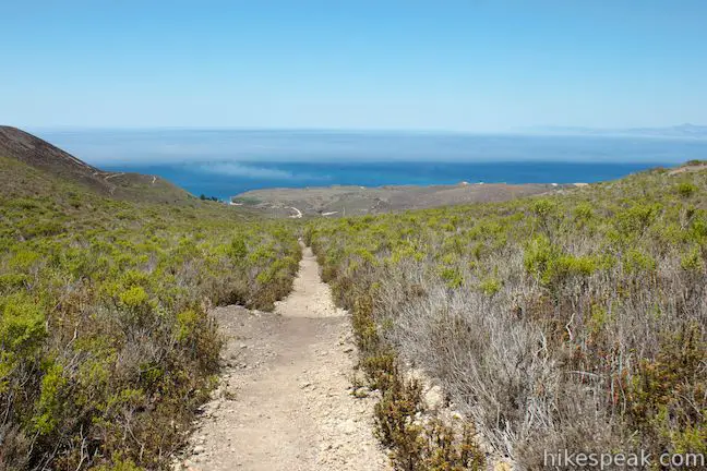
To begin the hike to Oats Peak, start from a trailhead behind the park visitor center in Spooner’s Ranch House on the road into Islay Creek Campground. Spot signs for Reservoir Flats Trail and Oats Peak Trail at the trailhead and begin up the dirt trail. On the opening leg of the hike, ascend the south side of Islay Creek Canyon, gaining an overview of the 50-site campground. Look back down the trail to see Spooner’s Cove, a bluff-framed beach at the bottom of Islay Creek Canyon, backed by the blue water of the Pacific Ocean.
At 0.3 miles from the start, meet a marked junction with Reservoir Flats Trail, a two-mile loop in Islay Creek Canyon that breaks off to the left. Stay to the right up Oats Peak Trail. In another hundred feet, come to the first split (or former split) between New Oats Peak Trail and Old Oats Peak Trail. Turn left to follow the new trail. In another two hundred feet, turn right to continue up New Oats Peak Trail. Most junctions along the way to the summit are well marked.
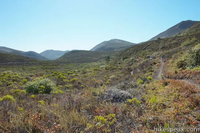
Enjoy views up Islay Creek Canyon and across the depression just below, which is explored by Reservoir Flats Trail. In another almost flat 0.2 miles, the new trail reaches an intersection and goes straight across Old Oats Peak Trail. If you look to your left, you can practically see another junction between the two trails. Cross Old Oats Peak Trail on the new trail and ease up an extra gradual switchback that flips back to the next crossing between the two trails after 0.05 miles. This junction is approximately 0.6 miles from the start via the new trail. If Old Oats Peak Trail was open, hikers could swap out the first two sections of New Oats Peak Trail for the overlapping section of Old Oats Peak Trail, which was not particularly challenging.
There is a greater difference in lengths between the next sections of the new and old trail (1.2 miles versus 0.43 miles). New Oats Peak Trail ascends 225 feet as it weaves gradually up the side of the canyon. This roundabout section of New Oats Peak Trail presents expanding views up and down Islay Creek Canyon, while the pyramid shaped summit of Valencia Peak looms large to the south.
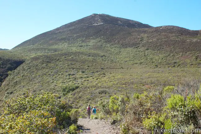
The next junction is a tricky one. New Oats Peak Trail reunites with Old Oats Peak Trail, 1.78 miles from the start via the new trail. The start of Beebe Trail is directly across from the top of New Oats Peak Trail, appearing like a continuation of the new trail. Beebe Trail heads west up to a junction with Badger Trail near Valencia Peak Trail, and then heads in the opposite direction, climbing east to reunite with Oats Peak Trail farther up the mountainside. Beebe Trail is therefore yet another option to choose from to reach Oats Peak. Let’s ignore Beebe Trail for now and stick with Oats Peak Trail. Turn left at the top of New Oaks Peak Trail onto Old Oats Peak Trail to hike up a unified section of the trail over the next quarter mile.
Oats Peak Trail continues up the mountainside, dropping into a draw with a patch of illusive shade and a trickling stream. As you exit the trees, come to another split in the trail. Bear left to continue up New Oats Peak Trail. This junction is approximately 2.02 miles from the start via the new trail.
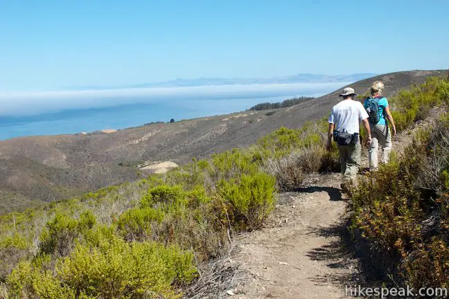
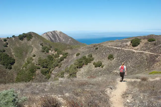
New Oats Peak Trail again uses several switchbacks to explore the ridge above Islay Creek Canyon, in contrast to Old Oats Peak Trail, which made a direct run up the mountainside. There are sweeping views of the ocean below the canyon and of Hazard Peak across the canyon to the north. After a mile, the new trail meets back up with Old Oats Peak Trail (a quarter mile above the junction below via the old trail). From this end of New Oats Peak Trail, turn left up Oats Peak Trail. The trail bends to the right and reaches another junction after about fifty feet. This is the top of Beebe Trail. Stay to the left to continue up Oats Peak Trail.
The trail ascends into a dip in the mountainside, just below the towering form of Valencia Peak. New and Old Oats Peak Trails go their separate ways again, at a split just 0.05 miles up the trail (at approximately 3.08 miles from the start via New Oats Peak Trail). Straight ahead, a bowl-shaped depression is framed by ridges on both side. New Oats Peak Trail goes up the ridge on the left, north of the depression, while Old Oats Peak Trail tackles the ridge to the right. Bear left to continue up New Oats Peak Trail.
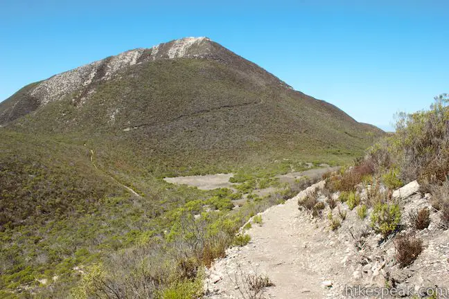
As you would expect, New Oats Peak Trail uses several switchbacks to make its way up the ridge and east toward Oats Peak. As you round a bend in the trail, the impressive views of nearby Valencia Peak are exchanged for equally impressive views up the coast toward Morro Rock in Morro Bay, backed by the beautiful coastline extending north toward San Simeon.
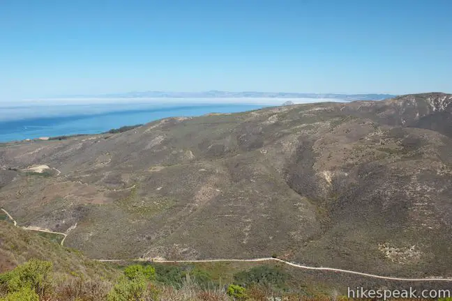
Progressing east, New Oats Peak Trail crosses a saddle with views up and down Islay Creek Canyon. The trail turns up another rise on the ridgeline to reach one more intersection between new and old Oats Peak Trail. The junction sits in the saddle above the depression that the two trails have been traveling around. This junction is 4.78 miles from the start via New Oats Peak Trail.
Straight ahead, New Oats Peak Trail flattens, crossing the side of the ridges that rise to the left. Old Oats Peak Trail crosses New Oats Peak Trail to ascend that ridge to a crest before dropping to a saddle on the other side where it meets back up with New Oats Peak Trail. Both routes are just under a quarter mile long, but New Oats Peak Trail is significantly easier.

When the trails come back together, you are at the end of New Oats Peak Trail. An overlook off the end of New Oats Peak Trail has views over Islay Creek Canyon, which looks wild and remote from this vantage.
While things have been very gradual up until this point, extra effort is required to reach the summit. Only one trail advances to the top, climbing 175 feet over the final 0.4 miles to the summit of Oats Peak. This last leg is steeper than you might expect, actually ascending 140 steep feet in the next 0.15 miles to a false summit before crossing a dip to reach the true top of Oats Peak.
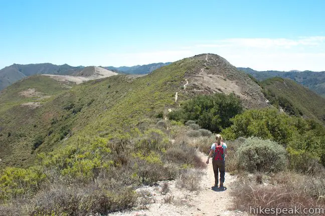
Epic views fill this final leg of the hike, but don’t stop until you reach the top! To the west, Valencia Peak is framed by beautiful blue pockets of the Pacific Ocean. To the north, Hazard Peak rises above the far side of Islay Creek Canyon. Beyond the boundaries of Montaña de Oro State Park, you can admire the coastline curving past Morro Rock, and scope out the iconic string of Morros (volcanic peaks) extending inland across San Luis Obispo County. Behind the Morros, rise the Santa Lucia Mountains, which create a verdant backdrop for the whole scene.
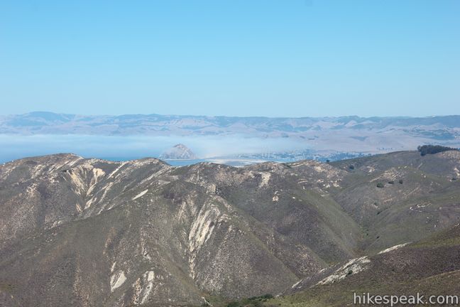
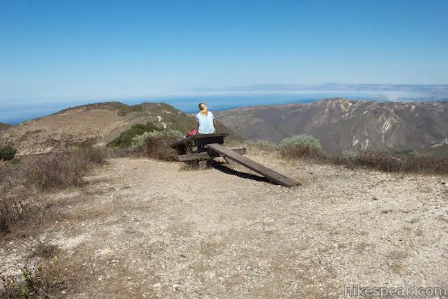
At the summit of Oats Peak, discover new views inland over the Irish Hills and south over Coon Creek Canyon. A dilapidated picnic table sits at the summit (unless it has been replaced) where you can pause to admire the views.
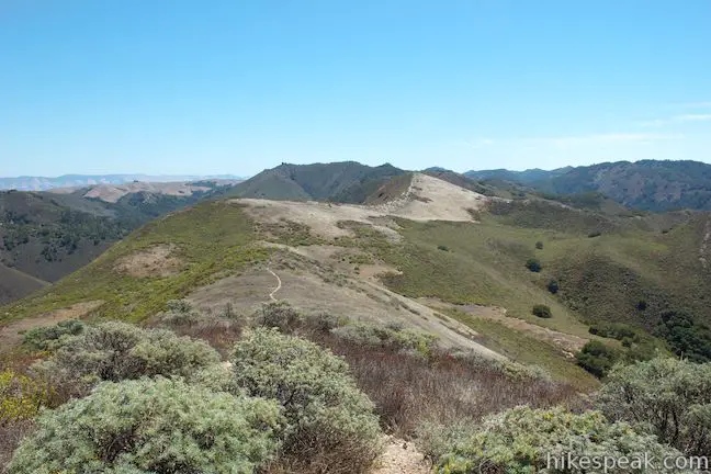
Oats Peak Trail actually continues beyond the summit, descending east across a saddle to another junction. To the right, a trail descends a ridge to Coon Creek Trail, while another trail continues straight ahead toward Alan Peak (well, it actually only goes to False Alan Peak), the highest summit in Montaña de Oro State Park. From Oats Peak, you can extend the hike to Alan Peak, or hike down Coon Creek Trail to Pecho Valley Road near the coast for a longer loop hike or shuttle hike. If you aren’t extending the hike, turn back down Oats Peak Trail.
Since there are so many junction between New Oats Peak Trail and Old Oats Peak Trail, you may find it helpful to have turn-by-turn directions for both routes from the trailhead to the summit (directions for the old trail are provided mostly for archival purposes, unless the trail reopens).
The basic directions for the hike up New Oats Peak Trail are:
- Begin up the trail behind the park visitor center (0 miles)
- Turn right at a junction with Reservoir Flats Trail (0.3 miles)
- Turn left onto New Oats Peak Trail (0.31 miles)
- Turn right to stay on New Oats Peak Trail (0.33 miles)
- Go straight across Old Oats Peak Trail (0.53 miles)
- Go straight across Old Oats Peak Trail again after an exaggerated switchback (0.58 miles)
- Turn left to join Old Oats Peak Trail and don’t go straight on Beebe Trail (1.78 miles)
- Turn left onto New Oats Peak Trail at split just after shaded creek (2.02 miles)
- Turn left onto Old Oats Peak Trail (3.02 miles)
- Stay left past the top of Beebe Trail (3.03 miles)
- Turn left onto New Oats Peak Trail (3.08 miles)
- Cross Old Oats Peak Trail in a saddle above the depression (4.78 miles)
- Reach the overlook at the end of New Oats Peak Trail and turn right to continue to the summit (5.0 miles)
- Reach the top of Oats Peak (5.4 miles)
The basic directions for the hike down New Oats Peak Trail are:
- Leave the summit of Oats Peak (0 miles)
- Return to the overlook at the top of New Oats Peak Trail and turn left down the new trail (0.4 miles)
- Cross Old Oats Peak Trail in a saddle above the depression (0.62 miles)
- Turn right to continue down New Oats Peak Trail (2.32 miles)
- Stay to the right past the top of Beebe Trail (2.37 miles)
- Bear right onto Old Oats Peak Trail (2.38 miles)
- Turn right onto a unified section of trail, heading toward the shaded creek (3.38 miles)
- Turn right past a junction with Beebe Trail to continue down New Oats Peak Trail (3.62 miles)
- Go straight across Old Oats Peak Trail (4.82 miles)
- Go straight across Old Oats Peak Trail again after an exaggerated switchback (4.87 miles)
- Turn left to stay on New Oats Peak Trail (5.07 miles)
- Turn right to continue down the unified trail (5.09 miles)
- Turn left at a junction with Reservoir Flats Trail (5.1 miles)
- Return to the trailhead behind the park visitor center (5.4 miles)
The basic directions for the hike up Old Oats Peak Trail are/were:
- Turn right at the junction with Reservoir Flats Trail (0.3 miles)
- Stay to the right past the start of New Oats Peak Trail (0.31 miles)
- Go straight through a crossing of New Oats Peak Trail (0.37 miles)
- Go straight through another crossing of New Oats Peak Trail (0.39 miles)
- Go straight past a junction with Badger Trail, which connects to Valencia Peak Trail (0.61 miles)
- Go straight past a junction with New Oats Peak Trail on the left and Beebe Trail on the right (0.82 miles)
- Stay to the right past a split with New Oats Peak Trail just after a shaded creek (1.07 miles)
- Stay to the right past a reunion with New Oats Peak Trail (1.41 miles)
- Stay to the left past the top of Beebe Trail (1.42 miles)
- Turn right at split with New Oats Peak Trail (1.47 miles)
- Stay left through a junction with a trail up Valencia Peak (1.6 miles)
- Go straight across an intersection with New Oats Peak Trail to ascend a bump on the ridge (2.21 miles)
- Reach a junction with the end of New Oats Peak Trail and continue straight for the summit (2.45 miles)
- Reach the top of Oats Peak (2.85 miles)
The basic directions for the hike down Old Oats Peak Trail are/were:
- Hike down from the summit of Oats Peak to the junction at the top of New Oats Peak Trail and continue straight up a crest in the ridgeline (0.4 miles)
- Cross New Oats Peak Trail at the next intersection (0.64 miles)
- Stay to the right past a junction with a trail to Valencia Peak (1.25 miles)
- Stay to the left past a reunion with New Oats Peak Trail (1.38 miles)
- Stay to the right at a junction with the top of Beebe Trail (1.43 miles)
- Stay to the left through a junction with New Oats Peak Trail (1.44 miles)
- Stay to the left past the departure of New Oats Peak Trail near the shaded creek (1.78 miles)
- Go straight past a junction with New Oats Peak Trail on the right and the bottom Beebe Trail on the left (2.03 miles)
- Go straight past a junction with Badger Trail, which connects to Valencia Peak Trail (2.24 miles)
- Cross an intersection with New Oats Peak Trail (2.46 miles)
- Cross another intersection below the short switchback on New Oats Peak Trail (2.48 miles)
- Stay to the left past the start of New Oats Peak Trail (2.54 miles)
- Stay to the left past the junction with Reservoir Flats Trail (2.55 miles)
- Reach the bottom of Oats Peak Trail (2.85 miles)
The hike to Oats Peak offers great views over Montaña de Oro State Park, along the coast, and inland on the Irish Hills. Dogs are not allowed on this trail. The new trail opened to bikes and horses in March of 2014. Wear long pants and watch out for poison oak along the trail. No entrance fee is charged to visit Montaña de Oro State Park and no permit is required to hike to Oats Peak, so get out and enjoy!
To get to the trailhead: From San Luis Obispo, exit Highway 101 at Los Osos Valley Road and drive northwest toward Los Osos. After 11.2 miles, Los Osos Valley Road becomes Pecho Valley Road and turns sharply to the south. Continue the final 3.7 miles, entering Montaña de Oro State Park and passing through a eucalyptus grove before reaching the road to Islay Creek Campground, on the left side of the road just past Spooner’s Cove and the visitor center in Spooner’s Ranch House (and before the trailheads for the Bluff Trail and Valencia Peak). Turn left onto the road and drive past the visitor center toward the campground. Park at the trailhead on the right, just before the road drops to the campground.
Trailhead address: Pecho Valley Road, Montaña de Oro State Park, Los Osos, CA 93402
Trailhead coordinates: 35.273872, -120.88553 (35° 16′ 25.93″N 120° 53′ 07.90″W)
(New Oats Peak Trail is in green)
View Montaña de Oro State Park in a larger map
Or view a regional map of surrounding Central Coast trails and campgrounds.
 | Reservoir Flats Trail This 2-mile loop delivers fine ocean and canyon views as it explores the bottom of Islay Creek Canyon in Montaña de Oro State Park. |
 | Islay Creek Trail This easy 6-mile round trip hike follows a wide trail up a coastal canyon flanked by thousand-foot peaks, passing a small waterfall to reach an abandoned barn. |
 | Hazard Peak Trail This 6-mile round trip hike ascends coastal ridges to a 1,076-foot summit with panoramic views that include a dynamic perspective of Morro Bay. |
 | Hazard Peak - Islay Creek Loop This 9.2 mile loop continues beyond Hazard Peak deeper into Montana de Oro before circling back on Islay Creek Trail. |
 | Valencia Peak Trail This 4.5-mile hike summits a 1,347-foot peak with stunning views over Montaña de Oro. |
 | Bluff Trail This hike of around three miles tours tide pools, beaches, and impressive cliffs along the picturesque coast of Montaña de Oro State Park. |
 | Rattlesnake Flats Trail – Badger Trail – Bluff Trail Loop This 1 2/3-mile hike offers a twist on the Bluff Trail, going along and just above the coast of Montaña de Oro State Park. |
 | South Dune Trail – Bloody Nose Trail – Hiedra Trail – Hazard Peak Trail Loop This 2 2/3-mile loop combines four trails through dunes and eucalyptus trees to lovely coastal views. |
 | Dune Trail to Hazard Canyon Reef This one-mile hike in Montaña de Oro State Park descends an oceanfront ravine to a rocky shoreline graced with engaging tide pools. |
 | Coon Creek Trail This 5-mile out and back hike ventures up a coastal canyon at the south end of Montaña de Oro State Park. |
 | Point Buchon Trail This 1 1/3 to 6.8-mile hike explores the beautiful coastline south of Montaña de Oro State Park. |
 | Morro Dunes Ecological Reserve This 2.6-mile loop serves up panoramic views over Morro Bay as it ascends 800 feet from Los Osos to Montaña de Oro State Park. |
 | Elfin Forest Natural Reserve This easy 1-mile loop on a boardwalk explores a pygmy forest on the edge of Morro Bay. |
 | Cerro Cabrillo This tough 2.5-mile hike summits the highest mountain in Morro Bay State Park, a 911-foot member of the Nine Sisters. |
 | Portola Point This 2-mile loop explores a short hill just east of Morro Estuary in Morro Bay State Park. |
 | More hikes in San Luis Obispo Explore other trails around San Luis Obispo including Morro Bay State Park and the Morros. |
 | Islay Creek Campground This 50-site campground is located at the heart of Montaña de Oro State Park in Islay Creek Canyon, and is a great base camp for treks in the park. |


We hiked the New Oats this weekend and now that its fully open the old trail is blocked off so there’s no confusing twists and turns which was great especially because the views from New Oats are amazing! The downside is there are a lot of bikers enjoying the newly opened trail, many of whom do not yield to hikers and a few even blew dust up short stopping… Not all were so bad.. quite a few were quite kind and shared their love of the path! Also bikers cannot go beyond the Oats peak down Coon’s creek – there is a huge sign at the top… so if you want a bike free decent or assent head on Coons!
Happy Hiking!!
They have ruined the this trail. They changed it for mountain bikes. It is no longer a challenge except for having to avoid the bikes flying up and down the trail. I used to see wildlife on my hikes and now none. Where have the rabbits, deer, coyote, bobcats and even lizards gone. They destroyed the north side of MDO (Montana De Oro) and now they are doing the same to the south side. This used to be such a great hike on trails now it is just a walk on a bike path. I’m very sad for the many people who will never be able to enjoy the former challenging hike.
I ran the New Oats path today for the 1st time and agree with both Molly and Curtis– it’s a simply breathtaking trail but I had a lot of close calls with zooming bikers leaving a lot of dust to inhale. Are their similar trails closed to bicyclists?
Valencia Peak Trail does not allow bikes and has unbelievable views!
I see it now– Coon Creek Trail next time !!!!!
!!!!!
Someone needs to update the above trail description since the old hiking trail is no longer available. It is misleading. I was going by the trail description and planned to take the shorter old hiking route. The new biking trail is a disappointment for hikers.
Thanks for the note. I’ve made the changes. It would have be handy if the park maintained both trail options…
I’ve become addicted to jogging the Coon Creek Trail to Oats Peak & back. Super serene. It’ll fill up your senses.