Emerald Lake, Dream Lake, and Nymph Lake in Rocky Mountain National Park

Emerald Lake Trail visits a trio of beautiful mountain lakes in Rocky Mountain National Park, easing past Nymph Lake and Dream Lake on the way to Emerald Lake, which is cradled below 12,000-foot peaks along the Continental Divide. This three-lake hike is 3.6 miles round trip with 650 feet of elevation change. This scenic hike begins from Bear Lake Trailhead, where a fourth lake can added to the outing with Bear Lake Nature Trail.
Bear Lake Trailhead is about 10 miles from the park’s eastern entrance near Estes Park. The trailhead has a large parking area and a shuttle service that maintains trail access when the park is congested. This hike gets underway with two quick junctions. Walk up the trail between the shuttle stop and the ranger station to come to an immediate split. The trail to the right leads to an easy loop around Bear Lake. Turn left, following signs for Emerald Lake and the other lakes to continue with this hike.
Not long after the first junction, you will reach a second junction with a kiosk that has a map and hike information. Pass over the trail to Alberta Falls on the left and take the trail on the right, which heads uphill next to a sign for Nymph Lake, Dream Lake, Emerald Lake, and Lake Haiyaha.
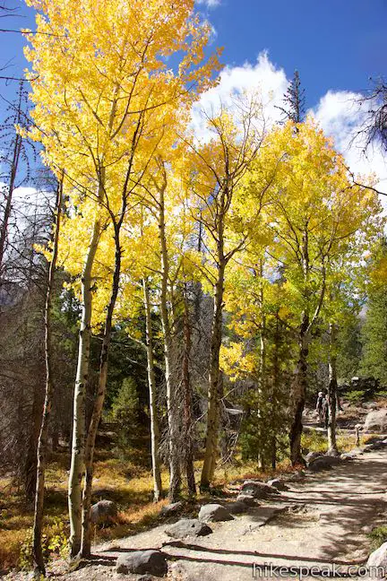
The dirt trail rises gradually through conifers like subalpine fir, lodgepole pines, and Engelmann spruce. If you hike this trail from mid-September to early October, you’ll be captivated by a colorful tree than stands out from the rest. These are quaking aspen, which attract big crowds to Rocky Mountain National Park each fall when their leaves turn yellow, orange, and gold. Strong winds eventually strip the aspen of their leaves.
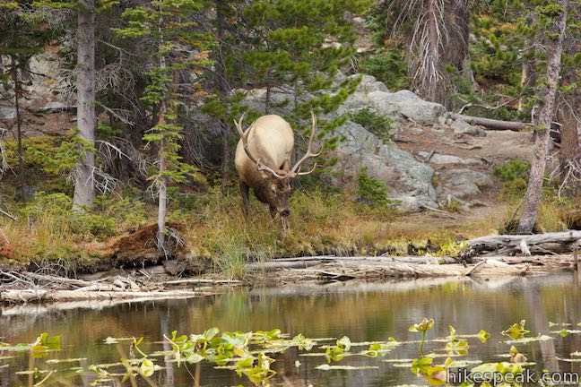
Emerald Lake Trail wraps around a short round mountain that offers occasional views south through the trees toward Glacier Gorge. After half a mile of hiking, come to the edge of the hike’s first lake. Nymph Lake is just off the left side of the trail. This lake is the smallest of the three and covered by lily pads. Maybe you’ll be fortunate enough to see elk in the forest around the lake.
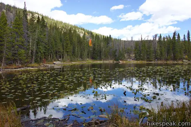
The trail passes along the east side of the lake, lining you up for postcard-worthy perspectives across its reflective water toward Hallett Peak, which has steep cliffs and rises to 12,713 feet. Despite its diminutive size, Nymph Lake is quite lovely.
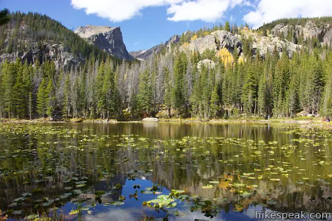
After curling around the north side of Nymph Lake, Emerald Lake Trail ascends past boulders and some exposed bedrock. You can venture out onto the boulders for views looking northeast toward Glacier Basin and the landscapes your drove past on Bear lake Road up to the trailhead. A little farther up the trail, you’ll discover an even better viewpoint. The trail turns to the left and rises to the south. Just before the trail curves to the right, find a large boulder protruding from the ridge on the left side of the trail. Step out on the rock for a grand view over the treetops. This unofficial overlook is 0.8 miles from the trailhead. Look down on Nymph Lake, 100 feet below, and northeast down Glacier Basin over conifer-covered ridges and valleys in Rocky Mountain National Park. Patches of aspen add yellow to this landscape in late September.

Step back onto the trail from the outcropping and continue up Emerald Lake Trail. As the trail proceeds west along another slope, you’ll discover open views over a dramatic landscape of ridges and canyons to the south. Look south up Glacier Gorge, a deep trough in the terrain that rises above the trees into alpine tundra. Half Mountain stands out over the side of the gorge. At the back of the gorge, Longs Peak rises to 14,259 feet and is the highest summit in the Rocky Mountain National Park.

Take in this fantastic view before the trail leaves the exposed terrain and slips back into forest. Pass through a cluster of aspen and come to a sharp turn to the right in front of a tumbling creek. Go up a flight of steps and the trail will curve back to the left to a bridge crossing Tyndall Creek, which flows through Emerald Lake and Dream Lake from a small glacier on the Continental Divide next to Hallett Peak.
Just past the creek crossing is an overlook that sits off the left side of the trail. This spot offers views out from the forest down the valley to the southeast. Proceed up the trail along a grassy area bordering Tyndall Creek.
After just over a mile of hiking, you will come to a junction. Lake Haiyaha Trail parts to the left, extending 1.1 miles up to another mountain lake. Turn right, following the sign for Dream Lake and Emerald Lake. Leave the junction and cross a footbridge over to the right side of Tyndall Creek. Look up the creek as it flows through a grassy area bordered by pines and backed by Hallett Peak.
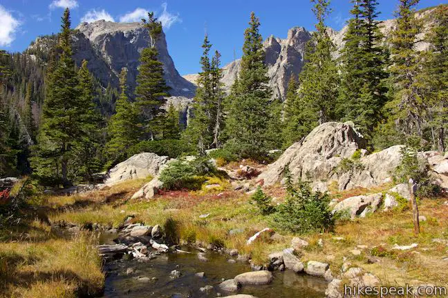
The trail curves to the left and comes up to a rocky crest and a trail sign by the outflow of Dream Lake. Walk off the left side of the trail to approach the end of Dream Lake. You’ll find open views up the pine-framed lake, which extends like a finger toward Hallett Peak.
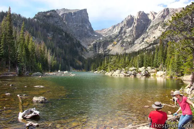
Many hikers turn around at Dream Lake for a 2.2-mile round trip hike with 450 feet of elevation change. If you aren’t going all the way to Emerald Lake, it is worth continuing another quarter mile up Emerald Lake Trail as it takes a level course along the side of Dream Lake.
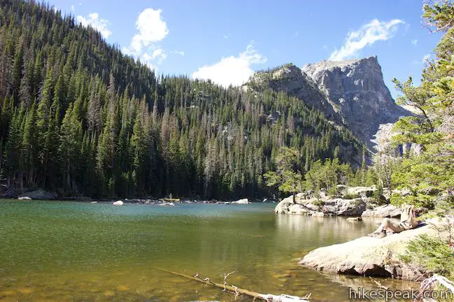
Proceeding to the right from the sign for Dream Lake, the trail makes its way along the water’s edge. After a boardwalk through a marshy spot, the dirt trail wraps around a bend on the shoreline. Pause to enjoy the views up and down the lake before Emerald Lake Trail passes the inlet at the west end of Dream Lake and returns to the forest.
Above Dream Lake, the trail becomes steep, using wooden steps to gain 200 feet over the last 0.4 miles. Your heart rate will likely increase as you rise to 10,000 feet above sea level during this last stretch of the hike. The trail ascends alongside Tyndall Creek and eventually exits the forest into meadows below Emerald Lake. Hallett Peak rises steeply to the west, getting even larger as you approach the trail’s end.
Go over a rocky rise in the terrain and come down to the edge of Emerald Lake, which is rounder than Dream Lake and fills the basin at the top of valley you’ve been hiking up. The steep wall of Hallett Peak looms over the lake to the west. Jagged peaks near Flattop Mountain rise to the north of Hallett Peak. In between and out of view is Tyndall Glacier. Although it is shrinking, Tyndall Glacier is one of a handful of remaining glaciers in Rocky Mountain National Park. A stream of water flows down the trough below Hallett Peak and cascades into Emerald Lake on a thin waterfall. This glacier-fed stream brings minerals to the lake that are responsible for its beautiful blue-green color.
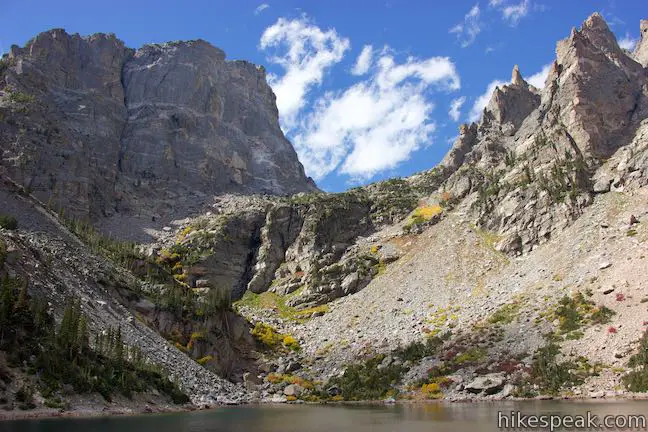
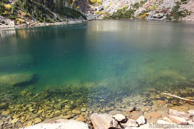
A footpath goes around the lake and allows summer visitors to venture past the end of the trail. Off both sites of the trail’s end, you’ll find boulders that make nice places to stretch out for a break by the lake. If you brought a bathing suit, you may feel compelled to take a quick dip in the cold mountain water. Snow and ice can cover the lake outside of the summer season.
After admiring Emerald Lake, turn around to hike the 1.8 miles back the way you came to Bear Lake trailhead. Emerald Lake Trail offers fantastic views and beautiful lakes. Just before reaching the trailhead, you can turn up Bear Lake Nature Trail for a loop around the lake closest to the trailhead.
Bear Lake Trailhead is a popular destination. The parking area fills up on summer weekends and during the busy period from mid-September to mid-October during the elk rut when the aspen leaves change color. The Bear Lake Shuttle runs daily from Memorial Day Weekend through mid-October from 7 a.m. to 7 p.m. Visitors can take the shuttle from Glacier Basin Park & Ride up to the Bear Lake Trailhead. Other stops at Bierstadt Lake Trailhead and Glacier Gorge Trailhead allow for additional exploring and shuttle hikes. The buses run in approximately 15-minute intervals.
Dogs and bikes are not allowed on the trail to Nymph Lake, Dream Lake, and Emerald Lake. A national park entrance fee must be paid to reach the trailhead. No permit is required for this hike, so get out and enjoy!
To get to the trailhead: From Estes Park, drive southwest on Route 36 to the Beaver Meadows Entrance Station for Rocky Mountain National Park. Proceed another quarter mile and turn left onto Bear Lake Road. Drive 9 miles up this road to the parking area at road’s end for Bear Lake Trailhead. To take the shuttle, drive 5 miles up Bear Lake Road and turn right into Glacier Basin Park & Ride.
Trailhead address: Bear Lake Trailhead, Bear Lake Road, Rocky Mountain National Park, Estes Park, CO 80517
Trailhead coordinates: 40.31195, -105.6457 (40° 18′ 43.02″N 105° 38′ 44.52″W)
View Rocky Mountain National Park in a larger map
Or view a regional map of surrounding Colorado trails and campgrounds.
 | Bear Lake Nature Trail This easy 0.65-mile hike takes a loop around Bear Lake in Rocky Mountain National Park, passing numerous views across the beautiful subalpine lake. |
 | Rattlesnake Gulch Trail This 3.8-mile hike in Eldorado Canyon State Park rises from a rugged and charming canyon to the ruins of an old hotel and an overlook facing mountains on the Continental Divide. |
 | More trails in Colorado Explore other destinations in Colorado, including hikes in Colorado National Monument. |
Emerald Lake Trail on liveandlethike.com
Emerald Lake Trail on rockymountainhikingtrails.com
Emerald Lake Trail on alltrails.com
Emerald Lake Trail on dayhikesneardenver.com
Emerald Lake Trail on protrails.com
Emerald Lake Trail on backpacker.com
Emerald Lake Trail on hikingproject.com
Emerald Lake Trail on rootsrated.com
Emerald Lake Trail on outdoorproject.com


Go the extra miles...
Submit a rating of this hike to go with your comment. Contribute to the average trail rating.