Mount Fremont Lookout
in Mount Rainier National Park

Mount Fremont houses the nearest fire lookout tower to Mount Rainier. On a clear day, the lookout promises some of the park’s best views of Mount Rainier and the surrounding Cascade Mountains. The 6-mile round trip hike from the Sunrise Lodge and Visitor Center to Mount Fremont Lookout is exceptionally scenic and fulfilling, with 800 feet of elevation gain.

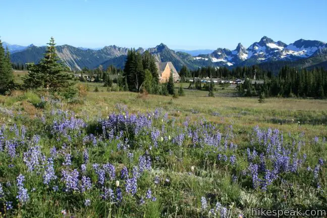
Sunrise is already a famously picturesque destination in Mount Rainier National Park. Stray a short distance from the trailhead (at 6,400 feet) and the views get even better.
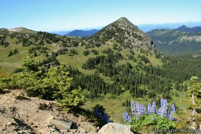
Embark north toward Sourdough Ridge Trail, making two quick lefts before progressing west along the spine of the ridge. Enjoy the view to the right (north) toward McNeeley Peak, a pyramid shaped mountain surrounded by a valley that is so perfectly V-shaped it looks fake. Rest on a bench along the trail and admire the surroundings.

After 1/3 of a mile hiking up the rocky ridge trail, bear left, leaving the ridge for a gradual descent into a hanging valley between Sourdough Ridge and the snow-covered slopes of the Burroughs Mountains beneath Mount Rainier. The trail wraps around Frozen Lake, a small body of water covered in show shelves that is used as a natural water source for inhabitants below. Follow the trail around the lake past a short spur trail to a scenic overlook that looks back over Sunrise.
At a 5-way junction just past Frozen Lake (don’t worry, it’s well marked), turn right toward Mount Fremont. There are no more junctions from here, just a 400 foot climb over 1.35 miles to the lookout.
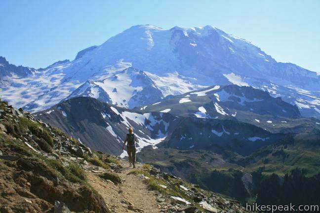
Cross the valley above the lake and retake the ridge before continuing north on a gradual course across large jagged rocks on the steep western slope of Mount Fremont. Enjoy grand views to the west toward Skyscraper Mountain, and don’t forget to look over your shoulder for staggering views of Mount Rainier. The daunting, frigid peak has more glaciers than any other mountain in the lower 48.

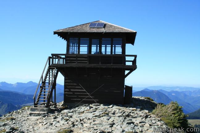
Reach the lookout at 7,180 feet, 20 feet below the actual summit, where you are greeted with a sweeping panorama to the north. No mountain in that direction is as tall as Mount Fremont for miles, making for a seemingly endless views. March up the steps to a square-shaped observation deck and stroll around the lookout tower. Large glass windows allows you to peer in at the compact living quarters used when the station is occupied.
Mount Fremont Lookout is incredibly well placed, offering expansive views over the Cascade Mountains north of Mount Rainier. If you are hesitant to turn around, don’t be. On the hike back, you will be heading straight toward Mount Rainier. Could it get any better?

There is an entrance fee to reach this trail in Mount Rainier National Park, but no permit is required to hike to Mount Fremont Lookout.

To get to the trailhead: Take Route 410 (Mather Memorial Parkway) to Sunrise Road, 3.5 miles north of the intersection with Route 123. Turn west on Sunrise Road and climb 15 miles of switchbacks to the Sunrise area parking lot at the end of the road. The trail leaves from the north side of the parking lot between the visitor center and the lodge.
Trailhead address: Sunrise Park Road, Mount Rainier National Park, Ashford, WA 98304
Trailhead coordinates: 46.9146, -121.642045 (46° 54′ 52.55″N 121° 38′ 31.36″W)
View Mount Rainier National Park in a larger map
Or view a regional map of surrounding Washington trails and campgrounds.
 | Naches Peak Loop Trail This colorful 3.75-mile loop crosses fields of summer wildflowers, passing subalpine lakes and great views of Mount Rainier. |
 | Skyline Trail This tremendously scenic loop on the slopes of Mount Rainier is considered the park's must-do hike. |
 | Silver Falls Loop Trail This 3-mile loop travels through an old-growth forest to a waterfall on Ohanapecosh River in the southeast corner of Mount Rainier National Park. |
 | More trails in Washington Explore other hikes in the Evergreen State, including Mount Saint Helens National Volcanic Monument. |
 | Camping in and around Mount Rainier Information on the developed campgrounds in Mount Rainier National Park as well as places to camp in the surrounding national forest. |


Go the extra miles...
Submit a rating of this hike to go with your comment. Contribute to the average trail rating.