
Monserate Mountain offers a workout of a hike, beginning just off Interstate 15 in the Northern San Diego County city of Fallbrook, just ten miles south of Temecula in Riverside County. There is 1,200 vertical feet between the trailhead at the base of Monserate Mountain and the panoramic summit at the top, tackled on a 1 2/3-mile ascent. You can turn around at the top for a 3 1/3-mile out-and-back hike or explore more of Monserate Mountain Preserve on a 4.4-mile loop. The loop adds sweeping views as it ventures south from the summit on a Ridge Trail to a water tank, before circling back to the start. You’ll work up a sweat on either hike, achieving views that stretch from the Agua Tibia Mountains to the east to a sliver of the Pacific Ocean to the west.
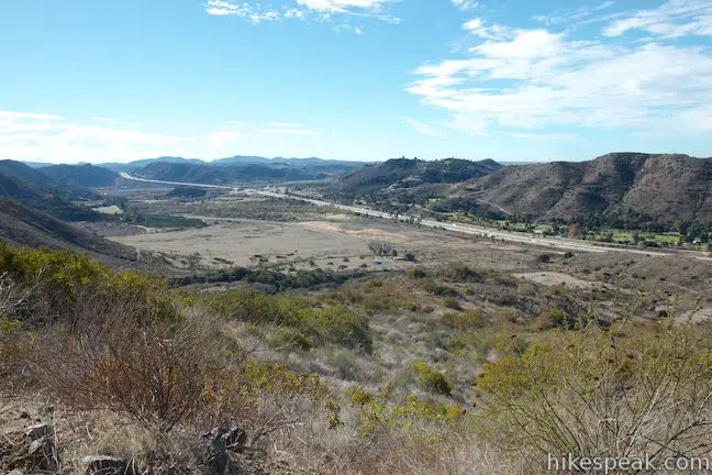
Start from a trailhead on Pankey Road, just east of Interstate 15, where there is a large dirt parking area and a wide dirt trail heading up the western flank of Monserate Mountain. After passing through a gate, the rough and eroded trail wastes no time climbing up the mountain. One benefit of this rapid ascent is that the noise of the freeway fades away faster than you would expect. You’ll also discover views south over a fertile valley nourished by the San Luis Rey River. The trail is lined by chaparral and a few large orange boulders that you can use to take a break on if you need to catch your breath.
After 0.75 miles, in which you’ll gain 550 feet, you will come to T-junction with a paved one-lane service road. This is the start of the loop for those opting for the 4.4-mile hike and there is a tall wooden marker directing you to the left to reach the summit. To the right (south) the road descends along the mountainside before climbing to the water tower, which is visible on the ridge above.
Turn left to continue the climb to the summit. The pavement ends after a tenth of a mile, where you’ll pivot right to resume hiking up a rough dirt road. Hiking north, you will pass junctions with two marked side trails. Stay to the right past Red Diamond Trail and Canonita Trail at 1.05 miles and 1.35 miles from the start respectively.
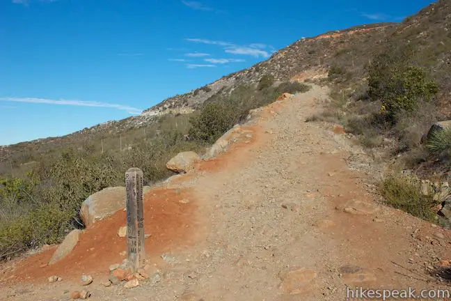
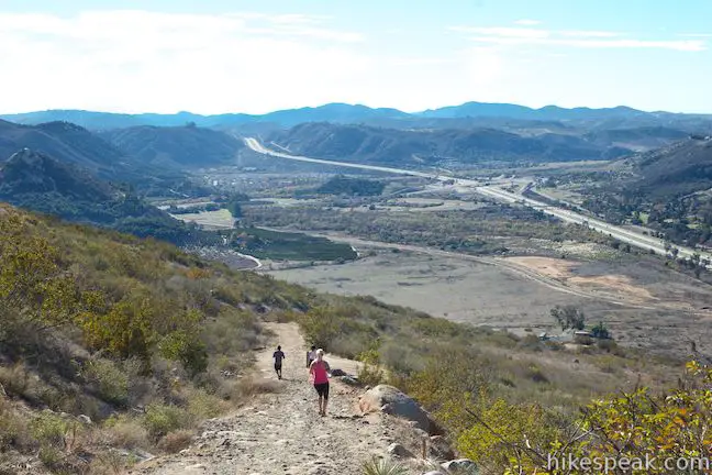
Just past the junction with Canonita Trail, the trail up Monserate Mountain makes a sharp turn to the right. The trail gets rough around this bend, which will point you east toward the summit. The expanding views will spur you up the final climb. At 1.55 miles from the start, the trail plateaus below the summit and you will come to a junction that does not have a tall wooden marker. To the right, the Ridge Trail heads south toward the water tank. Bear left at the junction to hike a short distance up to the summit of Monserate Mountain.
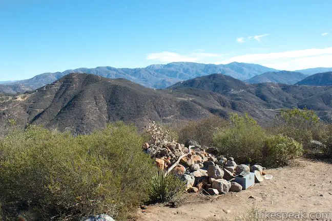
After 1/8 of a mile, the spur trail ends at the 1,567-foot summit of Monserate Mountain. Hop up on a pile of boulders at the top to get clear round-the-compass views over the chaparral. To the west, you’ll spot a reservoir atop the ridge on the other side of I-15. Beyond that, on a clear day, you’ll spot a slice of the Pacific Ocean. Red Mountain rises to the northwest, backed by the Santa Ana Mountains. Rolling farmland stretches to the north, meeting boulder-strewn hills that flank the east side of Rainbow Valley. Beyond a row of ridges to the east, you’ll spot the hulking mass of the Agua Tibia Mountains, which rise to 5,077 feet at Eagle Crag. To the south, there are two farm-filled valleys on both sides of Monserate Mountain, but that view is partially blocked by the mountain itself. To really get a view in this direction, you’ll have to continue with the loop to the water tank.
When you’ve taken in the view from Monserate Mountain, hike back to the junction below the summit. For the 3 1/3-mile return hike, turn right and hike back the way you came, remembering to turn right down the trail to Pankey Road shortly after you reach the pavement. For the 4.4-mile loop, turn left and take the ridge trail south toward the water tank and additional views from Moserate Mountain.
The Ridge Trail descends approximately 335 feet over the next 0.8 miles and is fairly gradual, with one steep section assisted by wooden steps. As you head south, you’ll enjoy broad views west off Monserate Mountain. The trailhead and the valley to the south look far beneath you. As you continue, the views expand to the south and east, where the Agua Tibia Mountains again dominate the view.
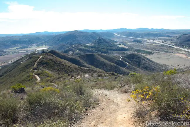
After half a mile, cross a crest where the Ridge Trail leaves the ridgetop and descends to the left (east) down a flight of wooden stairs. Continue down the trail to the water tank, which is impossible to miss at the south end of the ridge.
You will pass through a gate at the end of the Ridge Trail and come to a paved road that goes up to the water tank, 2.6 miles from the start. Turn left down the paved road, which immediately curves to the southwest. If you’re not thrilled to be hiking down pavement, you’re in luck. After 0.15 miles, take a path breaking off the right side of the road, which serves as a shortcut and a reprieve from the pavement (if you stick with the road, be sure to make a right turn when you reach the intersection below). The rocky shortcut path crosses the ridge and descends a quarter mile to rejoin the road.
When you reach the road, Pala Mesa Mountain Drive, swing to the right and pass through a white gate marked with a Monserate Mountain Preserve sign. Head north now, closing down the loop. The paved road heads downhill on the mountainside below the water tank, and you will have views north toward the summit. After crossing a low point on the road, you will climb again, ascending 225 feet over the last 0.4 miles to close out the loop. When you reach the marked junction, turn left and hike the last 0.75 miles down to the trailhead on Pankey Road. If you somehow miss the junction, the end of the pavement in another tenth of a mile will clue you in that you’ve gone too far and are heading back to the summit.
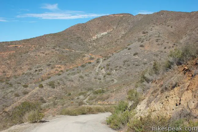
There are two downsides to hiking the loop on Monserate Mountain, the extra 0.8 miles of pavement and the extra 225-foot ascent at the end of the loop (can that qualify as a downside) when you’re probably not in the mood to hike uphill again. There are added views to compensate for this though, so if you have the time, it is worth converting the 3 1/3-mile out-and-back hike into a 4.4-mile loop. No fee or permit is required to hike in Monserate Mountain Preserve, but the Fallbrook Land Conservancy, which maintains Monserate Mountain Preserve, appreciates donations and volunteers. Dogs and mountain bikes are welcome, so get out and enjoy!
Directions to the Trailhead
- From the north, take Interstate 15 south, seven miles past Temecula to exit 51 for Mission Road.
- Turn right at the end of the offramp, followed by an immediate left to head south down Highway 395.
- After 1.8 miles, turn left on Stewart Road.
- Pass under the freeway to reach Pankey Road.
- Turn right and park in the dirt lot on the right.
- The trailhead is on the east side of Pankey Road.
- From the south, take Interstate 15 north of San Diego for approximately 80 miles to exit 46 for Route 76.
- Turn left at the end of the ramp onto Route 76 and make the next right onto Old Highway 395.
- Drive 2.6 miles north and turn right on Stewart Road.
- Pass under the freeway to reach Pankey Road.
- Turn right and park in the dirt lot on the right.
- The trailhead is on the east side of Pankey Road.
Trailhead Location
Trailhead address: Pankey Road, Fallbrook, CA 92028
Trailhead coordinates: 33.365934, -117.159113 (33° 21′ 57.36″N 117° 09′ 32.80″W)
View Monserate Mountain in a larger map
Or view a regional map of surrounding Southern California trails and campgrounds.
 | Kwaay Paay Peak This 2.5-mile hike rewards a good workout with panoramic views as it climbs to a 1,194-foot summit in Mission Trails Regional Park, just 10 miles from downtown San Diego. |
 | Observatory Trail The 5.1-mile hike travels between Observatory Campground and Palomar Observatory, crossing a pleasant mountain woodland with valley views along the way. |
 | Indian Flats Trail This easy half-mile hike from Atáxam Mámta'ash Campground (formerly Indian Flats) explores seasonal pools in the East Fork of the San Luis Rey River. |
 | More hikes in Southern California Explore more trails in Orange, Riverside, San Bernardino, and San Diego counties. |
Common Questions about Monserate Mountain in Fallbrook
- Is the trail open?
- Yes. You should expect to find that Monserate Mountain Loop is open. There are no recent reports of trail closures. If you discover that the trail is closed, please help your fellow hikers by reporting a closure.
- Is this trail free to access?
- Yes, Monserate Mountain Loop is free to access. No entrance fee, pass, or permit is required. If you discover that access rules have changed, please provide feedback on your experience.
- How much time does this hike take?
- It takes approximately 2 hours 30 minutes to hike Monserate Mountain Loop. Individual hiking times vary. Add extra time for breaks and taking in the views.
- How long is this hike?
- The hike to Monserate Mountain Loop is a 4.4 mile loop with 1200 feet of elevation change.
- Are dogs allowed on this trail?
- Yes, dogs are allowed on Monserate Mountain Loop. The trail is open to hikers, dogs, bikes.
- Does this trail go to a summit?
- Yes, Monserate Mountain Loop reaches a summit with panoramic views.
- Where is the trailhead located?
- The trailhead for Monserate Mountain Loop is located in Fallbrook, CA.
Trailhead Address:
Pankey Road
Fallbrook, CA 92028
Trailhead Coordinates:
33.365934, -117.159113 - What are the driving directions to the start of the hike?
To get to the trailhead: From the north, take Interstate 15 south, seven miles past Temecula to exit 51 for Mission Road. Turn right at the end of the offramp, followed by an immediate left to head south down Highway 395. After 1.8 miles, turn left on Stewart Road. Pass under the freeway to reach Pankey Road. Turn right and park in the dirt lot on the right. The trailhead is on the east side of Pankey Road.
From the south, take Interstate 15 north of San Diego for approximately 80 miles to exit 46 for Route 76. Turn left at the end of the ramp onto Route 76 and make the next right onto Old Highway 395. Drive 2.6 miles north and turn right on Stewart Road. Pass under the freeway to reach Pankey Road. Turn right and park in the dirt lot on the right. The trailhead is on the east side of Pankey Road.
View custom Google Maps directions from your current location.
- Are there other trails near Monserate Mountain Loop?
- Yes, you can find other nearby hikes using the Hikespeak Hike Finder Map.


911 Memorial Hill Climb
September 13,2014
To be held on Monserate Mountain.
Register: http://www.fallbrookfirefighters.org
“NEVER FORGET”
This is a great trail, it’s tough and challenging but scenic and beautiful. A great sense of accomplishment when you reach the summit.
Super challenging for a beginner like me but breath-taking views to make up for it. You can see the freaking ocean, for Pete’s sake!
that’s great amanda that you can “see the freaking ocean”..
Decided it was time to stop driving by the mountain saying “one day I need to hike that trail!”, well today was the day. What an amazing ascent, all within the first few minutes, got to see a gopher snake taking its sweet ole’ time. Met a great lady cruising up, she allowed me to tag along up the trail, she’s been there before, and we went up that mountain, she had a great pace going. Since it was my first time there she knew the lay of the trail, and made it that much more exciting. Would suggest anyone to do this trail, and don’t do what I did for years, just drive by and say “one day!”.
thankfully, I didn’t see any snakes on trail. This guide helped us reach the summit and take the loop towards the water tank, then back down. took us 2hr 15min including 15min or so at the top.
nice views!
Come hike with us on September 12, 2015 and remember 9/11.
https://www.facebook.com/events/887292454669491/
Is my second day in a week to do this trail. First time, we almost got to the top. Today, we went around, took us probably an hour and a half, amazing! oh, yes, I got my first scar falling down…ouch!
Got a little winded at first then after a short rest started up the steep summit again. Noticed a hovering spacecraft over my head then ran to the top and hid in the bushes quivering like a wet puppy.