
The San Gabriel Mountains are graced by several enchanting canyons with sylvan steams flanked by bays and alders. Monrovia Canyon is no exception, complete with a splendid 30-foot waterfall that tops off the experience. Monrovia Falls can be reached from a few different starting points in Monrovia Canyon Park. Falls Trail presents a gradual 1.6-mile round trip hike with 350 feet of elevation gain. Connect that to Bill Cull Trail for a slightly less gradual 3-mile round trip hike with 600 feet of elevation gain to explore more of Monrovia Canyon Park.
- Monrovia Falls is one of the Los Angeles waterfall hikes.
Falls Trail
The short route to Monrovia Falls begins from the Monrovia Canyon Park Nature Center, located at the end of Canyon Boulevard. Find the trailhead in the picnic area behind the Nature Center and begin hiking north.
After less than a tenth of a mile descending into the canyon, you will come to a junction. Turn right and continue up the canyon on Falls Trail. The trail to the left, Self Guided Nature Trail, heads downstream for a quarter mile to an alternate trailhead, located at a bend in the road up to the nature center (with limited parking). Along the Self Guided Nature Trail is a junction with Bill Cull Trail, which is used for the longer hike to Monrovia Falls.
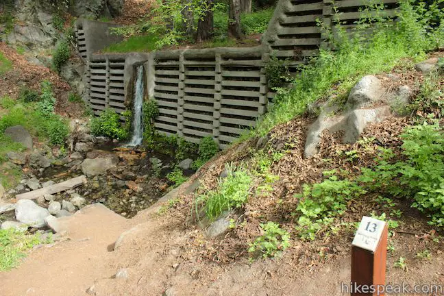
Beyond the first junction, Falls Trail heads upstream for 0.7 miles to the waterfall. Pass a check dam in Monrovia Canyon Creek on the left just before the trail crosses the creek. Rock hop to the other side and continue along the creek through a lush grove of alders.
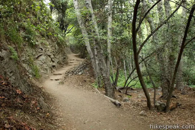
No additional junctions come on the way to the waterfall. Trail is contained by the U-shaped canyon, making hard to get off course. Relax and enjoy the charming scenery. Falls Trail crosses a few stone steps and some relatively narrow ledges that give the hike a sense of adventure. Cross the rocky canyon bottom next to a small cave and return to the right bank as the trail comes to an end at Monrovia Falls.
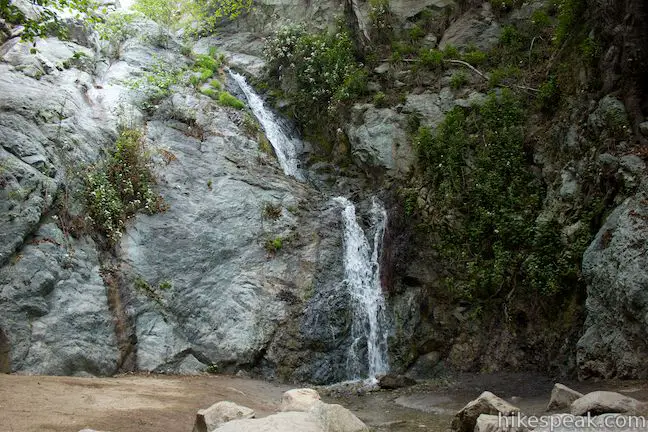
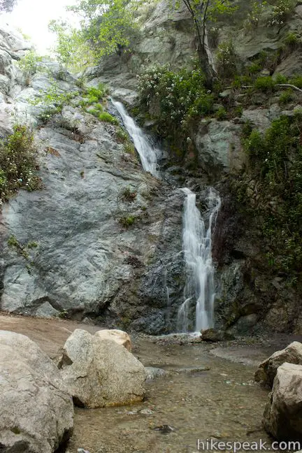
Not quite in free fall (except when it’s really gushing), the 30-foot waterfall plunges over two steep slides down the rock face at the back of the canyon, making a slight shift in direction as it cascades. Monrovia Falls flows year-round, but is most robust during the winter wet season.
Boulders below Monrovia Falls (a.k.a. Monrovia Canyon Falls) make good places to sit and have a snack. After absorbing the waterfall, simply hike back down the canyon the way you came.
Bill Cull Trail
The long route to Monrovia Falls involves hiking 0.7 miles on Bill Cull Trail, followed by a brief stretch on the Self Guided Nature Trail before joining Falls Trail. Park at the lower lot, alongside the entrance station for Monrovia Canyon Park. Walk a couple hundred feet up the road past the booth and turn left up the marked Bill Cull Trail.
You will quickly climb above Canyon Boulevard for a view south out the mouth of the canyon. After a few switchbacks between live oak trees, the dirt single-track passes through a junction with a new trail that is still under construction (labeled as proposed trail on the park map). According to a reader (see Rob’s comment below), the proposed trail is now open and leads up to an overlook.
Past the junction, Bill Cull Trail continues along the west side of the canyon. Across the way, above the east side of the green canyon is a long concrete dam, the Sawpit Dam, which is over 150 feet tall, built for flood control in 1927.
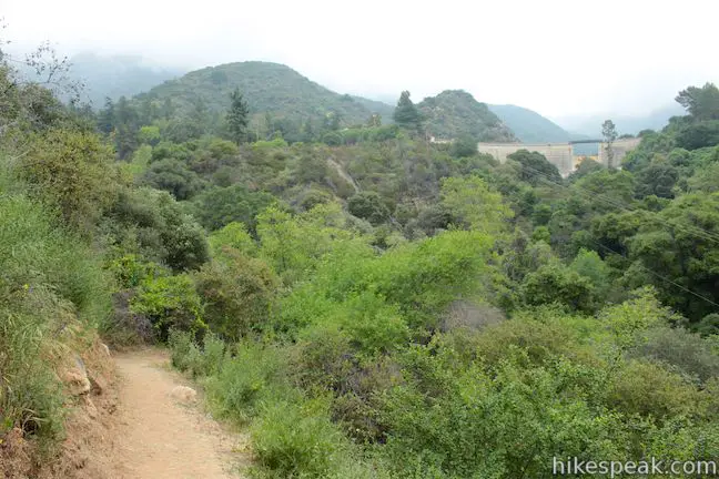
In the spring, the dirt trail passes sun-drenched spring wildflowers like phacelia and wishbone bush. You will have views north up the canyon, spotting an overlook and the nature center at the start of Falls Trail. As Bill Cull Trail comes to a close, it dips beneath a canopy of trees and descends into the canyon. You’ll pass a wooden seat built into a tree right before it is time to rock hop across the creek to reach a T-junction with the Self Guided Nature Trail.
Turn left and hike up the canyon. After a tenth of a mile on the Self Guided Nature Trail, you will reach the junction with Falls Trail coming down from the Nature Center. Go straight to continue up the canyon on Falls Trail. Pass the check dam, cross the creek and hike 0.7 miles up to the waterfall.
Monrovia Canyon Park is usually crowded on weekend, so arrive early to get a parking space and find some peace on the trail. The park, operated by the City of Monrovia, is closed on Tuesdays, open from 8 a.m. to 5 p.m. on other weekdays, and open from 7 a.m. to 5 p.m. on weekends. The entrance fee is $5 per vehicle.
Bikes are permitted on the roads in Monrovia Canyon Park, but are not allowed on the dirt trails to the waterfall (there is a bike rack at the start of the Self Guided Nature Trail). Dogs are allowed on the trails to Monrovia Falls, so get out and enjoy!
To get to the trailhead: Take the 210 Freeway to Monrovia (east of Arcadia and Pasadena). Take exit 34 onto Myrtle Ave. and drive north for 1.1 miles to Foothill Boulevard. Turn right, drive four blocks to Canyon Boulevard and turn left. Drive north for 1.6 miles to the park entrance station, making a pair of right turns to stay on Canyon Boulevard. The lower lot for Bill Cull Trail is to the left of the entrance station. The nature center is another 0.6 miles up the road.
Trailhead address: 1200 North Canyon Boulevard, Monrovia, CA 91016
Trailhead coordinates: 34.176584, -117.98952 (34° 10′ 35.70″N 117° 59′ 22.27″W)
You may also view a regional map of surrounding Los Angeles trails and campgrounds.
 | Hermit Falls This 2.5-mile heads down canyon away from Sturtevant Falls toward a 30-foot waterfall. The lush canyon and the babbling creek are quite calming. |
 | Sturtevant Falls This 3.3-mile hike visits a 60-foot waterfall and a lush cottage-lined canyon. |
 | Santa Anita Canyon Loop This 9.5-mile loop visits two peaceful creeks in sylvan canyons, passing a 60-foot waterfall and plenty of beautiful wilderness. |
 | Fish Canyon Falls This 4.8-mile round trip hike leaves from an active rock quarry and progresses up a beautiful canyon to a mesmerizing multi-tiered waterfall. |
 | Azusa Peak (and Glendora Peak) via Garcia Trail This 2 2/3-mile or 4 2/3-mile hike ascends Garcia Trail to "the A" and one or two picturesque summits along Glendora Ridge Motorway. |
 | More trails in the San Gabriel Mountains Explore other destinations in the range. |
 | Switzer Falls This 4.5-mile hike starts out above and finishes below a 50-foot tall waterfall. |
 | Millard Falls This one mile hike visits a 50-foot waterfall up one of the most scenic canyons in the range. |
 | Eaton Canyon Falls This 3.5-mile hike goes up Eaton Wash to a narrow stretch of Eaton Canyon containing a pleasant 40-foot waterfall. |
 | Trail Canyon Falls This 4-mile hike ascends a mountain-framed canyon to a 30-foot beauty on the east side of the San Gabriel Mountains. |
 | Cooper Canyon Falls This 3-mile hike leaves from Buckhorn Campground and visits a short waterfall in an enchanting glen of tall pines. |
 | Rubio Canyon Trail This 1.3-mile round trip hike ventures into a rustic canyon to a double waterfall. |
 | More waterfalls around Los Angeles Explore other waterfalls in the Santa Monica and San Gabriel Mountains. |
The official trail guide for Monrovia Canyon Park
Monrovia Falls in Afoot & Afield Los Angeles County by Jerry Schad
Monrovia Falls on Dan's Hiking Pages
Monrovia Falls on world-of-waterfalls.com
Monrovia Falls on nobodyhikesinla.com
Monrovia Falls on californiathroughmylens.com


Nice photos and write up!
Would like to know which of these waterfall hikes would be easy enough for young children? I had taken my boys when they were young, but cannot remember which one we took. Was pretty much following a trail with a little easy climbing rocks and was about a 45 minute walk to the falls.
Please let me know. I would now like to take my grandsons.
Falls Trail will be the shortest and the easiest. I hope you all enjoy the hike!
Etiwanda Falls is good too. 1.4 mile hike, go early, bring water. 90% of this hike is in the sun. Cool and shady at the falls.
Are trails easy for on old person to manage the walk?
Yes. Lots of built in steps and very well maintained. Just take your time and enjoy all the views.
Went to the park for the very first time today. Extremely beautiful place to visit. The park is very dog friendly and even provides disposable bags for picking up after our pets. That being said there were tons of dogs at the park. Most pet owners were friendly and conscious of their dogs behavior. Only one guy in a raiders jersey had issues. If you take your dog be prepared to be around lots of other dogs. The trails are well maintained and I highly recommend a visit. Enjoy.
how long is the hike? (roundtrip)
It states it is a 1.6 mile round trip. It could be a little longer if you do the nature trail going up or coming down.
Did Bill Cull to the falls on 4/19/17. Falls were surprisingly beautiful for the size. The water along the way was some of the clearest I have ever seen (though there wasn’t a ton of it in the creek). The “Proposed Trail” has been completed. It is an overlook trail that takes you up about 300′ (to 1480′) over a fairly steep but well maintained half mile (estimating) for a nice private view with a bench. Its a nice out and back addition if you want to lengthen your hike a bit more.
Sounds like you had a great hike. Thanks for the update!
Thank you for the write up and clear directions. My 22 month son enjoyed this as his first time hiking and was able to walk himself almost the entirety of the way (excepting some steep areas and a couple rocky parts). There was a good amount of water in the falls, and the stream crossings were very manageable. Thanks!
My daughter is 16 months and she gets really sweaty fast. Does this hike have shade or is it really sunny?
I would like to know where does the water begins I for the waterfall. I also would like to know where does the water of the waterfall ends. Thank you! I absolutely love the Monrovia Canyon Park.
FYI, the park is currently closed after the recent rainstorms