Lucky Boy Vista Trail offers a level 2.5-mile round trip hike to a modest overlook at the site of an old mine. The trailhead is a half-mile from the Pine City – Desert Queen Mine Trailhead and easy to find. There are no junctions along the trail to be concerned with. From the parking area, hike southeast across the desert on an easy track that climbs just 125 feet over 1.25 miles.
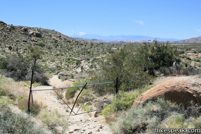
Small rock formations border the trail, but otherwise the desert surroundings are open and sprawling. Turn around for a view of Mount San Gorgonio, the highest mountain in Southern California, rising above the desert floor. Pass around a metal gate at the halfway point and continue through the desert of Joshua trees, yucca, and cacti.

At 1.25 miles, the terrain drops away to offer a view of the rock formations to the northeast. A footpath continues beyond the ridge to connect to the Split Rock loop and Split Rock Picnic Area off Park Boulevard. This is by no means the best viewpoint in Joshua Tree, but considering the minimal effort, it wouldn’t really be fair if it was.

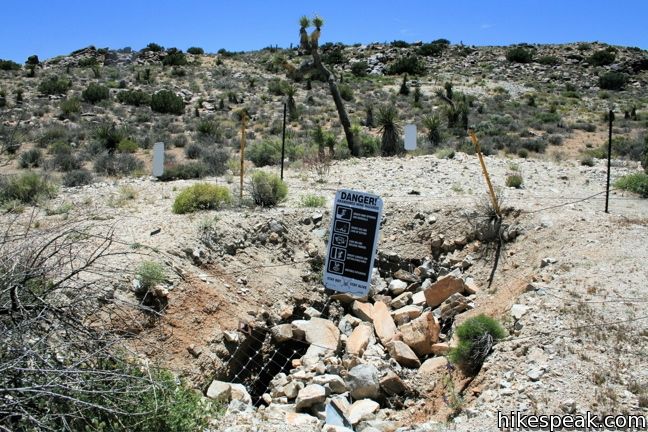
After enjoying the “lucky boy” view, double back and take a look at the vertical mine shafts just off the trail to the east. The shafts are surrounded by fencing and covered with rocks and grates. They are the only obvious remnants of Elton Mine. After taking it all in, find the trail again and return the way you came. To see more mine shafts and remains, take the nearby hike to Desert Queen Mine.
To get to the trailhead: From Park Boulevard 5 miles west of the intersection with Pinto Basin Road, turn north on Desert Queen Mine Road (opposite Geology Tour Road). Drive less than a mile over dirt road and turn right into the parking area with the blank trail sign. This is the only turn off en route to the Desert Queen Mine – Pine City Trailhead.
Trailhead address: Desert Queen Mine Road, Joshua Tree National Park, CA 92277
Trailhead coordinates: 34.01795, -116.0824 (34° 01′ 04.6″N 116° 04′ 56.6″W)
View Joshua Tree National Park in a larger map
Or view a regional map of surrounding California Desert trails and campgrounds.
 | Desert Queen Mine This 1.6-mile hike follows a level trail to an overlook before crossing a canyon to visits the ruins of one the most profitable gold mines in the California desert. |
 | Crown Prince Lookout This easy 3.25-mile round trip hike crosses a desert plateau to a pair of overlook near the site of an World War II era observation post. |
 | Wall Street Mill This level 1.55 to 2.15-mile hike visits a well-reserved gold mill, exploring the mining history of Joshua Tree National Park. |
 | Barker Dam This level 1.5-mile loop visits a small foreign-looking reservoir within the Wonderland of Rocks. |
 | Wonderland Wash This level 2.1-mile hike travels past the ruins of Wonderland Ranch up a use trail into the Wonderland of Rocks. |
 | Hidden Valley This one mile loop circles the interior of a small valley surrounded by tall rocks that serves as an excellent bouldering arena. |
 | Ryan Mountain This 3-mile hike offers summit views from the center of Joshua Tree National Park. |
 | Ryan Ranch This 0.8 or 1.2-mile round trip hike visits the ruins of an old adobe homestead beneath Ryan Mountain. |
 | Lost Horse Mine This 4-mile hike visits a well-preserved mine and mill. |
 | Inspiration Peak This 1.2-mile hike leaves the crowds at Keys View for even grander views at a 5,550-foot summit that looks out on the Coachella Valley, the Salton Sea, Mount San Jacinto, and much of Joshua Tree National Park. |
 | Fortynine Palms Oasis The 3-mile round trip hike visits a cool desert oasis. |
 | Indian Cove The 101-site campground is home to a 0.6-mile interpretive trail and endless bouldering and rock climbing opportunities. |
 | Warren Peak This 5.5-mile hike summits a peak with impressive views over the west side of Joshua Tree. |
 | High View Nature Trail This 1 1/3-mile loop climbs a ridge on the west side of the park that offers views of San Gorgonio Mountain and Yucca Valley, along with an introduction to desert plants. |
 | Arch Rock This short hike leads to a natural arch in the granite formations by White Tank Campground. |
 | Mastodon Peak This 2.6-mile loop visits a 3,400-foot summit with panoramic views of southeastern Joshua Tree. |
 | Lost Palms Oasis This 7.2-mile hike visits a desert oasis nestled between mountains in the southeast corner of the park. |
 | Cholla Cactus Garden This quarter-mile loop allows visitors to stroll through an intense concentration of cholla cacti. |
 | Hikes in the California Desert Explore more trails in Death Valley National Park, Joshua Tree National Park, Anza-Borrego Desert State Park, and Mojave National Preserve. |
 | Joshua Tree Campgrounds Nine campgrounds with 500 total sites are spread throughout the park to facilitate your visit. |
 | Joshua Tree Wildflowers The desert in bloom is something any outdoor enthusiast in California should see. |


This is not the Lucky Boy Vista trail that you will hike if you get a map from the NPS at one of the park visitors center. That trail is longer(over 6 miles), has some fun scrambling and bouldering over trails that are not well marked and is set in a loose sand dry creek bed for the first 1 1/2 miles (the sand makes it a not very enjoyable slog). NPS staff called it a new trail. Find another trail until they re-route out of the sand and mark the rest of it.