La Jolla Canyon Falls
in Point Mugu State Park

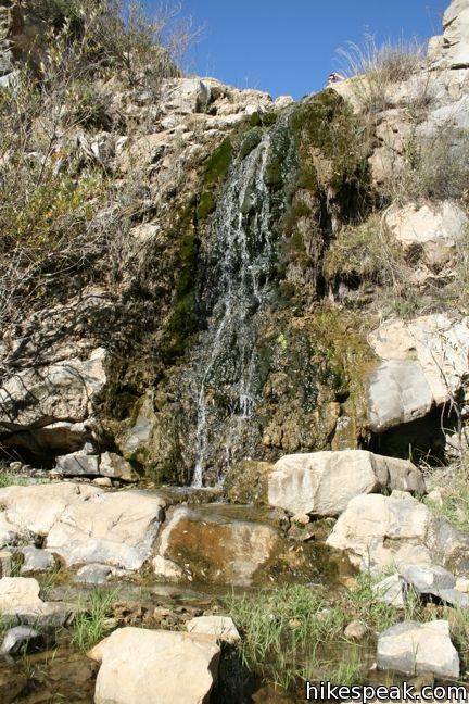
La Jolla Canyon Falls is a short seasonal waterfall located 3/4 of a mile up La Jolla Canyon Trail in Point Mugu State Park. The twenty-foot cascade offers one of the easiest hikes in the park, with just 250 feet of elevation between the trailhead and the falls. La Jolla Canyon Trail continues above the waterfall, ascending a rocky V-shaped canyon. If you choose to hike farther, the options are plentiful.
Update: La Jolla Canyon Trail was damaged in the winters of 2015 and 2017 and is closed until further notice.
- La Jolla Canyon Falls is close to many other Los Angeles waterfall hikes.

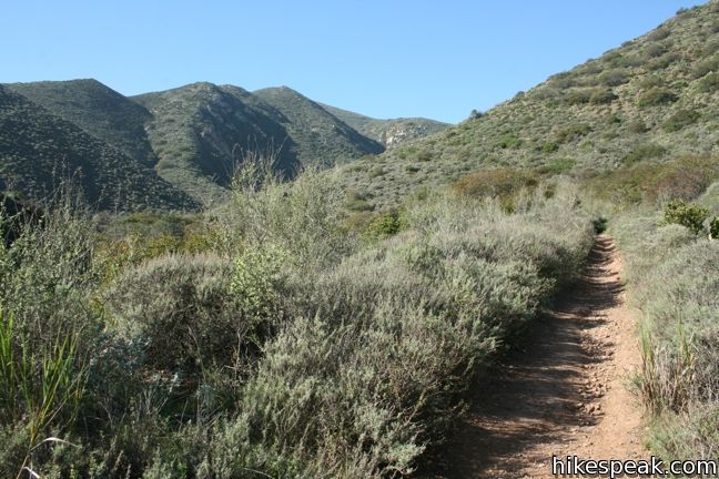
To see La Jolla Canyon Falls, begin from La Jolla Canyon Day Use Area, just off Pacific Coast Highway between Point Mugu and Big Sycamore Canyon on the west end of the Santa Monica Mountains. Two trails depart from the parking area. Ray Miller Trail heads to the right up the east ridge of La Jolla Canyon, while La Jolla Canyon Trail heads straight up the mouth of the canyon. The single track swings to the northeast following the gravel canyon bottom between thousand-foot ridges that add gravity to the trek.
Cross the typically dry creek bed and transfer to the west side of the canyon just before reaching La Jolla Canyon Falls. This 20-foot cascade funnels water over short mossy ledge. A singe set of switchbacks to the right access the top of the waterfall, where a nice perspective down La Jolla Canyon awaits.

You could turn around here for a 1.5-mile round trip hike, but even if that is your plan, La Jolla Canyon is likely to draw you a bit farther. Just above the waterfall, a side canyon joins La Jolla Canyon at a confluence decorated by Walnut trees. This is a nice shady spot for a creek side picnic.
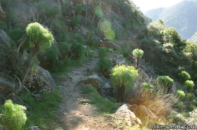
The trail continues to the right up the main channel of La Jolla Canyon, which becomes steeper, narrower, and more rugged. Bare rock walls are dressed with giant coreopis (a bizarre plant that looks like fennel crossed with Joshua tree in a lab run by Dr. Seuss).
La Jolla Canyon Trail ends 2.4 miles from the start, at a junction with La Jolla Valley Fire Road (near La Jolla Valley Hike-in Campground). Half a mile above the falls is a junction with La Jolla Valley Loop Trail. This track can be used to explore the valley above La Jolla Canyon, and connect to Mugu Peak Trail. The peak trail provides some of the most scenic coastal views of any trail in the Santa Monica Mountains, warranting the 1,250-foot ascent. It is 6.5 miles round trip to the summit of Mugu Peak, and if you hike that far, you may wish to consider the 11.75-mile La Jolla Canyon Loop, which ascends the east ridge of La Jolla Canyon on Ray Miller Trail, crosses La Jolla Valley, and then returns to the canyon via Mugu Peak Trail just above waterfall. It is one incredible trek.

This short hike to a short waterfall is 1.5 miles round trip with 250 feet of elevation gain. It makes a nice appetizer hike for the bounty of trails in Point Mugu State Park. An eight-dollar fee is charged to park in the day use area, which can be avoided by walking in from the free roadside parking along Pacific Coast Highway.
Update: La Jolla Canyon Trail was damaged in the winters of 2015 and 2017 and is closed until further notice.
To get to the trailhead: From Los Angeles, take the 10 Freeway west through Santa Monica and follow PCH northwest for 34 miles through Malibu to Point Mugu State Park. Fifteen miles past the intersection with Kanan Dune Road and 1.5 miles past Sycamore Canyon, turn right into La Jolla Canyon Day Use Area. Proceed into the park to the parking lot on the left. From Oxnard, head southeast on PCH for ten miles and turn left into La Jolla Canyon Day Use Area.
Trailhead address: Pacific Coast Highway, Point Mugu State Park, Malibu, CA 90265
Trailhead coordinates: 34.086245, -119.03676 (34° 05′ 10.48″N 119° 02′ 12.33″W)
You may also view a regional map of surrounding Los Angeles trails and campgrounds.
 | La Jolla Canyon Loop This 11.75-mile hike explores Point Mugu State Park on the west end of the Santa Monica Mountains, offering extraordinary ocean views (while still visiting La Jolla Canyon Falls). |
 | Mugu Peak This 6.5-mile hike ascends from the bottom of La Jolla Canyon to the top of a 1,266-foot peak, providing exceptional ocean and canyon views. |
 | Scenic and Overlook Trails Loop This 2.7 to 3.5-mile hike takes in tremendous ocean views above Big Sycamore Canyon in Point Mugu State Park. |
 | Sandstone Peak This 6.25-mile loop summits the tallest peak in the Santa Monica Mountains. |
 | The Grotto This 3-mile out and back hike visits a remote grotto in the Santa Monica Mountains National Recreation Area. |
 | More trails in the Santa Monica Mountains Explore other destinations in the range. |
 | Eaton Canyon Falls This 3.5-mile hike goes up Eaton Wash to a narrow stretch of Eaton Canyon containing a pleasant 40-foot waterfall. |
 | Paradise Falls This 40-foot waterfall is located within Wildwood Park in Thousand Oaks and is reachable via several trails. |
 | Solstice Canyon This easy and level 2.6-mile out and back hike visits the ruins of a burned down ranch and a small waterfall. |
 | More waterfalls around Los Angeles Explore other waterfalls in the Santa Monica and San Gabriel Mountains. |
 | Sycamore Canyon Campground This 58-site campground in Point Mugu State Park sits at the mouth of a beachfront canyon and has access to trails through the west end of the Santa Monica Mountains. |


Last time I did this around jan/feb 2015, the trail was ruined from erosion from all the heavy rains that happened. The pch was even closed for a while to try getting to point Mugu (from santa monica) and when it finally re opened , I went up there since this is one of my favorite trails and you can still hike to the waterfall but no more access to climb up it and continue through the rest of the trail system, which is too bad cause it was a great hike. Haven’t been back since so maybe someone somehow rebuilt the trail but I doubt it. Even those wooden steps that were to the left side of the waterfall as you approach it were washed out.
Went to this trail 8/31/15… sadly still completely destroyed. Very sad, I used to go to this trail all the time. It apparently burned sometime last year.. And then when the rains came there was nothing to keep the water from tearing down the canyon.. Even the stone stairs carved into the waterfall were ripped away… It’s going to be a long time before this trail is worth visiting.
Hello Justin,
Did you take the La Jolla Canyon Trail from Ray Miller trailhead?
[…] Hiking directions: The Ray Miller Trailhead is just outside the parking lot. The hike is marked by a trailhead sign, which indicates that it is 0.8 miles to the 20-foot waterfall. If you want to make the hike longer, you can continue to hike beyond the waterfall. The trail will ascend into a canyon. To see more photos and information about this hike, visit La Jolla Canyon Falls on hikespeak.com. […]
This hike should be removed. La Jolla Trail has been closed since January 2015. The waterfall no longer exists due to huge rock formations collapsing. It is extremely dangerous to attempt to pass through that section without experience in rock climbing and proper equipment. There are no plans to recreate this passage by the California State Parks. Camarillo Springs fire and heavy rains damaged the trails and loosened boulders on the canyon walls, increasing the hazard of landslides. For your own safety, please stay out of La Jolla Canyon!