
Pay a visit to Kwaay Paay Peak for an efficient workout that’s rewarded with panoramic views. The 2.5-mile round trip hike to the 1,194-foot summit climbs 885 feet, with steep stretches that will have your heart pumping. The summit is just ten miles from downtown San Diego, within the 6,800 acres of Mission Trails Regional Park, so you’ll see beautiful natural landscapes and cityscapes on this fun San Diego hike.
A couple places can be used to begin your hike to Kwaay Paay Peak. Both are located along Father Juniper Serra Trail, a paved road through Mission Trails Regional Park. For a shorter, 2.2-mile round trip trek that skips the end of the ridge north of Kwaay Paay Peak, hikers can begin from Old Mission Dam Historic Site (more on this option later).
For the full Kwaay Paay Peak Trail, set out from Father Juniper Serra Trail near Kumeyaay Lake Campground. The trail goes south and immediately comes to a split that presents one more route to Kwaay Paay Peak. The main trail turns right and launches up the ridge that extends north from Kwaay Paay Peak. The trail crosses a crest and drops across a saddle, where it meets the other trail that heads to the left from the junction by the trailhead. This alternate route to the west of the main trail can be used to surpasses the north end of the ridge. Add variety to your hike by using this trail for one trip up or down the mountain.
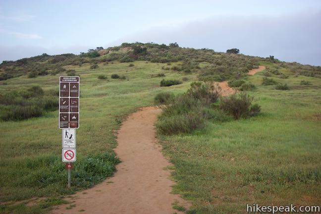
Kwaay Paay Peak Trail leaves the first junction and swings around to the north side of the ridge to begin a steep climb up a rutted slope. Catch your breath and look over your shoulder to get nice early views to the north across Father Juniper Serra Trail toward the riparian woodland along the San Diego River and around Kumeyaay Lake. You can look farther north toward San Clemente Canyon Freeway (Route 52) and east over Santee.
Come over the top of the ridge, after gaining close to 200 feet in the first 0.2 miles, and take the trail along a wooden fence (don’t stray off track and trample the plants). The trail aims toward, Cowles Mountain and Pyles Peak, which form the other side of Mission Gorge to the southeast. To the right, peer across the ridge toward South Fortuna Mountain. As you turn downhill, the trail curves to the right and points toward Kwaay Paay Peak. Drop about 25 feet of hard-fought elevation as you cross the saddle before resuming the ascent.

At 0.42 miles from the start, the alternate route along the west side of the ridge joins Kwaay Paay Peak Trail from the left. Continue a short distance farther and come to a second junction, which is on the right, 0.45 miles from the start. This is Mission Dam-Kwaay Paay Peak Trail, which takes a 0.3-mile long route from Old Mission Dam Historic Site up to this junction. A sign at the junction, which you will see on the hike back down has an arrow for the main trail labeled “Campground – Lake” and an arrow for Mission Dam-Kwaay Paay Peak Trail labeled “Old Mission Dam.”
From the junction with the trail from Old Mission Dam Historic Site, it is 0.8 miles to the summit with close to 650 feet of elevation change. There are no more junctions, so set your target on the mountaintop, which you’ll see as you begin the next section of the hike. This middle stretch of the trail is relatively moderate. North and South Fortuna Mountain rise to your right and there are broad views to the north looking back down the trail and over surrounding grassy ridges.

At 0.95 miles from the start, Kwaay Paay Peak Trail crosses a landing and a short saddle below the trail’s steepest ascent. In the calm before the climb, enjoy a look at dramatic rocky cliffs that appear to your right below South Fortuna.
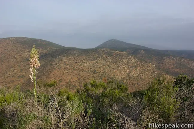
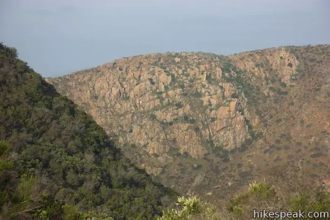
The next 0.15 miles are very steep, gaining some 250 feet, but pull through and things will taper out as you approach the round mountaintop. A couple flights of wooden steps provide extra traction up the steep dirt trail.
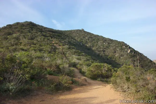
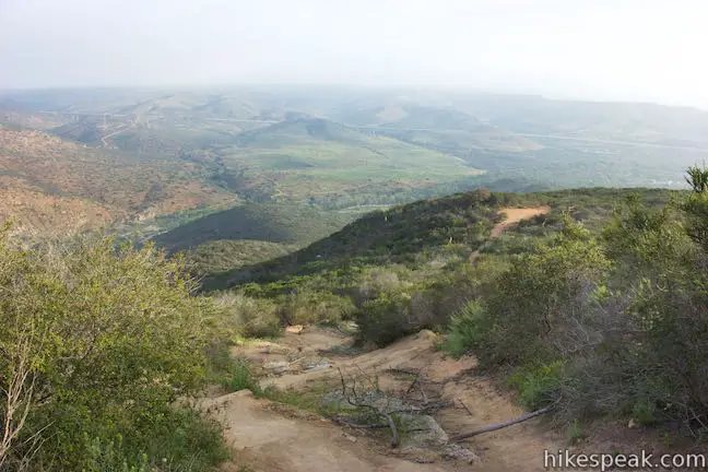
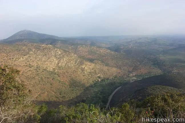
Above the climb, look left for a fleeting look at the mountains to the southeast, which come before the end of the trail, about 1.2 miles from the start. Pyles Peak takes up more of the view, but behind that, you’ll spot the 1,591-foot crown of Cowles Mountain, which is the highest point in the city of San Diego.
As the trail flattens, you will arrive at the viewpoint on the summit of Kwaay Paay Peak. Have a seat on one of the boulders in the dirt clearing. The overlook is surrounded by dense brush and enclosed by wooden fences to protect the vegetation. The summit offers sweeping views looking southwest over San Diego and northwest toward Fortuna Mountain. The top of the trail is on the west side of the summit, blocking views of Cowles Mountain or the south side of San Diego from the end of the trail.
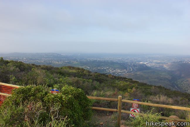
According to the San Diego Reader, the name Kwaay Paay comes from a Kumeyaay Indian word that means leader. You may feel ready to lead after the short, tough hike to this 1,194-foot summit. The mountaintop is 1.25 miles from the start of Kwaay Paay Peak Trail or 1.1 miles from Mission Dam Historic Site.
Hike back down the trail, when you have finished enjoying the view. If you took the main trail up but decide to hike down Mission Dam-Kwaay Paay Peak Trail, the two trails can be connected with a quarter mile long walk along Father Junipero Serra Trail. Other trails from Old Mission Dam Historical Site allow for additional hikes, including a 0.2-mile round trip stroll to the ruins of the Mission Dam.
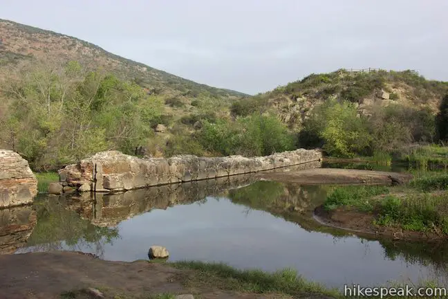
Mission Dam-Kwaay Paay Peak Trail: For the 1.1-mile long route to Kwaay Paay Peak, start from the parking area by Old Mission Dam Historical Site. Since you’re here, warm up with the short, level hike to Mission Dam. Take the trail from the end of the parking lot, immediately passing through a picnic area. After a tenth of a mile, a wide seasonal pool in the San Diego River appears to the left, created by sections of a stone retaining wall that still remain from a 200-year-old dam. A panel along the trail explains that:
After many attempts dating back to 1774 to provide a reliable source of water for crops and livestock for Mission San Diego de Alcala, a dam and flume system was finished between 1813 and 1816 by Indian laborers and Franciscan Missionaries to divert waters of the San Diego River for a distance of 6 miles. The aqueduct system continued in existence until 1831 when constant flooding caused the dam and flume to fall into disrepair. They were not repaired due to the secularization of the missions.
The river looks quite pleasant above the dam, but stay out of the water. Swimming and wading is not allowed.
Return to the parking area at Old Mission Dam Historical Site and walk out the other end of the parking area and across Father Junipero Serra Trail. Find the start of a dirt single track on the other side, heading up a grassy slope toward Kwaay Paay Peak, which is visible right from the start.
Hike up Mission Dam-Kwaay Paay Peak Trail for 0.15 miles to an outcropping of rocks on the right side of the trail. This is a good spot to pause and look down over the woodland along the San Diego River. The long ridge of Fortuna Mountain borders opposite side of the gorge. Mission Dam-Kwaay Paay Peak Trail continues up the side of a draw in the landscape below the mountain, offering excellent views of Kwaay Paay Peak. Nearing the top of the trail, gaze toward the north end of the ridge that is crossed by the main fork of Kwaay Paay Peak Trail.

When Mission Dam-Kwaay Paay Peak Trail ends after 0.3 miles, bear right and hike another 0.8 miles to the summit. Return via the same route for a 2.2-mile round trip hike with 895 feet of elevation change (not counting the short stroll to Mission Dam).
The hike is a little easier starting from Mission Dam, but all routes to Kwaay Paay Peak are challenging and worthwhile. No permit is required to hike to Kwaay Paay Peak and there is no fee to visit Mission Trails Regional Park. Leashed dogs are allowed on Kwaay Paay Peak Trail, but bikes are not.
To get to the main trailhead: Take Interstate 15 to exit 11 for San Clemente Canyon Freeway (Route 52). Take Route 52 east for 6 miles. Exit on Mast Boulevard. Turn left at the bottom of the ramp. Pass under the highway and turn right on West Hills Parkway. Drive 0.7 miles and turn right on Mission Gorge Road. Make the first right onto Father Junipero Serra Trail after a quarter mile. Drive 0.4 miles to the start of the trail on the left (south) side of the road. Street parking is available the road by the trailhead. Additional parking can be found in a dirt lot at the intersection of Father Junipero Serra Trail and Bushy Hill Drive, just 0.2 miles east of the trailhead.
Trailhead address: Father Junipero Serra Trail, Santee, CA 92071
Trailhead coordinates: 32.84022, -117.03701 (32° 50′ 24.79″N 117° 02′ 13.23″W)
To get to Old Mission Dam Historic Site: Take Mission Gorge Road to Father Junipero Serra Trail and drive 0.65 miles to the parking area for Mission Dam, which is on the right across from the trail to Kwaay Paay Peak. A gate crosses half of Father Junipero Serra Trail at Old Mission Dam Historical Site. Father Junipero Serra Trail is closed to westbound vehicle traffic from this point on (that lane of the road is for cyclists and pedestrians only).
Trailhead address: Father Junipero Serra Trail, Santee, CA 92071
Trailhead coordinates: 32.83958, -117.04126 (32° 50′ 22.48″N 117° 02′ 28.53″W)
View Kwaay Paay Peak in a larger map
Or view a regional map of surrounding Southern California trails and campgrounds.
Mission Dam to Kwaay Paay Peak Trail


 | Moserate Mountain This 4.4-mile loop begins with a 1 2/3-mile ascent that gains 1,200 feet to reach a panoramic summit and then descends along a ridge for even more views. |
 | Observatory Trail The 5.1-mile round trip hike travels between Observatory Campground and Palomar Observatory, crossing a pleasant mountain woodland with valley views along the way. |
 | Indian Flats Trail This easy half-mile round trip hike from Atáxam Mámta'ash Campground (formerly Indian Flats) explores seasonal pools in the East Fork of the San Luis Rey River. |
 | More hikes in Southern California Explore more trails in Orange, Riverside, San Bernardino, and San Diego counties. |
Kwaay Paay Peak Trail in Afoot and Afield: San Diego County by Jerry Schad
A San Diego Reader article on Kwaay Paay Peak Trail
Kwaay Paay Peak Trail on alltrails.com
Kwaay Paay, Mission Dam, and Kumeyaay Lake on modernhiker.com
Kwaay Paay Peak on summitpost.org
A park trail map from Mission Trails Regional Park Foundation
The official website for Mission Trails Regional Park Foundation


[…] was humping as fast as my dead legs could carry me up Kwaay Paay, an incredibly steep, 1200-foot climb, that would complete my 5 Peak Challenge attempt, and allow […]