Kiholo Bay & Wainanali‘i Lagoon
in Kiholo State Park Reserve

While much of Hawai‘i’s coastline is understandably built up with vacation destination resorts, some areas have a wilder feel, like Kīholo Bay. Driftwood decorates the rugged coastline, just 25 miles north of Kona, and green sea turtles ease through the bay’s cyan-colored shallows. The Hawaii State Parks website describes Kīholo State Park Reserve as:
A stark, lava-covered coastal park with small bays, sparsely vegetated coastline, historic lava flows, and wide open spaces.
Experience the park on a two-mile round trip hike across a rocky shore, passing coves and beaches that lead to the turquoise water of Wainanali‘i Lagoon. This lovely locale has a unique history – built into fishponds by Hawaiians prior to a landscape-redefining 19th century lava flow. Additional hiking in the park includes a 1-mile round trip outing down the coast in the opposite direction to a black sand beach.
Start from a parking area at the end of a 1-mile long dirt road that descends to the coast from Hawaii 19, the main route north of Kona. Off the circle at the end of the road, find a wide trail crossing pahoehoe lava rock that pushes through an airy forest of kiawe trees for thirty yards to arrive at the coast. Ahead, the volcanic surface stretches into the ocean like black fingers, forming tide pools with their touch.
Unless you’re heading to the black sand beach, half a mile to the left, bear right to make your way toward Wainanali‘i Lagoon. A well trodden path passes through an archway in the trees. The route becomes less defined as you go. Because most of the trek to Wainanali‘i Lagoon is not on an established trail, the hiking can be rough and slow-going. Budget extra time for your visit.
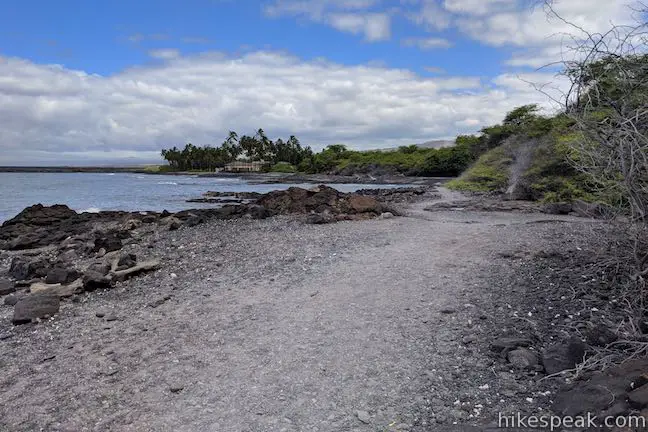
After 1/8 of a mile on the coast, look on your right for rocks that mark the site of Keanalele (also known as Queen’s Bath), a lava tube cave just below the surface. Openings in the crust of pahoehoe lava reveal a pool of freshwater mixing with saltwater in a tunnel just underground. Have a look, but stay out; swimming in this pool or any cave in Kīholo State Park Reserve is not permitted.
Continue walking northeast along the coast. As you go, enjoy views north over Kīholo Bay toward the slopes of Kohala. Soon afterward, and a quarter mile from the start, curl around the back of a partially sheltered cove. This is an easy spot to snorkel, if you’re eager to take a break and cool off in the ocean.
Walk up the coast past more tide pools. Cross a trail on the right that heads inland and connects to a road (which could be used to make a less scenic loop back to the trailhead). Keep on moving up the coast, where signs of a defined route lead to a picnic table atop a gravely beach. Just behind this beach is a large yellow building wrapped by coconut trees, one of the private holdings within the reserve. The picnic table is 0.4 miles from the trailhead and makes a decent early turnaround point for those who tire of trudging up the rocky shoreline.
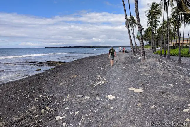
Moving along, the path disappears, so forge your own route. Since your feet sink deeper into the rocks and sand than they would on a hard-packed trail, this two-mile hike may actually feel like double the distance because of the extra effort. If your legs get soar, simple stop and gaze out over the beautiful bay.
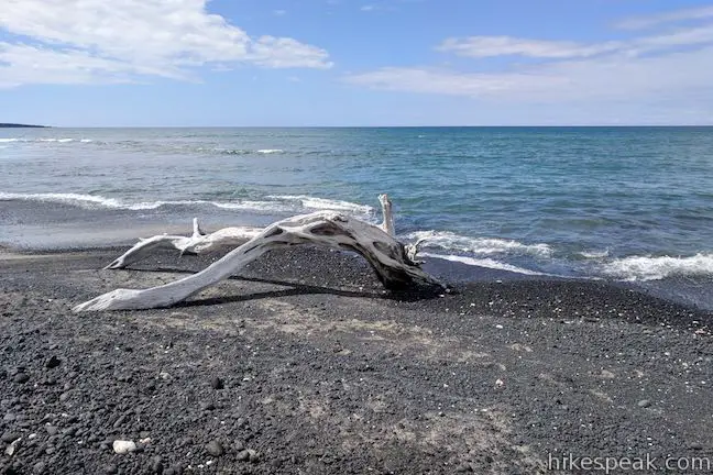
Shortly after the first property, spot a second retreat constructed in an impressive Balinese style. A bench here could be used to take a break. Aside from a few sandy stretches, the coast remains rocky as you continue north.
Arrive at a round point, 3/4 of mile from the start. The most recessed part of Kīholo Bay is to your right, hosting a short black beach. Across from the point, spot the small island and long peninsula framing Wainanali‘i Lagoon. The blackened landscape of a not-so-old lava flow meets the far side of the bay.
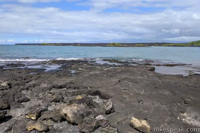
About 200 years ago, this view would have looked very different. Early in the 19th century, Kamehameha I, the first ruler of the kingdom of Hawaii, took advantage of the freshwater flowing into the bay and had an ambitious 6-foot tall, 20-foot wide seawall built to enclose a grand fishpond with a 2-mile circumference. A village stood next to this large-scale fish-farming operation. In 1859, a 300-day long eruption on Mauna Lau channeled molten lava to the coast, destroying the village and reshaping the fishponds and shoreline. Instead of being enclosed by a wall, water and marine life now flow freely around a small island and a long peninsula that partially enclose Wainanali‘i Lagoon.
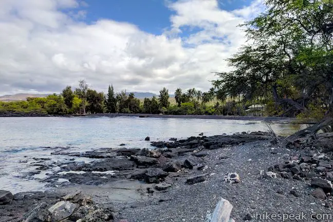
Proceed past the point and walk around the back of the bay across the beach. Use a short bridge to cross a stream flowing into the bay that connects to privately-owned fishponds just inland. On the far side of the beach, make your way to the edge of Wainanali‘i Lagoon. The turquoise pool is so inviting, you may be compelled to swim – or at least stand and watch the fish and sea turtles (honu).
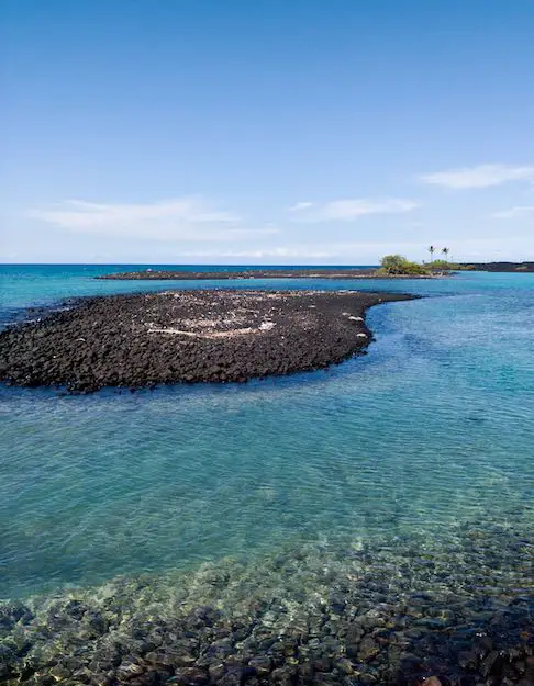
The peninsula-shielded lagoon has calm clear water. The mixture of freshwater and ocean water in Wainanali‘i Lagoon accounts for the vivid turquoise color, which is lighter than the rest of Kīholo Bay. Snorkelers are sure to see a splendid variety of tropical fish. The sea turtles have dibs on the lagoon, like the rest of Kīholo Bay, so give them plenty of space when you are on land and in the water. (It is illegal to approach the sea turtles.)
Wainanali‘i Lagoon is about one mile from the trailhead. You could explore farther or swim for hours. Either way, return by the same route when it is time to leave.
Kīholo Bay Black Sand Beach
At the end of the path from the parking area to the coast, if you look to the left, you’ll spot a black sand beach. To reach it, just walk a half-mile down the shore. A pool behind the beach, called Waia’elepi can be observed but is not open for swimming.
Dogs are not allowed in Kīholo State Park Reserve. The coast is not suitable for bikes. The park is open from 7 a.m. to 7 p.m. from April through Labor Day and from 7 a.m. to 6 p.m. during the rest of the year. A camping area near the trailhead is open from weekends only. Sites are $12 per night (as of 2018) and may be reserved in advance on the state parks website. No permit is required to hike in Kīholo State Park Reserve and parking at the trailhead is free, so get out and enjoy!
The dirt road down to the trailhead from Highway 19 is somewhat rough, so high clearance vehicles are recommended.
To get to the trailhead: From Kona, travel north on Hawaii 19 (Queen Ka‘ahumanu Highway). Pass Keahole Airport Road and go another 11 miles to a scenic overlook for Kiholo Bay on the left (makai side of the road). Take the turn lane to pull into the scenic overlook. Then pull back out onto Hawaii 19 and drive 0.4 miles southwest (in the opposite direction). Turn right down the first dirt road, which is unmarked. Drive 1 mile down this road to a trailhead parking area. Stay straight past roads on the right and left that come around 0.8 miles from Hawaii 19.
Coming from Waimea, it is a 25 miles southwest to the Kiholo Bay Scenic Overlook just before the turnoff for the road to the trailhead.
Trailhead address: Kiholo Bay Parking, Kīholo State Park Reserve, Queen Ka‘ahumanu Highway, Kailua-Kona, HI 96740
Trailhead coordinates: 19.85125, -155.93188 (19° 51′ 04.5″N 155° 55′ 54.8″W)
View Kiholo State Park Reserve in a larger map
Or view a regional map of surrounding Hawaii trails and campgrounds.
 | Kalahuipua‘a Trail and Fishponds Loop This action-packed 1.7-mile hike explores a lava field with a lava tube shelter and impressive fishponds along a gorgeous coastline. |
 | Malama Trail This 0.2 to 1.2-mile hike visits rare rock carvings in Puakō Petroglyph Archeological District on the west coast of the Big Island of Hawai'i. |
 | Royal Grounds – Pu‘uhonua Loop This half-mile loop on the coast south of Kona explores Hawaiian royal grounds and a place of sanctuary in Pu‘uhonua O Hōnaunau National Historical Park. |
 | Waipi‘o Beach & Muliwai Trail Overlook This 4.88-mile hike plunges into fantastically-wild Waipi‘o Valley, crosses a remote black sand beach (framed by cliffs and waterfalls), and climbs to a stellar view overlooking the ocean, beach, and valley. |
 | ‘Akaka Falls This short loop slips through a tropical valley to bold views of a 442-foot single-drop waterfall. |
 | Rainbow Falls This 0.2-mile hike around Rainbow Falls Lookout explores a viewpoint facing a lovely waterfall and also ventures up to the top of the falls. |
 | Kaumana Caves This underground hike explores lava tubes on the edge of Hilo, created by an 1881 eruption of Mauna Loa. |
Kiholo Bay and Wainanali'i Lagoon on bigislandhikes.com
Kiholo Bay and Wainanali'i Lagoon on smartrippers.com
Kiholo Bay and Wainanali'i Lagoon on hawaiianforest.com
Kiholo Bay on trailblazerhawaii.com
The hike to Wainanali'i Lagoon from an alternate starting point on alltrails.com
Kiholo State Park Reserve on .outdoorproject.com
The 1859 eruption of Mauna Loa on pacificislandparks.wordpress.com


Go the extra miles...
Submit a rating of this hike to go with your comment. Contribute to the average trail rating.