Castle Canyon Trail to Inspiration Point
in the San Gabriel Mountains

Castle Canyon Trail is a dirt single track that connects the ruins at Echo Mountain to Inspiration Point, which was a premier vista point for the resort’s visitors and still offers sweeping views. In the past, a railway took Echo Mountain’s guests up into the mountains, but now leg power is required to get up Castle Canyon Trail to Inspiration Point. The single track is gradual when it leaves Echo Mountain, but becomes steeper as it goes, gaining 1,325 feet over 2 miles. Inspiration Point has two pavilions, built to match those that stood in the past, as well as sighting tubes that align visitors with views over Los Angeles. Inspiration Point is an excellent destination for a hike in the San Gabriel Mountains, especially since the hike reaches other attractions as well.
Castle Canyon Trail ventures north from Echo Mountain, rising to Inspiration Point. To reach Castle Canyon Trail, hikers must first get to Echo Mountain. Sam Merrill Trail is the most direct and popular route to the Echo Mountain ruins, ascending 1,400 feet over 2.9 miles (one way). For something a bit longer, Sunset Ridge Trail and Mount Lowe Road (which parallel each other) can be used to approach Echo Mountain, offering different views and glimpses of the old Mount Lowe Railway. Hiking to Echo Mountain via Sunset Ridge Trail is 7.5 miles round trip with 1,425 feet of elevation change. Hiking on paved Mount Lowe Road instead trims the distance to 6.9 miles.
Those taking Castle Canyon to Inspiration Point from Echo Mountain can return by the same route or take either Upper Sam Merrill Trail or Mount Lowe Road down to Echo Mountain Trail to form a loop. Mount Lowe Road passes Mount Lowe Trail Camp, built on the ruins of Thaddeus Lowe’s Alpine Tavern at the top of Mount Lowe Railway, along with additional attractions along the old railway, like viewpoints and the remnants of several bridges. The loop adds 5.9 miles to a hike to Echo Mountain that begins up Sam Merrill Trail for a total of 2,715 feet of elevation change. For those beginning on Sunset Ridge Trail, the distance is extended by 4.25 miles round trip (since the Sunset Ridge Trail route already includes taking Echo Mountain Trail from Cape of Good Hope to Echo Mountain) with a total of 2,440 feet of elevation change.
Echo Mountain
As you approach the ruins of Echo Mountain from the northwest, you’ll pass Echo Mountain Picnic Area, which was established by the old tennis grounds on the northwest side of the ruins. The picnic area is in a peaceful pine grove and is a nice spot to take a break after visiting the ruins.
Large rusting gears and an old train car line the trail as you approach what is left of the resort complex known as the White City. Steps lead up to a level area where short stone walls outline the layout of the large buildings. Below these steps is a landing where guests arrived on “White Chariots,” the tramcars that brought guests from Rubio Canyon to Echo Mountain. The impressive incline tramline has long disappeared, but the old route is visible below.
Echo Mountain’s history is explained by numerous park-provided plaques. The resort and railway built by Thaddeus S. C. Lowe attracted over 3 million guests in its 40 years of operation, making it one of the most popular destinations in Southern California. A panel alongside the foundation offers this description of the resort:
The world famous Echo Mountain House was completed in 1894. It was a beautiful “L-shaped” building, four stories high with a 400-foot wing offering a southern exposure. A massive metal dome crowned the structure. The entire interior of the hotel was furnished in natural wood and had, in addition to 70 sleeping rooms, office space, social and recreation halls, a dining room, curio shop, Western Union office, bowling alley, billiard room, barber shop, shoeshine stand, and other facilities for the comfort of guests. The hotel cost $65,000, a vast sum at the time.
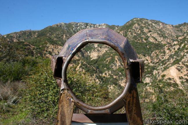
From the footprint of the resort, walk northeast across the clearing to a strange looking relic, the Echo Phone. In an era before cell phones and walkie-talkies, the Echo Phone could be used to shout messages across the mountain. A series of these metal megaphones were used to communicate back and forth to the resort. Step up and give the Echo Phone a try. The booming messenger still resonates across Castle Canyon to the north. If you know where to look, you’ll be able to spot Inspiration Point at the top of the saddle above Castle Canyon.
Professor Lowe chose a fine spot for his resort. The sprawling vista that drew guests from around the world can now be enjoyed by hikers at no charge. Linger, explore, and take in all that the Echo Mountain ruins have to offer.
Castle Canyon Trail
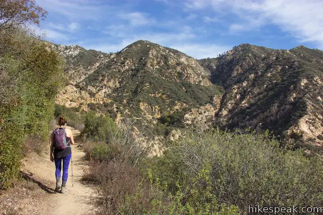
Castle Canyon Trail is the easternmost of three trails that head north between the top of Sam Merrill Trail and the ruins of the resort on Echo Mountain. Assuming that you explore the ruins of Echo Mountain first (which you should), backtrack a short distance on Echo Mountain Trail to find Castle Canyon Trail, which parts to the north just pass Echo Mountain Picnic Area. Turn right on Castle Canyon Trail, which actually goes downhill at first before leveling out and turning gradually uphill. You are trekking up the west side of a canyon above Rubio Canyon. Behind you, the ridge that was once topped by the White City Resort can be seen cutting into the canyon. As you head up the trail, listen for people shouting into the Echo Phone. The sound really does reverberate off the canyon walls.
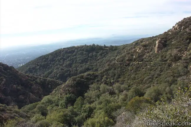
The trail rounds the back of a side canyon, dropping into a grove of bay laurels. Cross a creek bed and hike up out of the canyon. Exiting the trees, you’ll find clear views south toward the Echo Mountain ruins and the valley below. The trail curves to the left around the end of a ridge and heads up into Castle Canyon.
This steep, rocky trench is longer than it might look, making the ascent to Inspiration Point greater than it first appears from Echo Mountain. The trail pushes up the bottom of Castle Canyon. As the trail starts to get steeper, a quick switchback veers off to the left, but then the trail turns back toward the canyon floor. Shortly thereafter, the trail crosses to the east side of the canyon. Look out for a sharp left turn up a rocky ledge to proceed with the ascent – don’t loose track of the trail at this spot.
Castle Canyon Trail forges a zigzagging course around boulders and trees, eventually climbing up the east side of the canyon. Find pine-framed views down Castle Canyon toward the base of the mountains and the cities beyond. Keep pushing up the trail and Inspiration Point will finally be revealed at the top the canyon, an impossible-to-miss stone pavilion with a wooden roof.
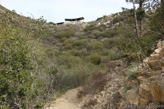
Castle Canyon Trail tapers out and actually turns away from Inspiration Point to wrap around a depression before finally rising to the viewpoint. At the top of the trail, meet a dirt road next to Inspiration Point and make the obvious left to walk into the first pavilion at the scenic overlook.
Inspiration Point
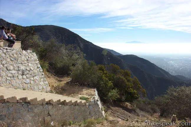
Inspiration Point was established for resort visitors. The viewpoint has two large pavilions that were rebuilt to match the ones that were visited by guests at the Alpine Tavern. A sign on the pavilion promotes Inspiration Point’s “world famous telescope view overlooking 3,000 square miles.” The pavilion sports a collection of sighting tubes, which you can look through to spot different areas of Los Angeles. On clear days, you should be able to look through the metal tube pointing toward Catalina Island and examine that island at least 60 miles away.
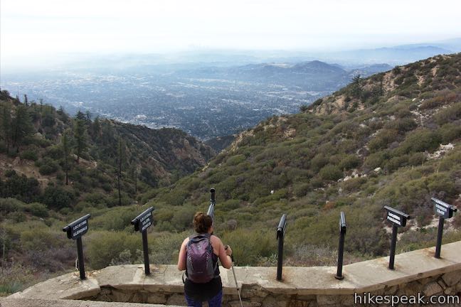
An interpretive sign explains how Inspiration Point was developed:
Originally only sighting tubes and benches were here. In 1925, two shelters were built. They lasted until the late 1950s. Volunteers reconstructed these shelters in the summer of 1996 on their original foundations.
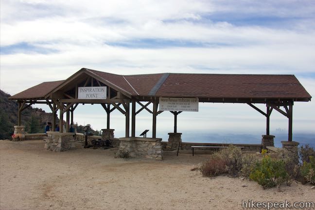
The dirt road beside Inspiration Point is Muir Peak Road. Look east from the road across Eaton Canyon toward Mount Wilson and surrounding peaks. This is an inspiring view too. Mount Lowe Road can be taken southeast beyond Castle Canyon Trail to the nearby summit of Muir Peak, as well as Easter Rock, a prominent formation where Easter services were held for resort guests.
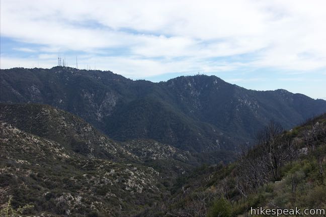
Beyond Inspiration Point
Hike back down Castle Canyon Trail or do something loopy and make Mount Lowe Road your return route. For the loop option back to Echo Mountain Trail, hike north on Muir Peak Road for a quarter mile to a T-junction with Mount Lowe Road. On your left just before the road is the top of Upper Sam Merrill Trail, a single-track route back to Echo Mountain. Walk up to the bigger intersection and turn left to head downhill on Mount Lowe Road. To the right, the wide dirt road ascends for another 3.45 miles to Eaton Saddle on Mount Wilson Red Box Road, the starting point for a downhill hike to Inspiration Point. After turning left, Mount Lowe Road goes down around a horseshoe bend to the left where it passes Mount Lowe Trail Camp (0.45 miles from Inspiration Point).
Mount Lowe Trail Camp
Spot a large Angeles National Forest sign at the bend in Mount Lowe Road that ushers you into the trail camp. Set in a forest of cedars, oaks, and spruce, the campground rests on a level area where the Alpine Tavern once stood. The campground has tent sites, vault toilets, a fire ring, hitching post, and picnic tables. It is a decent place to stop for a snack, even for those just hiking through.
Interpretive signs around the trail camp tell the story of the Alpine Tavern. On the right side of the campground, you’ll find the ruins of the tavern’s lobby where parts of the basement wall and grand fireplace still stand. The remnants of the railway line that brought guests up to the mountain retreat can be seen to the left. The concrete feet of what was an “S” shaped a bridge are still in place. This was the final bridge in the impressive path of the mountain railway.
Thaddeus Lowe opened the Alpine Tavern in 1895 at the top of the Mount Lowe Railway. When the resort on Echo Mountain was destroyed, the Alpine Tavern was expanded to handle more guests, until it too was wiped out by wildfire in 1936. In 1959, most of the remaining ruins were destroyed to build the trail camp. In its day, the Alpine Tavern offered guests the finest amenities: long-distance telephones and private baths with hot and cold water. There were leisure activities like ballroom dancing, billiards, croquet, tennis, and mini-golf. Today’s visitors have to get by on less, but the natural beauty remains a draw.
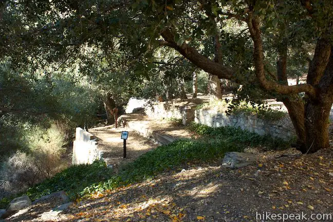
The Angeles National Forest website states that the trail camp has five hike-in campsites, but the campground is not split into numbered sites and instead has a general camping area with several suitable places to put up tents. Mount Lowe Trail Camp would make a great destination for a group backpacking trip. The trail camp gets light usage and is open year round on a first-come first-served basis. There is no fee to camp at the Mount Lowe Trail Camp and no permit is required. You should plan to carry in your drinking water, but water may be available to filter from a nearby stream during spring months.
Beyond Mount Lowe Trail Camp
Proceed down Mount Lowe Road from the trail camp, venturing 2.8 miles down the road to Cape of Good Hope past more traces of Mount Lowe Railway. The trail goes through a forest of pines and oaks and wraps around the side of a trench in the San Gabriels called Grand Canyon. A mile from the trail camp, you will pass Granite Gate, a landmark from the Mount Lowe Railway. A sign explains how the gate was created with dynamite:
In this area it was necessary to blast a path for the railway out of the Hard Granite. The cutting of the Granite Gate itself took 8 months with the walls being left intact on Professor Lowe’s orders. This “gate” provided a picturesque frame for photos of the trolley cars & tourists. Part of the Rock was removed in the 1960’s to widen Granite Gate.
Remnants of the electrified line above the railway can be seen at Granite Gate. This is a good place to look out across Grand Canyon, which drops away to the north. Tom Sloane Saddle is to the northwest and Brown Mountain is farther to the west. Mount Lowe can be seen to the northeast, rising to 5,600 feet. Thaddeus Lowe, after whom the peak is named, planned to build his railway all the way to the mountaintop, as a panel explains:
This summit, previously known as Oak Mountain, was named Mt. Lowe in the fall of 1892. At the time, railway construction was going on in Rubio Canyon and Echo Mountain. Professor Lowe had planned to run the railway to this summit and build a large hotel here. A suspended cable car would then reach to San Gabriel Peak to the north. There he planned to build an observatory and institute to study nature and the heavens. In 1895, with his money supply depleted, Professor Lowe had to end railroad construction at the Alpine Tavern, 1,100 feet below.
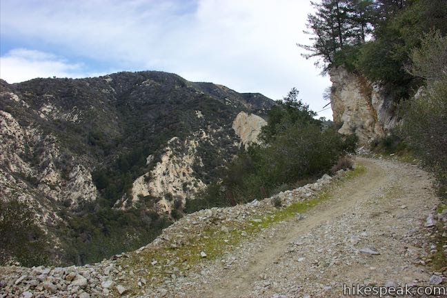
As you continue down Mount Lowe Road, imagine how different these mountains might be if that hotel had actually been built and the whole railway was still in place. The wide dirt trail curves to the left to head south, treating hikers to more views west over Millard Canyon, which is broad, rugged, and beautiful.
Chaparral becomes the dominant vegetation, providing more open views than the trees above. Just over half a mile past Granite Gate and 1.55 miles below Mount Lowe Trail Camp, pass the site of Halfway Bridge, which marked the midway point on the Alpine Division of the railway between Echo Mountain and the Alpine Tavern. The Alpine Division was 3.5 miles long and had 18 bridges and 127 curves. If it were constructed today, Mount Lowe Railway would be an engineering feat. And yet, the bridges and rail line were put in place over 100 years ago.
The views crescendo in another quarter mile when the trail comes around a bend with a big panorama. To the west, you can look down over two more sections of the road divided by a horseshoe bend. Beyond that, Millard Canyon cuts down toward the cities below, which are broken up by the San Rafael Hills, Verdugo Mountains, and the Santa Monica Mountains. Look south toward Cape of Good Hope, which stands out on Sunset Ridge.
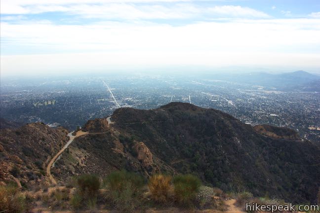
As you continue down the trail, you’ll even discover a view to the southeast toward Echo Mountain itself. Pass through the location of the Circular Bridge, 0.35 miles below Halfway Bridge. Evidence of Circular Bridge has disappeared, but it was another clever bit of engineering along the railway, as a panel explains:
The bridge was the solution to allow the railway to travel into the upper regions of the steep Millard Canyon. The bridge was 400 feet long with a diameter of 150 feet, on a 4 1/2% grade and was 20 feet higher from beginning to end. It seemed to run into empty space before returning to the mountain side.
It must have been quite an experience to ride a trolley up to this curve, with the tracks appearing to disappear into the sky before the actually route was revealed.
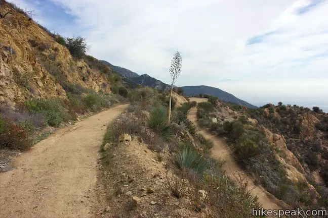
Make a tight curve to the right and descend Mount Lowe Road to a horseshoe bend to the left that sets you hiking south again. Come to a panel marking the site of Dawn Station, 2.5 miles below Mount Lowe Trail Camp. This station had a connection to a gold mining operation in Millard Canyon. A 2.4-mile long trail went from Dawn Station down to the mine and ore was carried up from the canyon to the railway by mules (appropriately named Jack and Jill). Trolleys transported the ore out of the mountains for processing. The tunnels of Dawn Mine can still be visited in Millard Canyon. Stick with Mount Lowe Road for another 0.3 miles to arrive at the Cape of Good Hope. The road becomes paved just before reaching the landmark.
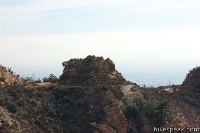
Cape of Good Hope
The road has been cut through the ridge by cape of Good Hope, separating a rock tower from the rest of the ridge. Before walking through the cut-in, turn right on a path around the cape and you’ll find a panel just off the road that offers a bit of history about Mount Lowe Railway:
The railway from Echo Mountain to the Alpine Tavern covered 3 1/2 miles with 127 curves and 114 straight segments. You are looking at the longest straight segment on that route—a mere 225 feet long (less than 1/20 of a mile)!
The short straight section is just above Cape of Good Hope and the rest of the route was much tougher to design, with 18 bridges and so many curves. Mount Lowe Railway was in operation from 1893 to 1936 when it was abandoned due to lack of funding and natural damage like fires. The railway was used by trolleys with an overhead electric line.
At the Cape of Good Hope, the railway made a panoramic 200-degree turn around the rocky point. Between Echo Mountain and the cape, the railway presented views south down Las Flores Canyon. After that, passengers were treated to views west down Millard Canyon. Looking out from Cape of Good Hope, it’s easy to understand why Mount Lowe Railway was such an attraction, marketed as “the grandest scenic trip on Earth” and “the 8th wonder of the world.”
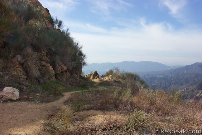
Take the path around Cape of Good Hope to return to Mount Lowe Road near Sunset Ridge Trail. There are three ways to proceed from Cape of Good Hope and the route you chose probably depends on where you started the hike. Continue down Mount Lowe Road another 2.45 miles to a trailhead on Chaney Trail. Make a right turn off the road just below the cape to take Sunset Ridge Trail down to a lower junction with Mount Lowe Road to arrive at the same trailhead. Go east from the road across from Cape of Good Hope to take Echo Mountain Trail down to Echo Mountain and Sam Merrill Trail. If you began on Mount Lowe Road or Sunset Ridge Trail, descend by either of those routes. If you took Sam Merrill Trail up to Echo Mountain, hike down Echo Mountain Trail past more remnants of Mount Lowe Railway to return to Sam Merrill Trail.
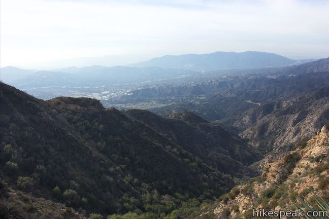
Echo Mountain Trail to Echo Mountain
Leaving Mount Lowe Road, you’ll get to see more of the railway. Hike east on Echo Mountain Trail from a junction on Mount Lowe Road that is well marked, just across from Cape of Good Hope. You’ll only need to hike 120 yards down this trail to reach another landmark on the old railway route. The trail slips past a pointed rock on the right called Sentinel Rock. Look on the ground next to the rock and you’ll see railroad ties left over from the old railway.
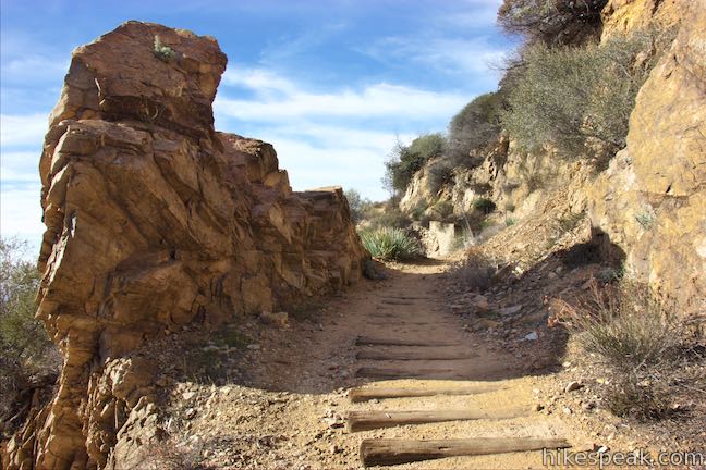
Continue along Echo Mountain Trail past the remnants of High Bridge. The concrete feet that supported this trestle bridge can be seen along the trail. Panels by the trail explain that the bridge was 113 feet long and 35 feet high, allowing the railway to take a straight course around the steep, uneven, and curved side of the canyon. Walk along the trail between the ends of the bridge, looking down Las Flores Canyon toward Pasadena and the other cities below.
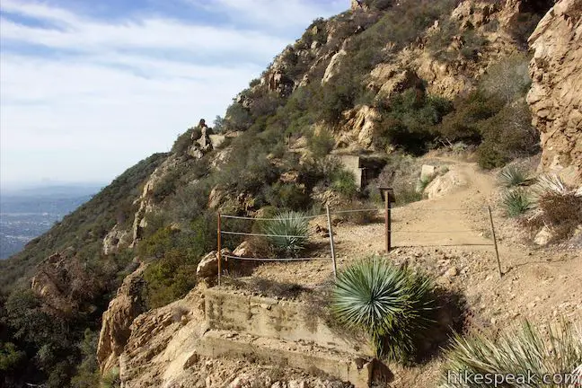
Echo Mountain Trail continues down around the back of the canyon past a panel that instructs you to look up the ridge above the trail to see the site of Circular Bridge, the famed bend on Mount Lowe Railway that you passed through above. It took Mount Lowe Railway 1 1/4 miles of track to reach the rounded 400-foot bridge from the location of the panel. If you were traveling directly, it would be just 1/5 of a mile and 700 vertical feet from this spot to Circular Bridge.
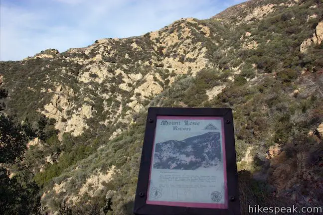
Continue down the trail past more pieces from the railway. After just under 0.8 miles on Echo Mountain Trail, come to a junction with Sam Merrill Trail that will be familiar from your hike up. You could stroll east to revisit the ruins of Echo Mountain. Otherwise, turn right and hike 2.7 miles back down Sam Merrill Trail to return to your starting point.
Summation
Hiking to Inspiration Point and potentially on the Mount Lowe Trail Camp and parts of Mount Lowe Road make a great extension for hikes to Cape of Good Hope and Echo Mountain. Starting on Sam Merrill Trail, the lollipop loop described here is 11.7 miles round trip with 2,715 feet of elevation change. If you start by hiking up Sunset Ridge Trail, go around the loop to Inspiration Point, and come down Mount Lowe Road to get back to the trailhead, you’ll have a double loop covering 11.45 miles with 2,440 feet of elevation change. No fee or permit are required for this hike. Dogs and bikes are allowed. Castle Canyon Trail is not suitable for bikes but Mount Lowe Road is popular with mountain bikers.
To get to the Mount Lowe Road Trailhead: Take the 210 Freeway to Pasadena. Exit Lake Avenue and head north. Reach a T-intersection after 3.5 miles and turn left onto Loma Alta Drive. Drive one mile and make a right on Chaney Trail. Drive up this steep winding road for 1 mile to a crest on Sunset Ridge where Mount Lowe Road begins on the right. Limited parking is located in front of the gate at the bottom of Mount Lowe Road and along Chaney Trail. Additional parking can be found at the end of Chaney Trail, 0.5 miles ahead, next to Millard Campground.
Trailhead address: Chaney Trail & Mount Lowe Road, Angeles National Forest, Altadena, CA 91001
Trailhead coordinates: 34.2148, -118.1476 (34° 12′ 53.27″N 118° 08′ 51.35″W)
To get to the Sam Merrill Trail Trailhead: From the 210 Freeway in Pasadena, take exit 26 and head north on Lake Ave. Drive 3.5 miles to the end of the road and find street parking. The trailhead is on the right, just before the road turns sharply to the left and becomes East Loma Alta Drive.
Trailhead address: 3302 Lake Avenue, Altadena, CA 91001
Trailhead coordinates: 34.20405, -118.1306 (34° 12′ 14.58″N 118° 07′ 50.16″W)
View Echo Mountain, Inspiration Point, and Cape of Good Hope in a larger map
Or view a regional map of surrounding Los Angeles trails and campgrounds.
 | Echo Mountain via Sam Merrill Trail This 5.8-mile hike visits a historic railway and ruins from a century old resort overlooking Pasadena. |
 | Mount Lowe Road & Sunset Ridge Trail to Cape of Good Hope This pair of trails can be combined for a 5.2-mile round trip hike to a historic viewpoint called Cape of Good Hope. Follow the old route of Mount Lowe Railway to the ruins on Echo Mountain to extend the hike by two miles round trip or bring the distance up to 11.85 miles by visiting Echo Mountain, Inspiration Point, Mount Lowe Trail Camp, and other landmarks. |
 | Millard Falls This one mile hike visits a 50-foot waterfall up one of the most scenic canyons in the range. |
 | Dawn Mine This 6-mile hike from Millard Campground leads past Millard Falls to an old gold mine. |
 | Rubio Canyon Trail This 1.3-mile round trip hike ventures into a rustic canyon to a double waterfall. |
 | Inspiration Point & Mount Lowe Trail Camp This 7.25-mile round trip hike descends Mount Lowe Road into the San Gabriel Mountains to a historic scenic overlook and a trail camp built on interesting ruins. |
 | San Gabriel Peak from Mount Lowe Road This 6,161 foot peak is also reachable via a 3.2-mile round trip hike from Eaton Saddle. |
 | Henninger Flats via Mount Wilson Toll Road This 6-mile round trip hike ascends 1,325 feet to a trail camp, tree nursery, lookout tower, and visitor center on a landing in the San Gabriel Mountains operated by the Los Angeles County Fire Department. The hike can easily be extended to 8.7 miles by exploring a loop above Henninger Flats. |
 | Eaton Canyon Falls This 3.5-mile hike goes up Eaton Wash to a narrow stretch of Eaton Canyon containing a pleasant 40-foot waterfall. |
 | More trails in the San Gabriel Mountains Explore other destinations in the range. |
 | Millard Campground This is a convenient place to camp at the base of the San Gabriel Mountains at the start of a trail to Millard Falls. |
 | Gabrielino Trail to Gould Mesa Trail Camp This 5-site trail camp in Angeles National Forest can be reached by venturing 5.1 mile round trip up a canyon surrounding the Arroyo Seco. |
Echo Mountain and Inspiration Point on modernhiker.com
Inspiration Point and Muir Peak on socalhiker.net
Inspiration Point on tchester.org
Echo Mountain on Dan's Hiking Pages
Echo Mountain and Inspiration Point on alltrails.com
Mount Lowe Railway on wikipedia.org
The official Angeles National Forest webpage for Castle Canyon Trail


Hi I’m planning to go to inspiration hike. What’s the best way to camp and also other things to do there? I’m a first timer.
Castle Canyon Trail around 1960 was almost unknown and very overgrown with brush, at least near Echo Mt. Some Mt. Lowe fans began clearing the brush.