
The 6-mile round trip hike to Indian Mountain starts from a convenient trailhead on Route 243, the main road between Banning and Idyllwild. While San Jacinto Peak is the blockbuster summit in the San Jacinto Mountains, this Indy is a crowd pleaser too, requiring a feature-length time commitment of two to three hours to hike to and from the 5,790-foot summit. The hike follows a wide dirt road past summer-blooming wildflowers that bolster views of San Jacinto Peak, Tahquitz Peak, and surrounding canyons and ridges. The summit delivers a peak performance with views over Helmet, Murrieta, and Temecula in the valley below.
On most summit treks, you hike up to the peak and then you hike down. For Indian Mountain, you’ll hike down before you hike up. The trailhead is at 5,425 feet and the summit is at 5,790 feet, but you can’t just gradually climb 365 feet. Instead, you’ll drop to a saddle at just below 5,000 feet. From the saddle, which sets Indian Mountain apart from its surroundings, you will ascend 815 feet to the summit. On the way back, you’ll descend 815 feet before recovering 450 feet to get back to the trailhead.
Start from Indian Vista, a scenic overlook on Route 243 near the mountain community of Idyllwild. Walk a couple hundred feet to the vista point for a view of the hike’s destination, a round mountain just to the south. You can also look to the east at nearby San Jacinto Peak, the highest point in Riverside County and the rest of the San Jacinto Mountains at 10,834 feet.
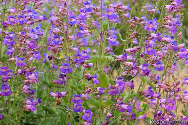
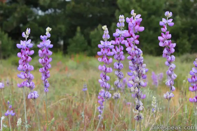
The hiking route to Indian Mountain, Forest Route 4S21 (Indian Mountain Fire Road), begins just to the west of Indian Vista. Set out over this soft dirt road, which heads down the mountainside below Indian Vista. In the late spring and summer, clusters of lupines and penstemon along the trail make it a lovely place to hike.
At around half a mile from the trailhead, get nice views over the canyon on the east side of the trail, a green trench carved by the North Fork San Jacinto River. Indian Mountain Fire Road makes a sweeping horseshoe bend to the left, wrapping around a pine tree with new views down the rippling ridges to the west.
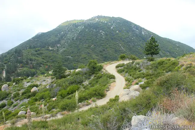
Another horseshoe bend sends the sandy road down to the low point of the hike. Cross the saddle, 1.3 miles from the start and begin hiking up Indian Mountain. The trail passes through pines over a bump in the terrain to come up to a second saddle. The fire road makes a gradual ascent up the east face of Indian Mountain along a slope of boulders and chaparral that provide no shade, but open views. Be sure to look over your shoulder to the northeast to see a chiin of ten thousand foot peaks: Folly Peak, San Jacinto Peak, Jean Peak, and Marion Peak.
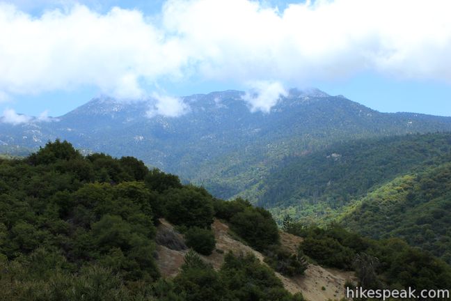
The road has a couple steeper spots, but is mostly a steady climb. A mile above the saddle, come up to a rocky landing on the side of Indian Mountain. A path to the left heads out to a pile of boulders where you could climb around and explore views of the mountaintop above and the canyon below.
From the landing, the road to the summit curves to the left and proceeds up the mountain. Follow the road west along the south face of Indian Mountain. The road curves to the left again and aims north, continuing to circle clockwise up to the summit. Half a mile above the landing, and 2.8 miles from the start, reach an important junction at the center of the round three-pointed summit. When the road makes a horseshoe bend to the left, look for a path breaking off to the right up a firebreak. Leave the dirt road and follow this trail for a tenth of a mile up to a small clearing at the summit. To get above the brush and take in the views, climb up a cluster of boulders at the summit.
The summit of little Indian Mountain can show off big views on a clear day (as long as clouds don’t roll in). San Jacinto Peak looks bold to the northeast. Tahquitz Peak stands out to the east. To the southwest, in the valley below, the blue water of Blue Diamond Lake stands out between Helmet and Murrieta. The summits of the San Bernardino Mountains cap things off to the north, completing the panorama from little Indian Mountain.
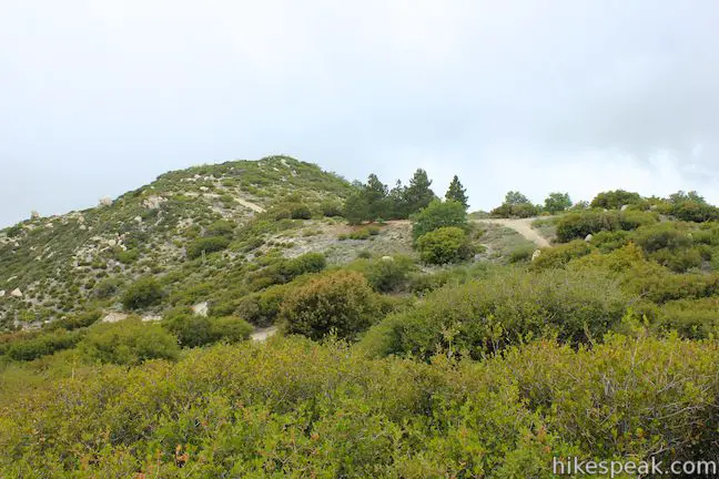
With a little more effort, you can check out a couple other high points on the triple-crowned summit of Indian Mountain. Backtrack to Indian Mountain Fire Road and continue around the bend to another trail on the right that heads up to a second boulder-strewn summit. Break off here to check out that spur trail and continue a short distance along the road until it crests near another high point that may be the true summit of Indian Mountain. Turn around before the road descends to the southwest and return the way you came.
Enjoy views of San Jacinto Peak as you hike back down the U-shape trail, preparing for a gradual climb of 425 feet in the last 1.3 miles to get back to the trailhead from the saddle. Dogs and mountain bikes are allowed on the trail to Indian Mountain in the San Jacinto Ranger District of San Bernardino National Forest. No permit is required to hike to Indian Mountain and it is free to park at the trailhead, so get out and enjoy!
To get to the trailhead: From Banning, which is 80 miles east of Los Angeles on the 10 Freeway, drive south on Route 243 up into the mountains for 15.5 miles to Indian Vista, which will be on the left (southwest) side of the road, 2/3 of a mile past the Lake Fulmor Picnic Area. Coming from the other direction, Indian Vista is 9 miles north of Idyllwild and 1.3 miles past Black Mountain Road. Park in the small paved lot at Indian Vista and walk a few hundred feet northwest along Route 243 (in the direction of Banning) to the top of Indian Mountain Fire Road (Forest Route 4S21) to begin the hike. If the gate at the top of the dirt road is open, you can also turn down the road in your vehicle and park in an open area a few hundred beyond the gate.
Trailhead address: California 243, San Bernardino National Forest, Idyllwild, CA 92549
Trailhead coordinates: 33.797213, -116.7777 (33° 47′ 49.96″N 116° 46′ 39.71″W)
View San Jacinto Mountains in a larger map
Or view a regional map of surrounding Southern California trails and campgrounds.
 | San Jacinto Peak via Marion Mountain Trail This non-nonsense 13.2-mile round trip hike ascends 4,500 feet to one of Southern California's most panoramic summits. |
 | Ernie Maxwell Scenic Trail This gradual 5.2-mile round trip hike near Idyllwild crosses quiet forests with rugged mountain views. |
 | Canyon View Loop Trail This 3.75-mile loop in Whitewater Preserve crosses Whitewater River and incorporates a section of the Pacific Crest Trail to deliver big views up and down Whitewater Canyon on the east end of the San Bernardino Mountain. |
 | More hikes in Southern California Explore more trails in Orange, Riverside, San Bernardino, and San Diego counties. |


[…] information: Trip report here […]
What an awsome area, will most likely put this hike on my bucket list. Awsome pics
which hiking trail in the Idyllwild area will be more of an exiting experience for me and my kids to camp for an overnight ?
Is it safe for kids to camp ?
Im sorry for the questions but it will be our first trip as a family.