Mount Wilson Toll Road to Henninger Flats
in the San Gabriel Mountains

In 1917, Mount Wilson Toll Road was used to bring equipment (including the 100-inch mirror) up to Mount Wilson Observatory where the world’s largest telescope was assembled for gazing out across the universe. Today visitors can use the same dirt road to enjoy naked-eye views across the Southland. On clear days the views extend to the Palos Verdes Peninsula, framed by two slices of the Pacific Ocean, and all the way to Catalina Island.
Although Mount Wilson Toll Road ascends for over ten miles into the San Gabriel Mountains to Mount Wilson, you’ll only need to hike three miles to reach Henninger Flats, where there is a campground, visitor center, and tree nursery operated by the Los Angeles County Fire Department. The stellar mountain perch is perfect for a mid-day picnic or an overnight escape. The hike up Mount Wilson Toll Road to Henninger Flats is 6 miles round trip with 1,325 feet of elevation change.
If you hike that far and want to go farther (but don’t have the energy to climb another 3,150 feet to Mount Wilson), you can extend the hike a bit farther up Mount Wilson Toll Road to a loop road to a helipad on the ridge above Henninger Flats, gaining broader views on an 8.7-mile round trip hike with 1,700 feet of elevation change.
There are a few places to begin the hike up to Henninger Flats. The most obvious place to start is from the beginning of Mount Wilson Toll Road on Pinecrest Drive in Altadena. Alternately, you could begin from Eaton Canyon Nature Center and venture up Eaton Canyon to Mount Wilson Toll Road (starting the same way you would to reach Eaton Canyon Falls). There is a gate at the start of Mount Wilson Toll Road that locks at night (between sunset and sunrise), so if you are planning a sunset hike to Hennigner Flats, it’s best to start from a middle trailhead, located on Altadena Drive at the corner of Midwick Drive. The Eaton Canyon Natural Area also closes between sunset and sunrise. For a pure day hike or an overnight trek, the simplest route is straight up Mount Wilson Toll Road.
From the gate along Pinecrest Drive, begin hiking down Mount Wilson Toll Road, which is paved for the first tenth of a mile. At 0.15 miles down the road, you will pass a single-track trail breaking off to the left. This is Altadena Crest Trail, which heads west, skirting the base of the San Gabriel Mountains above Altadena.
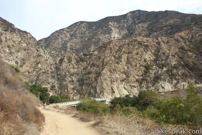
Mount Wilson Toll Road crosses a white concrete bridge spanning across Eaton Canyon and comes to a junction with Eaton Canyon Trail, 0.25 miles from the start. You could turn right here to hike a mile down Eaton Wash to Eaton Canyon Nature Center or pass beneath the bridge and hike half mile farther up Eaton Canyon to Eaton Canyon Falls. To reach Henninger Flats, stay to the left and continue up Mount Wilson Trail Road.
The trail turns uphill after the junction with Eaton Canyon Trail and keeps climbing all the way to Henninger Flats, steadily tackling 1,325 feet in then next 2.7 miles. The wide dirt road winds its way up the mountains on the east side of Eaton Canyon. As you climb, the views expand looking southwest over Altadena and Glendale toward downtown Los Angeles.
The trail rounds the back of a crease in the mountainside and comes to another junction next to a sign for Eaton Canyon Nature Preserve, 1.05 miles from the start. To the right, Walnut Canyon Trail (Horse Trail) descends into Eaton Canyon, offering another route between Eaton Canyon Nature Center and Mount Wilson Toll Road. Stay to the left to continue up the road to Henninger Flats. If you start from a different trailhead and use the Horse Trail to reach Mount Wilson Toll Road, it is 1.15 miles to this point from the nature center and 0.85 miles from the middle trailhead at the intersection of Midwick Drive and Altadena Drive (see the map below).

The wide dirt road will pass beneath a row of heavy power lines and come to the first of four benches placed at scenic spots along the trail. After the first bench, 1.35 miles from the start, it is just over half a mile to the second bench. In between, the trail weaves west for a stretch, makes a sharp left turn to head east, and then makes a sharp switch back to the right to resume heading west toward Henninger Flats.
Each twist in the road offers new views. Look southwest across the San Gabriel Valley toward the Santa Ana Mountains where Santiago Peak looms large, or look west toward the Verdugo Mountains and the edge of the San Fernando Valley. Looking southwest you’ll have views toward the skyscrapers in downtown Los Angeles backed by the rounded mass of the Palos Verdes Peninsula. On a clear day, you’ll spot Long Beach Harbor on the left side of the peninsula and Santa Monica Bay on the right side. Beyond the two shimmering slices of the Pacific Ocean, you may be able to make out Catalina Island if the air quality is good.
Mount Wilson Toll Road continues up around a crease in the mountainside below Henninger Flats, the pine-covered landing on the otherwise chaparral-covered mountainside above. Here you will pass the third park bench, before reaching another sharp left turn in the road. Below this switchback there is a steep canyon running down the west side of Henninger Flats that you can look down for views over Arcadia and the San Gabriel Valley toward Santiago Peak.
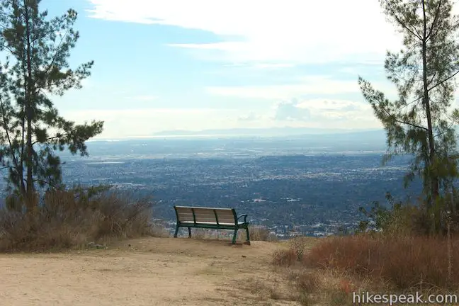
Continue up Mount Wilson Toll Road past the fourth well-placed bench at 2.75 miles from the start. In another tenth of a mile, pass a sign marking the entrance to Henninger Flats, a unique spot in the San Gabriel Mountains with a picnic area, campground, visitor center, and tree nursery operated by the Los Angeles County Fire Department.
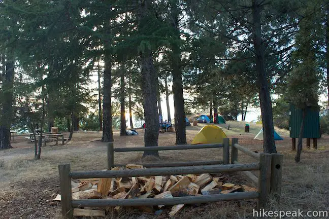
Stay on Mount Wilson Toll Road as it ventures through Henninger Flats. On the left, you will pass sites in the Lower Campground at Henninger Flats, which seems to double as a picnic area when there aren’t any campers. There are bathrooms to the right.
A tenth of a mile from the sign, you will come to a right hand bend in Mount Wilson Toll Road outside the Visitor Information Center. If you are continuing on to the helipad loop, or hiking to the Upper Campground, you can turn right to stay on Mount Wilson Toll Road. Otherwise, turn left and step inside the Henninger Flats Visitor Information Center where you can look at a relief map of the San Gabriel Mountains and learn about the history of Henninger Flats. In addition to finding out about the trees grown on Henninger Flats, you can also see examples of animals in the San Gabriel Mountains.
William Henninger was the first settler to build a home on the flats that bear his name in 1880. He constructed a water system for a garden that would eventually became an important nursery for reforestation efforts in California. A test forest of pines, cedars, and other conifers was developed on Henninger Flats to help early Angelinos determine which trees would grow best around Los Angeles. The Los Angeles County Fire Department website for Henninger Flats explains:
In 1892, Henninger was visited by T. P. Lukens and R. J. Busch. With Henninger’s permission, Lukens and Busch started the first experimental reforestation in California at the Flats in 1892 by planting some selected conifers.
Trees that thrived on Henninger Flats were planted all over Los Angeles County and beyond. Henninger Flats continues as a nursery even today, where trees used for conservation purposes are available to the public for free from December through March. To learn more about the nursery, ask a forester stationed in the visitor information center for a tour.
Outside the info center there is a fire lookout tower that was brought to Henninger Flats from Castro Peak in the Santa Monica Mountains. The tower was in service from 1915 to 1971. Today the summit of Castro Peak is covered in radio towers and is inaccessible to hikers. Take the ladder up into the tower to peer through the glass windows into the well-preserved lookout station. Fire lookout towers are a great part of the history of the San Gabriel Mountains and other mountain ranges in the west, so it is fitting that the lookout tower is being preserved by the Los Angeles County Fire Department on Henninger Flats.
Henninger Flats sits on a landing above steep mountain slopes, which means it delivers knockout panoramic views over the west end of the San Gabriel Valley. There are picnic tables, grills, and drinking water on Henninger Flats, so if you brought picnic supplies, you’re in for a treat. If you’re spending the night, Henninger Campground has around thirty free sites and is operated by the Los Angeles County Fire Department, which even offers free firewood.
If Henninger Flats is as far as you’re going, simply turn around and hike back down Mount Wilson Toll Road for a 6-mike round trip hike. To extend the hike without trekking another 7.5 miles to the top of the road at Mount Wilson, you can hike another 0.75 miles up Mount Wilson Toll Road to a junction with a loop road that ventures down a ridge to a helipad. This extension adds 2.7 miles and 375 vertical feet to this hike, along with great views over Henninger Flats and Eaton Canyon.
Continue up Mount Wilson Toll Road from the Visitor Information Center through pine trees in the LACFD tree nursery. After 0.2 miles, you will come to a T in the road where a sign for Mount Wilson Toll Road will direct you to the right. Continue this way and in another tenth of a mile you will reach a junction with a loop road through the campground. Stay to the left and you will soon pass the other end of the campground loop. A few hundred feet after that, you will pass another road breaking off Mount Wilson Toll Road on the left. Stay to the right and continue to ascend for another 0.3 miles to a junction with the road to the helipad. Before you reach the junction, you will get a view of the road going out on the ridge on the north side of Henninger Flats.
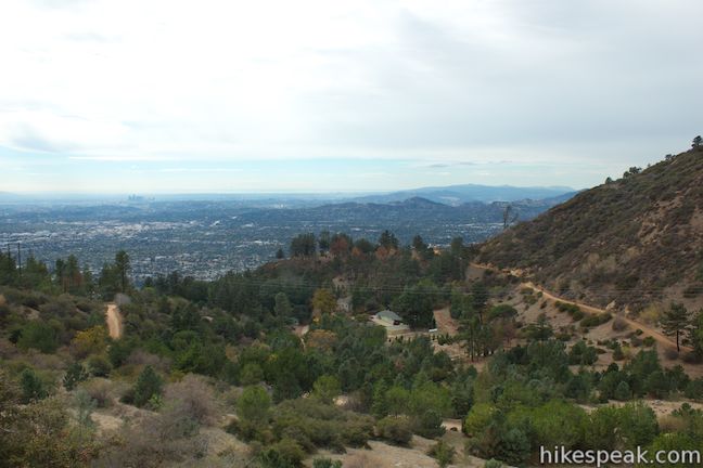
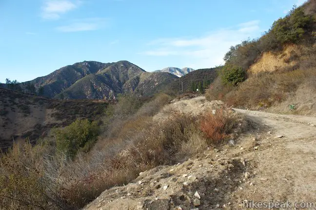
Follow an arrow for the helipad and turn left at the junction to begin hiking west down Forest Route 2N458. In less than a tenth of a mile, come to a split in the road where the loop begins. Bear left to hike the loop in a clockwise direction.
The road ascends to a high point around 2,925 feet and offers commanding views over Henninger Flats and the San Gabriel Valley. The trail then turns downhill toward the helipad site at the west end of the elongated loop. The helipad has panoramic views west where downtown Los Angeles, the Santa Monica Mountain, the Verdugo Mountains, and the west side of the San Gabriel Mountains are all easy to distinguish. You can also look north across Eaton Canyon toward the rising mass of Muir Peak. It is in the impressive mountains to the northwest that Thaddeus Lowe built Inspiration Point and the White City.
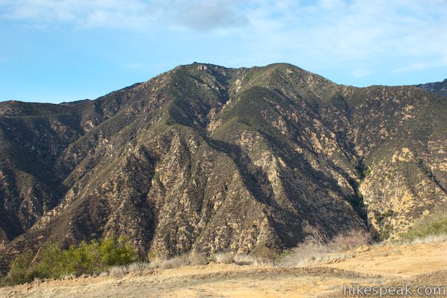
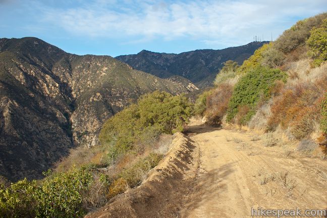
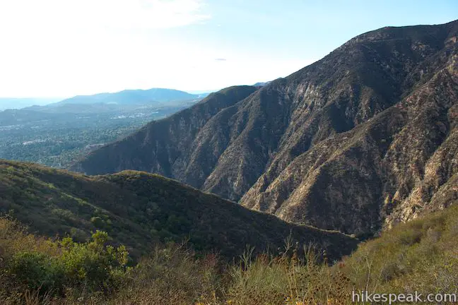
Leave the helipad and head back on the north side of the ridge, which offers more views up Eaton Canyon. At the top of the canyon, you will spot the radio towers near the summit of Mount Wilson. Hike back up to Mount Wilson Toll Road to complete the 1.2-mile loop to the helipad. Turn right and hike 0.75 miles down to Henninger Flats, followed by another 2.95 miles down to the trailhead in Altadena.
If you are interested in staying overnight at Henninger Flats, check out more photos and information about Henninger Campground. A free permit is required to camp overnight, but there is no fee or permit required to hike up Mount Wilson Toll Road to Henninger Flats or beyond. There is very little shade on Mount Wilson Toll Road leading up to Henninger Flats, so this hike is best on days that aren’t too hot. Dogs and mountain bikes are welcome, so get out and enjoy!
To get to the trailhead: Take the 210 Freeway to Pasadena to exit 29 for Altadena Drive. Head north on Altadena Drive for 2.7 miles and turn right on Crescent Drive. At the next intersection you will reach Pinecrest Drive. Turn right and find the start of Mount Wilson Toll Road on the right, a tenth of a mile up Pinecrest Drive. Parking is severely restricted on Pinecrest Drive, so you may need to park a block from the trailhead.
Trailhead address: 2260 Pinecrest Drive, Altadena, CA 91001
Trailhead coordinates: 34.191714, -118.105506 (34° 11′ 30.17″N 118° 06′ 19.82″W)
View San Gabriel Mountains in a larger map
Or view a regional map of surrounding Los Angeles trails and campgrounds.
 | Eaton Canyon Falls This 3.5-mile hike goes up Eaton Wash from Eaton Canyon Nature Center and passes below Mount Wilson Toll Road to venture up Eaton Canyon to a pleasant 40-foot waterfall. |
 | Echo Mountain via Sam Merrill Trail This 5.8-mile hike visits a historic railway and ruins from a century old resort overlooking Pasadena. |
 | Rubio Canyon Trail This 1.3-mile round trip hike ventures into a rustic canyon to a double waterfall. |
 | More trails in the San Gabriel Mountains Explore other destinations in the range. |
 | Henninger Campground in the San Gabriel Mountains This 30-site hike-in campground is spread out on a pine-covered landing that boasts big views over the San Gabriel Valley and can be reached via a 6-mile out-and-back hike up Mount Wilson Toll Road. |
 | Millard Campground in the San Gabriel Mountains This small campground at the base of the San Gabriel Mountains is the starting place for hikes to Millard Falls and Dawn Mine. |
 | Mount Lowe Trail Camp in the San Gabriel Mountains This 7.25-mile hike descends Mount Lowe Toll Road to Inspiration Point and the ruins of Alpine Tavern where there is now a trail camp with five first-come first-serve sites. |
 | More campgrounds around LA Check out a few other places to camp in Los Angeles County. |
A San Diego Reader article by Jerry Schad on Mount Wilson Toll Road to Henninger Flats
Henninger Flats on wikipedia.org
Henninger Flats on Dan's Hiking Pages
Mount Wilson Toll Road to Henninger Flats on eastwesthike.com
Mount Wilson Toll Road to Henninger Flats on nobodyhikesinla.com
Mount Wilson Toll Road to Henninger Flats on jessiestrails.blogspot.com


The last time I was at Henninger Flats they did not have fire rings and firewood was not needed/provided. Nice campground with a very nice view though.
The pictures you share are to recall times from long ago. If my friends and I hiked this toll road once it could be 50 plus times from the late fifties through early sixties. I don’t think we never thought that it could become that having a information center at Henninger flats and a thirty camp free sights provided by L.A.country Fire Dept. I guess time changes these places in order to have a control of an ever changing public.The public that may or may not understand “what is expected of them as to protecting nature that they wish to make use of. I’m now sixty seven and probably would make use of the benches that been provided along the old toll road today.
Some of the water outlets have been capped off at the campsites. Maybe you could get some from the bathroom? Otherwise only water outside firehouse is wild animal troughs that are full. Bring water!
I was up at Henninger Flats yesterday. There’s no water available. The concrete reservoir cracked and leaked all of the water out. There is also one or more leaks in the old distribution piping. Funds have been allocated to begin replacement of the system early in 2016 according to the fireman I spoke with. Without water, the tree nursery is shut down and the flush toilets are inoperative though there are pit toilets available. I noticed a number of dead conifers on the Fuji site marked for removal as well.
The Pinecrest gate to the Mt. Wilson toll road is now permanently open as of September 2017.
Do I need cash at any point? Closest grocery or convenience store? Any thing I should be warned about? Is there a way to reserve spots or parking? Any showers or bathrooms nearby?
No showers. No water. Only toilets. No services at campsite. You will have to hike/walk the three miles back down and another two miles into the city of Altadena/Pasadena to purchase anything.
This is a long hike that has a lot of elevation gain. Really great views and a nice hike. When you get the Henninger Flats, make sure you feel good and have energy, because the hike to Mt Wilson is a good 7 miles each way. It’s an easy trail to follow, with a good width and the trail is in good shape. There are some steeper sections, but nothing that is really steep.
The downhill can be fast if you want to move. There aren’t too many people on the trail to Mt Wilson, above Henninger Flats. Below Henninger Flats, you’ll see people again.
All of the water spigots are capped off (no water). Bring in your own. They do have flush toilets (ironically). I think they capped off thebwater to preven homeless persons from living there. Otherwise, its a moderately strenuous hike, however relatively short about 7 miles round trip, from toll road…the campsite is just beautiful! Again BRING WATER.
Henninger is great but as of June, you can only access thru Eaton Canyon after you’ve reserved a spot. Chain link fence everywhere we used to get in. We are 6 am hikers but can’t get in til 8:30 which is way too late.
Is water available as of October 2020