Grant Village to Grant Grove Trail
in Kings Canyon National Park

If you visit the Grant Grove Area of Kings Canyon National Park, you will probably want to stop by both the General Grant Tree in the Grant Grove and the visitor center in nearby Grant Village. You can drive between these two locations or connect them on foot with a trail that is one-mile one-way, passing through Azalea Campground to bridge the two busy areas. The trail is easy, a little more useful than scenic, with 250 feet of elevation change.
You can start the trail between Grant Village and Grant Grove from either end. Begin at the low end at the Grant Grove Parking Area and hike up to the visitor center, market, and cafe around the Grant Village Parking Area, or start from Grant Village and hike down to the grove. Since most people will probably be hiking toward the giant sequoias rather than away from them, this write-up will begin from Grant Village.
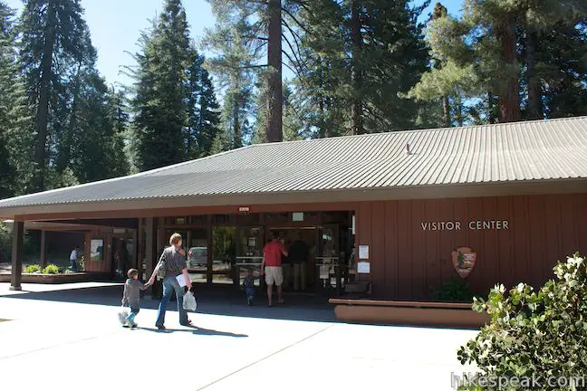
Tour the visitor center, grab a snack from the market, and start hiking. The trail kicks off from the west side of Generals Highway, just across from the visitor center. There is a crosswalk leading to a sign that reads, “Grant Tree Trail – Grant Tree 1.0.” Hike down this trail, which quickly comes to a 4-way junction. A trail to Sunset Campground is to the left (an alternate starting point for campers wishing to walk to Grant Grove). Straight ahead there is a staircase down to a fairly large amphitheater that accommodates ranger programs. The trail to Grant Grove is to the right. Turn this way on a dirt trail heading north parallel with Generals Highway.
The dirt single track crosses a gradual downhill slope through a pine forest to a small meadow where there is a trickling creek surrounded by green grasses and corn lilies. On the far side of the meadow, you will spot a few of the campsites in Azalea Campground. Cross a wooden footbridge and hike up to crosswalk on the paved road through Azalea Campground, which has 110 sites and is one of the three campgrounds in the Grant Grove Area. On the other side of the road, the trail descends through the campground’s tent-only loop. Just before you reach the paved loop road, you will reach a spot on the trail that is a little tricky when hiking in the other direction. Looking back you will see a sign with an arrow toward the visitor center that seems to point straight a gully to the campground bathrooms. The actual trail is not straight up from the sign, but actually a little to the left, running along a wooden fence. Remember this for the hike back.
Walk around the end of the paved campground loop and resume hiking on the dirt track toward Grant Grove. The trail runs alongside a meadow that lies between Azalea Campground and Columbine Picnic Area, and you will pass a bridge on the right connecting to the picnic area near the halfway point of this trail.
Leaving the campground and the picnic area behind, the trail continues gradually downhill through a forest of ponderosa pines and white firs. After a quick descent around a horseshoe bend, you will reach a crosswalk on Grant Tree Road. Cross this paved road, which also leads to the Grant Grove Parking Area, and continue down the dirt trail on the other side. This is the final quarter mile of this trail, where giant sequoias start to appear.
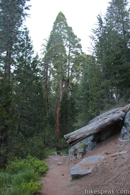
Follow the trail along the right bank of a stream flowing down to the Grant Grove. As you pass through pines and bounders, you will get a view of a tall sequoia with a broad golden trunk rising above the trail, indicating that you have arrived at Grant Grove.
Halfway between the road and the end of the trail at the Grant Grove Parking Area, you will come to a trail junction alongside the Michigan Tree. Prior to 1931, this tree was known as the Spring Tree because of a water source that originated beneath the tree. The spring proved to be too much of a good thing and what made the tree unique also lead to its downfall. The spring softened the ground, likely rotting the trees roots, causing the tree to fall.
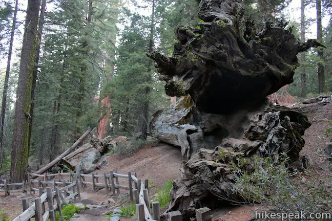
From this junction, you can either turn right to hike up to the base of the General Grant Tree or continue straight toward the other end of the trail at the Grant Grove Parking Area.
To reach the General Grant Trail: Turn right at the junction just before the Michigan Tree, and hike north up a wide dirt trail over a rise in the forest and down to a junction with the paved General Grant Tree Trail. Turn right, passing the Tennessee Tree to continue north a short distance to the General Grant Tree. There is a loop around the massive tree so that you can admire it from all angles.
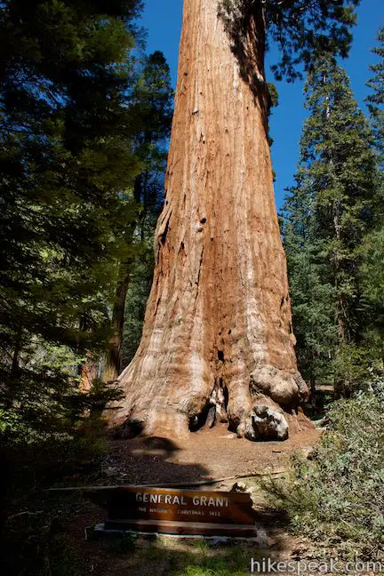
The General Grant Tree is the world’s third largest tree (General Sherman Tree is the largest) with the broadest base diameter of any sequoia at 40.3 feet. There are informative panels on the left (west) side of the tree, and views of a large fire scar on the east side. The General Grant Tree has a volume estimated at 46,608 cubic feet, weighs over 1,250 tons, is 267 feet tall (the height of a 24-story building), and has a diameter at base height of 29 feet. The General Grant Tree is young by sequoia standards at around 1,700 years old and is still growing thicker. As a point of reference, the lowest branch of the enormous tree is 129 feet off the ground.
The General Grant Tree is a significant tree for all of America. In addition be being “The Nation’s Christmas Tree,” The General Grant Tree is a national shrine in memory of the men and women of the Armed Forces who have served and fought and died to keep America free. The General Grant Tree is America’s only living shrine. The tree is of course named after Ulysses S. Grant, the victorious Civil War General and America’s 18th president.
To reach the Grant Grove Parking Area: Continue straight through the junction by the Michigan Tree past more super-sized giant sequoias like the Illinois Tree. Halfway to the lot, you will pass a tree on the right with a hole burned through it. The young and young at heart can crawl through the tree. On the other side of the hole, you will have a view of a small green meadow to the north that is lined by giant sequoias.
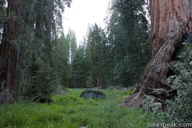
Continue to the end of the trail at the Grant Grove Parking Area, where you can behold the Happy Family cluster of sequoias on the left, a golden finish for this hike. This hike is two miles round trip from parking lot to parking lot, but the trek can easily be extended by adding some of the other trails in Grant Grove (General Grant Tree Trail, North Boundary Trail, North Grove Trail, and Dead Giant Loop Trail). If you hike from Grant Village to the General Grant Tree and just turn around, that hike would be about 2.25 miles round trip, but you would likely want to continue around General Grant Tree Trail to other interesting sequoias like the Centennial Stump and the Fallen Monarch. Dogs and mountain bikes are prohibited on trails in Kings Canyon National Park. A national park entrance fee is required to visit the park, but you will not need a permit to hike in the Grant Grove, so get out and enjoy!
To get to the Grant Grove trailhead: From Fresno, drive east on Route 180. After some 50 miles, you will reach the Big Stump Entrance Station for Kings Canyon National Park. Proceed 1.7 miles to a three-way intersection. To the right, Route 198 heads south toward Sequoia National Park. Turn left to stay on Route 180 and drive another 1.6 miles north to an intersection with Grant Tree Road. Turn left down Grant Tree Road, pass the entrance to Azalea Campground, and proceed 0.75 miles down to the Grant Grove Parking Area, which you will find below a right bend at the bottom of the road. General Grant Tree Trail begins from the northwest side of the lot and the trail to Grant Village begins at the east end of the lot.
To get to the Grant Village Trailhead From Fresno, drive east on Route 180. After some 50 miles, you will reach the Big Stump Entrance Station for Kings Canyon National Park. Proceed 1.7 miles to a three-way intersection. Turn left to stay on Route 180 and drive another 1.4 miles to Grant Village, which will be on the right. Turn right and park near the visitor center. Walk across Generals Highway to find the top of the trail across from the visitor center.
Trailhead address: Generals Highway, Kings Canyon National Park, CA 93628
Trailhead coordinates: 36.740049, -118.963588 (36° 44′ 24.17″N 118° 57′ 48.91″W)
You may also view Kings Canyon National Park in a larger map
Or view a regional map of surrounding Sierra Nevada trails and campgrounds.
 | General Grant Tree Trail This 0-8 mile loop passes through a Fallen Monarch in the Grant Grove to reach the General Grant Tree, one of the world's largest sequoias. |
 | North Boundary Trail This 3.55-mile hike starts on the trail between Grant Grove and Grant Village and passes the General Grant Tree to reach a 2.75-mile loop through the pine forest north of the Grant Grove. |
 | North Grove Trail This 2-mile loop explores a quiet grove of sequoias near the crowded Grant Grove and can combine with Dead Giant Loop Trail for 3.25-mile hike. |
 | Dead Giant Loop Trail This 2.25-mile loop passes a small meadow and a large dead sequoia to reach Sequoia Lake Overlook and can combine with nearby North Grove Trail for 3.25-mile hike. |
 | Panoramic Point This 0.5-mile round trip hike reaches an exception overlook with views into Kings Canyon. |
 | Buena Vista Peak This 2-mile round trip hike ascends 420 feet to a granite summit with 360-degree views over the Redwood Mountain Sequoia Grove and Kings Canyon. |
 | Hart Tree and Fallen Goliath Loop This 8.3-mile loop on Hart Tree Trail and Redwood Creek Trail passes tranquil streams and interesting sequoias in the Redwood Mountain Grove in Kings Canyon National Park. |
 | Grizzly Falls This 0.1-mile round trip stroll at Grizzly Falls Picnic Area in Sequoia National Forest reaches the base of an 80-foot waterfall along the Generals Highway near the Cedar Grove Area of Kings Canyon National Park. |
 | Roaring River Falls This paved 0.3-mile round trip hike reaches a thundering little waterfall on a tributary of the Kings River in Kings Canyon National Park. |
 | Kanawyer Loop Trail This 5-mile loop is scenic and easy, exploring east from the backcountry gateway at Road's End along both sides of the South Fork Kings River in Kings Canyon. |
 | More trails in the Sierra Nevada Mountains Explore other destinations in Kings Canyon National Park and the rest of the range. |
 | Sequoia and Kings Canyon National Parks Campgrounds There are 14 campgrounds with over 1,000 total sites spread throughout the parks to facilitate your visit. |


We are organizing a LARGE group – family and friends reunion for the end of July 2015. Some will stay at the lodge and cabins at Grants Grove while others will be in the group site at Sunset Camp .. some may even end up in individual sites at the camp grounds as the numbers increase. My question is as the group site only includes FIVE vehicles, is there any over-flow parking anywhere????