Eagle Rock Nature Trail in El Chorro Regional Park
in San Luis Obispo

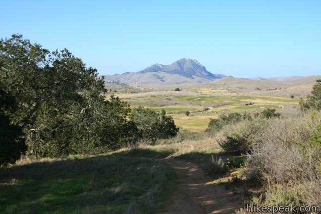
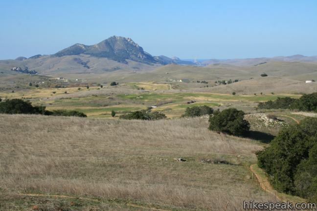
Along Highway One between San Luis Obispo and Morro Bay, is a regional park with over 700 acres of land that were formerly part of Camp San Luis. The versatile El Chorro Regional Park sports a 63-site campground, a botanical garden, playground, picnic area, dog park, volleyball courts, ball fields, and Dairy Creek Golf Course. Additionally, the park hosts a 2.4-mile loop to Eagle Rock Viewpoint. This pleasant hour-long hike climbs 450 feet to a rocky outcropping atop a grassy hill that peers over Chorro Valley toward Hollister Peak and Morro Bay.
Make your way through El Chorro Regional Park to a gate that halts vehicle traffic up Dairy Creek Road. Park in the dirt lot on the left (just past the dog park) and slip through the gate, which is intended to keep out bicycles and strollers in addition to cars.
Begin walking up the paved Dairy Creek Road. After just over a tenth of a mile, turn right up Eagle Rock Nature Trail, a well-marked single track starting next a sprawling oak with branches that beg to be climbed. The dirt track enters a live oak grove that presents a shaded quarter-mile climb to a stone landing.
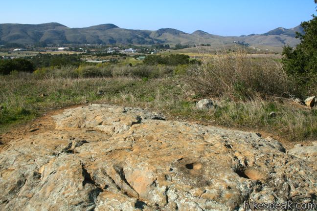
On the left side of the trail, you will find grinding holes carved into the rock. These morteros were used by Chumash Indians to make meal from acorns. The 4-inch deep holes carved in the rock show no signs of aging. Markers along the trail correspond with a self-guided pamphlet, which can be used to enhance the hike. The grinding holes can be found next to marker 3.


Proceed southeast another tenth of a mile and turn right through a gate on a spur trail to Eagle Rock Viewpoint. This switching single track offers over-the-shoulder views of Chorro Valley. Keep an eye to the northwest toward Hollister Peak as Morro Rock and Morro Bay come into view.
After another quarter mile up a grassy slope, the trail levels out. Here you get a nice view to the northeast toward the Santa Lucia Mountains. The final tenth of a mile is level and actually slightly downhill, progressing to a bench beneath an outcropping on the side of the grassy hill.
If you gaze down the hillside to the southeast, you will see a line of the white painted rocks, making up the profile of a stone eagle constructed on the hillside below. The eagle is visible from Highway One as you drive to the park from San Luis Obispo. Beyond the viewpoint is a chain-link fence with a sternly worded no trespassing sign. Beyond the fence is Camp San Luis Obispo, a base used by the California Army National Guard (hence the patriotic stone eagle). It is ill-advised to do anything but turn back down the trail when you are finished looking things over.

Return to the junction with the spur trail to Eagle Rock Viewpoint and turn right down Oak Woodlands Trail. This track descends 2/3 of a mile through more shady oaks to return to Dairy Creek Road. This trail is more gradual than Eagle Rock Nature Trail, so feel free to reverse the direction of the loop if you would like a longer easier ascent.
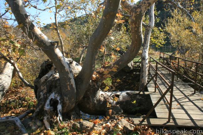
At the bottom of Oak Woodlands Trail, at the northeast corner of the loop, turn left and walk half a mile back to the trailhead. Halfway down the road, you will pass marker 16 on the right where a picnic table sits under the shade of sycamores along the creek. The guide for the nature trail describes this as the start of “Three Bridges Trail.” Curiously, only one bridge is visible and no trail beyond it is apparent. A bizarrely twisted sycamore next to the bridge is worth taking a look at.

Back on Dairy Creek Road, the hike concludes shortly after passing Eagle Rock Nature Trail. No permit is required for this 2.4-mile hike in El Chorro Regional Park. Dogs are allowed on leash. Bicycles are not allowed on the dirt trails. It is typically free to enter the park. However, on weekends and holidays between April and September, the park has a $3 day use fee.
To get to the trailhead: From Highway One, 5.5 miles northwest of San Luis Obispo and 7 miles southeast of Morro Bay, turn north at the light on Dairy Creek Road (across the street from Cuesta College). Drive into El Chorro Regional Park and proceed 3/4 of a mile through the park. Leave your vehicle in the lot to the left of the gate that blocks vehicle traffic and begin hiking of Dairy Creek Road.
Trailhead address: Dairy Creek Road, San Luis Obispo, CA 93405
Trailhead coordinates: 35.33567, -120.727234 (35° 20′ 08.41″N 120° 43′ 38.04″W)
You may also view a regional map of surrounding Central Coast trails and campgrounds.
 | Cerro Alto This semi-loop bags the 2,624-foot summit of Cerro Alto, plus a scenic ridge south of the peak, for a 5.35-mile hike with 1,600 feet of elevation gain. |
 | Cerro Cabrillo This tough 2.5-mile hike summits the highest mountain in Morro Bay State Park, a 911-foot member of the Nine Sisters. |
 | Black Hill This short 0.6-mile out and back hike ascends 175 feet to the summit of Black Hill, which presents 360-degree views over Morro Bay. |
 | Turtle Rock This easy 2.1-mile hike reaches a short rise between Black Hill and Cerro Cabrillo in Morro Bay State Park. |
 | Portola Point This 2-mile loop explores a short hill just east of Morro Estuary in Morro Bay State Park. |
 | Bishop Peak This 3.5-mile hike ascends 950 feet to highest summit in the Nine Sisters, offering excellent views of San Luis Obispo and the surrounding Morros. |
 | Stenner Creek Trail to The Eucs This 3.7-mile hike goes up Stenner Creek Canyon past a small waterfall and views of Bishop Peak to a collection of freeride bike trails called The Eucs. |
 | Poly Canyon Design Village This 2.5-mile hike visits an experimental architectural village designed by Cal Poly students at the base of the Santa Lucia Mountains. |
 | Cuesta Ridge Botanical Area This 6-mile round trip hike crosses a ridge in the Santa Lucia Mountains with panoramic views over San Luis Obispo, ascending to a grove of Sargent cypress in a botanical area in Los Padres National Forest. |
 | Reservoir Canyon This 5.35-mile hike ascends 1,350 feet past a waterfall and a collection of junk sculptures on the way to a treeless summit overlooking San Luis Obispo. |
 | More hikes in San Luis Obispo Explore other trails around San Luis Obispo including Morro Bay State Park and Montaña de Oro State Park. |


The hike is very easy, strolling on a decomposing roadway. There are interesting oak and sycamore trees along the road side and in the fields. Approximately two tens of a mile from the gate where you enter Dairy Creek trail, there is the trailhead to eagle rock trail. Because of new property owners, the Dairy Creek trail can no longer be completed as advertised. Dairy Creek trail stops because of locked gates after about a mile from the entrance gate. Eagle rock trail is moderate trail, approximately seven tens of a mile long, and gains in elevation almost 340 feet. The view from the top of the trail, eagle rock, is well worth the hike. You look over Camp San Luis Obispo and Questa College. We hiked it early in the morning when the fog was shrouding the mountains above us which gave a very interesting look to the country side. When we reached eagle rock, the sun broke through giving us a wonderful view looking South to North. The hike because of its elevation gain, takes about an hour to complete. The area is now owned and overseen by San Luis Obispo County, and they take very good care of the area. At the bottom of the hike, the county has a large park with outdoor play equipment for the kids, spots fields for the adults and an interesting art museum and botanical gardens.
[…] morning was a little more leisurely. After breakfast we drove to El Churro Regional Park. We went on the Eaagle Rock Trail to find the Mariposa Lily for my mother in law’s iNaturalist […]