River Trail Loop
in Deschutes River State Recreation Area

Right before spilling into the Columbia River, the Deschutes River flows down a canyon between grass and sagebrush-covered ridges with basalt outcroppings. Alongside the river, a pair of parallel trails allow hikers to enjoy a 3.1-mile loop with a variety of fine views.
The level River Trail (also known as Blackberry Trail) hugs the riverbank, while the rolling Upper Trail (also known as Riverview Trail) crosses a grassy terrace with broader vistas up and down the Deschutes. The exposed slopes of Deschutes River State Recreation Area can be a sunny change of scenery for those traveling from Portland and other forested areas to the west.
The hike begins from the end of the road through Deschutes River State Recreation Area, which has a 63-site campground and is located 15 miles east of The Dalles. Set out south from the end of the road, crossing a field toward a pair of signs at the start of the trails.
Walk across the grass for 0.15 miles to the trailhead where the loop on single-track trails begins. To the left, a trail rises toward the Old Railbed Trail, which goes up the river for 16 miles and is popular with mountain bikers. On the way up, the trail to the left meets the Upper Trail, also referred to as Riverview Trail (and potentially also referenced as Middle Trail). To the right of the trailhead signs is the beginning of River Trail (more formally called Atiyeh Deschutes River Trail and less formally known as Blackberry Trail).
The directions for the loop described here venture out on River Trail and return via the Upper Trail, although the loop could definitely be enjoyed in the opposite direction. Upper Trail provides more overviews of the river and its surroundings while River Trail gets right up next to the water.
Begin hiking on River Trail, which offers an easy, level experience that gains 20 feet in 1.3 miles. Push through an early thicket to absorb open views over mellow rapids. Tufts of grass forms small islands in the Deschutes River.
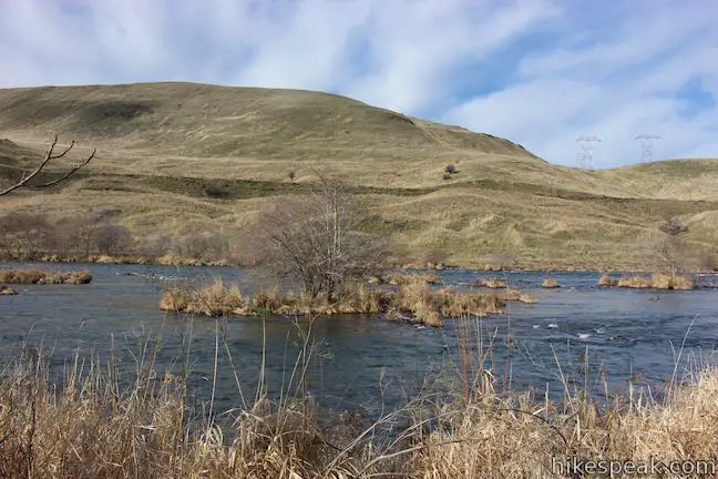
Proceed up the River Trail, gazing south toward grassy ridges that overlap nicely where the river weaves through the terrain. A tall grassy ridge rises above the opposite (west) side of the river canyon. The slopes above the trail are covered is sagebrush, topped by darker outcroppings of volcanic rock. Although it is quite close, the Upper Trail isn’t visible from River Trail.
After 0.4 miles, River Trail passes a gage station where the flow of the Deschutes River is measured. Just past the river gage, come to a junction with a sign displaying two arrows; River Trail is straight ahead, while Middle Trail is to the left. The sign indicates a short path that rises toward a low spot on the Upper Trail. This shortcut path can be used to form a loop of about 1 1/3 miles round trip. Unless you’re eager to cut things short, continue walking straight on River Trail.
The views change gradually as you make your way along the Deschutes River. The trail passes a bench beside a large lichen-covered boulder where you may take a break in the shade. Shortly thereafter, the trail crosses wooden bridges and boardwalks through a damp area where springs feed into the river. The end of the boardwalk has a viewing platform with another bench for resting with river views.
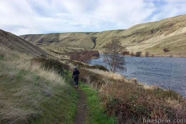
Continue on River Trail through thickets of blackberries and across a grassy area with intermittent small trees. Worried you’ll stray off course? The hillside to the left and the river to the right make the trail contained and easy to follow.
Wrapping around bends in the river, the trail offers nice views north toward grassy hills in the state of Washington. These are the Columbia Hills, which rise to Haystack Butte.
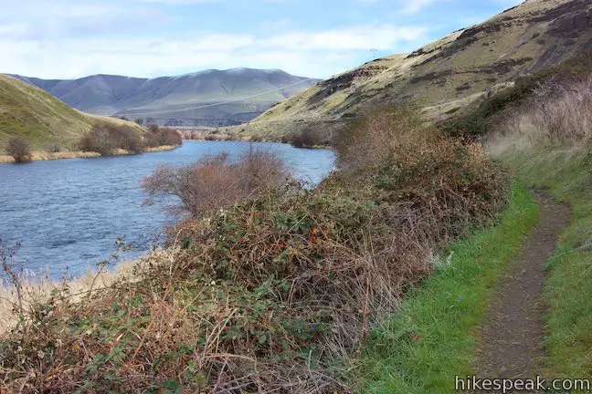
After a little over a mile on River Trail, pass a privy-style bathroom for those who need one. In another quarter mile, the trail reaches an important unmarked junction. On the way to this junction, the trail crosses through a thicket where a stream flows across the trail. During the wet months, hikers can rock hop across. Cross a grassy area for another 0.2 miles to a point where the trail stops being level and rises up the slope to the left. On the right, a less-worn extension of River Trail continues along the riverbank. Make sure to turn left!
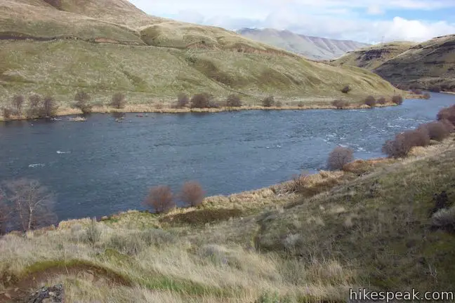
Rise up from River Trail, weaving up a recess in the terrain to rapidly gain 80 feet of elevation. Arrive on the edge of a grassy terrace, a short distance up from River Trail and 1.5 miles from the start of the hike. Come to a 3-way junction. Ferry Springs Trail goes to the right, offering a longer loop. Turn left onto Upper Trail (Riverview Trail) to proceed into the second half of the River Trail – Upper Trail Loop.
The small gain in elevation has a surprisingly substantial impact on the views. The perspectives up, down, and across the river are suddenly much broader. Big views of the big landscapes remain constant as you hike north across rolling slopes spotted with sagebrush. The sun-exposed grasses host wildflowers like longleaf phlox and redstem stork’s bill.
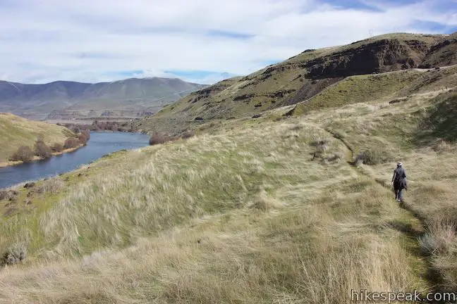
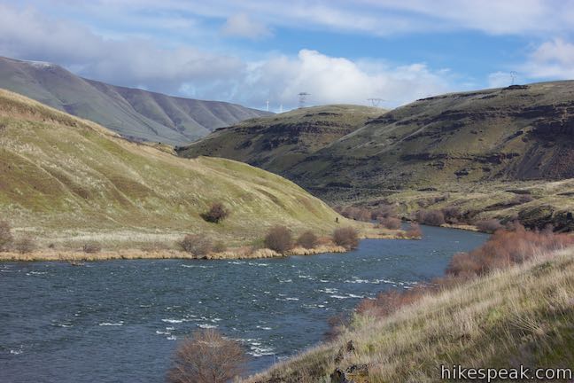
After about a quarter mile, Upper Trail drops into a ravine, crossing a stream that is lined by blackberries. Continue through rolling grasses, past a few small green info panels describing the area’s history, animals, plants, and climate. After 0.6 miles on the Upper Trail, pass an informative panel beside a bench with excellent river views. A nearby path connects up to the Old Railbed Trail and you may spot bikers using the bigger trail. The panel reads:
The most predominant songbird in the Deschutes River Canyon is the western meadowlark. It is the Oregon state bird. Open grassland like the surrounding slopes are prime meadowlark habitat. While the meadowlark is a migratory bird, these birds can be found year round. The song of the meadowlark is particularly beautiful, as it drifts from hillside to hillside.
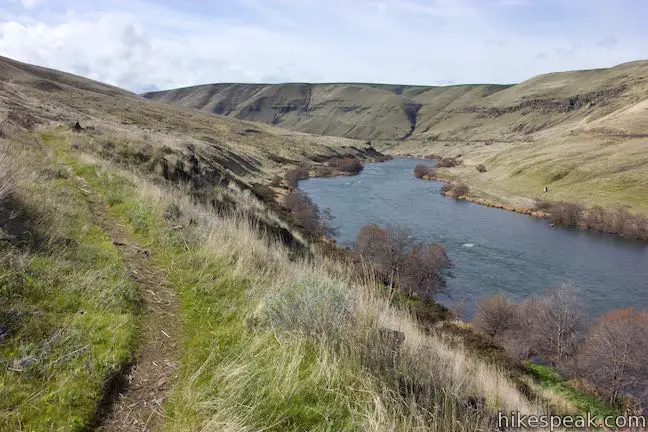
Look down over rapids in the Deschutes River as it flows around a gradual bend. Continue up the single-track trail, which dips through a rocky creek crossing. After another rise, the trail heads downhill, aligning hikers with views of the end of the Deschutes River where it joins the Columbia. In the background, the Columbia Hills rise to the north.
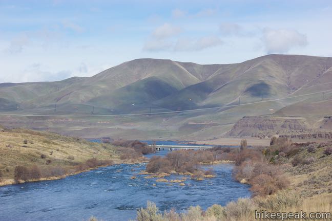
As Upper Trail sinks toward the river, spot the gage station along the lower trail. Pass a bench and a junction with the shortcut path coming up from River Trail. Proceed straight, hiking north into the final half mile of Upper Trail.
Rising into more sagebrush, bushes, and small basalt outcroppings, Upper Trail weaves past a few cherry trees with fragrant spring blossoms. Take a break at the last bench to soak up river views. Near the end of the trail, pass one more panel with insights into the plants that you’ve been hiking past:
This area, with an average annual precipitation of 11 inches, and extreme summer temperatures combined with drying winds, makes it intolerable for most types of vegetation. Some common plant types found in this area are sagebrush, rabbit brush, bitter brush and hackberry, as well as numerous annual and perennial plants and grasses.
When Upper Trail ends at a T-junction, turn left and descend a hundred yards to the signs by the start of River Trail. Make the obvious right turn and walk back across the lawn toward the parking area at the end of the park road.
Dogs are allowed on River Trail Loop, but bikes and horses are not permitted. Including the grassy walk between the road and the trailhead, River Trail Loop is 3.1 miles long with 115 feet of rolling elevation change. Be on the lookout for rattlesnakes, which live in this area. No permit is needed for this hike. Deschutes River State Recreation Area does not have a day use fee and only charges for overnight parking and camping, so day hikers can enjoy the Deschutes River at no charge.
The basic directions for River Trail Loop are:
- Begin by walking south from the end of the park road (0 miles)
- At the trailhead signage, proceed to the right onto River Trail (0.15 miles)
- Pass the gage station and a connector rising to the Upper Trail (0.6 miles)
- Pass a privy along the trail (1.2 miles)
- Bear left at a split to rise toward Upper Trail (1.45 miles)
- Climb to a junction with Ferry Springs Trail and turn left on Upper Trail (1.5 miles)
- Pass the connector trail coming up from River Trail near the gage station (2.4 miles)
- At the end of Upper Trail, turn left and hike down to the trailhead (2.9 miles)
- Back at the trailhead, turn right and walk across the field (2.95 miles)
- Return to the parking area at the end of the park road (3.1 miles)
To get to the trailhead: From The Dalles, which is 75 miles east of Portland, travel east on Interstate 84 for 12 miles to exit 97. At the end of the offramp, turn right and make an immediate left on Route 206. Drive east for 3 miles. Just after crossing the Deschutes River, turn right into the entrance of Deschutes River State Recreation Area. Pass a trailhead on the left and drive a third of a mile through the park campground to the area at the end of the road where the hike begins.
Trailhead address: Deschutes River State Recreation Area, Wasco, OR 97065
Trailhead coordinates: 45.6293, -120.908 (45° 37′ 45.5″N 120° 54′ 28.8″W)
View Deschutes River State Recreation Area in a larger map
Or view a regional map of surrounding Oregon trails and campgrounds.
 | Mosier Twin Tunnels This 2 to 9.5-mile hike ventures up Historic Columbia River Highway State Trail to a pair of tunnels carved into basalt cliffs on the side of Columbia River Gorge. |
 | Catherine Creek Interpretive Trail This short, paved loop explores meadows that burst with seasonal wildflowers, passing an overlook for a small waterfall and plentiful gorge views. |
 | Catherine Creek Arch This 1-mile round trip hike leads to the base of a curious natural arch in a basalt bluff. |
 | Coyote Wall This partial loop covers 5.8 miles as it ascends Coyote Wall to great views of its basalt cliffs and across Columbia River Gorge. |
 | Palouse Falls This short walk leads to a clifftop viewpoint facing a bold 180-foot waterfall in a basalt-walled canyon. |
 | Deschutes River SRA Campground This riverfront campground has 34 sites with electrical hookups, 25 more primitive sites, and 4 group sites. |


Go the extra miles...
Submit a rating of this hike to go with your comment. Contribute to the average trail rating.