
The New York State Park website describes Clark Reservation as ‘a geologic wonder of the last ice age and a botanist’s paradise.’ It’s all that and just 5 miles from Syracuse! The star of the park is Glacier Lake, a glacial plunge pool lake surrounded by dramatic limestone cliffs. Over a dozen trails explore this 365-acre park, allowing visitors to put together several different hikes. Each trail junction is marked with a large wooden trail sign that includes a helpful arrow pointing out the shortest route back to the trailhead.
One potential loop through Clark Reservation State Park is described below, covering 1.95 miles with 150 feet of elevation gain. The loop starts off on Cliff Trail, probably the park’s must-see trail, which crosses the top of the rocky 175-foot cliffs above Glacier Lake. The loop then makes use of a few other trails to pass through classic Central New York woodlands on the north side of the park, finishes on Mildred Faust Woodland Trail, which passes Dry Lake and a stream flowing into the sometimes ironically named pond. Since there are so many different trails to take, this hike can easily be extended to explore more of Clark Reservation State Park.
Note: Clark Reservation is probably most beautiful in the spring and summer, but the park is worth visiting year round. The photos below were taken on New Years Day, 2014.
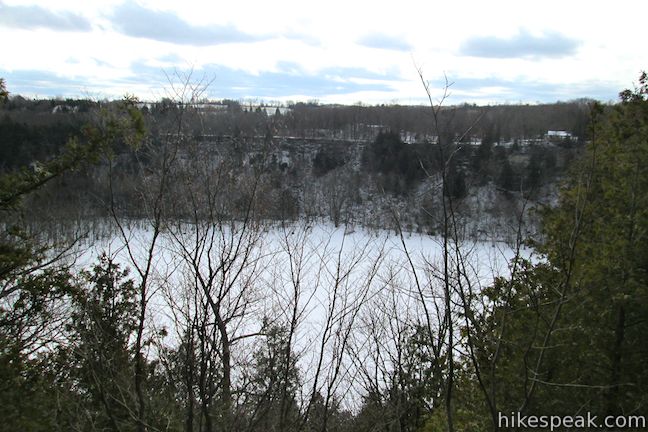
Start from the large parking area on the south side of the park where there is a nature center, overlook, and a playground on the cliffs above Glacier (Green) Lake. At the base of the cliffs, made up of 175 feet of limestone bedrock, you’ll spot a placid lake measuring between five and ten acres in surface area. Glacier Lake in a meromictic lake, like Green Lake and Round Lake in Green Lakes State Park, a rare class of lakes with surface water that does not mix with lower water masses and turnover like most lakes.
A kiosk at the trailhead offers a lot of information about Clark Reservation, including how the state park came to be:
Mary Clark Thompson purchased a portion of land including Glacier (Green) Lake to preserve it from being quarried and destroyed, as had recently happened with nearby Blue Lake. In 1915, Mrs. Clark gifted 109.7 acres of land to the State University of New York as a geological and botanical reserve to be named Clark Reservation, in memory of her late father, Myron Holley Clark, New York State Governor from 1955-1957.
Set out from the trailhead kiosk on Cliff Trail, which passes between the playground and the bathrooms to come to an immediate junction. This is the start of the loop. Stay to the right to hike in a counter-clockwise direction, starting off with Cliff Trail. The trail passes over uneven bluffs of limestone. Cracks in the limestone reveal small talus caves below. The rock’s interesting make-up provides a window into the park’s glacial pass. To the right, you will find more evidence – Glacier Lake. Geologists believe that, at the end of the area’s last ice age 10,000 years ago, an enormous waterfall formed as the glacier was receding. The waterfall’s “plunge pool” eroded a large depression that is now filled by Glacier Lake.
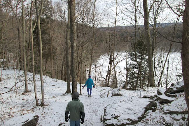
Atop the cliffs there is a forest of oaks, hophornbeam, and eastern red cedars, which you will pass through as you cross the outcroppings on the north side of Glacier Lake. After a quarter-mile of hiking, you will come to a junction with Long Trail. You could turn left here to begin exploring other areas of the park. However, you will probably be keen to keep walking along Cliff Trail, which is scenic and thrilling. If that’s the case, hike another quarter mile until you come to Saddle Rock Trail and then turn left, leaving Cliff Trail.
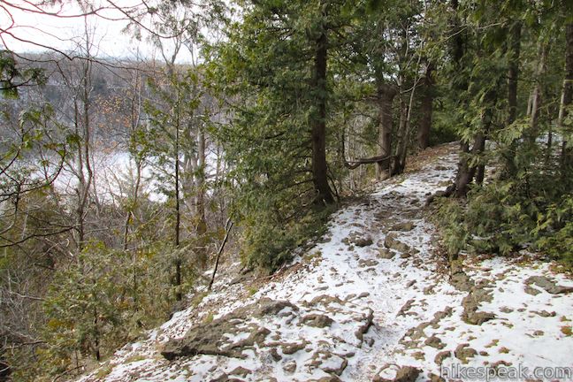
As you head away from the lake, you will see less bedrock and more trees. Pass Lower Basin on the right (one of the depressions in the undulating terrain around Glacier Lake) and come to a junction with Pulpit Rock Trail. Pulpit Rock Trail is shaped like a U, allowing you to hike it in either direction to reach Long Trail. The shortest route is to turn left and hike a tenth of a mile to Long Trail, reaching it 0.85 miles from the start of the hike.
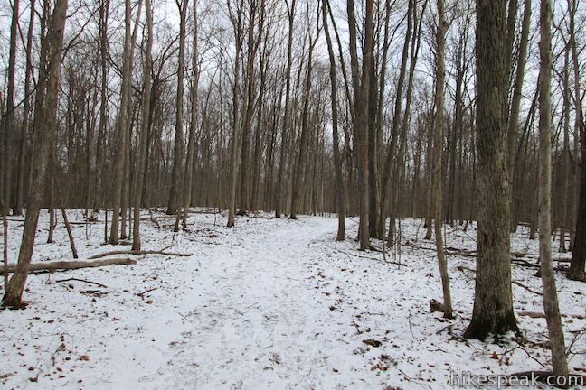
Turn right on Long Trail, heading north past the other end of Pulpit Rock Trail. When you come to a T-junction with Long Trail Extension, which ventures off toward the northeast corner off the park, turn left to stay on Long Trail. If the ground isn’t covered in snow, you may spot several varieties of ferns in Clark Reservation State Park, like maidenhair ferns and walking leaf ferns. A panel at the trailhead explains that:
Clark Reservation is a botanically rich environment. More than 200 species of ferns and flowering plants grow within the park. Both professional and amateur botanists marvel at the more than 80 species of trees, 26 types of ferns, and more than 100 types of moss that adorn the magnificent limestone outcroppings.
It may have been this diversity that drew Dr. Mildred E. Faust to the park, after whom the next trail is named. Faust was a charismatic professor of botany at Syracuse University who cataloged flora around New York State and brought students to Clark Reservation to share her passion for plants.
When Long Trail comes to a two-way junction with Mildred Faust Trail, 1.4 miles from the start, you are left with another decision to make. You can turn left (on what appears to be a continuation of Long Trail, or turn right to explore a small loop at the end of Mildred Faust Trail. If you stay to the left, you will immediately pass the end of Big Buck Trail on the left before coming to junction with the other end of the loop on Mildred Faust Trail, just 0.05 miles from the initial junction with the trail. Bear left here to head south and continue with the larger loop.
You could take this trail all the way back to the parking area at the trailhead, but to see one more (potentially dry) lake, turn left at the next junction on Dry Lake Trail. Make the next right on to Mildred Faust Woodland Trail (also marked as Mildred Faust Trail) and stay to the right after 0.05 miles through a junction with Table Rock Trail to head downhill toward Dry Lake.
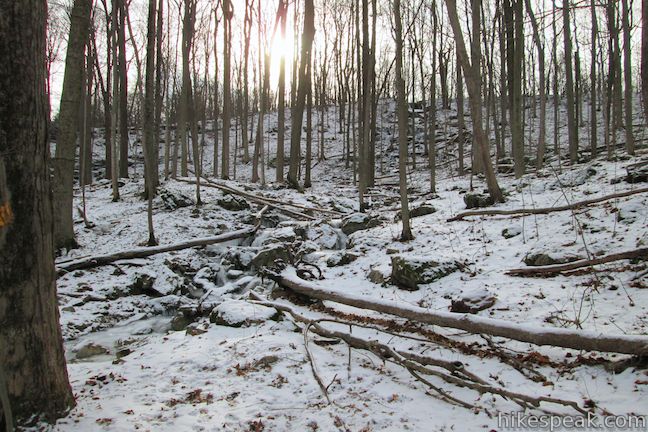
Mildred Faust Woodland Trail passes over a stream flowing into the west side of the Dry Lake. The creek freezes in the winter to form a special treat – beautiful icicle-covered cascades. Continue up the trail past Dry Lake to close out the loop. Make the obvious right turn when you reach Cliff Trail and walk a few hundred feet back to the trailhead parking area.
The basic directions for this loop through Clark Reservation State Park are:
- Begin down Cliff Trail from the trailhead kiosk (0 miles)
- Stay to the right past Mildred Faust Woodland Trail as the loop begins (0.03 miles)
- Go straight past Table Rock Trail on the left (0.1 miles)
- Go straight past Long Trail on the left, which is a shorter alternative route (0.25 miles)
- Turn left on to Saddle Rock Trail (0.5 miles)
- Go straight past Lower Basin Trail on the right (0.55 miles)
- Turn left on Pulpit Rock Trail, or turn right for a longer route to Long Trail (0.65 miles)
- Turn right on Long Trail (0.85 miles)
- Go straight past the other end of Pulpit Rock Trail on the right (0.95 miles)
- Turn left at a junction with Long Trail Extension (1.1 miles)
- Turn left onto Mildred Faust Trail past a loop on Mildred Faust Trail that goes to the right (1.4 miles)
- Go straight past Big Buck Trail on the left (1.41 miles)
- Stay left past the other end of the loop on Mildred Faust Trail (1.45 miles)
- Turn left on to Dry Lake Trail (1.62 miles)
- Turn right on to Mildred Faust Woodland Trail (1.67 miles)
- Stay right past Table Rock Trail (1.72 miles)
- Close the loop and turn right to return to the trailhead (1.92 miles)
- Finish by the trailhead kiosk (1.95 miles)
On weekends and holidays, there is a $4 entrance fee for Clark Reservation (as of January, 2014). Some trails may close due to winter conditions. Dogs are welcome on leashes. No permit (or reservation) is needed to hike in Clark Reservation State Park, so get out and enjoy!
To get to the trailhead: From Syracuse, drive south on Interstate 81 to exit 17 for State Street. At the end of the offramp, turn left on State Street and make the next left on East Brighton Avenue. Drive 1.4 miles up East Brighton Avenue and then continue to the left onto East Seneca Turnpike (Route 173). Proceed for 1.9 miles and turn left into Clark Reservation State Park. The trail starts on the north side of the large parking area.
Trailhead address: 6105 East Seneca Turnpike, Jamesville, NY 13078
Trailhead coordinates: 42.995036, -76.094169 (42° 59′ 42.12″N 76° 05′ 39.00″W)
You may also view a regional map of surrounding New York trails and campgrounds.
 | Green Lake & Round Lake This easy 3.25-mile loop explores a pair of aquamarine glacial lakes in Green Lakes State Park in Central New York. |
 | Southern Exposure Snowshoe Trail This 2.2-mile snowshoe trail loops south through a winter wonderland from the visitor center at Beaver Lake Nature Center (where you can rent snowshoes). |
 | Labrador Hollow Boardwalk This 0.5-mile boardwalk loop takes your through evergreens and wetlands to the shore of Labrador Pond in the heart of Labrador Hollow Unique Area. |
 | Tinker Falls This gradual 0.5-mile hike follows Tinker Falls Creek to the base of a lovely 50-foot waterfall. A trail to the top of Tinker Falls can be added to create a 1.3-mile trek in Labrador Hollow Unique Area. |
 | Hang Glider Launch Site via North County National Scenic Trail This 2.5-mile hike (or 3.2 miles when combined with the trails to Tinker Falls) ascends Jones Hill to a scenic overlook in Labrador Hollow Unique Area. |
 | More trails in New York Explore other hikes in the Empire State, including Central New York and the Adirondack Mountains. |


I lived across the road from the park while in high school; 1951 and 1952.
Hiked all over the park and found several caves overlooking the valley behind the park. Spent many hours exploring the caves. Never saw any fish in the lake. Considered it a “dead” lake. A great place to grow up.
Spring and Summer? How about Autumn? Early September/October are probably the best times to go hiking in Upstate New York. The fall foliage is at a peak, the temperature/humidity is reasonable, less insects, not nearly as wet or muddy.
what about the drone footage I saw at clark reservation?
Are there any unexplored caves that continue through the mountains? The story I have read was written by the land surveyors in 1801. They said they found a very long cave a mile from Jamesville on the Brown farm of that date. Any information about this would be helpful. Thanks, Mike
Anyone have directions to any of the caves? Hiked all over and haven’t been able to find them.