
Camassia Natural Area contains something special – one of the best wildflower displays in the greater Portland area. From April to May, the grassy plateaus in this 27-acre preserve boasts beautiful purples, blues, pinks and yellows created by Camas lilies, blue-eyed Mary, rosy plectritis, and buttercups (as well as other flowers). Explore this West Linn jewel on an easy 0.8-mile loop through colorful meadows and mellow forests.
Camassia Natural Area (also known as Camassia Nature Preserve) is named after the Camas lily, or common camas, which blooms abundantly in the park’s plateaus. The Nature Conservancy acquired this land in 1962 and in the decades since, they have removed invasive species, encouraged native growth, and added wood chip and boardwalk paths for visitors.
Camassia Natural Area has a few access points, but the easiest place to enter the park is from the end of Walnut Street, a short distance off Interstate 205. A path from road’s end enters the park and immediately comes to a split in front of a trail kiosk where the Loop Trail begins. The loop is just as lovely in either direction. If you pick up a trail guide at the kiosk, it is best to begin on the trail to the left so that the entries in the guide can be read in ascending order.
Take the trail to the left to head up the west side of the loop, leaving the neighborhood for a partially-shaded woodland. The first entry in the guide explains that this “forested wetland restoration site” was (like too many other forests around Portland) covered in English ivy before volunteers cleared out the ivy to foster a healthy environment for natives.
After a hundred yards of walking, pass a path that rises to the left and stay on what is obviously the main trail to the right. The path goes up to Windsor Terrace in the neighborhood to the west. Just after that, come to a junction with a path on the right that goes over to a small pond in the center of the park. During spring visits, when the wildflowers are at their peak, the pond is likely to be overflowing into the surrounding wetlands. The spur path dead ends near the swampy pond after a hundred yards. Although the pond itself is not a great attraction, a hearty collection of trillium bloom along the short path to the pond, making it an enjoyable side-excursion.
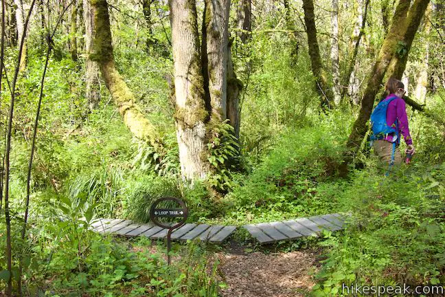
Loop Trail continues through the forest, rising toward the edge of a long meadow, also referred to as an herbaceous bald. Hit another junction, 1/8 of a mile from the start. To the left, a connector trail rises toward Windsor Terrace (a nearby street) and Wilderness Park (a protected forest to the northwest). To maximize the wildflower viewing on your hike, venture a hundred yards off the loop, taking Wilderness Park Connector Trail up one little switchback to a slightly elevated field of wildflowers. Turn around when the trail enters the forest. This pocket meadow has no shortage of wildflowers. Two-toned beauties called blue-eyed Mary are abundant, contrasted by the bright yellow of buttercups.
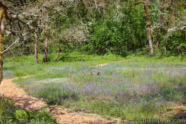
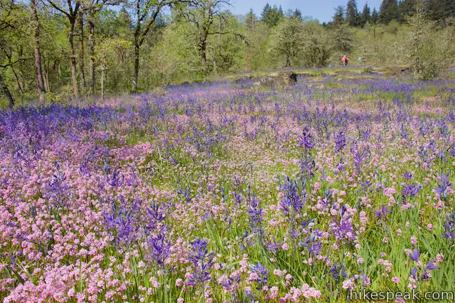
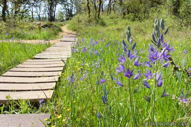
Return to the Loop Trail and proceed east into a much larger meadow, which is probably the most spectacular part of the park. Camas lilies explode out of the grasses like fireworks on stalks, with purple petals bursting around yellow stamens. The blooms of rosy plectritis cheer them on, carpeting the field in flowers that look like pink pom-poms.
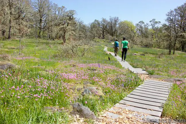
Meander across the meadow, which is wrapped by the twisted, lichen-covered branches of Oregon white oak. Obviously, don’t venture off the boardwalk and pathway through this fragile environment. At the east end of the meadow, a viewpoint on the right offers a perspective over the park’s pond.
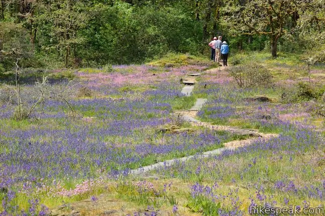
Just a tenth of a mile past the trail to Wilderness Park, Loop Trail reaches another marked junction with a second side trail worth exploring. The trail to the left ventures over a rise and down into forest on the way to West Linn High School. To see a lot of extra wildflowers, stray fifty yards up this trail and then turn around before it drops into the trees. Colorful rosy plectritis and Camas lilies seem to grow on top of each other in the southward sloping meadow near the junction.
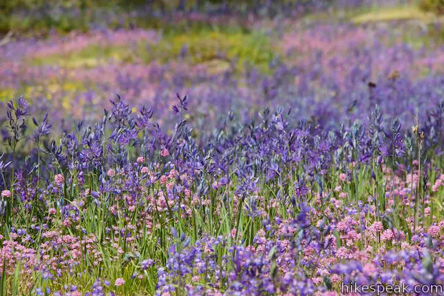
Continue to the right on the Loop Trail, easing through some oaks into another meadow. Mossy boulders and bedrock break up the flowering grasses, providing a window into the geologic history that created this blossoming environment. An entry in the trail guides, sums up the park’s past:
The bedrock exposed so beautifully here is Yakima basalt from a series of lava flows 15 million years ago. From 19,000 to 12,000 years ago, major floods poured down the present Columbia River Gorge and up the Willamette River Valley. These floods swept away soils and vegetation from parts of the valley and deposited ice-rafted granite boulders from as far away as Canada.
Come down the trail to a split. To the left, a short spur ventures out to the edge of a basalt ledge. Look across a grassy dip toward a ridge with a cell tower on it than has been the home of an osprey nest since 1997. On the left side of your perch is a tall Pacific madrone tree, which has red-orange bark that stands out from other members of the forest.
Continue down the Loop Trail through more great wildflower beds in Camassia Natural Area. A series of grassy rock-wrapped plots contain different mixed of wildflowers.
As the trail bellies out and begins to rise, come to one more park highlight. At 0.2 miles from the High School Trail junction, pass a viewpoint on the left. Look east toward Mount Hood. This giant 11,249-foot snow-covered mountain (Oregon’s tallest) usually looks best when it is lit from the west by the afternoon light.
Over the final 0.2 miles, the Loop Trail passes through small meadows and returns to the forest. These meadows were heavily restored by The Nature Conservancy to remove invasive plants and shrubs and reintroduce native wildflowers and grasses. Grab a bit of shade as you return to the trail kiosk where the loop began. Bear left to make your way back to Walnut Street to complete this 0.8-mile loop hike with a couple spurs and 70 feet of elevation change. Dogs and bikes are not allowed on this outing. No fee or permit is required to hike the Loop Trail through Camassia Natural Area, so get out and enjoy!
- For more wildflower viewing, head across the river to Canemah Bluff Nature Park.
To get to the trailhead: Take Interstate 205 to the west side of the Willamette River, 12.5 miles south of the merger with Interstate 84 and 7.5 miles east of Interstate 5. Take exit 8 for State Route 43 (signs for West Linn and Lake Oswego). At the end of the offramp, head south toward Oregon City (this will be a left turn for those traveling south on I-205 and a right turn for those coming from I-5). At the first intersection, where the road splits, bear right up Willamette Falls Drive. After a curve to the left, and 0.3 miles on Willamette Falls Drive, bear right up Sunset Drive. Cross over I-205 and make the first right onto Walnut Street. Drive two blocks to the trailhead at the end of the road and park where available.
Trailhead address: 4800 Walnut Street, West Linn, OR 97068
Trailhead coordinates: 45.3592, -122.6182 (45° 21′ 33.1″N 122° 37′ 05.5″W)
View Camassia Natural Area in a larger map
Or view a regional map of surrounding Oregon trails and campgrounds.
 | Canemah Bluff Nature Park This 1-7-mile hike explores wildflower fields and forests on a perch above the Willamette River near Oregon City. |
 | Trillium Trail in Tryon Creek State Natural Area This short nature trail is packed with plant-identifying panels as well as benches and viewing platforms. |
 | Two-Mile Loop in Tryon Creek State Natural Area Combine Old Main Trail, Red Fox Trail, Cedar Trail, Middle Creek Trail, and Maple Ridge Trail to loop through rolling woodland and across 3 bridges. |
 | George Himes Trail This short lollipop loop ascends into Portland's West Hills for a woodland walk with a view of Mount Hood. |
 | Marquam Nature Park Hike through peaceful forest in a pocket of Portland's West Hills on a 1.3, 3, or 4.25-mile loop. |
 | Scouters Mountain Nature Park This 1.2-mile loop explores a forested mountain east of Portland, rising to a shelter and a viewpoint facing Mount Hood. |
 | Powell Butte This 2.15-mile lollipop loop combines Mountain View Trail and Summit Lane to explore the top of Powell Butte and its big views from Southeast Portland. |
 | Trails in Oregon Explore more hikes in Oregon in and beyond the Greater Portland Area. |


Go the extra miles...
Submit a rating of this hike to go with your comment. Contribute to the average trail rating.