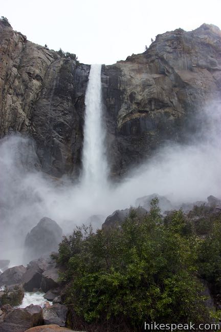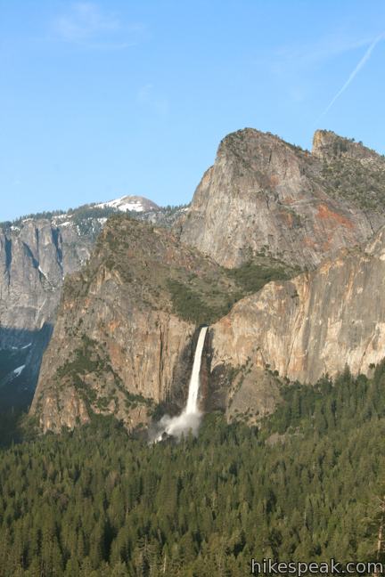
The 620-foot single-drop Bridalveil Fall is not the longest waterfall in Yosemite National Park, but it is one of the most elegant. A half mile round trip hike delivers visitors to a viewing platform at the base the waterfall. The short and easy hike is not to be missed.
From the trailhead, Bridalveil Fall is visible through the pine forest, plunging from a hanging valley along the south wall of Yosemite Valley. Follow the paved trail to its base, making a right at the only junction. The trail to the left crosses a series of bridges over Bridalveil Creek and provide nice views of the waterfall en route to an alternate trailhead along Highway 41 (without a parking lot). The trail to the right rises gradually through the forest along Bridalveil Creek, taking you closer to the booming waterfall with every step.

The trail ends at a viewpoint incredibly close to the waterfall. Stand at the base of Bridalveil Fall and you will be smacked with plenty of mist or waterfall-created rain during spring and summer months. By late fall, the trim waterfall slims down and may barely hits the ground in lean water years.
The view of Bridalveil Fall from Tunnel View is also a must see. For those who enter Yosemite from the south on Highway 41, the sight of Bridalveil Fall is unmistakable from this perch, and Bridalveil Fall Trail makes the sensible next stop. This fifteen-minute hike brings you right up to one of Yosemite’s prize falls. Dogs are welcome. An entrance fee is required to get to Bridalveil Fall Trail in Yosemite National Park, but no permit is needed for this short hike, so get out and enjoy!.

To get to the trailhead: From Tunnel View, drive 1.5 miles east into Yosemite Valley on Highway 41. The trailhead for Bridalveil Fall is on the right and well marked. From Yosemite Valley, take Highway 140 to the intersection with Highway 41. Turn right and make an immediate left into the parking area for Bridalveil Fall.
Trailhead address: Southside Drive (Highway 41), Yosemite National Park, CA 95389
Trailhead coordinates: 37.7168, -119.651 (37° 43′ 00.5″N 119° 39′ 03.6″W)
You may also view a regional map of surrounding Sierra Nevada trails and campgrounds.
Bridalveil Fall from a picnic area across the Merced River


 | Wildcat Falls This short path finds a secluded cascade along El Portal Road near the Arch Rock Entrance of Yosemite National Park. |
 | Yosemite Falls Trail This 3.5 to 7.1-mile hike rises from Yosemite Valley past Columbia Rock to unforgettable views of Upper Yosemite Fall. |
 | Lower Yosemite Fall Trail This 1.2-mile hike delivers visitors to the base of the tallest waterfall in North America. The experience is not to be missed. |
 | Mirror Lake This 2 to 2.8-mile hike visits a reflective pool on the east end of Yosemite Valley. |
 | The Mist Trail to Vernal Fall and Nevada Fall This 1.8 to 6.1-mile hike takes an exciting course past two of Yosemite's prize waterfalls. |
 | Half Dome This epic 16-mile hike climbs 4,800 feet on one of Yosemite's most popular and most challenging trails. |
 | Taft Point Trail This 2-mile round trip hike visits an overlook on the south wall of Yosemite Valley with fascinating rock fissures carved into the exposed granite. |
 | Chilnualna Falls Trail This 8-mile round trip hike ascends 2,200 feet past a raucous string of cascades to the top of a waterfall alongside Wawona Dome. |
 | Mariposa Grove of Giant Sequoias This 1.6-mile hike (or longer) visits the biggest trees in Yosemite. |
 | More trails in the Sierra Nevada Mountains Explore other destinations in Yosemite National Park and the rest of the range. |
 | Yosemite National Park Campgrounds Thirteen campgrounds with over 1,600 total sites are spread throughout the park to facilitate your visit. |
 | Housekeeping Camp What's not a hotel and not a campground? Housekeeping Camp offers a different type of lodging in the middle of Yosemite Valley. |


Go the extra miles...
Submit a rating of this hike to go with your comment. Contribute to the average trail rating.