
Archie Briggs Natural Area presents views over a dramatic stretch of the Deschutes River north of Bend. The river makes a sweeping curve beneath tall cliffs of volcanic rock and is backed by grand mountains like Black Butte and Mount Jefferson. Gaze down the canyon from atop cliffs on the south side of the curve in the river by an intersection of Deschutes River Trail and Archie Briggs Canyon Trail. The easiest way to this view is to hike 1.25 miles round trip down Archie Briggs Trail on the north side of Awbrey Butte in Northwest Bend.
Archie Briggs Canyon Trail crosses Mount Washington Drive less than 0.4 miles above the Deschutes River. Since there’s no parking at this intersection, start from the next spot where Archie Briggs Canyon Trail crosses a road, Panorama Drive. A less used section of the trail ascends from here toward Winslow Drive near Sylvan Park around the top of Awbrey Butte.
Hike downhill on Archie Briggs Canyon Trail through a pine filled ravine. After less than 0.2 miles, the dirt single track crosses Mount Washington Drive. Wait for a gap in traffic and cross to the other side where the trail resumes. As it drops below the road, the trail curves to the left and then swings back to the right. Drop into a gully, where the trail splits. The official trail proceeds to the right, while another well-worn path goes down the bottom of the ravine to the left. Either route is fine, coming down to Deschutes River Trail in another 0.3 miles.
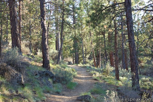
At the bottom of Archie Briggs Canyon Trail, meet the wide cinder trail running along the river. A 200-foot deep canyon lies just ahead. You can turn right or left on Deschutes River Trail to get a better view over the canyon. The section of Deschutes River Trail to the left is fairly steep, so skip that and take the path of least resistance and turn right.
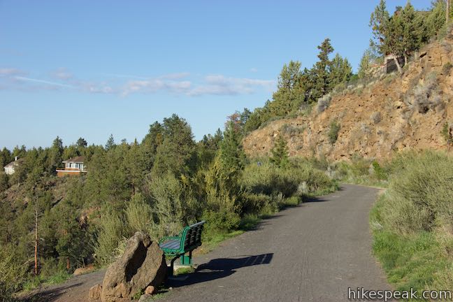
Go up a gradual slope along the edge of a bluff, quickly coming to a bench with stellar views over the canyon. The Deschutes River comes from the right and makes a swinging curve to the north. Tall cliffs of dark brown volcanic rock frame the river. Beyond the cliffs on the opposite side of the river is a grassy field and forest in an area called Gopher Gulch that the City of Bend has acquired for parkland.
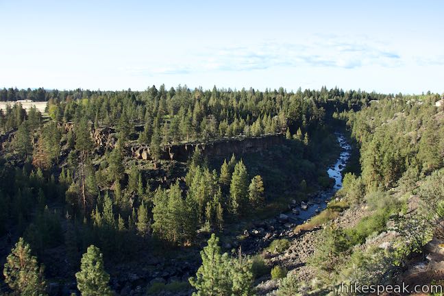
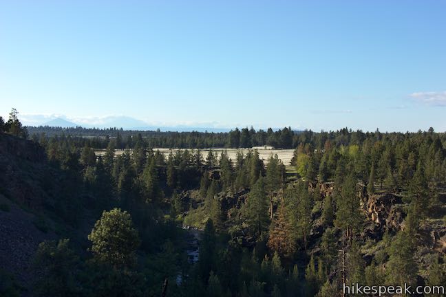
In the distance, look for Black Butte and Mount Jefferson rising triumphantly above a forest of conifers. If conditions are clear, walk east for a stretch on Deschutes River Trail to catch sight of Middle and North Sister rising to the west. You can hike farther on Deschutes River Trail, but the best views from this north-of-Bend stretch of this trail can be found around Archie Briggs Canyon Trail.
From the bench, walk back to Archie Briggs Canyon Trail and hike 0.55 miles back up to Panorama Drive, regaining 325 feet of elevation to complete this 1.25-mile round trip hike. Dogs and bikes are allowed on Archie Briggs Canyon Trail and Deschutes River Trail. Parking is free and no permit is required, so get out and enjoy!
To get to the trailhead: From Bend, take NE 3rd Street (Route 20) north to Mount Washington Drive, which comes just after you pass under Bend Parkway (Route 97). Turn left on Mount Washington Drive and go 2.4 to Constellation Drive. Turn left and make an immediate right onto Panorama Drive. Take this for a third of a mile and park before of after a curve in the road to the right. The trail begins from the inside of this curve.
Trailhead address: 3360 NW Panorama Drive, Bend, OR 97701
Trailhead coordinates: 44.0855, -121.3347 (44° 05′ 07.80″N 121° 20′ 04.91″W)
You may also view a regional map of surrounding Oregon trails and campgrounds.
 | Shevlin Loop Trail This 4.75-mile tour of Shevlin Park just a few miles east of Bend explores pine forests on both sides of Tumalo Creek. |
 | Pilot Butte This 1.8-mile hike ventures up the dominant landmark in Bend to offer sweeping views of the majestic surroundings. |
 | Tumalo Falls See Bend's best waterfall on a short walk to a downstream viewpoint or a half-mile round trip hike to an overlook by the top of the falls. |
 | Tumalo Falls Loop This 7.4-mile circuit ventures above Tumalo Falls and explores numerous other waterfalls and cascades on Tumalo Creek, combining North Fork Trail, Swampy Lakes Trail, and Bridge Creek Trail. |
 | Black Butte The 4-mile hike summits one of the most identifiable peaks in Central Oregon, which has fire lookout towers and panoramic views of the Cascade Mountains. |
 | Head of the Metolius This 0.5-mile hike visits the surprising source of the Metolius River, a gushing spring accompanied by views of Mount Jefferson. |
 | West Metolius River Trail The 5.4-mile hike follows the west bank of the Metolius River to incredible gushing springs and a fish hatchery. |
 | Lava Butte This hike explores a cinder cone with a fire lookout tower and a crater-circling trail that offer panoramic views over Lava Butte Lava Flow and the Cascade Mountains. |
 | Trail of the Molten Land This 1.1-mile long paved partial loop cuts through Lava Butte Lave Flow and is packed with information and views. |
 | Trail of the Whispering Pines This interpretive botanical trail explores high desert plants on the edge of Lava Butte Lava Flow on a quarter-mile long path. |
 | Lava River Cave This underground hike explores a lava tube south of Bend that is filled with fascinating volcanic features. |
 | Deschutes River Trail to Benham Falls This 1.9-mile hike follows a leisurely trail along the Deschutes River to aggressive cascades called Benham Falls where the river churns and tumbles through a gap between cliffs. |
 | More trails in Oregon Explore other hikes in Central Oregon, the Columbia River Gorge, and elsewhere. |


[…] The trail reaches its northernmost conclusion just over 4 miles from the start and I’d recommend running this entirety if you can. However, just getting out on this trail for any length of time is wonderful enough. If you are looking for more miles, there are some offshoots on this trail (such as the relatively short and challenging, Archie Briggs Canyon Trail) […]
[…] little bit more time on technical trails, I would recommend the relatively short, yet challenging, Archie Briggs Canyon Trail. You can hit this cut off from the DRT right around mile 3.3 or so and it will take you ever […]