Hikes in Riverside County

Riverside County covers over 7,000 square miles, stretching east from Orange County all the way to the California border with Arizona. The Santa Ana Mountains form a natural border with Orange County on the west side of Riverside County.

The highest point in Riverside County is San Jacinto Peak, towering over the San Jacinto Mountains as it rises to 10,834 feet. The eastern half of the county is desert and includes Palm Springs, the Coachella Valley, and Joshua Tree National Park. As a housekeeping note, the trails in Joshua Tree are not listed in the Southern California section of hikespeak.com and can be found with the other hikes in the California Desert.

Highlights of Riverside County

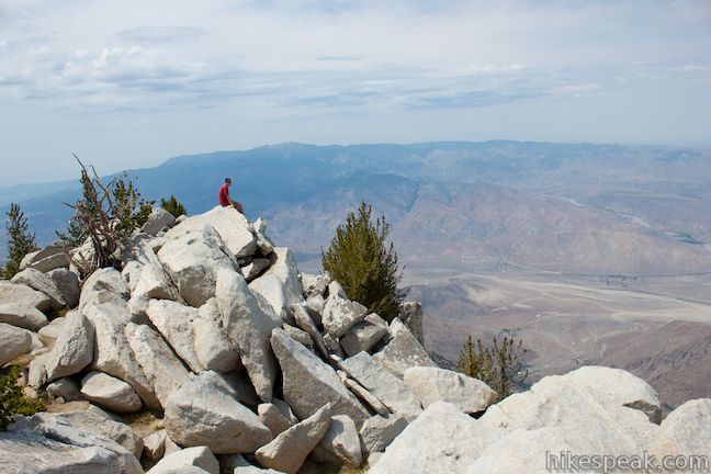
  • This non-nonsense 13.2-mile round trip hike ascends 4,500 feet to one of Southern California's most panoramic summits.
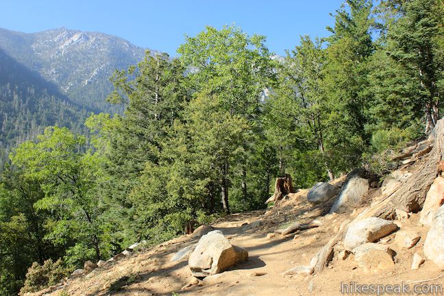
  • This 6-mile round trip hike crosses a saddle to a 5,790-foot summit with views of the mountains around San Jacinto Peak near Idyllwild.
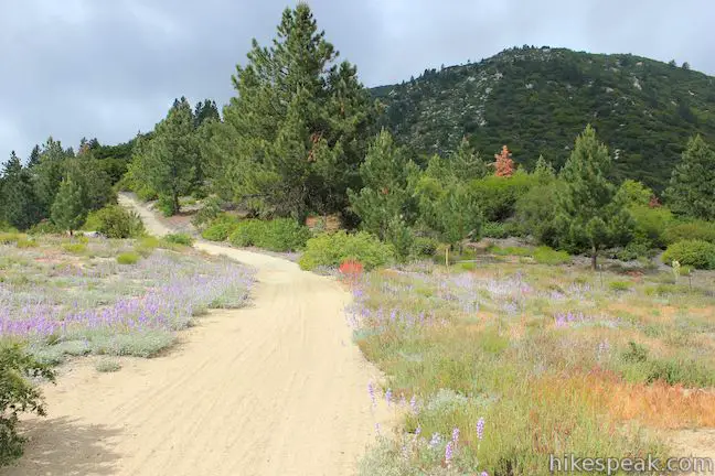
  • This gradual 5.2-mile round trip hike near Idyllwild crosses quiet forests with rugged mountain views.
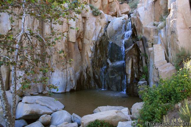
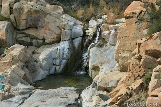
  • This 1/3-mile round trip hike visits a refreshing waterfall, cascade, and swimming hole off Ortega Highway in the Santa Ana Mountains.
  • This 1.5-mile hike ventures up a wilderness canyon to a five-star five-tier waterfall along San Mateo Creek in the Santa Ana Mountains.
  • This short loop examines common plants in the Santa Ana Mountains, along with uncommon views views across the mountain range, passing an old mine for more fun.
  • This 3 1/3-mile round trip hike follows an old road to an old campground with views over San Mateo Canyon in the Santa Ana Mountains.

Riverside County Hiking

This collection of trails in Riverside County, California lists hikes roughly from north to south and west to east. The table may also be sorted alphabetically or by distance to help you pick your next hike. Each trail links to its own report complete with photos, GPS maps, elevation profiles, directions, and all other information needed to locate and enjoy these hikes. Below the table is an interactive map showing the location of each hike.

TrailDescriptionDistanceLocation
Whitewater Preserve230Canyon View Loop Trail
This loop in Whitewater Preserve crosses Whitewater River and incorporates a section of the Pacific Crest Trail to deliver big views up and down Whitewater Canyon.
3.75 miles
650 feet
33.989183,
-116.656132
Indian Mountain Trail250Indian Mountain
This out and back hike crosses a saddle to a 5,790-foot summit with views of the mountains around San Jacinto Peak near Idyllwild.
6 miles
815 feet
33.797213,
-116.7777
San Jacinto Peak via Mountain Trail260San Jacinto Peak via Marion Mountain Trail
This non-nonsense out and back hike ascends to one of Southern California's most panoramic summits.
13.2 miles
4500 feet
33.79117,
-116.735386
Ernie Maxwell Scenic Trail270Ernie Maxwell Scenic Trail
This gradual out and back hike near Idyllwild crosses quiet forests with rugged mountain views.
5.2 miles
675 feet
33.764735,
-116.687213
El Cariso Nature Trail390El Cariso Nature Trail
This loop examines common plants in the Santa Ana Mountains, along with uncommon views views across the mountain range, passing an old mine for more fun.
1.35 - 1.55 miles
125 feet
33.650867,
-117.413113
Ortega Falls400Ortega Falls
This hike visits a refreshing waterfall, cascade, and swimming hole off Ortega Highway in the Santa Ana Mountains.
0.33 miles
50 feet
33.625765,
-117.426339
Tenaja Falls Falls590Tenaja Falls
This hike ventures up a wilderness canyon to a tall, five-tier waterfall along San Mateo Creek in the Santa Ana Mountains.
1.5 miles
275 feet
33.5491,
-117.3946
Fisherman's Camp6000Fisherman's Camp
This hike follows an old road to an old campground with views over San Mateo Canyon in the Santa Ana Mountains.
3.33 miles
400 feet
33.532281,
-117.393036
hikespeak
Tenaja Falls Trail San Mateo Canyon Wilderness Santa Ana Mountains Waterfall Hike
Tenaja Falls pours over a sandstone staircase in the San Mateo Canyon Wilderness of the Santa Ana Mountains. Even through the waterfall's setting is picturesque and remote, the hike to the waterfall is a short and easy, following Tenaja Falls Trail for 1.5 miles round trip with 275 feet of elevation change. Totaling 150 feet in height with multiple tiers, this Southern California waterfall... Read more.
By: Published: Last updated: March 24, 2019
Heaps Peak Arboretum Sequoia Trail San Bernardino Mountains Nature Trail San Bernardino National Forest Arboretum hike Lake Arrowhead California
Get to know the plants, animals, and natural history of Southern California at Heaps Peak Arboretum. Located near Lake Arrowhead, the arboretum is a developed piece of San Bernardino National Forest. Sequoia Trail is the main trail through Heaps Peak Arboretum, covering 3/4 of a mile with 90 feet of elevation change. The star of the trail is a planted grove of sequoiadendron giganteum, or... Read more.
By: Published: Last updated: May 19, 2024
Kwaay Paay Peak Trail Hike Mission Trails Regional Park San Diego California Mission Dam to Kwaay Paay Mountain
Pay a visit to Kwaay Paay Peak for an efficient workout that's rewarded with panoramic views. The 2.5-mile round trip hike to the 1,194-foot summit climbs 885 feet, with steep stretches that will have your heart pumping. The summit is just ten miles from downtown San Diego, within the 6,800 acres of Mission Trails Regional Park, so you'll see beautiful natural landscapes and cityscapes on... Read more.
OK! Add to trails I’ve hiked
OK! Add to trails I want to hike
Tagged with · Free Trails · Mission Trails Regional Park · Santee · Summits
Distance: 2.5 miles · Elevation change: 890 feet
By: Published: Last updated: December 27, 2022
Monserate Mountain Preserve Hike Fallbrook Monserate Mountain Summit Trail Monserate Mountain Loop Trail San Diego County
Monserate Mountain offers a workout of a hike, beginning just off Interstate 15 in the Northern San Diego County city of Fallbrook, just ten miles south of Temecula in Riverside County. There is 1,200 vertical feet between the trailhead at the base of Monserate Mountain and the panoramic summit at the top, tackled on a 1 2/3-mile ascent. You can turn around at the top for a 3 1/3-mile... Read more.
OK! Add to trails I’ve hiked
OK! Add to trails I want to hike
Tagged with · Fallbrook · Fallbrook Land Conservancy · Free Trails · Monserate Mountain Preserve · Summits
Distance: 4.4 miles · Elevation change: 1200 feet
By: Published: Last updated: February 5, 2024
Canyon View Loop Trail Whitewater Preserve Pacific Crest Trail San Bernardino Mountains Palm Springs hike
You would not expect to find a Whitewater River in the vicinity of Palm Springs, but this surprising river is vital for the fertility of the Coachella Valley, bringing wonderful water from the San Bernardino Mountains to the desert below where it empties into the Salton Sea. Journeyman hikers can pass through Whitewater Preserve on the Pacific Crest Trail and day hikers can get in on the... Read more.
OK! Add to trails I’ve hiked
OK! Add to trails I want to hike
Tagged with · Creeks · Free Trails · Pacific Crest Trail · San Bernardino Mountains · Whitewater Preserve
Distance: 3.75 miles · Elevation change: 650 feet
By: Published: Last updated: January 10, 2018