Australia
Pristine beaches, remote wildernesses, and unique animals give Australia global appeal for outdoorsy travelers. At roughly the size of the Contiguous United States, Mainland Australia covers 7.69 million square kilometers (2.97 million square miles) making it earth’s largest island or smallest continent depending on your perspective. There are 23.5 million Aussies spread out across the land, which is about 13% of the population of the United States. Not to be forgotten is the the island of Tasmania, located 250 kilometers off the south coast of Victoria. Tasmania covers approximately 68,000 square kilometers (26,000 square miles) and is a secluded destination for hiking, camping, and touring.
Australia Hiking
Hikespeak.com offers a small sample of the outdoor fun available in Australia with information on hiking tracks, campgrounds and holiday parks in the states of Victoria and Tasmania.
Hikes in Australia
This collection of hiking trails in Tasmania and Victoria, Australia, lists the hikes roughly from west to east and north to south. The table may also be sorted alphabetically or by distance to help you pick your next hike in Australia. A search feature can be used to quickly isolate the hike you are looking for. Each trail links to its own report complete with photos, maps, directions, and all the other information needed to locate and enjoy these hikes. Below the table is an interactive map with the location of each trail.
| Trail | Description | Distance | Location |
|---|---|---|---|
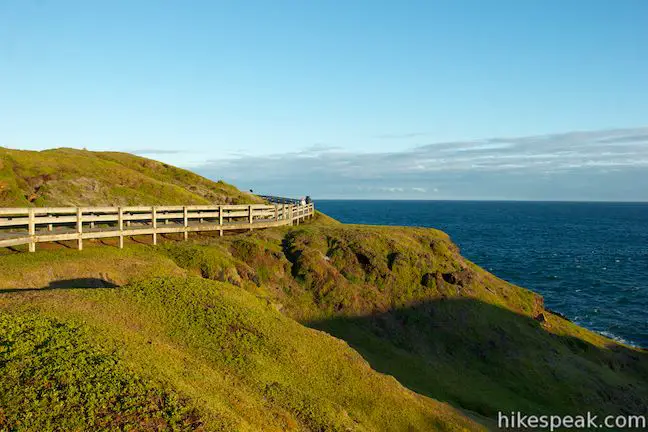
 750 750 | Nobbies Boardwalk on Phillip Island This short out and back walk on Point Grant provides excellent coastal views highlighted by Seal Rocks, Nobbies, and the Nobbies Blowhole. | 1 km 15 meters | -38.517163, 145.117576 |
 760 760 | Penguin Parade to the Nobbies on Phillip Island This coastal 4-kilometer long road can be walked, driven, or biked between the Penguin Parade Visitor Center and the Nobbies Centre. | 8 km 25 meters | -38.508812, 145.147153 |
 770 770 | Summerlands Beach on Phillip Island This short out and back return hike brings you to a picturesque surf beach that is taken over by little penguins in the evening. | 1 km 10 meters | -38.508812, 145.147153 |
 780 780 | Pyramid Rock on Phillip Island This short out and back walk takes hikers out onto a grassy point to two overlooks of Pyramid Rock, a triangle-shaped rock island just off the coast. | 0.8 km 10 meters | -38.525928, 145.221826 |
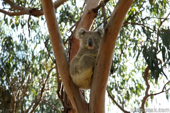
 790 790 | Koala Conservation Centre on Phillip Island This loop explores the fantastic boardwalks in the Koala Conservation Centre as well as a longer trail through eucalyptus woodlands. | 1.2 km 15 meters | -38.485668, 145.262828 |
 800 800 | Cape Woolamai on Phillip Island This loop along beaches and bluffs is packed with Cape Woolamai highlights, including Woolamai Surf Beach, the Pinnacles, Cape Woolamai Beacon, Old Granite Quarry, and Cleeland Bight. | 8.5 km 112 meters | -38.543936, 145.339985 |
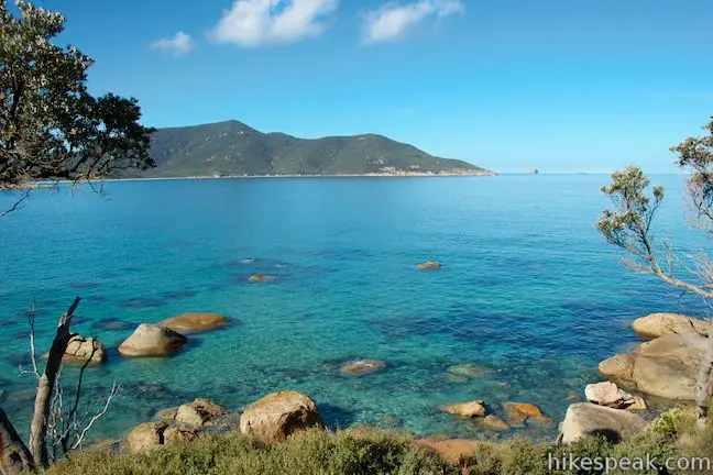
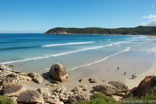
 850 850 | South Norman Bay to Little Oberon Bay in Wilsons Promontory National Park This out and back hike is packed with coastal views, traveling from Tidal River Campground to Norman Bay and across Norman Point to Little Oberon Bay, a pristine beach with pale sand and clear turquoise water. | 9.5 km 70 meters | -39.030653, 146.321366 |
 895 895 | Mount William in Tasmania This out and back hike tops a short summit that is the high point of Mount William National Park with panoramic views over the coastline at the northeast corner of Tasmania. | 3.6 km 140 meters | -40.90896, 148.207197 |
 905 905 | Saint Columba Falls in Tasmania This out and back hike descends into a rainforest to the base of a powerful 90-meter tall waterfall. | 1.2 km 40 meters | -41.321271, 147.926203 |
 915 915 | Cataract Gorge in Tasmania This loop combines Zig-Zag Track, Cataract Walk, and Bridge Walk to explore Cataract Gorge Reserve, an impressive natural area just outside the center of Launceston. | 3.4 km 80 meters | -41.445923, 147.122482 |
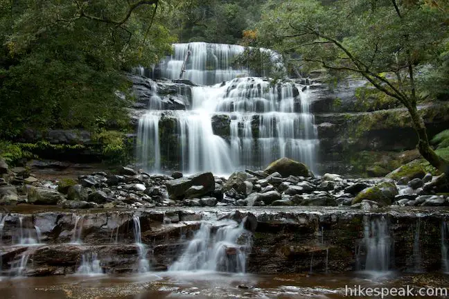
 925 925 | Liffey Falls in Tasmania This out and back walk in the rainforest passes the Upper Cascades on the Liffey River to reach the base of lovely Liffey Falls, one of Tasmania's finest waterfalls. | 2.2 km 70 meters | -41.700153, 146.759189 |
 945 945 | Apsley Waterhole & Lookout Track in Tasmania This loop travels through a eucalyptus forest to a popular swimming hole on the Apsley River in Douglas-Apsley National Park. | 1.2 km 30 meters | -41.865414, 148.190469 |
 950 950 | Friendly Beaches in Tasmania This hike explores a long, pristine beach on the east coast of Tasmania north of the Freycinet Peninsula. | 0.1 km 10 meters | -41.992685, 148.285445 |
 953 953 | Cape Tourville in Tasmania This short circuit provides big views along the east coast of Freycinet Peninsula, circling 100-meter tall bluffs to reach the Cape Tourville Lighthouse. | 0.6 km 10 meters | -42.122311, 148.34135 |
 960 960 | Wineglass Bay and Hazards Beach Circuit in Tasmania This rewarding loop through Freycinet National Park visits pristine light sand beaches at Hazards Beach and the renowned Wineglass Bay. | 12 km 220 meters | -42.14581, 148.289189 |
 965 965 | Moorland Mosaic in Tasmania This out-and-back boardwalk in Mount Field National Park crosses an alpine meadow covered with an interesting mix of plants. | 0.65 km 20 meters | -42.682995, 146.611678 |
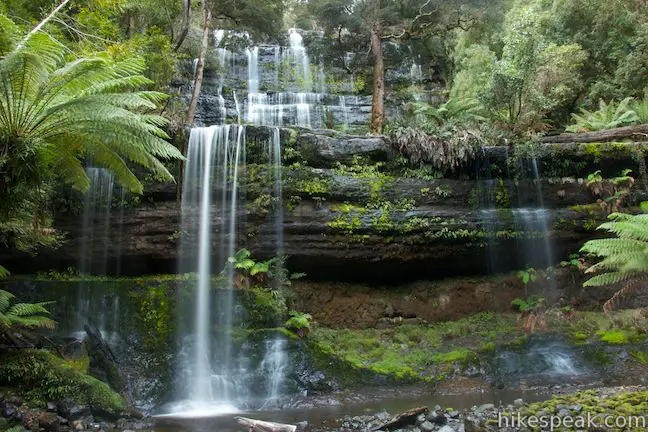
 970 970 | Russell Falls & Horseshoe Falls in Tasmania This hike in Mount Field National Park visits one of Tasmania's most famous and beautiful waterfalls and can be extended from 1.8 to 2.65 kilometers by venturing to the top of Russell Falls and nearby Horseshoe Falls. | 1.65 km 80 meters | -42.682073, 146.716127 |
 978 978 | Pinnacles Boardwalk & Summit Trig in Tasmania The short walk on the top of Mount Wellington explores two short boardwalks and a trig station at the summit. | 0.75 km 20 meters | -42.89542, 147.237723 |
 980 980 | Octopus Tree and Circle Track in Tasmania This loop in Hobart's Wellington Park reaches a unique eucalyptus tree with tentacles for roots that wrap around a boulder. | 1.1 km 50 meters | -42.908751, 147.24798 |
 985 985 | Coal Mines Historic Site in Tasmania This short loop explores the ruins of an old prison and coal mine that relied on convict laborers. | 0.8 km 10 meters | -42.988141, 147.714598 |
 990 990 | Blowhole & Fossil Bay Lookout in Tasmania This short walk in Tasman National Park reaches a coastal vista point and a wave-carved tunnel through a rocky point that has the potential to spray up like a whale spout. | 0.45 km 10 meters | -43.034392, 147.947942 |
 991 991 | Tasmans Arch & Devils Kitchen in Tasmania This short walk visits two impressive features on the coast of the Tasman Peninsula, a natural bridge and a chasm carved by the sea. | 0.9 km 9 meters | -43.042071, 147.950548 |
 996 996 | Cape Raoul in Tasmania This bushwalk explores the pristine coastline at the southwest end of the Tasman Peninsula, reaching a cape with daunting 200-meter tall cliffs dropping to swirling seas. | 12 - 14 km 240 meters | -43.195255, 147.777145 |
Or explore hikes in Australia on the Oceania Hike Finder Map
