Hikes on California’s North Coast
With limited development, dramatic waterfront, and enchanting redwood forests, the North Coast of California is basically designed to lure visitors into the outdoors. The north Coast is made up of Del Norte County (which starts at the Oregon Border), followed by Humboldt County, Mendocino County, Sonoma County, and Marin County (just above San Francisco). A string of coastal California State Parks provide excellent hiking opportunities while preserving a unique slice of the American landscape. If your goal is to set foot in a forest of ancient coastal redwoods, the best place to go is the North Coast of California!
Hiking California’s North Coast
This collection of trails in the North Coast region of California lists hikes from north to south. The table may also be sorted alphabetically or by distance to help you pick your next hike. Each trail links to its own report complete with photos, GPS maps, elevation profiles, directions, and all the other information needed to locate and enjoy these hikes. An interactive map is also provided.
| Trail | Description | Distance | Location |
|---|---|---|---|
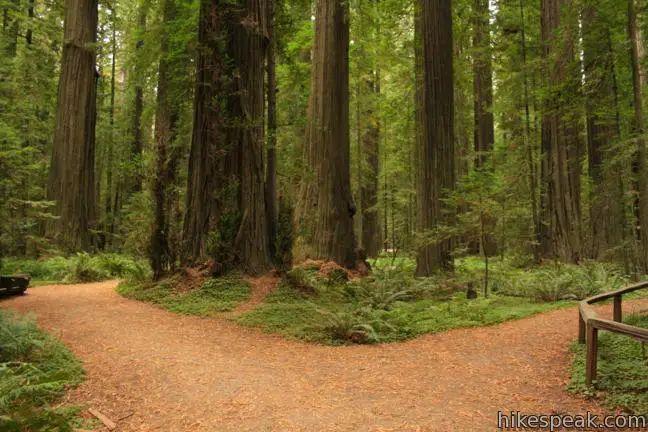
 100 100 | Stout Memorial Grove This short loop explores an exceptional old growth grove of coastal redwoods in Jedediah Smith Redwoods State Park. | 0.55 miles 75 feet | 41.789697, -124.0847 |
 120 120 | Yurok Loop and Hidden Beach This hike explores a rugged and beautiful area of California's north coast, combining Yurok Loop Trail and the Hidden Beach Section of Coastal Trail to visit beaches, forests, and ocean vistas. | 2.25 miles 120 feet | 41.5946, -124.0997 |
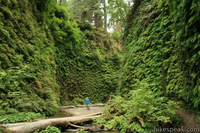
 150 150 | Fern Canyon Trail This loop or out and back hike in Prairie Creek Redwoods State Park explores a lush canyon with walls of ferns. | 1 mile 75 feet | 41.400618, -124.0657 |
 165 165 | Haystack Trail This lollipop loop hike tours the top of a volcanic dome with excellent views of Mount Shasta. | 2.55 miles 375 feet | 41.5307, -122.2768 |
 170 170 | Spring Hill This lollipop loop hike hits a short summit near Mount Shasta with excellent views of Mount Shasta, Black Butte, and the surroundings. | 2.9 miles 625 feet | 41.3288, -122.322 |
 173 173 | Lake Siskiyou Trail (South Shore Loop) This short and easy lakefront loop offers great views across Lake Siskiyou toward Mount Shasta and the surrounding evergreen wilderness. | 1.1 miles 50 feet | 41.2777, -122.3329 |
 175 175 | Faery Falls and Ney Springs This short hike travels along a creek up to an impressive 50-foot waterfall, passing the ruins of an old resort along the way. | 1.4 miles 250 feet | 41.265953, -122.32439 |
 176 176 | Heart Lake and Little Castle Lake This hike visits lakes in a beautiful area of Shasta-Trinity National Forest, including the charming-contoured waters of Heart Lake. | 2 - 3 miles 645 feet | 41.2303, -122.3816 |
 177 177 | Castle Peak and Heart Lake This off trail hike ventures above Heart Lake to a summit with extraordinary views of the Castle Crags and Mount Shasta. | 3.2 miles 1,180 feet | 41.2303, -122.3816 |
 181 181 | Crags Trail to Castle Dome This out and back hike in Castle Crags State Park ascends through a garden of granite crags to the base of Castle Dome, | 5.6 - 6 miles 2,150 feet | 41.1597, -122.3068 |
 183 183 | Root Creek Trail This out and back hike in Castle Crags State Park takes a level and easy course to a tumbling creek in a mossy forest. | 2.2 miles 80 feet | 41.1597, -122.3068 |
 185 185 | Vista Point Trail This short hike reaches the principal viewpoint in Castle Crags State Park, which has a great perspective of granite peaks known as the Castle Crags, along with views of Mount Shasta and the surrounding wilderness. | 0.5 miles 50 feet | 41.1595, -122.30575 |
 187 187 | Hedge Creek Falls Trail This short hike leads to a forest-wrapped waterfall, passing behind the falls to arrive at a Sacramento River Overlook. | 0.6 miles 130 feet | 41.23625, -122.2696 |
 190 190 | Bailey Cove Trail This easy 3.1-mile loop circles a hill-covered peninsula that extends into Shasta Lake, providing both lake views and shade. | 3.1 miles 50 feet | 40.7997, -122.3169 |
 192 192 | Drury-Chaney Loop Trail This lollipop loop provides an easy and enchanting hike through redwood trees at the park's north end. | 2.4 miles 100 feet | 40.44307, -123.98633 |
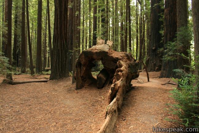
 195 195 | Grieg-French-Bell Trail This short loop in Humboldt Redwoods State Park wanders across a forest floor covered in sorrel, visiting giant redwoods that include the Girdled Tree, which had its bark stripped away. | 0.5 miles 25 feet | 40.4403, -123.9855 |
 200 200 | Founders Grove Nature Trail This short loop in Humboldt Redwoods State Park explores an ancient grove honoring the founders of the Save-the-Redwoods League. | 0.5 miles 25 feet | 40.352153, -123.923897 |
 250 250 | Gould Grove Trail This loop explores a forest of ancient redwoods adjacent to the in Humboldt Redwoods State Park Visitor Center. | 0.5 miles 50 feet | 40.308085, -123.908575 |
 300 300 | Woodland Trail This hike explores patches of redwoods surrounded by a shaded oak forest in Richardson Grove Redwoods State Park. | 1 - 1.25 miles 50 - 325 feet | 40.021954, -123.794194 |
 350 350 | Durphy Creek Trail - Tan Oak Springs Trail Loop This loop climbs a forest ridge before descending to Lookout Point, where you can enjoy an unimpressive view to the south over Richardson Grove Redwoods State Park. | 3.75 miles 1,000 feet | 40.019891, -123.79399 |
 400 400 | Laguna Point Boardwalk This boardwalk in MacKerricher State Park provides an easy stroll with plentiful ocean views. | 0.6 miles 25 feet | 39.48909, -123.799623 |
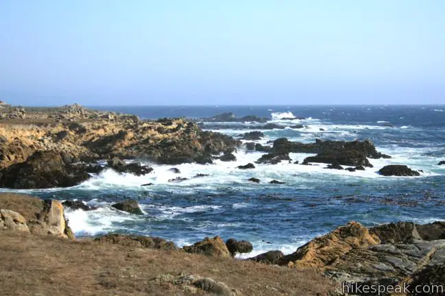
 500 500 | Salt Point Trail This out and back hike explores the jagged coastline at the heart of Salt Point State Park. | 3 miles 50 feet | 38.56669, -123.33185 |
