Charmlee Wilderness Park hiking trail Malibu California Ocean overlook old ranch ruins Charmlee Hike
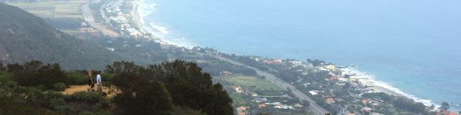
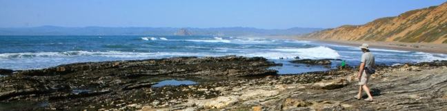
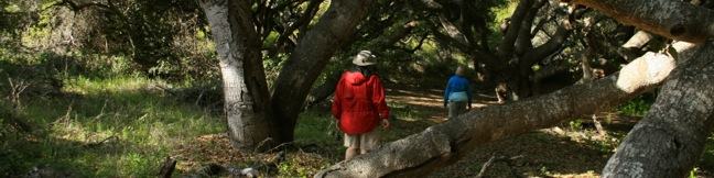
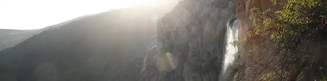
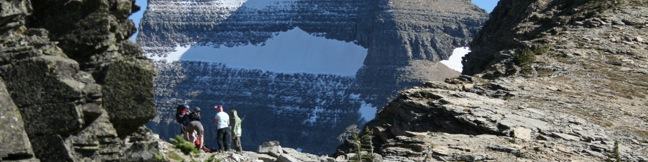
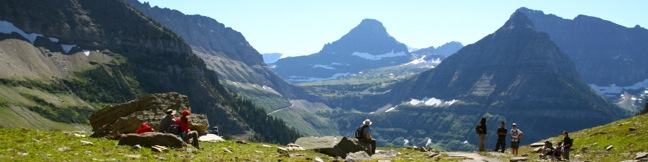
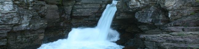
Charmlee Wilderness Park is perched on a bluff overlooking Malibu's alluring coast. Operated by the Mountains Recreation and Conservation Authority (previously the city of Malibu), this 590-acre park has eight miles of interwoven trails, making it easy to build your own hike between two to four miles, easy to moderate. In spring, Charmlee puts on a champion's display of wildflowers. The... Read more.
By: Published: Last updated: May 21, 2024
Johnson Ranch Open Space loop hike San Luis Obispo trail Johnson Ranch Trail
Johnson Ranch Open Space preserves 242 acres of old ranch land just south of San Luis Obispo. The 3.7-mile Johnson Ranch Loop explores the municipal open space, which is dominated by rolling grassy hills accented by serpentine rocks. A shortcut can be used to trim the hike to 2.5 miles. There is 200 feet of total elevation between the high and low points of the hike, a distance that is... Read more.
OK! Add to trails I’ve hiked
OK! Add to trails I want to hike
Tagged with · Free Trails
Distance: 3.7 miles · Elevation change: 200 feet
By: Published: Last updated: April 2, 2019
Dune Trail Montaña de Oro State Park Hazard Canyon Reef hike tide pools trail Los Osos California San Luis Obispo
For a quick one-mile jaunt in Montaña de Oro State Park, hike down Dune Trail to Hazard Canyon Reef. At the bottom of this oceanfront ravine is a rocky shoreline graced with engaging tide pools. Explore up or down the coast to extend your stay, or settle in for a picnic on the sandy beach. The postcard views of Morro Rock are a good reason to stick around. The trail begins from Hazard... Read more.
By: Published: Last updated: May 11, 2017
Los Osos Oaks California State Natural Reserve hike San Luis Obispo
The 90-acre Los Osos Oaks State Natural Reserve protects a pocket of 800-year-old oaks near San Luis Obispo, California. Los Osos Creek Trail, Chumash Trail, and Oak View Trail loop through the park presenting easy hikes between 0.75 and 1.5 miles. The trails pass beneath (and sometimes between) the gangly branches of pygmy oaks, offering quiet hikes through a shady grove. A bridge into... Read more.
OK! Add to trails I’ve hiked
OK! Add to trails I want to hike
Tagged with · California State Parks · Free Trails · Los Osos
Distance: 1.5 miles · Elevation change: 25 feet
By: Published: Last updated: October 8, 2024
Escondido Falls hiking trail in Malibu Winding Way directions photos pictures and map Escondido Canyon Waterfall
When Escondido Falls is flowing strong, it is flat out one of the finest waterfalls around Los Angeles. The waterfall has an easy-to-reach lower tier that is 50 feet tall and a hard-to-reach upper tier that's 150 feet tall and stunning in optimum conditions. The 3.5 mile round trip hike to Lower Escondido Falls begins just off Pacific Coast Highway and begins by traveling uphill for 0.75... Read more.
By: Published: Last updated: May 21, 2024
Crypt Lake Trail Waterton Lakes National Park hike Alberta Canada Waterton-Glacier International Peace Park
Crypt Lake Trail is consistently ranked as one of the top hiking trails in the Canada Rockies. To reach the trailhead, you must first take a 15-minute ferry across Upper Waterton Lake. From there it is a 10.8-mile round trip hike to a sparkling turquoise lake cradled by horseshoe-shaped cliffs. You'll gain 2,300 feet along the way, passing waterfalls, crawling through a tunnel, and clinging... Read more.
OK! Add to trails I’ve hiked
OK! Add to trails I want to hike
Tagged with · Lakes · National Parks · Waterfalls
Distance: 10.8 miles · Elevation change: 2300 feet
By: Published: Last updated: February 26, 2024
Garden Wall Trail Grinnell Glacier Overlook Highline Trail hike Glacier National Park Montana Granite Park Chalet Continental Divide
Picture yourself standing on the Continental Divide overlooking a crackling glacier that feeds a string of sparkling turquoise lakes. That is only part of the panorama you'll enjoy from Glacier Overlook, a no-nonsense notch on a section of the Continental Divide in Glacier National Park named the Garden Wall. Approached from the west, Glacier Overlook offers a window looking east over a... Read more.
OK! Add to trails I’ve hiked
OK! Add to trails I want to hike
Tagged with · Continental Divide · National Parks
Distance: 2 miles · Elevation change: 1000 feet
By: Published: Last updated: January 9, 2018
Highline Trail Glacier National Park Montana hike Logan Pass Garden Wall the loop
Rarely does a trail deliver as many breathtaking views as Highline Trail in Glacier National Park. This is one of the most incredible day hikes in Glacier (and therefore anywhere on the planet). Highline Trail begins on the Continental Divide, delivering lofty views right from the start. Things are pretty level for the first three miles, making it easy for less ambitious hikers to still... Read more.
OK! Add to trails I’ve hiked
OK! Add to trails I want to hike
Tagged with · Continental Divide · Going-to-the-Sun Road · National Parks
Distance: 13.5 miles · Elevation change: 3400 feet
By: Published: Last updated: January 10, 2018
Grinnell Lake Trail Many Glacier Hotel Lake Josephine Swiftcurrent Lake hike Glacier National Park Montana
Grinnell Lake Trail offers a level hike along a string of glacier-fed lakes. The trail departs from Many Glacier Hotel on the northeast side of Glacier National Park. There are trails along opposite sides of two beautiful subalpine lakes preceding Grinnell Lake, as well as a short spur to a waterfall, that give hikers a few options. Also, a ferry service that transports guests from Many... Read more.
OK! Add to trails I’ve hiked
OK! Add to trails I want to hike
Tagged with · Lakes · National Parks · Waterfalls
Distance: 7.5 miles · Elevation change: 300 feet
By: Published: Last updated: April 27, 2017
Saint Mary Falls Trail Glacier National Park Montana hike Virginia Falls Saint Mary Lake cascades St. Mary Falls Waterfall
This 3-mile hike on the east side of Glacier National Park presents intimate views of two waterfalls on creeks flowing into Saint Mary Lake. Before the Mississippi-bound water from the Continental Divide reaches the grand lake, it spills over Saint Mary Falls and Virginia Falls, two easy-to-reach gushers that can be picked up as a pair. The trail descends 200 feet to Saint Mary Falls and... Read more.
OK! Add to trails I’ve hiked
OK! Add to trails I want to hike
Tagged with · Going-to-the-Sun Road · National Parks · Waterfalls
Distance: 3 miles · Elevation change: 250 feet
By: Published: Last updated: January 10, 2018