Little Sycamore Canyon Trail - Serrano Ridge Trail Fire Road - Camarillo Canyon Road - Stagecoach South Trail Loop hike in Laguna Coast Wilderness Park Orange County California
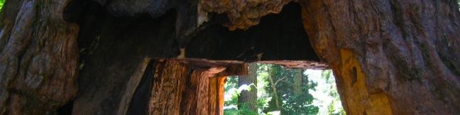
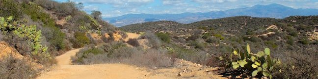
This five-mile loop combines four trails to visit two canyons in the mountains between Laguna Beach and Irvine. Little Sycamore Canyon is framed by a big wall of pocketed sandstone that makes it an interesting destination. The high end of the hike along Serrano Ridge Trail offers broad inland views toward the Santa Ana Mountains. Hiking the loop over Little Sycamore Canyon Trail, Serrano... Read more.
By: Published: Last updated: October 8, 2024
Garcia Trail to Azusa Peak A sign Glendora Ridge Motorway Glendora Peak hike San Gabriel Mountains
In Griffith Park, Mount Lee has the Hollywood Sign. In the San Gabriel Mountains, Azusa Peak has the A. The big white uppercase A just below the summit is hard to miss from the city below. You can hike to the A and up to the top of Azusa Peak on a 2 2/3-mile out and back hike with 1,275 feet of elevation change. After the steep climb, you have the option to hike to a second peak, Glendora... Read more.
OK! Add to trails I’ve hiked
OK! Add to trails I want to hike
Tagged with · Azusa · Free Trails · Summits · Dog-Friendly Trails · Mountain Biking Trails · San Gabriel Mountains
Distance: 4.66 miles · Elevation change: 1800 feet
By: Published: Last updated: January 9, 2018
Placerita Canyon Nature Center hike Ecology Trail Newhall
Placerita Canyon Natural Area is an interesting park on the west end of the San Gabriel Mountains near Newhall Pass. Gold was discovered in Placerita Canyon in 1842, and a century later the canyon rushed onto the silver screen as a backdrop for westerns. Today, the park is home to the Placerita Canyon Nature Center where you can learn about local plants and animals. Tucked behind the... Read more.
By: Published: Last updated: March 12, 2021
Placerita Canyon hike Waterfall Trail seasonal falls Newhall Los Pinetos Creek Waterfall trek Los Pinetos Canyon Falls
Located on the west end of the San Gabriel Mountains, Placerita Canyon Natural Area (also know as Placerita Canyon State Park) is an interesting park that has something for everyone. There are easy canyon trails and tougher backcountry tracks, along with a nature center and an Ecology Trail that offers an easy loop for those interested in local plants. The park has history too. Gold was... Read more.
By: Published: Last updated: December 7, 2018
Towne Trail Big Bear Lake San Bernardino Mountains California hike
If you travel to Big Bear Lake in the San Bernardino Mountains, there's a good chance you like the outdoors. Those looking for a short hike that's quick to access from town should set out on Towne Trail. This 2 2/3-mile round trip hike ascends 200 feet on a gradual rolling course along the base of the mountains on the south side of Big Bear Lake. Discover periodic views north over the lake... Read more.
By: Published: Last updated: May 19, 2024
Carpinteria Salt Marsh Nature Park estuary hike
Since so much of the coastline of Southern California has been developed upon, it comes as a relief to find a 230-acre estuary that has been set aside and preserved as a vital ecosystem for shorebirds. Carpinteria Salt Marsh Nature Park offers a level 1.2-mile round trip hike through part of El Estuaro past several observation areas and benches. While this might not appear to be the most... Read more.
OK! Add to trails I’ve hiked
OK! Add to trails I want to hike
Tagged with · Carpinteria · Carpinteria Salt Marsh Nature Park · Free Trails · Nature Trails
Distance: 1.2 miles · Elevation change: 10 feet
By: Published: Last updated: February 12, 2018
Caballero Canyon Trail Santa Monica Mountains hike Reseda Los Angeles California Topanga State Park Marvin Braude Mulholland Gateway Park
Located on the north side of the Santa Monica Mountains in Tarzana, Caballero Canyon Trail is a straightforward dirt single track that ascends 625 feet over 1.7 miles to an unpaved section of Mulholland Drive. Caballero Canyon Trail makes a satisfying 3.4-mile round trip hike (or ride if you take your mountain bike), and extensions are available to places like San Vicente Mountain. If you... Read more.
By: Published: Last updated: January 17, 2018
Dragoon Gulch Trail Sonora California Sierra Foothills hike
Dragoon Gulch Trail is the primary trail in the city of Sonora in the foothills of the Sierra Nevada Mountain. The loop is made up of five short sections, which combine to form a 2.5-mile loop with 325 feet of elevation gain. If you prefer to avoid hiking on pavement, the loop can be reduced to 1.5 miles, without sacrificing the trail's most enjoyable areas. The city of Sonora, nicknamed... Read more.
OK! Add to trails I’ve hiked
OK! Add to trails I want to hike
Tagged with · Creeks · Free Trails · Sonora
Distance: 2.5 miles · Elevation change: 325 feet
By: Published: Last updated: July 26, 2023
Calaveras Big Trees State Park hike North Grove Big Trees Trail Arnold California giant sequoias
Ever wonder what happened when settlers first set eyes on giant sequoia trees? Relive the excitement of that discovery and see the enormous trees for yourself at Calaveras Big Tree State Park. The 10-square mile park has two groves of sequoias, two campgrounds, picnic areas, and a number of hiking trails. You could easily spend a couple days exploring the park, but if you only have one... Read more.
By: Published: Last updated: January 8, 2019
Upper Natural Bridge Trail Coyote Creek Natural Bridges of Calaveras County swimming hole tunnel hike Vallecito California
The Sierra Nevada Mountains hold many wonders. Some are famous worldwide, like the silken waterfalls in Yosemite National Park and the giant trees in Sequoia National Park. Others, like the Natural Bridges in Calaveras County, are only famous with locals. These no-less-amazing limestone tunnels make a charming destination for a short hike in the Sierra foothills (and an enthralling summer... Read more.
OK! Add to trails I’ve hiked
OK! Add to trails I want to hike
Tagged with · Creeks · Free Trails · Natural Bridges
Distance: 2 miles · Elevation change: 300 feet
By: Published: Last updated: January 9, 2018