Castle Dome hike Crags Trail Indian Springs Castle Crags State Park Castle Crags Wilderness
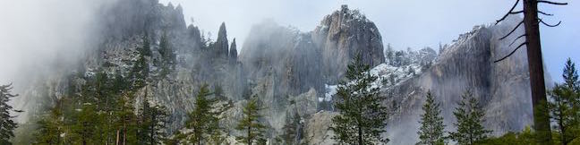
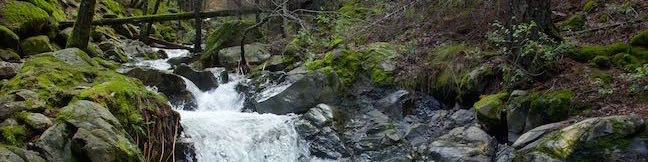
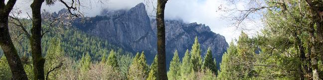
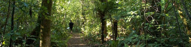
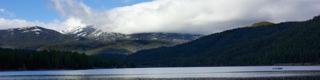
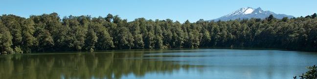
Spectacular granite peaks known as the Castle Crags tower over Castle Crags State Park in Northern California. This dramatic enclave of peaks is largely inaccessible to hikers, but you'll get a great taste of the Castle Crags on Crags Trail, which climbs to the foot of Castle Dome, a 4,996-foot granite dome that looks plucked from the Sierra. Although Crags Trail stops below the summit of... Read more.
By: Published: Last updated: April 23, 2017
Root Creek Trail Castle Crags State Park hike Northern California
Root Creek Trail presents an easy 2.2-mile round trip hike, starting in Castle Crags State Park. Most of the trail is wheelchair-friendly, until it passes into Castle Crags Wilderness in Shasta-Trinity National Forest where the trail gets just a bit less maintained on the final push to Root Creek. When you reach the creek, you can relax and watch tumbling water cascade past mossy boulders... Read more.
By: Published: Last updated: April 23, 2017
Vista Point Trail Castle Crags State Park Scenic Overlook hike Northern California
A popular destination for visitors to Castle Crags State Park is the scenic overlook at the end of Vista Point Trail. This easy half-mile round trip hike leads to a triptych of views. On your left, you'll spot the Gray Rocks rising above evergreen ridges. On your right, there is a clear view of Mount Shasta. In the center, rise the Castle Crags, a fortress of daunting granite peaks. It's... Read more.
OK! Add to trails I’ve hiked
OK! Add to trails I want to hike
Tagged with · California State Parks · Castle Crags State Park · Wheelchair-Friendly
Distance: 0.5 miles · Elevation change: 50 feet
By: Published: Last updated: April 23, 2017
Rimu Walk Mangawhero Forest Tongariro National Park Hike Ohakune New Zealand
Not all trails in Tongariro National Park cross dramatic volcanic landscapes. At the south end of Tongariro National Park near the town of Ohakune, you'll find a short nature trail through a dense forest, typical of those found throughout New Zealand. Panels along the 0.8-kilometer walk describe the trees and other plants in the area. There are no big views or volcanic features along Rimu... Read more.
By: Published: Last updated: May 6, 2017
Spring Hill Trail Rocky Point Loop Spring Hill Hike Mount Shasta City California
The Mount Shasta Area is full of daunting mountain peaks (not the least of which is Mount Shasta) but that doesn't mean you can't find a shorter summit hike with rewarding views. Spring Hill Trail is located conveniently close to Mount Shasta City and while this hike is just 2.9 miles round trip with 625 feet of elevation gain, you'll get an eyeful off the beautiful surroundings, including... Read more.
OK! Add to trails I’ve hiked
OK! Add to trails I want to hike
Tagged with · Free Trails · Mount Shasta · Summits
Distance: 2.9 miles · Elevation change: 625 feet
By: Published: Last updated: February 4, 2019
Lake Siskiyou Trail South Shore Loop Hike Alternate South Shore Trail Lake Siskiyou Hike Mount Shasta City California
For a short, pleasant stroll, what could be better than a level, lakefront loop through evergreens? Set out for Lake Siskiyou, a reservoir southeast of Mount Shasta. From the edge of the lake's calm blue waters are clear views of massive Mount Shasta and the surrounding mountains. If you're feeling ambitious, you can hike all of Lake Siskiyou Trail on an over 7-mile loop around the lake. ... Read more.
OK! Add to trails I’ve hiked
OK! Add to trails I want to hike
Tagged with · Free Trails · Lakes
Distance: 1.1 miles · Elevation change: 50 feet
By: Published: Last updated: February 4, 2019
Faery Falls hike Ney Springs Resort Ruins Ney Springs Creek Trail Ney Springs Canyon Trail Ney Springs Road Hike Fairy Falls Waterfall Mount Shasta City California
Want to visit historic ruins and a waterfall you'll be wild about, all on a hike that's under 1.5 miles round trip? Set out for Ney Springs Creek near Mount Shasta City, where you can hike 0.7-miles (one way) up an evergreen canyon to Faery Falls, which plunges about 50 feet. Along the way to this beautiful attraction, you'll pass what remains of Ney Springs Resort, a former destination for... Read more.
OK! Add to trails I’ve hiked
OK! Add to trails I want to hike
Tagged with · Free Trails · Mount Shasta · Waterfalls
Distance: 1.4 miles · Elevation change: 250 feet
By: Published: Last updated: May 19, 2024
Portuguese Bend Reserve Burma Road hike Palos Verdes Peninsula Los Angeles
Portuguese Bend Reserve is a 399-acre park on Palos Verdes Peninsula with an elaborate network of trails covering beautiful ocean-facing hillsides, canyons, and ridges. With so many trails, several hikes in the park are possible, including the 5.15-mile trek described here, made up of two loops. For something shorter, skip the lower loop for a 3-mile round trip hike with 575 feet of... Read more.
OK! Add to trails I’ve hiked
OK! Add to trails I want to hike
Tagged with · Free Trails · Ocean Views · Rancho Palos Verdes · Dog-Friendly Trails · Palos Verdes Peninsula
Distance: 5.15 miles · Elevation change: 975 feet
By: Published: Last updated: January 24, 2018
Tawhai Falls Walking Track Tongariro National Park Whakapapa Village Waterfall New Zealand
Tawhai Falls is a lovely little waterfall in Tongariro National Park. The short single-drop waterfall along the tree-lined Whakapapanui Stream is located near Whakapapa Village, home of the park's main visitor center and campground, making it a convenient and enjoyable addition to your Tongariro itinerary. The 20-minute walk to the falls is 0.8 kilometers (0.5 miles) round trip with 40... Read more.
OK! Add to trails I’ve hiked
OK! Add to trails I want to hike
Tagged with · Free Trails · New Zealand Department of Conservation · New Zealand National Parks · Waterfalls · Whakapapa Village · Tongairo National Park
Distance: 0.8 kilometers / 0.5 miles · Elevation change: 40 meters / 130 feet
By: Published: Last updated: May 6, 2017
Lake Rotokura Walking Track Ohakune New Zealand Mount Ruapehu reflected in Lake Rotokura Ecological Reserve
When the water is still, Lake Rotokura acts like a mirror to Mount Ruapehu, delivering a great postcard view. A relatively easy 2-kilometer (1.25-mile) walk crosses through Lake Rotokura Ecological Reserve, located east of the town of Ohakune, just outside the boundaries of Tongariro National Park. This is a peaceful short walk, leading to a setting that's quite beautiful in clear... Read more.
OK! Add to trails I’ve hiked
OK! Add to trails I want to hike
Tagged with · Free Trails · Lakes · New Zealand Department of Conservation · Ohakune
Distance: 2 kilometers / 1.25 miles · Elevation change: 75 meters / 250 feet
By: Published: Last updated: May 6, 2017