Spa Thermal Park Huka Falls Walkway Taupo New Zealand Waikato River Otumuheke Stream Huka Rapids Waterfall Huka Falls Hike Huka Falls Trail
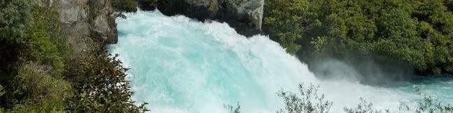
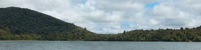
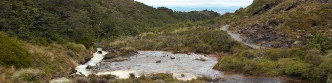
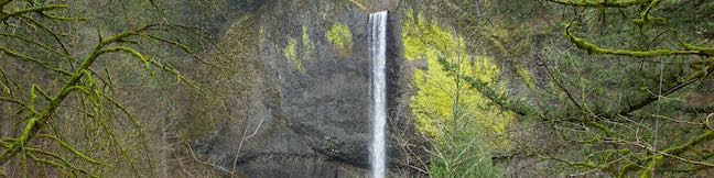
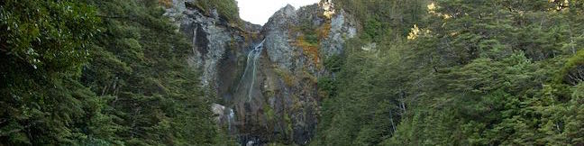
Above Huka Falls, the Waikato River presses through a ravine of sheer rock cliffs, creating a churning canal of rapids. At the end of this ravine, the water surges out as Huka Falls, where it makes a powerful push into the river below. To see the waterfall and the ravine, visitors can simply walk 200 meters from a car park by Huka Falls. To add a walk along Waikato River to the itinerary,... Read more.
OK! Add to trails I’ve hiked
OK! Add to trails I want to hike
Tagged with · Free Trails · Hot Springs · New Zealand Department of Conservation · Taupo · Waterfalls
Distance: 7.3 kilometers / 4.5 miles · Elevation change: 45 meters / 150 feet
By: Published: Last updated: May 3, 2017
Lake Rotopounamu Track Tongariro National Park Greenstone Lake Hike Lake Rotopounamu Walk Turangi New Zealand
With scenery that is more verdant than the volcanic landscapes at the center of Tongariro National Park, Lake Rotopounamu Track provides a peaceful walk to a small, forest-cradled lake with inviting beaches. Lake Rotopounamu, which is also know as Greenstone Lake, covers one square kilometer. Lake Rotopounamu Loop Track circles the lake for a hike that's 6.4 kilometers (4 miles) round trip... Read more.
OK! Add to trails I’ve hiked
OK! Add to trails I want to hike
Tagged with · Free Trails · Lakes · Nature Trails · New Zealand Department of Conservation · New Zealand National Parks · Rainforests · Turangi · Tongairo National Park
Distance: 6.4 kilometers / 4 miles · Elevation change: 90 meters / 295 feet
By: Published: Last updated: May 6, 2017
Silica Rapids Track Whakapapa Village Silica Rapids Track Tongariro National Park Cascades hike Silica terraces New Zealand
Silica Rapids Track explores improbable landscapes in Tongariro National Park, where cream-colored streams cascades over terraces of silica. The 5.15-kilometer (3.2-mile) long track starts from Whakapapa Village and ends two kilometers farther up Bruce Road, allowing it to be explored as a point-to-point hike with the assistance of a vehicle or a 7.15-kilometer (4.45-mile) loop without one. ... Read more.
OK! Add to trails I’ve hiked
OK! Add to trails I want to hike
Tagged with · Free Trails · New Zealand Department of Conservation · New Zealand National Parks · Whakapapa Village · Tongairo National Park
Distance: 5.15 kilometers / 3.2 miles · Elevation change: 190 meters / 625 feet
By: Published: Last updated: September 10, 2019
Taranaki Falls Track Loop Hike Tongariro National Park Waterfall Walk New Zealand
Taranaki Falls Track is an impressive 6.45-kilometer (4-mile) loop starting from Whakapapa Village in Tongariro National Park. The track crosses alpine grasslands, beech forests, and other landscapes shaped by incredible nearby volcanoes. Around the midpoint of the loop, the track reaches Taranaki Falls, which plunges nearly twenty meters (65 feet) from volcanic cliffs into a pleasant pool.... Read more.
OK! Add to trails I’ve hiked
OK! Add to trails I want to hike
Tagged with · Free Trails · New Zealand Department of Conservation · New Zealand National Parks · Volcanoes · Waterfalls · Whakapapa Village · Tongairo National Park
Distance: 6.45 kilometers / 4 miles · Elevation change: 115 meters / 375 feet
By: Published: Last updated: January 24, 2018
Spencer Butte Hike Eugene Oregon Ridgeline Trail Spencer Butte Summit
Spencer Butte rises high above the south end of the Willamette Valley near Eugene, Oregon. A 5.2-mile round trip hike to the mountaintop crosses through a lush forest covered in ferns and ascends to a nearly treeless 2,060-foot summit where there are round-the-compass views over Lane County's bucolic valleys and evergreen-covered hills. The woodland walk at the start is pleasant enough to... Read more.
OK! Add to trails I’ve hiked
OK! Add to trails I want to hike
Tagged with · Buttes · Eugene · Summits
Distance: 5.2 miles · Elevation change: 1100 feet
By: Published: Last updated: June 14, 2021
Latourell Falls Trail Waterfall hike Columbia River Gorge Talbot State Park Oregon Lower Latourell Falls loop trail to Upper Latourell Falls
Latourell Falls is a stunning waterfalls tumbling into the Columbia River Gorge east of Portland. More precisely, there are two waterfalls on Latourell Creek totaling 359 feet of falls. Lower Latourell Falls is a beautiful 225-foot single drop waterfall that can be seen right from the trailhead along Historic Columbia River Highway. Farther up the canyon is Upper Latourell Falls, which is... Read more.
OK! Add to trails I’ve hiked
OK! Add to trails I want to hike
Tagged with · Cascade Range · Free Trails · Guy W. Talbot State Park · Oregon State Parks · Waterfalls
Distance: 2.3 miles · Elevation change: 475 feet
By: Published: Last updated: January 9, 2018
Cuesta Ridge Botanical Area hike West Cuesta Ridge Road San Luis Obispo Los Padres National Forest Cuesta Ridge Trail
Discover a tucked-away oasis of Sargent cypress straddling a ridge in the Santa Lucia Mountains north of San Luis Obispo. The evergreens are accompanied by coastal views that could have you imagining you're somewhere farther north in California. The hike to Cuesta Ridge Botanical Special Interest Area is 6 miles round trip up a partially paved road with 950 feet of elevation change. A... Read more.
By: Published: Last updated: September 26, 2019
Inspiration Point Tunnel Road Hike Tunnel Trail Jesusita Trail Inspiration Viewpoint Santa Barbara California Santa Ynez Mountains Mission Canyon
Located in the Santa Ynez Mountains, 1,800-feet above the Santa Barbara Coast, Inspiration Point attracts hikers with panoramic views over city and sea. Two routes lead to this picturesque perch. If you want to make a day of it, you can approach the viewpoint from the west on a moderate 7.55-mile round trip trek up Jesusita Trail to Inspiration Point from San Roque Road. For something less... Read more.
OK! Add to trails I’ve hiked
OK! Add to trails I want to hike
Tagged with · Free Trails · Ocean Views · Santa Ynez Mountains
Distance: 3.75 miles · Elevation change: 825 feet
By: Published: Last updated: February 12, 2018
La Tuna Canyon Trail Verdugo Mountains hike La Tuna Canyon Park hike Los Angeles California
La Tuna Canyon Trail explores a pair of canyon on the northwest side of the Verdugo Mountains between Burbank and Sunland. There are views north toward the San Gabriels and west toward the San Fernando Valley from this dirt trail as it ascends 975 feet over 2.25 miles on a winding route through the 1,100 acres of La Tuna Canyon Park. At the top, there is a bench offering relaxing views and... Read more.
OK! Add to trails I’ve hiked
OK! Add to trails I want to hike
Tagged with · Free Trails · Sun Valley · Dog-Friendly Trails · Mountain Biking Trails · Verdugo Mountains
Distance: 4.5 miles · Elevation change: 975 feet
By: Published: Last updated: December 7, 2018
Waitonga Falls Track Tongariro National Park Waterfall Walk Ohakune Hike Mount Ruapehu New Zealand
It's pretty obvious that Waitonga Falls Track goes to a waterfall, which is actually the tallest waterfall in Tongariro National Park. The track's other offerings may surprise you though, like a boardwalk across alpine wetlands with pools that hold a mirror to Mount Ruapehu, the biggest volcano in New Zealand. Indeed, you'll get big enjoyment from this 4-kilometer (2.5-mile) round trip trek... Read more.
OK! Add to trails I’ve hiked
OK! Add to trails I want to hike
Tagged with · Free Trails · New Zealand Department of Conservation · New Zealand National Parks · Ohakune · Volcanoes · Waterfalls · Tongairo National Park
Distance: 4 kilometers / 2.5 miles · Elevation change: 110 meters / 360 feet
By: Published: Last updated: May 6, 2017