
Yellowstone National Park has 12 developed campgrounds with over 2,000 available campsites during the peak summer season. Reservations are accepted at several of the park’s campgrounds, Bridge Bay Campground, Canyon Campground, Fishing Bridge RV Campground, Grant Campground, and Madison Campground. These campgrounds are operated by a private company, Xanterra Parks and Resorts. Reservations at these campgrounds may be made online, or by calling 866-GEYSERLAND (866-439-7375). For last minute reservations, call 307-344-7901. All other campgrounds in Yellowstone are operated by the national park service and are first-come first-serve. Campgrounds frequently fill, so secure a first-come first-serve site early in the day.
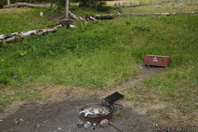
During summer months, camping stays are limited to a maximum of 14 days with up to six people per site. Wood and charcoal fires are permitted at all campgrounds except Fishing Bridge RV Campground (additional seasonal fire restrictions may occur). Collecting firewood is permitted. All food, utensils, and anything that might attract bears and other wildlife must be kept inside a vehicle or a bear storage locker when not in use. Dispose of trash responsibly and do not burn waste in fire rings.
Visit the official Camping in Yellowstone page for more information.
Campgrounds in Yellowstone National Park
Mammoth Campground | 85 sites | open year-round | first-come first-serve | $14 per night | potable water, picnic tables, fire rings, and flush toilets | elevation 6,200 feet
Madison Campground | 278 sites | open early May to late October | reservations accepted | $20 per night | potable water, picnic tables, fire rings, a dump station, and flush toilets | elevation 6,800 feet
Fishing Bridge RV Campground | 325 sites | open mid May to late September | reservations accepted | no tents | $45 per night | potable water, picnic tables, a dump station, pay showers, laundry, and flush toilets | elevation 7,800 feet
Norris Campground | 100 sites | open late May to late September | first-come first-serve | $14 per night | potable water, picnic tables, fire rings, and flush toilets | elevation 7,500 feet
Tower Fall Campground | 32 sites | open late May to late September | first-come first-serve | $12 per night | potable water, picnic tables, fire rings, and vault toilets | elevation 6,600 feet
Bridge Bay Campground | 432 sites | open late May to mid September | reservations accepted | $20 per night | potable water, picnic tables, fire rings, a dump station, a boat dock, and flush toilets | elevation 7,800 feet
Slough Creek Campground | 23 sites | open late May to late December | first-come first-serve | $12 per night | potable water, picnic tables, fire rings, and vault toilets | elevation 6,250 feet
Canyon Campground | 273 sites | open early June to early September | reservations accepted | $25 per night | potable water, picnic tables, fire rings, a dump station, pay showers, laundry, and flush toilets | elevation 7,900 feet
Pebble Creek Campground | 27 sites | open mid June to late September | first-come first-serve | $12 per night | potable water, picnic tables, fire rings, and vault toilets | elevation 6,900 feet
Indian Creek Campground | 75 sites | open mid June to mid September | first-come first-serve | $12 per night | potable water, picnic tables, fire rings, and vault toilets | elevation 7,300 feet
Lewis Lake Campground | 85 sites | open mid June to early November | first-come first-serve | $12 per night | potable water, picnic tables, fire rings, a boat dock, and vault toilets | elevation 7,800 feet
Grant Village Campground | 430 sites | open late June to late September | reservations accepted | $25 per night | potable water, picnic tables, fire rings, a dump station, pay showers, laundry, a boat dock, and flush toilets | elevation 7,800 feet
Hikes in Yellowstone National Park
| Trail | Description | Distance | Location |
|---|---|---|---|
 100 100 | Pebble Creek This 12-mile long trail travels down a beautiful backcountry meadow between Montana and Wyoming, bringing through hikers to a second trailhead (shorter out and back hikes are also possible without a car shuttle). | 5 - 12 miles +950 feet -1375 feet | 45.005477, -110.03437 |
 120 120 | Boiling River This out and back hike follows a riverbank to an only-in-Yellowstone hot springs where a stream of water cooked by nearby hydrothermal features mixes with the river. | 1.25 miles 50 feet | 44.9923, -110.69121 |
 130 130 | Mammoth Hot Springs This series of boardwalks explores a park highlight, a collection of colorful hot springs terraces. | 1.75 miles 300 feet | 44.968472, -110.707605 |
 140 140 | Wraith Falls This short easy hike crosses a meadow to a viewpoint of a ghostly 100-foot cascade. | 0.8 miles 100 feet | 44.942445, -110.6236 |
 150 150 | Calcite Springs Overlook This short loop overlooks a dramatic section of the Yellowstone River lined by bleached cliffs and steam venting hydrothermal springs. | 0.25 miles 25 feet | 44.901788, -110.393053 |
 160 160 | Tower Fall This out and back hike starts with a direct view of a 132-foot waterfall. Unfortunately, the final leg of the trail to the base of Tower Fall is closed due to damage from rock and mud slides. | 1 miles 225 feet | 44.891908, -110.38711 |
 170 170 | Porcelain Basin of Norris Geyser Basin This pair of loops explores a stark basin with an impressive collection of hot springs and geysers like Ledge Geyser. | 0.5 - 1.1 miles 100 feet | 44.726133, -110.7020 |
 170 170 | Back Basin of Norris Geyser Basin This loop passes Steamboat Spring, the world's largest geyser, and several other hydrothermal features. | 1 - 1.75 miles 100 feet | 44.726133, -110.7020 |
 200 200 | North Rim Trail on the Grand Canyon of the Yellowstone This trail follows the north wall of the canyon past several exceptional views between Inspiration Point and the Brink of the Upper Falls. | 3.3 - 7.6 miles 250 feet | 44.72504, -110.46988 |
 210 210 | Inspiration Point on the Grand Canyon of the Yellowstone This jutting point is one of the premier vistas along the Grand Canyon of the Yellowstone River, reachable at the bottom of a flight of stairs from a parking area at the east end of North Rim Trail. | 0.10 miles 50 feet | 44.72504, -110.46988 |
 220 220 | Lookout Point on the Grand Canyon of the Yellowstone This short spur off North Rim Trail (which you can also drive right up to) achieves an impressive view of Lower Falls in the Grand Canyon of the Yellowstone River. | 0.15 miles 25 feet | 44.72152, -110.48788 |
 230 230 | Artist Point on the Grand Canyon of the Yellowstone This viewpoint delivers one of the most photographed views in Yellowstone, a memorable perspective of the 308-foot Lower Falls. | 0.2 miles 50 feet | 44.720183, -110.479766 |
 240 240 | Point Sublime on the Grand Canyon of the Yellowstone This hike explores the south rim of the Grand Canyon of the Yellowstone River, passing Artist Point toward more excellent views. | 3 miles 250 feet | 44.720183, -110.479766 |
 250 250 | Uncle Tom's Trail on the Grand Canyon of the Yellowstone This hike descends a steel staircase clinging to the south wall of the canyon to a viewing platform with spectacular views of Lower Falls. | 0.7 miles 500 feet | 44.71522, -110.4962 |
 260 260 | Brink of the Upper Falls on the Grand Canyon of the Yellowstone This short trail extending from North Rim Trail reaches a daunting overlook atop the 109-foot waterfall at the start of the Grand Canyon of the Yellowstone River. | 0.25 miles 75 feet | 44.71457, -110.5007 |
 300 300 | Artists' Paintpots This hike circles a hillside hydrothermal area, passing bursting mudpots, bubbling hot springs, and mesmerizing milky blue pools. | 1.1 miles 125 feet | 44.696237, -110.741095 |
 310 310 | Monument Geyser Basin This out and back hike reaches a rarely visited hydrothermal area that is boardwalk-free and fun to explore. | 2.8 miles 700 feet | 44.683667, -110.74452 |
 320 320 | Mud Volcano Area This boardwalk visits a collection of sulfur-scented muddy springs atop a resurgent dome in the magma chamber of the Yellowstone Caldera. | 0.2 - 0.85 miles 25 - 100 feet | 44.6249, -110.4336 |
 340 340 | Fountain Paint Pot This easy loop in Lower Geyser Basin passes geysers, hot springs, mudpots, and fumaroles - all of the hydrothermal features found in Yellowstone. | 0.5 miles 50 feet | 44.548546, -110.807223 |
 350 350 | Midway Geyser Basin This walkway passes Excelsior Geyser and Grand Prismatic Spring, the largest hot springs in Yellowstone. | 0.8 miles 75 feet | 44.528424, -110.836253 |
 360 360 | Biscuit Basin This loop explores hydrothermal features in Upper Geyser Basin like Black Opal Pool, Sapphire Pool, and Black Pearl Geyser. | 0.65 miles 50 feet | 44.48505, -110.85255 |
 400 400 | Old Faithful Geyser The tall, frequent eruptions of Yellowstone's most famous geyser have been dazzling visitors for over a century and are easy to witness today. | 0 - 2 miles 0 - 250 feet | 44.46041, -110.828213 |
 500 500 | West Thumb Geyser Basin This easy loop explores a hydrothermal area on the shore of Yellowstone Lake. | 0.65 miles 25 feet | 44.415605, -110.57362 |
 600 600 | Riddle Lake This level out and back hike crosses the Continental Divide to a backcountry lake with a small beach. | 5 miles 100 feet | 44.358408, -110.582163 |
Are there any trails you would recommend where we could hike in, stay a night, and hike out. Hike should be pretty easy and less than three miles. Want to give my high school kids a taste of the back country experience without burning them out. The ability to have a wood fire and possibly fish would also be nice.
Pebble Creek Trail might be a good option for you. You could start from either end of the trail and hike in to one of the backcountry campsites along the way. Enjoy Yellowstone!
What camp areas at Yellowstone or Tetons are good for tents? Don’t want to be in a parking lot.
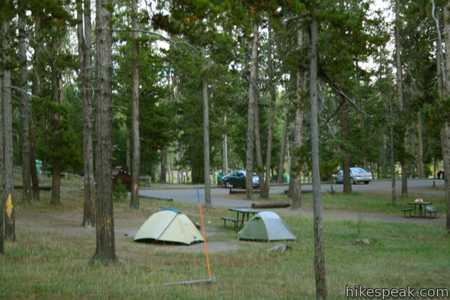
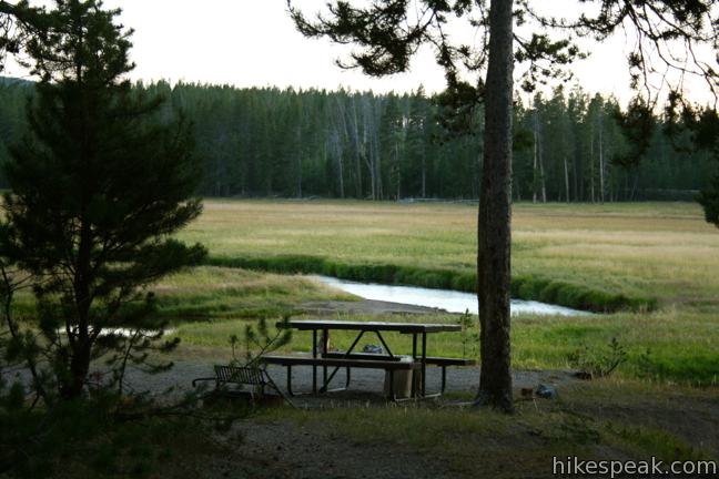
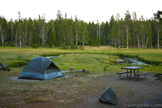
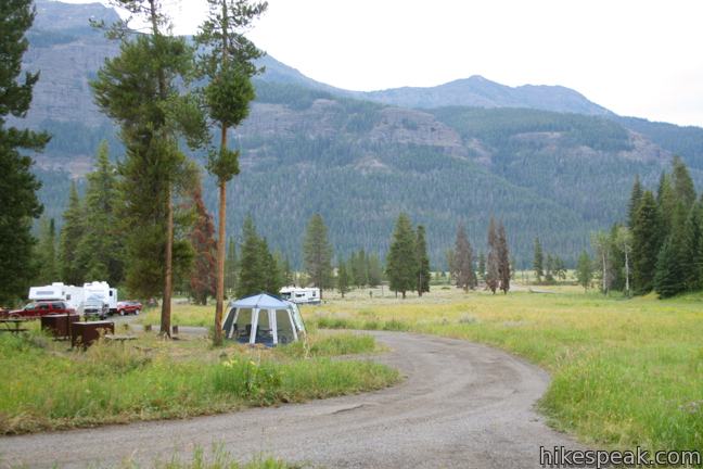
I don’t think you’d be camping on a parking lot anywhere in Yellowstone. Norris Campground is a nice big campground with sites in a few different settings ranging from forest to field.