
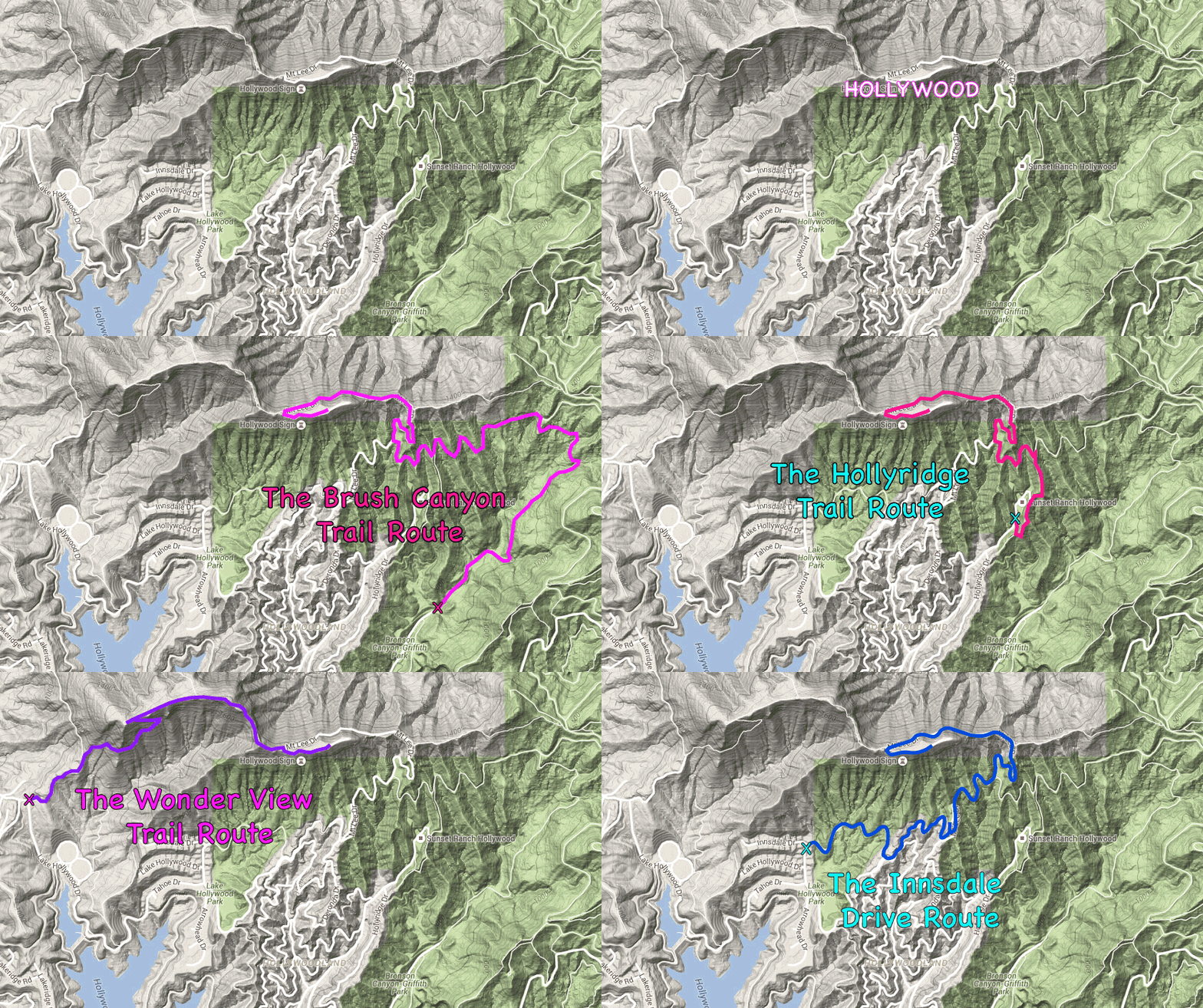
Griffith Park is full of Los Angeles landmarks like the Hollywood Sign, the Griffith Observatory, and the Greek Theater. The park includes other less-known prizes like an abandoned zoo and tropical gardens along Ferndell Trail. For those who want to hike up to the Hollywood Sign, there are four obvious routes to choose from:
Hiking to the Hollywood Sign from…
- Burbank Peak Trail – 3 miles round trip with 875 feet of elevation change
- Hollyridge Trail – 3.5 miles round trip with 750 feet of elevation change
- Innsdale Drive – 4.6 miles round trip with 750 feet of elevation change
- Brush Canyon Trail – 6.4 miles round trip with 1,050 feet of elevation change
- Griffith Observatory – 8.8 miles round trip with 575 feet of elevation change
Each route to the Hollywood Sign offers a satisfying hike into Griffith Park.
What is each trail to the Hollywood Sign like?
The shortest, most challenging route takes Burbank Peak Trail (formerly known as Wonder View Trail) and Aileen Getty Ridge Trail to the top of Cahuenga Peak and then crosses a ridge to the Hollywood Sign on Mount Lee. This can be least crowded route, but the trail is rough and packs a good workout on the way to Mount Lee.
The next shortest option, and the easiest way to the Hollywood Sign, is to start on Hollyridge Trail, which departs from the top of Beachwood Drive. Unfortunately, parking restrictions can make this outing longer than the trail length would suggest, particularly on weekends – and a recent closure has made the trailhead for Hollyridge Trail inaccessible.
While slightly longer than the Hollyridge Trail route, the hike up Innsdale Drive, Mulholland Highway, and Mount Lee Drive delivers the greatest head-on views of the Hollywood Sign.
For a good day hike, take the longest route, beginning up Brush Canyon Trail from the end of Canyon Drive. Parking here is fairly ample and adding a side trip to Bronson Cave (a.k.a the Batcave) is easy to do.
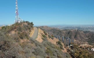
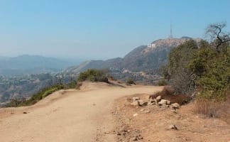
Both Hollyridge Trail and Brush Canyon Trail link up with Mulholland Fire Road, taking that trail to Mount Lee Drive to ascend to the the viewing area behind the Hollywood Sign at the top of Mount Lee. Stand at the summit and look down on the Hollywood Sign and out over the cityscape of Los Angeles.
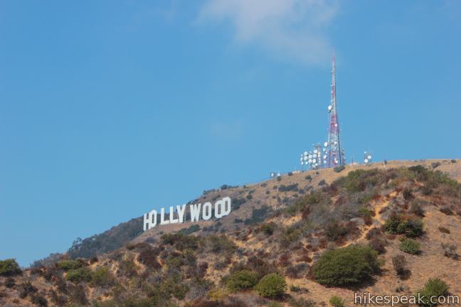
Prefer not to hike? The Los Angeles Department of Recreation and Parks sometimes offers a shuttle through the park to views of the Hollywood Sign. Griffith Observatory also offers views of the Hollywood Sign.
Looking for another route?
It is also possible to hike from Griffith Observatory to the Hollywood Sign. This route is long at 8.8 miles round trip and crosses over Mount Hollywood along the way for extra climbing. By starting at the bottom of Mount Hollywood Drive from the intersection below the Griffith Observatory, the distance can be shortened to 7 miles round trip, bypassing Mount Hollywood.
The route starting from Innsdale Drive can also be expanded to cross Cahuenga Peak and Burbank Peak, and wrap along the shore of Lake Hollywood Reservoir for an all inclusive 7.4-mile outing on Hollywood Sign – Hollywood Reservoir Loop.
The Hollywood sign isn’t the only hiking destination in Griffith Park, so check out more great Griffith Park Hikes.
What is the history of the Hollywood Sign?
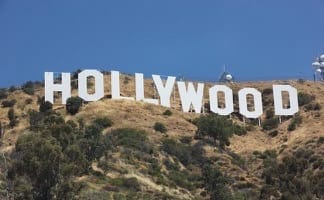
The iconic letters on Mount Lee, which number 9 today, where four letters longer when the sign was erected in 1923. Spelling Hollywoodland, the large white letters advertised a neighborhood developing below the sign along Beachwood Drive and surrounding ridges. The original letters were fifty feet tall and lit by thousands of bulbs. When the letters went up, they were intended to be temporary. However, the Hollywood Sign has endured for nearly 100 years later.
Inevitably, the letters on the sign deteriorated over the years and became an eyesore. The sign was restored in 1949, when ‘land’ was dropped from the lettering to better represent all of Hollywood. The sign needed to be revitalized again by 1979, when the current 45-foot tall letters were installed. What started as a souped-up billboard advertisement is now one of the world’s most iconic landmarks (but lacks national landmark designation).
Trail Map for Griffith Park and the Hollywood Sign
Explore trails to the Hollywood Sign and other hikes in Griffith Park on this map:

Hi,
I was hoping you could tell me approximately how long the hike takes (i’m hiking with a friend and we’re hoping to do the hike at sunrise and I have a 3:45 flight back to Chicago). Looking for thoughts as to whether this is realistic???
thank you,
Griffith Park closes from sunset to sunrise, so keep that in mind. Set aside a couple hours if you’re hiking Hollyridge Trail or Wonder View Trail and extra time if you’re trying Brush Canyon Trail.
Hello are all trails open for Hollywood sign hike? Where do we park? Heard paking can be a problem. Thank you!
All the trails are open, so check the directions for the route that interests you. Parking definitely can be limited/restricted.
**Update: The trailhead for Hollyridge Trail was closed to the public in April 2017
Can you please tell me which trails we can take strollers with us?
Brush Canyon Trail and Hollyridge Trail are wide enough for strollers. The Innsdale Drive Route is also on wide mostly-paved roads.
Also in Griffith Park, you’ll find wide trails to the Old Zoo Picnic Area, Beacon Hill, and Bronson Cave. Just outside the park, Lake Hollywood Reservoir Walking Trail is wide and level with nice views of the Hollywood Sign.
Are dogs allowed on the trails?
Yes, dogs are allowed on all trails in Griffith Park.
Dogs must be on a leash though. Park rangers can give a ticket if they aren’t.
Is 2 hours for the Hollyridge Trail or Burbank Peak Trail & Aileen Getty Ridge Trail a fast pace, or slow walk?
Also, where is the trailhead/parking for each hike?
Thank you
Click on the links for each trail for all the specifics, including directions to each trail.
Each of the individual write-ups have trailhead directions. Hiking at an easy pace (30 minute miles), Hollyridge Trail can be done in under two hours.
I was wondering which trail would be good to get a good city view and Hollywood sign view ?
They will all give you that, particularly Brush Canyon Trail.
IS THERE A WAY U CAN DRIVE A CERTAIN AMOUNT OF THE WAY TO GET CLOSE TO THE HOLLYWOOD SIGN..
Unless you work for the city, Mount Lee Drive is closed to vehicles.
i always wanted to go to hollywood
how long will it take to hike for each trail
Your time may vary, but Burbank Peak Trail & Aillen Getty Ridge Trail usually take under 2 hours, Hollyridge Trail takes about 2 hours, Brush Canyon Trail takes 3 hours or more, and the route starting on Innsdale Drive should take about 2.5 hours.
Hi! I am interested in hiking the Canyon Blvd. trail but from what I have been reading a lot f the cutoff’s and so forth are not marked along the trail. I have been trying to find a detailed map of the tail online but no luck. Any idea’s where I can get one?
This page has a map of the hike leaving Canyon Boulevard (Brush Canyon Trail). The trail map is interactive and can be used to display your location as you hike. The write-up has turn-by-turn directions for the hike, so that it is easy to stay on course.
[…] More Trails in Griffith Park […]
[…] for those of you reading this, you will now be informed that there are various trails that lead to the Hollywood sign. There are short ones that lead you straight to the sign, there […]
Can we hike later at night*?* if so untill what time are we allowed to* thank you***
Trails in Griffith Park are closed from sunset to sunrise.
So what happens if we are still hiking or on our way down after sunset?
Is there a warning announcements the park is due to close?
If you are finishing the hike just after sunset, that won’t be a problem (no announcement or alarm).
Is the Griffith Park trail the best way to get to the Sign?
Hi – All of these trails are in Griffith Park.
I think he meant to say is Griffith Park the best way to see the front of the sign. Not from the rear.
Are these hikes physical for a 260 pound man in his 70’s. Always wanted to see the signs up close
I’m a 56 y.o. Cardiomyopathy patient with heart failure and an ejection fraction of 24%. I just made the hike, this past weekend, with no trouble. It did take me a bit over 7 hours, round trip; however, I also did the Cahuenga Peak climb. Without that, it would have taken me probably ~5 hours. I also saw some relatively obese individuals making the climb. Get there early (around 6 or 7) and take your time. You’ll do great and have an experience you’ll cherish!
Do all these trails offer a view of the front of the Hollywood sign? If not, which trail offers a view of the front of the sign?
You won’t see the front of the sign on the hike to the sign up Burbank Peak and Cahuenga Peak. For the best views of the front of the Hollywood Sign, check out the hike starting on Innsdale Drive.
Are the park open on Thanksgiving day 2016
Griffith Park is open every day of the year from sunrise to sunset.
Is their a limit for dog sizes when your walking up to the hollywood sign or can you just bring any sized dog, because I have a German shepherd and she is pretty big and I would love to bring her with me to see the sign.
I’ve never seen any limits on dog sizes. You should be fine.
does it cost anything?
Parking at any of these trailheads is free.
Is there a good route to hike to the Hollywood sign and then over to the observatory?
That would be possible, but impractical.
You could start by hiking up Hollyridge Trail to Mulholland Drive. Turn left to hike up to the Hollywood Sign and then return to that junction to hike the other way. Look at the directions to Mount Chapel, Mount Bell, and Mount Hollywood from there (you may decide to skip the first two peaks). From Mount Hollywood Descend the trails on Mount Hollywood to Griffith Observatory. To get back to Hollyridge Trail, the best thing to do from there is probably walk down West Observatory Road and hike up Mount Hollywood Drive back to Mulholland Drive. Have a great hike of you try all this!
Oh Hikespeak, my route is the best. Legal yet unpublicized. You should add it. Just sayin…
https://youtu.be/U0MwmDx_X4w
Yep, that’s a great route. Nice footage.
A write-up for that route has been published!
Hi where is there parking nearby?
Hollyridge Trail is closed since April 18th 2017
Hello, I am curious if there are any trails leading up to the back of the sign that are stroller friendly.
You’ll have to push the stroller up a mountain, but…
starting on Innsdale Drive you’ll have wide, mostly paved trails all the way to the top.
Hi there- do you know if the trailhead for Hollyridge Trail will be open to the public by September 2017? Is this trail stroller friendly?
Expect the trail to be closed until further notice. This route to the Hollywood Sign is wide enough for a stroller, but you do have to deal with the elevation.
Hello, which is the shortest and easiest trail for kids to hike with parents to the Hollywood sign
[…] You can find more hikes to the sign on: Hikespeak.com […]
You know I came to Los Angeles last April 2016. It was a wonderful. However, we didn’t see the sign from this view. We always regret it. We will definitely follow this post next time. Thank you!
Can you get to any of trails by public transport?
We will be staying in West Hollywood
The sign has gone through a lot since its first debut nearly 100 years ago!
Here you will find some more interesting facts and stories about the iconic sign which will make you appreciate the sign’s rich history even more.
Click here – https://www.velvetropes.com/backstage/hollywood-sign-history-8-surprising-facts/
[…] be a visit to Los Angeles if you didn’t get a picture with famous Hollywood sign! Available from your hike up to the observatory or directly from the parking lot of the observatory, the Hollywood sign is clear and open for you […]
[…] of the park’s size, a round trip trail run from the observatory to the Hollywood Sign is approximately 14K. Further, Griffith Park is five times larger than New York City’s Central […]
i woud like to take a picture of the DOOWYLLOH sign in the foreground and the city in the background. what’s the best trail to take to be able to do this? can i take photo equipment such as tripod, etc.? how about rules/laws on drones?
Hi, can you recommend a company who will provide a guided tour up to the sign, taking the more challenging route, thanks
[…] We got to the parking lot at Griffith Observatory around 6:30am and were ready to start our hike. So if you are considering to take on the challenge of hiking up to the Hollywood Sign yourself, this is where you’re going to want to go. Because right next to Griffith Observatory there are a lot of hiking trails that go through the Griffith Park of which a couple of them will directly lead you to the Hollywood Sign. […]
What is the cost to park your Car at the start of the hikes to the Hollywood Sign
can you hike up to the hollywood sign for free by yourself with no tour guide? or does it cost money?
Yes. Hiking in Griffith Park is free to the public. No guide needed.
Hi. Which hike leads to the back of the sign. And which hike lets you get closest? Unfortunately I can’t do the hike myself but I will be able to drop of my family anywhere. Thank you in advance for your response.
Hello,
How safe is the Hollywood hike in terms of bush fire?
Do you need to wear hiking boots for these trails?
Running shoes (or similar) will be fine for most outings in Griffith Park.
Burbank peak/Wisdom Tree/Wonderview trail is closed due to Covid.
Can you tell me if it is allowed to bike or cycle up Mt Lee Drive, to the Hollywood Sign?
Great article. Is it safe to leave your car near the little parking lot at the trailhead?
[…] making its way into countless T.V. shows and films. See it for yourself by making your way to Griffith Park and hiking up the trail toward the sign. Make sure to stop along the way to snap photos as the […]