Hikes in the California Desert
The California desert contains volcanic craters, sand dunes, oases, and some of the most fascinating geology in the United States. The best way to see many of these features is on foot. Choose a trail from the list below and begin exploring the California desert.
Four excellent parks combine to protect 8,500 square miles of California desert:
- Death Valley National Park
- Mojave National Preserve
- Joshua Tree National Park
- Anza-Borrego Desert State Park
California Desert Hiking
This collection of trails in the California desert lists the hikes from north to south. The table may also be sorted alphabetically or by distance to help you pick your next trek. Each trail links to its own report complete with photos, maps, directions, and all the other information needed to locate and enjoy these trails. An interactive map is also provided.
| Trail | Description | Distance | Location |
|---|---|---|---|
 110 110 | Ubehebe Crater in Death Valley You can get a great view of Ubehebe Crater from an overlook near the parking lot, and there are also three trails to choose from. | 0 - 2 miles 0 - 275 feet | 37.0108, -117.4549 |
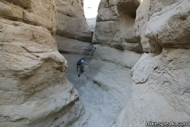
 120 120 | Mosaic Canyon in Death Valley This out and back hike starts up a smooth marble slot canyon and exposes visitors to unique Death Valley geology. | 1 - 4 miles 100 - 750 feet | 36.57193, -117.14434 |
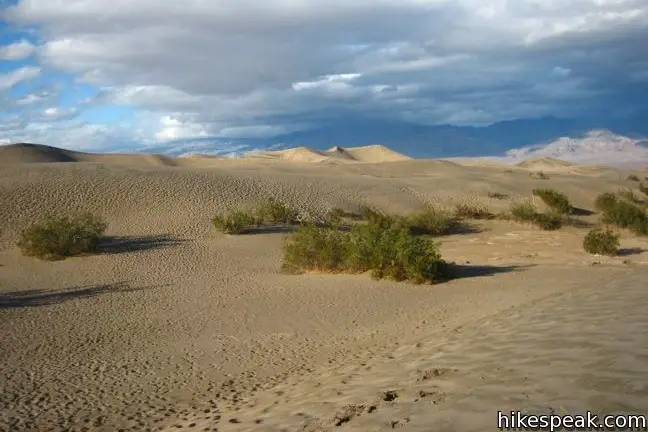
 130 130 | Mesquite Flat Sand Dunes in Death Valley This hike explores the most visible sand dunes in Death Valley | 1 - 3 miles 100 feet | 36.6062, -117.1150 |
 140 140 | Grotto Canyon in Death Valley This out and back hike requires a bit of climbing and is a lesser-visited trail in Death Valley. | 2 - 4 miles 625 feet | 36.5823, -117.1041 |
 150 150 | Salt Creek in Death Valley This easy out and back hike crosses a short boardwalk bordering a rare desert stream. | 1 mile 25 feet | 36.5906, -116.9906 |
 160 160 | Harmony Borax in Death Valley This short walk around the Harmony Borax plant offers a window into the mining past of Death Valley. | 0.25 miles 25 feet | 36.48003, -116.87335 |
 170 170 | Golden Canyon - Gower Gulch Loop in Death Valley This loop visits some of the most stunning terrain in Death Valley. | 4 miles 675 feet | 36.4207, -116.8467 |
 180 180 | Badlands Loop in Death Valley This loop offers a great immersion into the terrain beneath Zabriskie Point. | 2.5 miles 300 feet | 36.42085, -116.8099 |
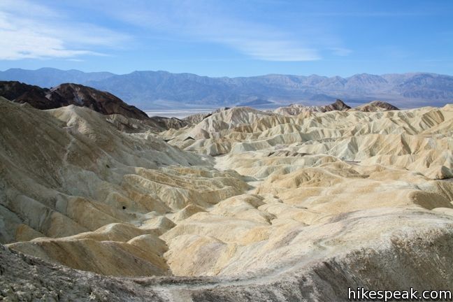
 190 190 | Zabriskie Point in Death Valley Zabriskie Point offers a stunning panorama of the badlands near Furnace Creek. | 0.25 miles | 36.42085, -116.8099 |
 200 200 | Twenty Mule Team Canyon in Death Valley This 2.8-mile one way road lets visitors experience a fine canyon right from the driver’s seat. | 0 miles | 36.40953, -116.7947 |
 210 210 | Artist’s Drive in Death Valley This 9-mile drive crosses a sloping mountainside composed of vibrant soil colored by rich metals. | 0 - 0.5 miles | 36.32995, -116.82995 |
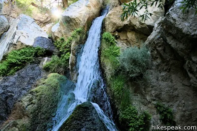
 220 220 | Darwin Falls in Death Valley This out and back hike visits a refreshing year-round waterfall on the western edge of Death Valley. | 2 miles 275 feet | 36.32776, -117.51466 |
 230 230 | Wildrose Peak in Death Valley This out and back hike summits a 9,064-foot peak in the Panamint Mountain Range on the west side of Death Valley. | 8.4 miles 2,200 feet | 36.2467, -117.0763 |
 240 240 | Charcoal Kilns in Death Valley These conical constructions converted lumber to charcoal for area miners from 1879 to 1882. | 0 - 0.5 miles | 36.2467, -117.0763 |
 250 250 | Natural Bridge Canyon in Death Valley This is a great out and back hike for those interested in learning about the geological history of Death Valley. | 2 miles 400 feet | 36.28115, -116.7699 |
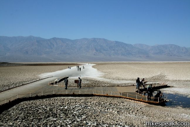
 260 260 | Badwater Basin in Death Valley This is the lowest place in North America -- a required stop for first time visitors to Death Valley. | 0 - 1 miles 10 feet | 36.2301, -116.7671 |
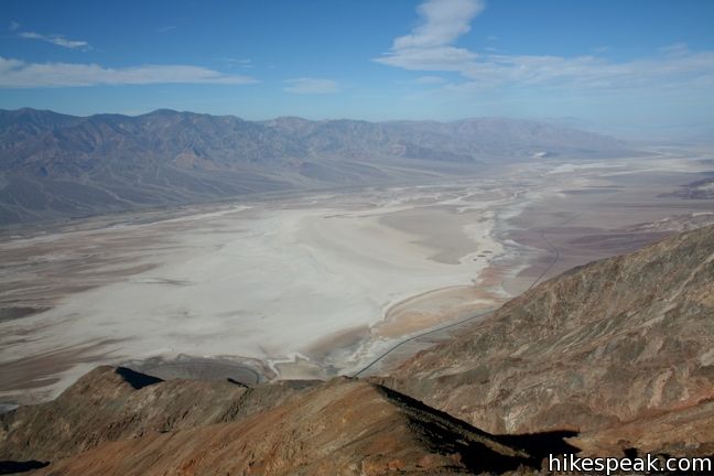
 270 270 | Dante’s View in Death Valley This towering overlook above Badwater Basin offers panoramic views of Death Valley. | 0 - 1 miles 0 - 200 feet | 36.2206, -116.7266 |
 280 280 | Sidewinder Canyon in Death Valley This out and back hike visits narrow slot canyons full of pour-overs, carve outs, and dark passages that beg to be explored. | 4 - 7 miles 500 - 750 feet | 36.0650, -116.7448 |
 290 290 | Ashford Mill in Death Valley These ruins, where gold was once processed for the Ashford Mine, provide an example of how tough life can be in this harsh desert. | 0.1 miles | 35.9209, -116.6813 |
 380 380 | Teutonia Peak in Mojave National Preserve This out and back hike crosses the world's densest Joshua tree forest, passing an abandoned silver mine to reach a rocky summit with views of Cima Dome. | 3.4 - 4 miles 700 feet | 35.31625, -115.5525 |
 390 390 | New York Peak in Mojave National Preserve This out and back hike summits the highest point of the New York Range in the northeast corner of the preserve. | 7 - 9 miles 2400 feet | 35.27675, -115.2518 |
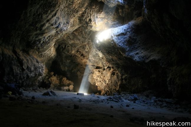
 400 400 | Lava Tube in Mojave National Preserve This short out and back hike drops underground into an old lava tube lit by holes in the surface. | 0.6 miles 150 feet | 35.21378, -115.7532 |
 410 410 | Petroglyphs in Mojave National Preserve This faint path visits ancient engravings in the volcanic rock at the western rim of the cinder fields just off Kelbaker Road. | 0.25 miles 25 feet | 35.205572, -115.872077 |
 417 417 | Rock Spring in Mojave National Preserve This loop visits a rare desert spring, a Rock House built in the 1920s, a miners' mill site, and an old U.S. Army post on a short and scenic circuit. | 1.33 miles 100 feet | 35.15502, -115.3348 |
 420 420 | Hole-in-the-Wall in Mojave National Preserve This loop takes visitors through a landscape of pocketed rocks. Ringbolts allow fun passage through narrow canyons. | 0.5 - 1.5 miles 150 feet | 35.0440, -115.3980 |
 430 430 | Fountain Peak in Mojave National Preserve This off trail trek summits a peak with commanding views over the Providence Mountains. | 5 miles 2700 feet | 34.9432, -115.51268 |
 440 440 | Kelso Dunes in Mojave National Preserve This out and back hike climbs the highest point in this 45 square mile dune field. | 3 miles 470 feet | 34.89235, -115.69906 |
 450 450 | Silver Peak in Mojave National Preserve This out and back hike summits a 6,365-foot peak in the Granite Mountains. | 8.5 miles 2,500 feet | 34.8206, -115.6476 |
 500 500 | Amboy Crater This out and back hike travels up and into a volcanic crater near Mojave National Preserve. | 3 miles 275 feet | 34.5572, -115.7814 |
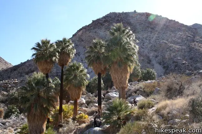
 560 560 | Fortynine Palms Oasis in Joshua Tree The out and back hike visits a palm tree oasis in the desert on the north side of Joshua Tree. | 3 miles 350 feet | 34.1193, -116.1120 |
 570 570 | Indian Cove in Joshua Tree The 101-site campground is home to a 0.6-mile interpretive trail and endless bouldering and rock climbing opportunities. | 0.6 - 2 miles (or more) 25 feet | 34.09488, -116.1685 |
 580 580 | Contact Mine in Joshua Tree This out and back hike travels up a wash, a canyon, and an old road to a mountainside mine site. | 3.9 miles 700 feet | 34.0723, -116.0327 |
 587 587 | High View Nature Trail in Joshua Tree This loop climbs a ridge on the west side of the park that offers views of San Gorgonio Mountain and Yucca Valley, along with an introduction to desert plants. | 1.35 miles 325 feet | 34.076169, -116.399369 |
 590 590 | Warren Peak in Joshua Tree This out and back hike summits a peak with impressive views over the west side of Joshua Tree. | 5.5 miles 1,000 feet | 34.07155, -116.3909 |
 600 600 | Desert Queen Mine in Joshua Tree This out and back hike follows a level desert trail to an overlook before crossing a canyon to visits the ruins of an old gold mine. | 1.6 miles 150 feet | 34.0236, -116.0776 |
 610 610 | Lucky Boy Vista in Joshua Tree This level out and back hike visits a modest overlook at the site of an old mine. | 2.5 miles 125 feet | 34.01795, -116.0824 |
 620 620 | Wall Street Mill in Joshua Tree This level out and back hike visits a well-reserved gold mill, exploring the mining history of Joshua Tree National Park. | 1.55 - 2.15 115 feet | 34.0251, -116.1419 |
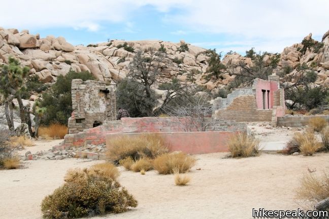
 630 630 | Wonderland Wash in Joshua Tree This level out and back hike travels past the ruins of Wonderland Ranch up a use trail into the Wonderland of Rocks. | 2.1 miles (or more) 75 feet | 34.0251, -116.1419 |
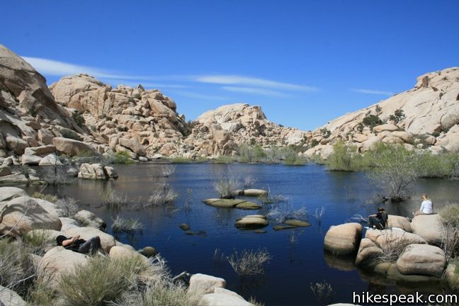
 640 640 | Barker Dam in Joshua Tree This level loop visits a small foreign-looking reservoir within the Wonderland of Rocks. | 1.5 miles 50 feet | 34.0251, -116.1420 |
 650 650 | Hidden Valley in Joshua Tree This loop circles the interior of a small valley surrounded by tall rocks that serves as an excellent bouldering arena. | 1 mile (or more) 75 feet | 34.01237, -116.1680 |
 660 660 | Ryan Mountain in Joshua Tree This out and back hike offers summit views from the center of Joshua Tree National Park. | 3 miles 1,050 feet | 34.00257, -116.13594 |
 670 670 | Ryan Ranch in Joshua Tree This out and back hike from Ryan Campground or Park Boulevard visits the ruins of an old adobe homestead beneath Ryan Mountain. | 0.8 - 1.2 miles (or more) 85 feet | 33.988821, -116.153846 |
 680 680 | Lost Horse Mine in Joshua Tree This out and back hike visits a well-preserved mine and mill. | 4 miles 400 feet | 33.9507, -116.15982 |
 690 690 | Inspiration Peak in Joshua Tree This out and back hike leaves the crowds at Keys View for even grander views from a 5,550-foot summit. | 1.2 miles 425 feet | 33.9272, -116.18745 |
 700 700 | Crown Prince Lookout in Joshua Tree This easy out and back hike crosses a desert plateau to a pair of overlook near the site of an World War II era observation post. | 3.25 miles 50 feet | 33.991885, -116.067908 |
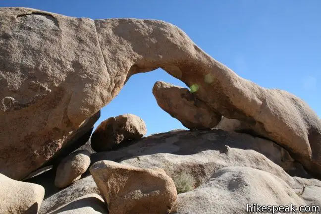
 710 710 | Arch Rock in Joshua Tree This lollipop loop visits a natural arch in the granite formations around White Tank Campground. | 1.3 miles 100 feet | 33.9899, -116.02275 |
 720 720 | Cholla Cactus Garden in Joshua Tree This loop offers a stroll through an intense concentration of cholla cacti. | 0.25 miles 5 feet | 33.9253, -115.9289 |
 730 730 | Mastodon Peak in Joshua Tree This loop visits a 3,400-foot summit with panoramic views of southeastern Joshua Tree. | 2.6 miles 440 feet | 33.7370, -115.8107 |
 740 740 | Lost Palms Oasis in Joshua Tree This out and back hike visits an oasis nestled between mountains in the southeast corner of the park. | 7.2 miles 400 feet | 33.7370, -115.8107 |
 750 750 | Bajada Trail in Joshua Tree This level nature trail loop explores the plants living on a desert bajada. | 0.3 miles 5 feet | 33.681238, -115.801784 |
 810 810 | Calcite Mine Trail in Anza-Borrego Desert SP This figure-eight shaped lollipop loop visits enthralling narrows and a mine site important to the history of the park. | 4 - 4.25 miles 600 feet | 33.2811, -116.0964 |
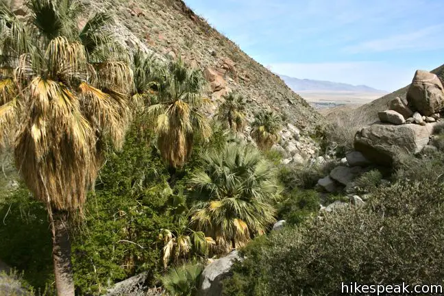
 820 820 | Borrego Palm Canyon Trail in Anza-Borrego Desert SP This loop visits a popular palm tree oasis in a canyon west of Borrego Springs. | 3.25 miles 450 feet | 33.2702, -116.4182 |
 822 822 | Panoramic Overlook Trail in Anza-Borrego Desert SP The out and back hike ascends a ridge on the south side of Borrego Palm Canyon to sweeping views of the San Ysidro Mountains and Borrego Valley. | 1 mile 275 feet | 33.267663, -116.409476 |
 830 830 | Maidenhair Falls in Anza-Borrego Desert SP This out and back hike visits a 20-foot waterfall in a canyon near Borrego Springs, making it the perfect place to cool off on a hot day in the California Desert. | 5.5 miles 1,000 feet | 33.248037, -116.40594 |
 833 833 | Culp Valley Loop in Anza-Borrego Desert SP This loop visits Culp Valley Overlook and Pena Springs, delivering views of the San Ysidro Mountains and Borrego Valley along the way. | 2.2 miles 200 feet | 33.2241, -116.454725 |
 836 836 | Tubb Canyon Trail in Anza-Borrego Desert SP This out and back hike follows a footpath across Tubb Canyon to Big Spring in a desert canyon below Pinyon Ridge in the San Ysidro Mountains. | 1.5 miles 200 feet | 33.211274, -116.438534 |
 840 840 | The Slot in Anza-Borrego Desert SP This out and back hike crosses a narrow canyon beneath a natural rock span that is among the most photographed landmarks in the park. | 0.8 miles 100 feet | 33.18213, -116.21417 |
 843 843 | Kenyon Overlook Trail in Anza-Borrego Desert SP This loop sets out from Yaqui Pass to reach an incredible viewpoint across Mescal Bajada. | 1.15 miles 125 feet | 33.148143, -116.348653 |
 845 845 | Cactus Loop Trail in Anza-Borrego Desert SP This loop on a self-guided nature trail explores cacti and other plants that have adapted to survive in the Anza-Borrego Desert. | 0.75 miles 225 feet | 33.138755, -116.37494 |
 846 846 | Yaqui Well Trail in Anza-Borrego Desert SP This out and back hike on a self-guided nature trail explores area botany and history on the way to a rare desert water source. | 1.6 miles 100 feet | 33.138333, -116.37649 |
 850 850 | Village Site in Anza-Borrego Desert SP No hiking required to visit this Kumeyaay Indian Village Site on Mine Wash Road where you can find morteros in a collection of boulders. | 0.1 miles | 33.113076, -116.34512 |
 855 855 | Narrows Earth Trail in Anza-Borrego Desert SP This short self-guided loop explores the geology of the park. | 0.5 miles 50 feet | 33.13072, -116.30155 |
 860 860 | Elephant Trees Trail in Anza-Borrego Desert SP This easy loop offers a lesson in desert botany including the rare elephant tree. | 1 mile 50 feet | 33.068153, -116.1168 |
 870 870 | Pictograph Trail in Anza-Borrego Desert SP This out and back hike visits rock paintings drawn by Kumeyaay Indians who lived in the Anza-Borrego Desert thousands of years ago. | 1.8 miles 190 feet | 33.01965, -116.3598 |
 880 880 | Morteros Trail in Anza-Borrego Desert SP This brief hike visits a village of boulders once occupied by Kumeyaay Indians who left behind Morteros, grinding bowls carved into the rock. | 0.6 miles 40 feet | 33.00895, -116.3784 |
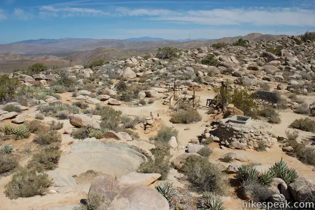
 890 890 | Marshal South Home Trail in Anza-Borrego Desert SP This out and back hike ascends to the ruins of an adobe cabin on Ghost Mountain (Yaquitepec) with great views above Blair Valley. | 1.3 miles 450 feet | 33.003382, -116.389789 |
 900 900 | Rainbow Canyon in Anza-Borrego Desert SP This out and back hike follows an undeveloped trail up a colorful canyon full of vibrant rock formations and desert plants. | 2.2 miles 300 feet | 32.99775, -116.44755 |
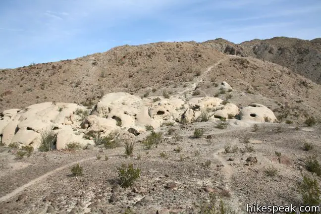
 930 930 | Wind Caves Trail This short hike climbs to a sandstone formation that begs to be explored. | 1.25 miles 250 feet | 32.9933, -116.1184 |
hikespeak
