Munson Creek Falls Trail
in Munson Creek Falls State Natural Site

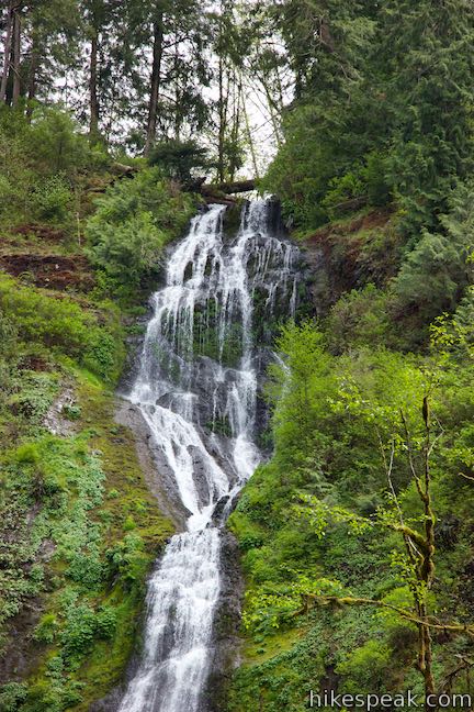
Measuring 319 feet tall, Munson Creek Falls is no tiny trickler. In fact, this is Oregon’s tallest waterfall west of the Willamette River. Munson Creek Falls has picturesque silky tiers framed by canyon greenery. The trek to the waterfall, Munson Creek Falls Trail, is just a quarter mile long (half a mile round trip) with 90 feet of elevation change. The trail explores a lush and lovely old-growth forest on the way to waterfall views. The hike is short and inviting, and getting there is easy too. Munson Creek Falls State Natural Site is located just 8 miles from Tillamook and the trailhead is only a mile and a half off US 101.
Munson Creek Road leaves Highway 101, seven miles south of Tillamook. The pavement turns to gravel and the road narrows. Drive into the forest along Munson Creek and quickly arrive at a parking area at road’s end, where you will find a portable toilet, a picnic site by the creek, and the start of the trail to Munson Creek Falls.
Set out on Munson Creek Falls Trail, which travels southeast up a box canyon alongside Monson Creek. The wide single-track trail is level at the start, but does gain some elevation as it follows the creak uphill to the waterfall. Munson Creek Falls Trail has a few patches that are steeper than you might expect to find on a hike as short as this one. However, the trail is not a workout. It’s a peasant woodland walk. Munson Creek Falls Trail would be tough for wheelchairs, but it is easy enough for young children.
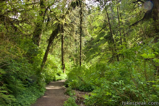
Travel through the old-growth forest of Munson Creek Falls State Natural Site. Western red cedar and sitka spruce rise tall above the trail, providing a shaded canopy. Alders and big-leaf maples thrive beside the creek. As it travels up the canyon, the trail is often right alongside the creek, where terraces of water spilling over rocks. Other times, the creek is only visible through windows between mossy downed logs and clumps of ferns, salmonberry, and elderberry. Spring brings blooming wildflowers like trillium, candy flower, and purple clusters of corydalis.
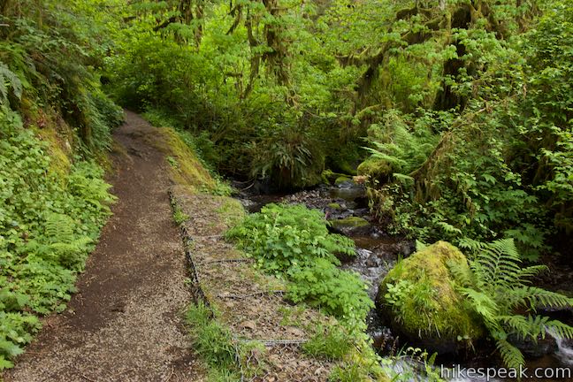
Pass through a lovely spot where the creek emerges from the forest and tumbles right past the trail, just as the trail launches up a slope. Ascend from there to the hike’s high spot, which delivers the trail’s first and best views of Munson Falls.
Ahead, the trail curves to the right and descends a flight of wooden steps. At the bottom of the steps, Munson Creek Falls Trail crosses a gully and rises to a spot where the trail is barricaded. Unfortunately, the “Trail Closed” sign brings this hike to an abrupt end. Ahead on the trail, there is a large washed out section that makes it unsafe to travel closer to Munson Creek Falls. Reportedly the trail closure is because of a landslide that occurred in the 1990s, which is before Munson Creek Falls State Natural Site became a state park in 2000, so it may be a while before the rest of the trail reopens, if it ever does.
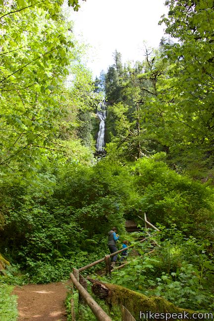
Since you can’t go any farther, stop to enjoy what’s around you. Beside the trail, the creek moves swiftly down the canyon (coursing faster than it did farther below the waterfall). The creek spills over rocks and splashes past mossy logs. Above you, Munson Creek Falls is visible straight ahead through tall brush and trees. The waterfall may be easier to see by backtracking across the gully to the perch at the top of the wooden steps.
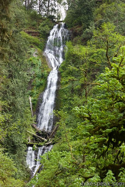
Munson Creek Falls emerges from the rim of a forested canyon wall and fans out as is slides over multiple drops. The spilling water strikes a log jam part way down the waterfall as it plunges dramatically into the canyon. Looking like one of the waterfalls you might see in the Columbia River Gorge, Munson Creek Falls is unexpectedly tall for Coastal Oregon. This special beauty is the largest waterfall in the Coast Range.
After absorbing the views of Munson Creek Falls, return the way you came, enjoying a second helping of all the greenery along Munson Creek Falls Trail. The hike is straight forward, with no confusing junctions to worry about. Dogs are welcome but bikes are not allowed. There is no fee to visit Munson Creek Falls State Natural Site and no permit is needed to hike the trail to Munson Creek Falls, so get out and enjoy!
- To see another waterfall in Coastal Oregon, check out Beaver Falls.
To get to the trailhead: From the center of Tillamook, where US 101 intersects Route 6 (to Portland) and Route 131 (to Oceanside and Cape Meares), travel south on Highway 101 for 7 miles. Turn left onto Munson Creek Road (signs for Munson Falls Natural Site). The road becomes unpaved and enters the forest. Follow the signs instructing you to turn left and then right to reach the large turnaround at the trailhead.
Coming from the south, take US 101 north of Lincoln City for 36 miles. Pass the intersection with Sandlake Road (which heads toward Cape Lookout, Whalen Island, and Cape Kiwanda) and drive another 4 miles to Munson Creek Road. Exit the right side of the highway and follow the directions above to the trailhead at road’s end.
Trailhead address: Munson Creek Falls State Natural Site, Munson Creek Road, Tillamook, OR 97141
Trailhead coordinates: 45.36565, -123.77355 (45° 21′ 56.3″N 123° 46′ 24.8″W)
View Munson Creek Falls in a larger map
Or view a regional map of surrounding Oregon trails and campgrounds.
 | Oceanside Beach to Tunnel Beach This 0.8-mile beach walk comes with an adventurous twist, a man-made tunnel through a cliff that leads from one beautiful beach to another more secluded beach in Oceanside. |
 | Cape Meares Lighthouse & Octopus Tree This easy 0.8-mile hike in Cape Meares State Park visits a beautiful lighthouse and an equally impressive tree, exploring a coastal cape with tall cliffs and big ocean views. |
 | Cape Lookout Trail This 5-mile round trip hike ventures down a promontory on the Oregon Coast with beautiful ocean views. |
 | Whalen Island Loop Trail This 1.5-mile hike explores a lovely island-like park in Sand Lake Estuary with ocean and wetland views. |
 | Cape Kiwanda This short beach hike explores tide pools and sand dunes at a rugged headland on Oregon's coast near Pacific City. |
 | Alder Island Nature Trail This short, easy hike off the coast south of Lincoln City explores a small island at the mouth of the Siletz River. |
 | Ecola Point to Indian Beach This 2 2/3-mile round trip hike explores a wild and beautiful section of Oregon Coast Trail between Ecola Point and Indian Beach in Ecola State Park. |
 | Saddle Mountain Trail This 5-mile round trip hike rises through fir forests and wildflower-filled slopes up to a summit with panoramic coastal views. |
 | Beaver Falls This short hike slips down through forest to a beautiful waterfall plunging over a basalt wall. |
 | Trails in Oregon Explore more hikes throughout the state of Oregon. |
 | Whalen Island County Campground This 33-site campground is a nice camping option on Whalen Island with easy access to estuary beaches and a loop hike. |
 | Cape Lookout State Park Campground This grand, oceanfront campground has over 200 sites right behind a big, beautiful beach. |
Munson Creek Falls Trail on oregonhikers.org
Munson Creek Falls Trail on tillamookcoast.com
Munson Creek Falls on world-of-waterfalls.com
Munson Creek Falls on waterfallsnorthwest.com
Munson Creek Falls Trail on alltrails.com
Munson Creek Falls Trail on hikingproject.com
Munson Creek Falls Trail on eyehike.com
Munson Creek Falls Trail on theoutbound.com
Munson Creek Falls Trail on thatoregonlife.com
A Statesman Journal article about Munson Creek Falls


Go the extra miles...
Submit a rating of this hike to go with your comment. Contribute to the average trail rating.