
Forest Park is a wonderful place to take a short hike in Portland. For a 5-trail, four-season outing, check out Dogwood Trail – Alder Trail Loop, which actually uses Keil Trail, Dogwood Trail, Leif Erikson Drive, Alder Trail, and Wildwood Trail to form a 2.8-mile circuit with just over 400 feet of elevation change. In the summer, these Forest Park trails offer cooling shade. In the fall, the deciduous trees along Dogwood Trail show off with changing colors. In the winter, leafless windows provide perspectives through the trees over Portland toward Mount Hood. In the spring, blooms from yellow violets, trillium, and other flowers beautify the woods. No matter what time of year you visit, Dogwood Trail – Alder Trail Loop elicits a short, enjoyable excursion in Forest Park.
Start from a trailhead on the side of Northwest 53rd Drive, with roadside parking for several vehicles. A trail leads east from the road down to two junctions. First, on your right, Keil Trail heads up a rise. Straight ahead, is a T-junction with Wildwood Trail, which parts to the left and right. The left branch will be used at the end of this loop (and the right branch could be used as a shortcut). For now turn right up Keil Trail to begin the loop.
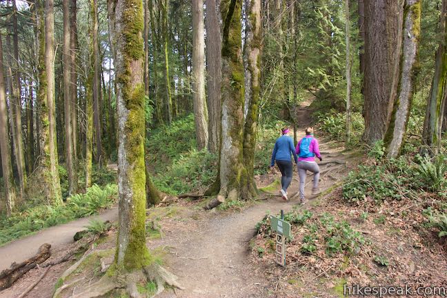
Hike uphill on Keil Trail, rising into forest above the road. This trail is named after William Keil, who was a Forest Park forester in the 1950s. Put in a little effort on this early ascent, before the hike turns downhill. You will only be on Keil Trail for 0.2 miles. When you come to a junction, turn left onto Dogwood Trail. (The short branch of Dogwood Trail going to the right connects to Wild Cherry Trail for the adjacent Wild Cherry Trail – Dogwood Trail Loop and could be merged with this hike for the longer Wild Cherry Trail – Alder Trail Loop.)
Dogwood Trail quickly crosses the crown of a round hill, taking you over the highest point of the loop at 900 feet. Turn downhill and pass through a forest of maples, alders, and Douglas firs. The forest sinks away off the sides of the ridge. When the deciduous trees are bare, you’ll find (still branch obscured) views over Northwest Portland. Mount Hood even appears in the distance to the east.
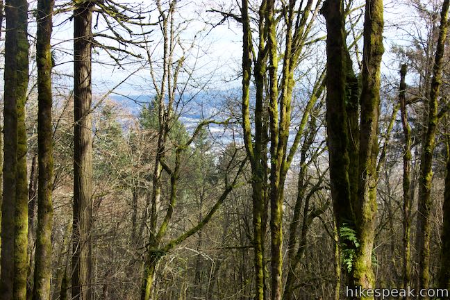
After a quarter mile on Dogwood Trail, the views become harder to find as the trail is enveloped in a denser forest. Follow the trail down the ridge to a junction with Wildwood Trail (Forest Park’s longest trail, previously seen at the trailhead). This junction comes 3/4 miles from the start of the hike. Continue straight across Wildwood Trail to stick with Dogwood Trail.
The lower section of Dogwood Trail gets a bit steeper as it weaves down the ridge, descending 200 feet in the next 0.35 miles. Enjoy the licorice ferns growing up the surrounding tree trunks. The hillsides are festooned with ferns too. This is Forest Park charm at its best!
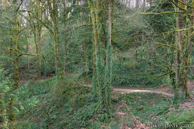
Weave your way down Dogwood Trail to a junction with Leif Erikson Drive, a wide unpaved road that isn’t open to vehicles. This is the lowest elevation point of the loop at 490 feet. Turn left and hike west up Leif Erikson Drive.
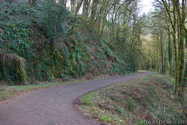
As you proceed across this wide multi-use trail through Forest Park, notice the dark ledge of Columbia River basalt on your left, guarded by sworn ferns. After 0.3 miles, Leif Erikson Drive curves around the back of a large draw in the terrain, crossing a branch of Alder Creek. You won’t find Alder Trail here. Instead, continue uphill as Leif Erikson Drive exits the draw, passing another basalt ledge. Curl around to the next crease in the terrain, where Alder Trail begins, bordering another branch of Alder Creek. The junction is marked with a plaque and trail signs. After 0.55 miles on Leif Erikson Drive, and 1.65 miles of hiking, turn left up Alder Trail.
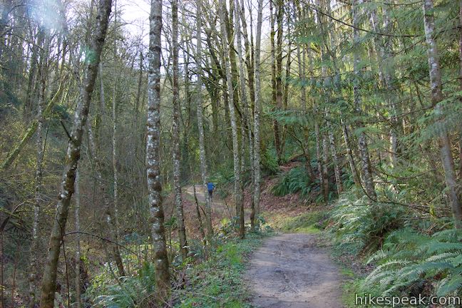
A narrow creek tumbles to your left, as you hike uphill on Alder Trail. Cross the creek after 1/8 of a mile and rise farther into the forest. The trail and creek are appropriately named; red alders are abundant. Splotchy lichens run up and down their stalky gray trunks. Bigleaf maples line the trail too, hosting mossy tapestries of licorice ferns.
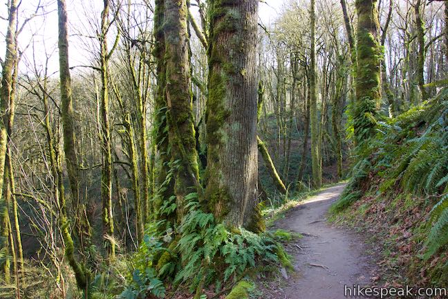
The dirt single track crosses a tiny branch of Alder Creek as it continues up into the forest. This woodland trail doesn’t seem to get as much Forest Park foot traffic, so take your time to enjoy it. At the 2.5 mile mark for the hike (after 0.85 miles on Alder Trail), come up to a T-junction with Wildwood Trail, where Alder Trail comes to an end. Turn left here and hike 0.3 miles back to the trailhead.
Wildwood Trail is fairly level, weaving around dips and draws in the terrain to explore more lovely forest. The slopes above this trail are short and more sunlight appears able to enter these woods than those below. When you return to the junction near the bottom of Keil Trail, leave Wildwood Trail and make the obvious right turn to walk up to Northwest 53rd Drive. Vehicles parked along the road are visible from the junction.
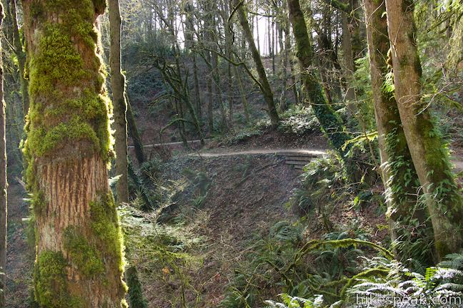
Dogwood Trail – Alder Trail Loop is a great way to spend 90 minutes in Forest Park (or less time for trail runners). The surroundings are satisfying throughout this 2.8-mile loop with 410 feet of elevation change. Bikes are not allowed (except on Leif Erikson Drive), but dogs on leashes are welcome. Parking at the trailhead is free and no permit is required for Dogwood Trail – Alder Trail Loop in Forest Park.
The basic directions for Dogwood Trail – Alder Trail Loop are:
- Leave NW 53rd Drive and begin up Keil Trail (0 miles)
- Turn left onto Dogwood Trail (0.2 miles)
- Cross Wildwood Trail (0.75 miles)
- At the bottom of Dogwood Trail, turn left up Leif Erikson Drive (1.1 miles)
- Turn left up Alder Trail (1.65 miles)
- At the top of Alder Trail, turn left onto Wildwood Trail (2.5 miles)
- Return to the junction by Keil Trail and walk up to NW 53rd Drive (2.8 miles)
For similar outings in Forest Park, check out Holman Lane – Wildwood Trail – Birch Trail Loop and Wild Cherry Trail – Dogwood Trail Loop.
To get to the trailhead: From Interstate 405 in downtown Portland, take exit 3 to head west on Route 30. Drive about half a mile to the first exit for Vaughn Street. The offramp passes over the top of Route 30 and merges with Vaughn Street. Drive a couple blocks west and turn left onto NW 25th Avenue. Drive half a mile south and turn right onto NW Lovejoy Street. In 400 feet, bear right onto Cornell Road. Drive 1.9 miles up Cornell Road and turn right up NW 53rd Drive. Go 1.1 miles up this road and park in one of the spaces on the right in front of the trailhead, located in a dip in the road between two hills. The parking is just before the mailbox for 2546 Northwest 53rd Drive.
The trailhead for Wildwood Trail and Keil Trail is 0.2 miles after the trailhead for Wild Cherry Trail and Dogwood Trail.
Trailhead address: Wildwood NW 53rd Trailhead, Northwest 53rd Drive, Portland, OR 97210
Trailhead coordinates: 45.5403, -122.7368 (45° 32′ 25.1″N 122° 44′ 12.5″W)
The loop on Keil Trail, Dogwood Trail, Leif Erikson Drive, Alder Trail, and Wildwood Trail is colored in orange, light brown, and pink.
View Forest Park in a larger map
Or view a regional map of surrounding Oregon trails and campgrounds.
 | Wild Cherry Trail – Dogwood Trail Loop This 2.5-mile Forest Park hike plots a nice, short, woodland escape by easing down Wild Cherry Trail to Leif Erikson Drive and rising back up Dogwood Trail. |
 | Wild Cherry Trail - Alder Trail Loop This 3.5-mile circuit explores more of woodland beauty in Forest Park. |
 | Holman Lane – Wildwood Trail – Birch Trail Loop This 2.7-mile loop combines three trails in Forest Park for a refreshing woodland walk. |
 | Lower Macleay Trail to Stone House This 1.8 to 2-mile hike starts by following Balch Creek to fern-covered ruins and can finish with a loop that exits Forest Park and passes through the Willamette Heights Neighborhood in Northwest Portland. |
 | Lower Macleay Park to Pittock Mansion This 5.4-mile hike in Forest Park takes Lower Macleay Trail to the Stone House ruins and ascends Wildwood Trail to Pittock Mansion, bagging a big view over Portland. |
 | Cornell Road to Pittock Mansion This 2.5-mile hike on Wildwood Trail and Upper Macleay Trail in Forest Park goes up a wooded hillside to Pittock Mansion, a landmark with panoramic views over Portland. |
 | Marquam Nature Park Hike through peaceful forest in a pocket of Portland's West Hills on a 1.3, 3, or 4.25-mile loop. |
 | George Himes Trail This short lollipop loop ascends into Portland's West Hills for a woodland walk with a view of Mount Hood. |
 | Trillium Trail in Tryon Creek State Natural Area This short nature trail is packed with plant-identifying panels as well as benches and viewing platforms. |
 | Two-Mile Loop in Tryon Creek State Natural Area Combine Old Main Trail, Red Fox Trail, Cedar Trail, Middle Creek Trail, and Maple Ridge Trail to loop through rolling woodland and across 3 bridges. |
 | Tualatin Hills Nature Park This 2.1-mile hike on Vine Maple Trail, Old Wagon Trail, and Oak Trail loops through forests and wetlands in a pocket of wilderness on the west side of Beaverton. |
 | Powell Butte This 2.15-mile lollipop loop combines Mountain View Trail and Summit Lane to explore the top of Powell Butte and its big views from Southeast Portland. |
 | Trails in Oregon Explore more hikes in Oregon outside Greater Portland. |


When is the best time to see the yellow flowers in Dogwood Trail?
Is the month of June good?
The yellow woodland violets have already started to appear in the West Hills. May should be a prime time to see them.