
Do you like to hike but suffer from a little bit of fomo (fear of missing out)? Make your way to Northwest Portland for an outing in Forest Park that has a bit of everything. Start up Lower Macleay Trail along Balch Creek, the park’s biggest year-round stream. Hike less than a mile through a verdant rainforest to arrive at Stone House (imaginatively nicknamed the Witch’s Castle), where the ruins of an old building are alluringly grown over with moss and ferns. From there, you can loop back on a different route. Take Wildwood Trail north to Holman Lane and diversify your hike back with a stroll through the Willamette Heights Neighborhood. This loop is 2 miles long with 400 feet of elevation change. Hiking out and back on Lower Macleay Trail is just 1.8 miles round trip with 210 feet of elevation change.
From Stone House, you can also venture south on Wildwood Trail and ascend to Pittock Mansion for panoramic views over Portland. Reference Lower Macleay Park to Pittock Mansion for more information about this longer hike, which ascends 850 feet of elevation and is 5.4 miles round trip (of 5.6 miles with the lower loop through Willamette Heights).
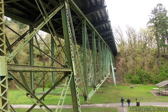
Lower Macleay Trail offers quick and convenient access to a prize park running northeast of downtown Portland. Forest Park covers over 5,000 acres and has more than 80 miles of trails through “one of the largest natural forested urban parks in America.” Set out from a trailhead at the end of NW Upshur Street and take the paved trail south through a lawn. The 1905-built (but 2014-rehabilitated) Balch Gulch Bridge passes overhead. Go straight through a junction on the left with a trail to the Lower Macleay Stairs, which come down alongside the bridge and are used and the end of the 2-mile loop after the walk through Willamette Heights.
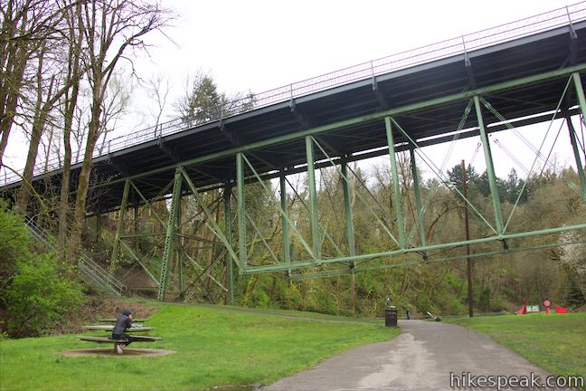
Beyond the bridge, approach a helpful trail kiosk on the right. Balch Creek flows along the left side of the trail through an interesting gated system that appears to be some sort of control for flood debris. Balch Creek is a habitat for cutthroat trout. Proceed up Lower Macleay Trail, which stays paved for a stretch as it begins a gradual course along the tumbling creek.
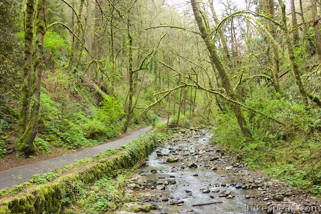
Cross a stone footbridge to the left side of the creek and get a nice perspective up and down the gulch. Shortly after that, and 0.2 miles from the start, the trail reaches a Stone Overlook next to the creek. Pause to watch the water leisurely sliding over rocks. The pavement ends just ahead, so this is the turnaround point for the wheelchair-friendly version of the hike.
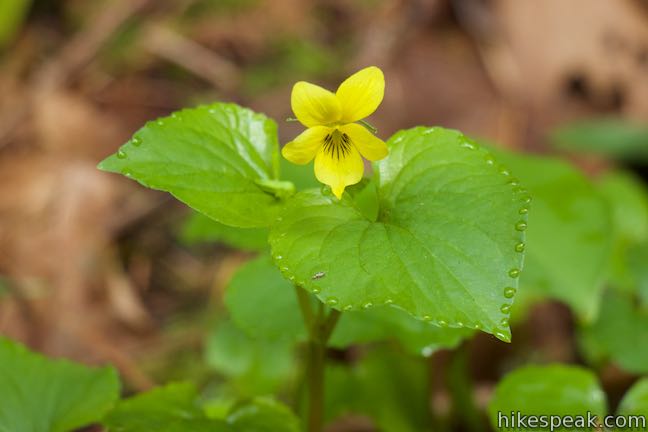
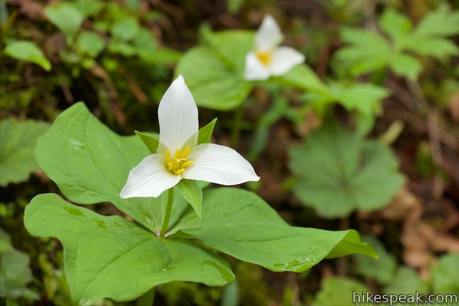
Lower Macleay Trail is unpaved for the duration. The dirt trail tilts up in a few places but remains relatively gradual for an easygoing creek side hike. While the trail doesn’t pick up much elevation, the sides of the gulch are steep. Oaks, cedars, and firs rise overhead with trunks and branches covered in moss and lichens. The ground is covered in greens too, including a variety of ferns. Trillium bloom along the trail in the spring, adding tri-pointed splashed of white and pink. Salmonberry bushes along the stream flash flowers of magenta while yellow violets contribute even more pops of color.
At 0.45 miles from the start, take a pair of bridges back to the right side of the creek just below a short crescent-shaped cascade. Lower Macleay Trail stays on the right side of the creek from this point on. The forest seems to get denser as you go. Are the trees getting bigger? Pass a Douglas fir that is 242 feet tall and believed to be the biggest in Portland. After 0.9 miles of hiking, come to a T-junction with Wildwood Trail in front of the Stone House.
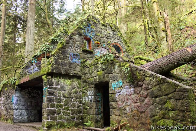
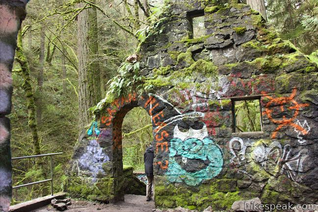
The Stone House was built around 1930 by the city of Portland as a rest stop for hikers. The building was damaged by a storm in the 1960s and the city decided not to make repairs. Instead, the defunct roof was removed along with the doors and pluming for the bathrooms. Old stone walls remain standing, but have been grown over by ferns, moss, and lichens to give the building an enchanting look. Take a staircase up to the second story and pass through doorways to roofless rooms. Adults will find the Stone House interesting and children seem to love it. A large tree trunk has fallen over the staircase on one side of the building and it feels like the forest is working to envelope the Stone House. Unfortunately, this cool Portland landmark has been marred with graffiti.
To experience more of Balch Creek, consider making a left turn in front of the Stone House onto Wildwood Trail. For a quarter mile, this trail borders the creek just like Lower Macleay Trail. Once Wildwood Trail crosses the creek, it launches into a switchback-filled ascent up the side of the canyon. Proceed this way if you are interested in the Lower Macleay Park to Pittock Mansion Hike.
From the Stone House, you could hike back the same way on Lower Macleay Trail for a pleasant and easy 1.8-mile round trip hike with 210 feet of elevation change. To mix things up and create a loop that passes through a neighborhood next to the park, turn right at the junction in front of the Stone House and head northeast on Wildwood Trail.
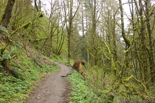
Wildwood Trail goes uphill on the side of the gulch above Lower Macleay Trail. Look down over Balch Creek and the trail you hiked up. A tenth of a mile from Stone House, pass a path breaking off to the left and stay on what is obviously the main trail. Eventually, Wildwood Trail separates from Balch Gulch and aims north across a wooded hillside.
Less than half a mile from the Stone House, you’ll hit an intersection with Holman Lane, another wide dirt trail. Turn right and hike 1/8 of a mile down this trail to a less used trailhead. Pass a field on the right and go through a gate to enter Willamette Heights, a neighborhood in Northwest Portland. Now you’ll need to navigate through a few intersections to get back to Lower Macleay Park.
Walk to the first intersection in front of the gate and turn left down Aspen Avenue. Go two blocks and turn right on Franklin Court (alternatively, you could go to the next bend on Aspen Avenue and turn right down a public staircase to Thurman Street and turn right). On Franklin Court, walk east until you come to a T-intersection and turn left on NW 32nd Avenue. Make your first right on Thurman Street. Go a block and continue straight onto Balch Gulch Bridge, which crosses over the top of Lower Macleay Park for a top-down view of the start of the hike. The bridge isn’t level and angles downhill more than you might expect. On the low side of the bridge, make a U-turn to the left and descend a staircase next to the bridge that goes down to the park. At the bottom of Lower Macleay Stairs, make the obvious right turn to walk back to the park entrance, completing this 2-mile loop.
No permit is required for this hike in Forest Park and Macleay Park and there is no fee to park near Lower Macleay Trailhead (just observe the street parking rules). Dogs are allowed on this loop, but bikes are not (bikes are only allowed on Holman Lane, but can use other trails in Forest Park). A bathroom is available at the trailhead.
The basic directions for this 2-mile loop are:
- Begin hiking up Lower Macleay Trail (0 miles)
- Visit the Stone House and turn right on Wildwood Trail (0.9 miles)
- Turn right on Holman Lane (1.35 miles)
- Leave Forest Park and turn left on NW Aspen Avenue (1.5 miles)
- Turn right on NW Franklin Court (1.6 miles)
- Turn left on NW 32nd Avenue (1.8 miles)
- Turn right on NW Thurman Street (1.85 miles)
- Cross Balch Gulch Bridge and turn left down the Lower Macleay Stairs (1.95 miles)
- Reach the park and turn right to finish the hike (2 miles)
To get to the trailhead: From Interstate 405 in downtown Portland, take exit 3 to head west on Route 30. Drive about half a mile to the first exit for Vaughn Street. The offramp passes over the top of Route 30 and merges with Vaughn Street. Drive several blocks and turn left onto NW 27th Avenue. Make the next right on NW Upshur Street and drive 0.3 miles to the park. After crossing 29th Avenue, the road narrows and street parking is available on the right. The road ends with a circle in Macleay Park that has a few more parking spots.
Trailhead address: 2960 NW Upshur Street, Portland, OR 97210
Trailhead coordinates: 45.53585, -122.7125 (45° 32′ 09.06″N 122° 42′ 45.00″W)
View Forest Park in a larger map
Or view a regional map of surrounding Oregon trails and campgrounds.
 | Lower Macleay Park to Pittock Mansion This 5.4-mile hike in Forest Park takes Lower Macleay Trail to the Stone House ruins and ascends Wildwood Trail to Pittock Mansion, bagging a big view over Portland. |
 | Cornell Road to Pittock Mansion This 2.5-mile hike on Wildwood Trail and Upper Macleay Trail in Forest Park goes up a wooded hillside to Pittock Mansion, a landmark with panoramic views over Portland. |
 | Holman Lane – Wildwood Trail – Birch Trail Loop This 2.7-mile loop combines three trails in Forest Park for a refreshing woodland walk. |
 | Dogwood Trail - Alder Trail Loop This 2.8-mile hike uses 5 trails (Keil Trail, Dogwood Trail, Leif Erikson Drive, Alder Trail, and Wildwood Trail) to form a lovely woodland loop in Forest Park. |
 | Wild Cherry Trail – Dogwood Trail Loop This 2.5-mile Forest Park hike plots a nice, short, woodland escape by easing down Wild Cherry Trail to Leif Erikson Drive and rising back up Dogwood Trail. |
 | Wild Cherry Trail - Alder Trail Loop This 3.5-mile circuit explores more of woodland beauty in Forest Park. |
 | Marquam Nature Park Hike through peaceful forest in a pocket of Portland's West Hills on a 1.3, 3, or 4.25-mile loop. |
 | George Himes Trail This short lollipop loop ascends into Portland's West Hills for a woodland walk with a view of Mount Hood. |
 | Trillium Trail in Tryon Creek State Natural Area This short nature trail is packed with plant-identifying panels as well as benches and viewing platforms. |
 | Two-Mile Loop in Tryon Creek State Natural Area Combine Old Main Trail, Red Fox Trail, Cedar Trail, Middle Creek Trail, and Maple Ridge Trail to loop through rolling woodland and across 3 bridges. |
 | Powell Butte This 2.15-mile lollipop loop combines Mountain View Trail and Summit Lane to explore the top of Powell Butte and its big views from Southeast Portland. |
 | Trails in Oregon Explore more hikes in Oregon outside Greater Portland. |
Stone House on oregonhikers.org
Lower Macleay Loop Hike on pdxfamilyadventures.com
Lower Macleay Loop Hike on georgerede.wordpress.com
Forest Park Guide: The Best Hikes on pdxmonthly.com
Macleay Park on portlandoregon.gov
The official City of Portland webpage for Forest Park
A map of Forest Park trails, roads, and firelanes on portlandoregon.gov
A topographical map of Forest Park on pdxparks.org
A map of Forest Park Trailheads from Forest Park Conservancy


This was a lovely hike! I’m not a fan of strenuous hikes; we took our time and enjoyed it a lot. We missed the turn to Wildwood Trail but doubled back when we’d gotten to the bridge under construction. The neighborhood was also very beautiful. 5/5 recommend
[…] there has to be something weird to do in Portland added to this hike, so you’ll also visit the Witch’s Castle… Find out more […]