
Fiscalini Ranch Preserve (previously called East West Ranch) is a 434-acre park right in the middle of Cambria, a coastal town at the north end of San Luis Obispo County. Bordered by neighborhoods to the north and south, the preserve provides public access to a mile of beautiful coastline spared from development except for trails with boardwalks, bridges, and whimsical benches made out of driftwood. The Bluff Trail in Fiscalini Ranch Preserve is a lovely place to enjoy an easy coastal walk. The ocean views are superb, flowers are abundant in the spring, and there are even opportunities to observe wildlife. Hike out and back on the Bluff Trail for a 1.9-mile hike or use Marine Terrace Trail, which lies just inland of the Bluff Trail for a 1.85-mile loop.
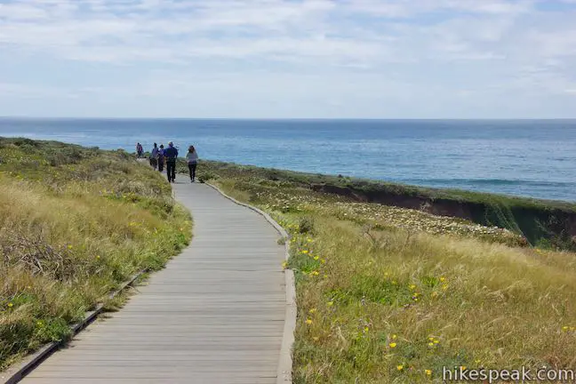
The Bluff Trail crosses twenty to forty-foot tall cliffs between two ends of Windsor Boulevard. You can start the hike from the north or south end, but the northern trailhead is the simplest for non-residents to reach, so you might as well set out from there. Enter the park and turn right up the boardwalk of the Bluff Trail. Marine Terrace Trail, which is a wide dirt road, is to the left. A sign at the start of the Bluff Trail summarizes the park’s history. The name Fiscalini comes from the family that owned a ranch on this land starting in the 1850s. The land was only recently set aside for public use, as the sign explains:
The ranch changed hands and was renamed East West Ranch in 1993. Plans were made to build houses here. Friends of the RanchLand, a local citizen’s group, worked with the American Land Conservancy to raise money to buy the land for public use. In 2001, the Fiscalini Ranch Preserve was permanently protected as public open space…
You won’t have to walk very far in the park to realize how fortunate it was that this land was saved. Near the start, there are views over Abalone Cove to the north. Look farther up the coast toward Big Sur, where the Santa Lucia Mountains rise above the Pacific Ocean. The houses on the opposite side of the cove disappear from view as you continue down the trail.
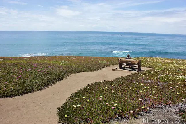
At around 250 yards from the start, a path on the right descends to a bench on the edge of the bluff surrounded by ice plant (sea figs) and other low ground cover. There are lots of benches along the Bluff Trail. Most are right along the trail, while others are set back a short distance. Proceed over a footbridge to come to another interesting bench, 0.2 miles from the start. Each bench along the trail is different, constructed with driftwood by local artists to add charming features along trail (that facilitate enjoying the Bluff Trail’s main attraction – the spectacular ocean views).
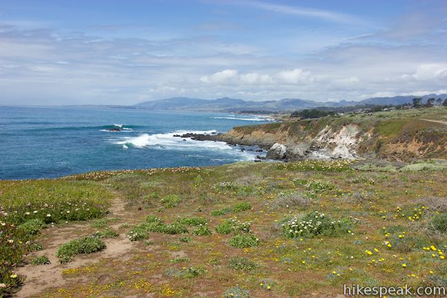
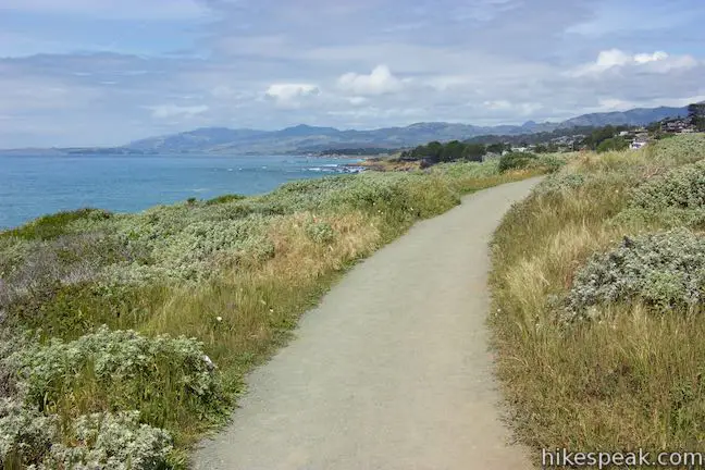
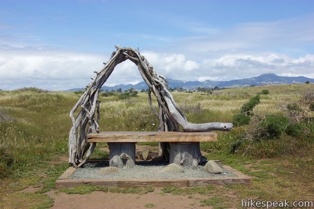
The Bluff Trail meanders south, rolling over grassy terrain that runs along the rocky bluffs. Snag views of steep sea cliffs and glance up and down the Pacific Ocean coast. After a gorgeous stroll of 0.45 miles, the Bluff Trail passes the most impressive bench in the park. Interwoven branches of driftwood arch over the seat like a rustic wedding arbor. Sit here for south-facing view down the coast. This is also a good place to spot some of the animals in Fiscalini Ranch Preserve. Coastal birds chirp from the short brush while round squirrels stand in the grass like prairie dogs and chew on California poppies and other growth.
Proceed down the Bluff Trail past a couple more inviting benches. At the final bench, at a bend in the coastline, 0.7 miles from the start of the Bluff Trail, look south over Otter Cove and the neighborhood beyond the park. During the whale migration, this would be an excellent place to spot whales passing close to the coast. Maybe you’ll get lucky and see an otter too.
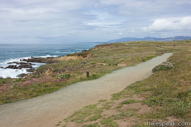
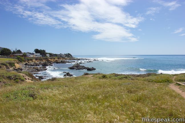
Take the Bluff Trail around the back of Otter Cover past a footpath down to the cobblestone beach. At 0.95 miles from the start, the Bluff Trail comes to an end at the edge of the neighborhood, presenting hikers with a choice. Venture back along the Bluff Trail to see all the great coastal sights a second time (for a 1.9-mile round trip hike with 50 feet of elevation change) or head a tenth of a mile inland to Marine Terrace Trail, which provides a parallel, but less scenic route back to the start for a slightly shorter 1.85-mile loop with 80 feet of elevation change.
To continue onto Marine Terrace Trail, you’ll need to briefly exit from the park. Walk out along South Windsor Boulevard from the end of the Bluff Trail. At the first intersection, turn left up Wedgewood Street. Walk a tenth of a mile and turn left at the next intersection onto Marlborough Lane. Walk past a few houses to find the start of Marine Terrace Trail (also known as Marlborough Trail). This wide dirt road is open to bikes (unlike the Bluff Trail) and is a popular route for joggers. Despite its proximity, the views from Marine Terrace Trail are quite different from the Bluff Trail. You won’t see as much of the ocean or the vibrant flowers that appeared along the bluffs. Marine Terrace Trail passes between grassy hills. Monterey pines line the tall hillside to the right on the inland side of Fiscalini Ranch Preserve.
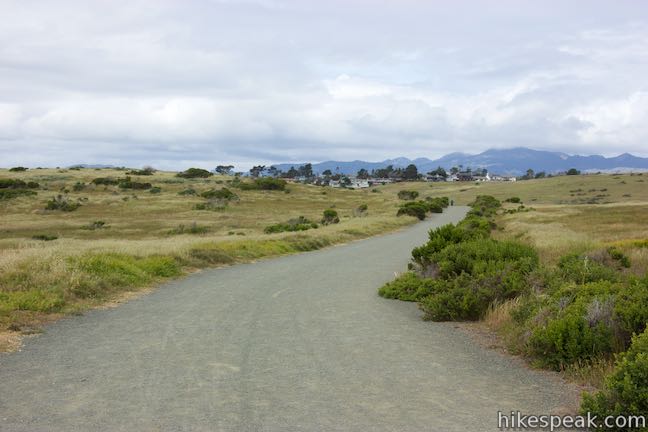
Stick with Marine Terrace Trail for 3/4 of a mile to complete the loop and return to the start by the north end of the Bluff Trail. No fee or permit is required to hike in Fiscalini Ranch Preserve. Dogs are allowed on the Bluff Trail and Marine Terrace Trail. Bikes are allowed on Marine Terrace Trail but not on the Bluff Trail. Thanks to improvements funded by the California Coastal Conservancy in 2006, the Bluff Trail is wheelchair-friendly and in excellent shape for a casual stroll. For another ocean-view hike just to the north, check out Moonstone Beach Boardwalk. To visit a second great San Luis Obispo County trail with the same name, hike the Bluff Trail in Montaña de Oro State Park.
To get to the trailhead: From San Luis Obispo, drive 34.2 miles north up Highway One to Cambria. Turn left at the traffic light onto Windsor Boulevard. Pass Moonstone Beach Drive and make a sharp left turn next to Shamel Community Park to go 1.1 miles to the end of Windsor Boulevard. Park along the street or in one of the few spots at the end of the road by the entrance to Fiscalini Ranch Preserve.
Trailhead address: 4600 Windsor Boulevard, Cambria, CA 93428
Trailhead coordinates: 35.55613, -121.1024 (35° 33′ 22.06″N 121° 06′ 08.64″W)
You may also view a regional map of surrounding Central Coast trails and campgrounds.
 | Moonstone Beach Boardwalk This 2.85-mile out and back hike crosses a boardwalk along a charming Cambria beach in Hearst San Simeon State Park. |
 | Headlands Trail This gradual 4.5-mile lollipop loop in Harmony Headlands State Park crosses a coastal valley to reach picturesque ocean bluffs on the rugged coast between Cayucos and Cambria. |
 | Piedras Blancas This 3.2-mile out-and-back hike ventures up the coast from the Piedras Blancas Elephant Seal Rookery to Piedras Blancas Light Station. Additional boardwalks at the rookery can be used to add another mile of hiking. |
 | Morro Rock via Morro Strand Trail This level one to 3.5-mile round trip hike starts from Cloisters Park and crosses Morro Strand State Beach to reach Morro Rock. |
 | Pacific Valley Bluff Trail This short out and back hike extends from Highway One to an ocean bluff with fantastic views of the Big Sur Coast. |
 | Jade Cove and Plaskett Rock Point This 1.5-mile hike along an ocean bluff visits a prominent peninsula and a small cove. |
 | More Central Coast Hikes Explore other destinations along the California coast between Ventura and Monterey, including trails in San Luis Obispo County. |


Are dogs allowed off leash on any of the trails?
Are dogs allowed- on or off leash- on this trail??
Dogs are allowed, but must be leashed
How high are the cliffs between the houses on the north side where the first bench is? It looked like 100′ from the first bench down to the beach? We were in Cambria for 9 days and love The Ranch.
[…] and see the tide pools at low tide. For a mellow hike along the sea, you can also wander the Bluff Trail in Fiscalini Ranch Preserve (a 434-acre preserve in the middle of […]
Is the trailhead RV accessible?