Limekiln State Park is located in Big Sur about halfway between Monterey and Morro Bay. The 716-acre park has one entrance along Highway One where you will find a 29-site campground. Some sites are nestled in a shaded redwood grove along Limekiln Creek while others are exposed to more sun and ocean views at the bottom of Limekiln Canyon. Campers have access to a small beach and nice short hiking trails up Limekiln Canyon to Hare Creek, Limekiln Falls, and historic lime kilns.

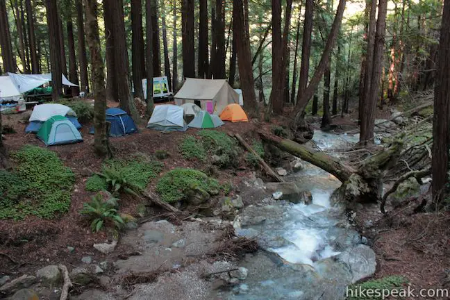
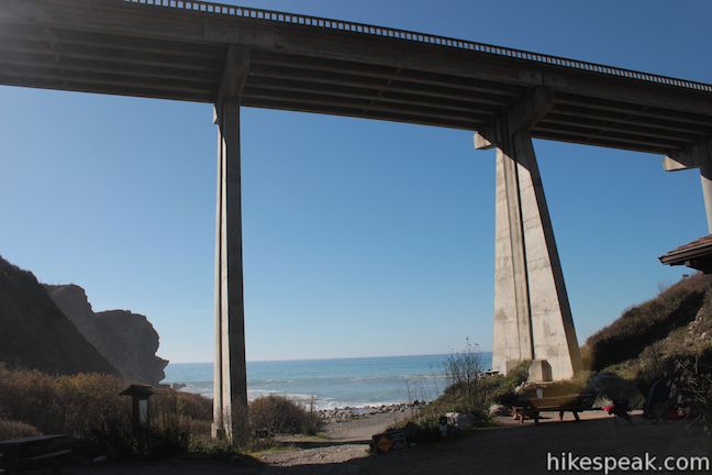
The campground in Limekiln State Park is split into two areas. The Redwood Campsites are located on the inland side of the campground, at the start of the trails up Limekiln Canyon. These seventeen campsites (sites 13 – 29) are spread along Limekiln Creek in a grove of fragrant redwood trees. The Ocean Campsites are located on the coastal side of the campground, across a bridge over Limekiln Creek. These twelve sites (sites 1 – 12) offer the quickest beach access and also have some ocean views. Sites one and two are perched up above the others for better views of the Pacific Ocean. Between the campsites and the beach, Highway One crosses overhead, spanning the canyon on a long concrete bridge. You’re sure to hear more traffic in the Ocean Campsites than back within the redwoods, but the sound of the surf combats that quite well.


The 29 standard non-powered sites at Limekiln State Park can be reserved in advance by calling 800-444-7275 or online at reservecalifornia.com. Each campsite is $35 per night. Sites can accommodate up to 8 people and are best suited for tents. RVs up to 24 feet long are only allowed in the Ocean Sites. Additionally, many of the other sites have room for just one vehicle. The two-car tent sites are 17 – 21 and 26 – 29.
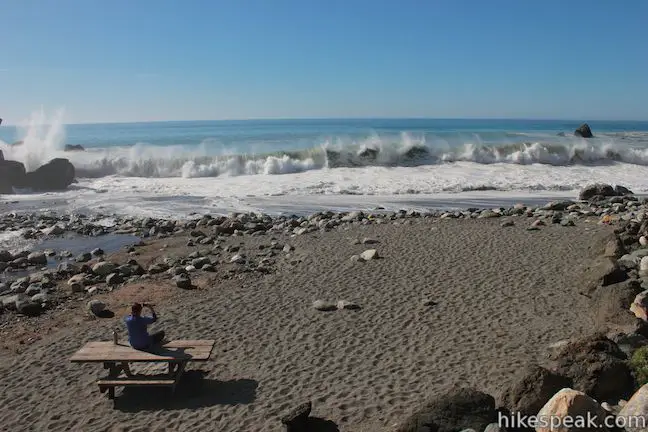
Each campsite has a fire ring and a picnic table. Campfires are allowed in the fire rings (you can also use camp stoves). Wood gathering is prohibited, but you can buy firewood from the campground host. The campground has flush toilets and showers, and drinking water is available. Check in time is 2 p.m. Check out time is noon. Dogs are allowed in the campground on leashes, but are not allowed out of the campground on park trails. There are a few picnic tables by the rough sand beach at the bottom of the canyon. This doesn’t look like a safe place to swim through. Waves smashing on the surrounding rocks can put on impressive displays of force.

Once you have paid to camp at Limekiln State Park, you should be able to enter other California State Park for no additional fee on the days that you are camping (like nearby Julia Pfeiffer Burns State Park and Pfeiffer Big Sur State Park). Limekiln State Park Campground is maintained and operated by Parks Management Company through a concession with California State Parks.
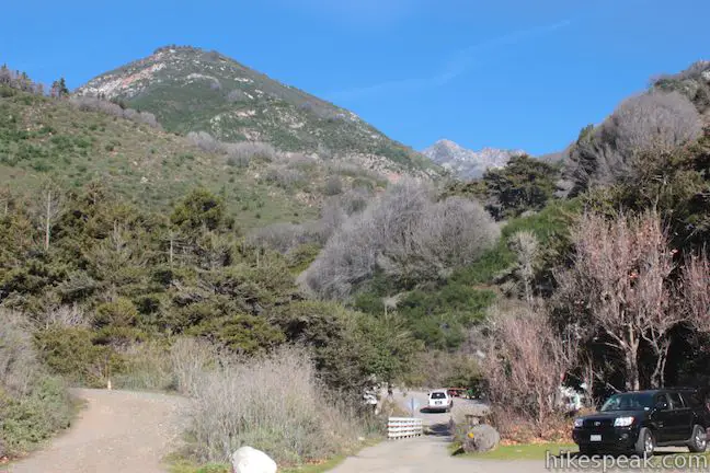
To get to the campground: From the south, drive up Highway One to the Limekiln State Park entrance, located on the east side of the road, 22.5 miles north of Ragged Point Inn (or 45 miles north of Cambria). From the north, drive 15 miles south from Julia Pfeiffer Burns State Park (home of McWay Falls). Just south of the bridge over Limekiln Canyon, turn down the park entrance road on the inland side of Highway One. Past the entrance booth, turn left to reach the Ocean Campsites or turn right to reach the Redwood Campsites.
Campground address: Highway 1, Big Sur, CA 93920
Campground coordinates: 36.010022, -121.518247 (36° 0′ 36.08″N 121° 31′ 5.69″W)
Use the map below to view the campground and get directions:
Or view Central Coast trails and campgrounds in a larger map
 | Hare Creek Trail, Limekiln Trail, and Falls Trail This 2.65-mile hike in Limekiln State Park explores a trio of trails along lovely streams in redwood-lined canyons, reaching Limekiln Falls and historic lime kilns. |
 | Pacific Valley Bluff Trail This short out and back hike extends from Highway One to an ocean bluff with fantastic views of the Big Sur Coast. |
 | Sand Dollar Beach This short hike to Big Sur’s longest beach passes two scenic overlooks on the way to the sand for a hike of 0.5 miles (or more) round trip. |
 | Jade Cove and Plaskett Rock Point This 1.5-mile hike along an ocean bluff visits a prominent peninsula and a small cove. |
 | McWay Falls This 0.6-mile hike looks out on a stunning Big Sur waterfall that pours 80 feet right on to the beach. |
 | Canyon Falls This 0.9-mile hike heads inland up McWay Creek past a picnic area in a redwood grove to a lovely little waterfall. |
 | Partington Cove This 1.5 mile hike visits a cove and a secluded beach along the scenic Big Sur coast. The cove is accessed through a tunnel. |
 | Salmon Creek Falls This short hike visits a fine 120-foot waterfall near the start of Salmon Creek Trail. |
 | Buckeye Trail This hike of 6.5 miles or more reaches incredibly ocean vistas and trail camps in the Silver Peak Wilderness. Connect Cruickshank Trail and Buckeye Trail for an excellent shuttle hike of 8.25 miles or more. |
 | Cruickshank Trail This hike into Silver Peak Wilderness starts with bold ocean views and crosses redwood groves to reach Upper Cruickshank Camp at a junction with Buckeye Trail, 5 miles round trip from Highway One. |
 | Pfeiffer Beach This short walk reaches an absolutely stunning beach that’s a classic feature of the Big Sur landscape. |
 | Big Sur River Gorge This half-mile off-trail hike ventures up the Big Sur River on a water-wading boulder-hopping adventure to a crystal clear pool that’s a gorgeous Big Sur swimming hole. |
 | Pfeiffer Falls and Valley View This 2.4-mile hike is like two hikes in one, reaching a waterfall in a canyon of redwoods and a vista point overlooking the Big Sur River Valley. |
 | Nature Trail – River Path Loop This easy 0.55-mile loop explores woodlands along the Big Sur River and a redwood grove that includes the unique and impressive Proboscis Tree. The loop can be combined with the trail to Pfeiffer Falls and Valley View for a 3-mile trek. |
 | Ridge Trail – Panorama Trail – Bluff Trail Loop This 8.7-mile loop in Andrew Molera State Park crosses a coastal ridge, bluff, and beach that are packed with amazing Big Sur views. |
 | More Central Coast Hikes Explore other destinations along the California coast between Ventura and Monterey, including trails in Los Padres National Forest. |
 | Kirk Creek Campground This outstanding 33-site campground in Los Padres National Forest has enormous ocean views from a bluff along the Big Sur coast. |
 | Plaskett Creek Campground This 45-site campground in Los Padres National Forest is positioned across Highway One from Sand Dollar Beach and Plaskett Rock Point on the coast of Big Sur. |
 | Pfieffer Big Sur State Park Campground This large campground in the heart of Big Sur is spread out through oak and redwood groves along the Big Sur River. |
 | Andrew Molera State Park Trail Camp This trail camp is easy to reach (just a short walk in) with campsites in a meadow along the Big Sur River near Molera Beach. |
The campground map and regulations handout for Limekiln State Park
Limekiln State Park Campground on campone.com (the campground operators)
Limekiln State Park Campground on hipcamp.com
Limekiln State Park Campground on campsitephotos.com
Limekiln State Park on wikipedia.org


Hello, im driving up tomorrow and I’m in campsite 15. If I have guests coming where can they park since it’s a one car per site?