Panoramic Overlook Trail
in Anza-Borrego Desert State Park

Grab your hiking boots and your camera for this short hike to 360-degree views. Panoramic Overlook Trail is a vista-filled one-mile out and back hike with 275 feet of elevation gain. The brief steep effort is rewarded by sweeping views over Borrego Valley from a ridge flanking Borrego Palm Canyon at the base of San Ysidro Mountains, the towering western boundary of Anza-Borrego Desert State Park.
Start from Borrego Palm Canyon Campground near the park visitor center in Borrego Springs. The campground is also the start of the popular hike up Borrego Palm Canyon Trail to a palm tree oasis in the canyon west of the campground. Our destination is a landing on the ridge south of the canyon.
Near site 71, find a trailhead for two trails. Visitor Center Trail heads straight south for 0.6 flat miles to the park visitor center (which can be used as an alternate trailhead for those willing to hike farther to avoid playing the $10 day use fee for Borrego Palm Canyon Campground). To the right of Visitor Center Trail is Panoramic Overlook Trail, which angles southwest toward the ridge.
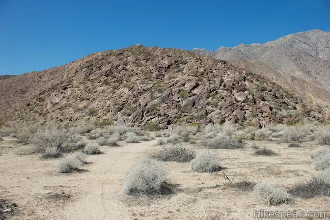
Hike across Panoramic Overlook Trail for 0.2 miles of flat open desert to the base of the ridge. A second sign is posted at this point where the trail turns up.
Note: There actually seem to be two paths for the level first leg of the hike. One goes straight to the base of the ridge, while another aims to the west, to far to the right. If you go this way by mistake (it’s easy to do), turn left when you hit a jeep road that runs along the bottom of the ridge and walk a tenth of a mile south to the sign at the beginning of the ascent.
Once Panoramic Overlook Trail begins to climb, you are in for an earnest effort, gaining about 265 feet in a quarter mile. The rocky single track switches up the end of the ridge. A tenth of a into the climb, you can take a spur path to the right out to a landing that has an already-panoramic view over Borrego Palm Canyon Campground and the Borrego Valley.
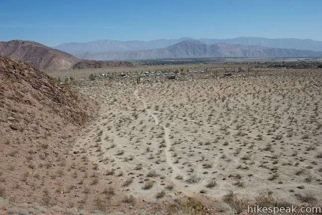
Continuing up the trail you will switch back and forth between views over Borrego Palm Canyon on the north side of the ridge and a smaller canyon to the south. Both canyons have steep walls dropping down to alluvial fans.
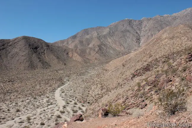
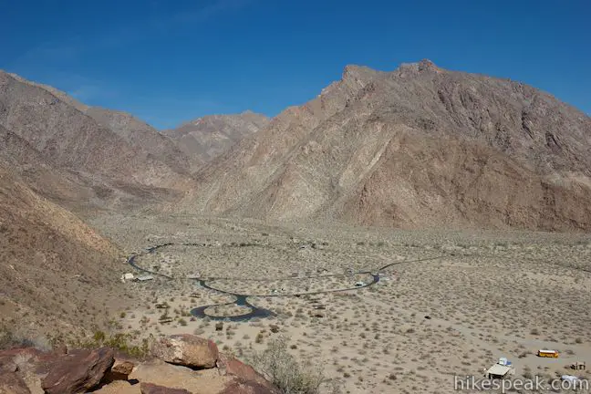
At the top of the trail, you will reach a round bump on the ridge with 360-degree view. The peaks surrounding the 6,147-foot summit of San Ysidro Mountain loom large to the west, about 5,000 feet above Panoramic Overlook (and truly bold hikers can make an off trail ascent into the mountains from here). The ridge drops dramatically to the north for an overview of Borrego Palm Canyon Campground in Borrego Palm Canyon. To the east is the wide flat expanse of Borrego Valley, which contains the city of Borrego Springs at the heart of Anza-Borrego Desert State Park. You can see the Borrego Badlands around Font’s Point across Borrego Valley.
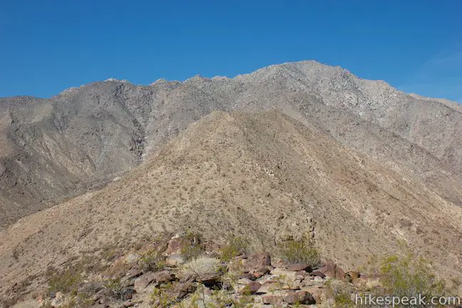
When you have had your panoramic experience at the top, hike back the way you came. You will be down in no time! If you’ve got extra energy, make the 3.25-mile round trip hike up Borrego Palm Canyon Trail and take a break in an oasis of California fan palms.
Bikes and dogs are not allowed. Borrego Palm Canyon Campground has a $10 day use entrance fee (as of March, 3012), which required to park at the trailhead. No permit is required for this hike. Panoramic Overlook Trail should not be overlooked!
To get to the trailhead: From Christmas Circle in Borrego Springs, drive 1.5 miles west on Palm Canyon Drive to an unmarked service road just past Route S22, and 0.2 miles before the park visitor center. Turn north and drive one mile to the entrance of Borrego Palm Canyon Campground. Inside the campground, make the first left into a campground loop where you will find a trailhead parking area near campsite 71 at the far southwest side of the loop.
Trailhead address: Borrego Palm Canyon Campground, Anza-Borrego Desert State Park, Borrego Springs, CA 92004
Trailhead coordinates: 33.267663, -116.409476 (33° 16′ 03.58″N 116° 24′ 34.11″W)
You may also view a regional map of surrounding California Desert trails and campgrounds.
 | Borrego Palm Canyon Trail This 3.25-mile loop visits a popular palm tree oasis in a canyon west of Borrego Springs. |
 | Hellhole Canyon Trail to Maidenhair Falls This 5.5-mile hike visits a 20-foot waterfall in a canyon near Borrego Springs, making it the perfect place to cool off on a hot day in the California Desert. |
 | Culp Valley Loop This 2.2-mile loop visits Culp Valley Overlook and Pena Springs, delivering views of the San Ysidro Mountains and Borrego Valley along the way. |
 | Calcite Mine Trail This 4.25-mile trek climbs 600 feet to a historic mine site, exploring exciting narrows along the way. |
 | Kenyon Overlook Trail This 1.15-mile loop sets out from Yaqui Pass to reach an incredible viewpoint across Mescal Bajada. |
 | The Slot This short hike descends through a narrow canyon beneath a natural rock span that is among the most photographed landmarks in Anza-Borrego Desert State Park. |
 | Hikes in the California Desert Explore more trails in Death Valley National Park, Joshua Tree National Park, Anza-Borrego Desert State Park, and Mojave National Preserve. |
 | Anza-Borrego Desert Campgrounds There are four developed campgrounds, eight primitive campgrounds, and extensive roadside camping to accommodate your visit to California's largest state park. |
 | Anza-Borrego Desert State Park Wildflowers The desert bloom brings bursts of color to barrel cactus, beavertail cactus, ocotillo, and more. |


Are there any campsites open for April 20-22. Tent camping.