Hikes in New York
The Empire State offers a kingdom of trails for hikers and mountain bikers. Even in Manhattan, there is hiking on the High Line Trail. Above the Catskills and the Finger Lakes, the state’s premier hiking region is the Adirondack Mountains. New York State’s Adirondack Park preserves over six million acres of forests, lakes, mountains, and streams on private and public land. Adirondack Park is the largest state-protected park in the United States, making New York a great state for hikers!

Hiking New York
| Trail | Description | Distance | Location |
|---|---|---|---|
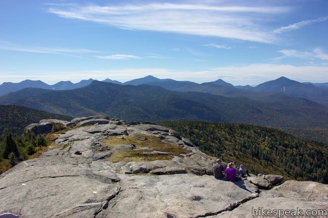
 070 070 | Cascade Mountain & Porter Mountain This hike bags a pair of High Peaks near Lake Placid with excellent views over the Adirondack Mountains. | 6.2 miles 1925 feet | 44.2189, -73.8876 |
 100 100 | Buttermilk Falls This short out and back hike visits a pleasant waterfall on the Raquette River near Long Lake. | 0.5 miles 25 feet | 43.913998, -74.483024 |
 150 150 | Grassy Pond This out and back hike crosses level terrain to a peaceful pond, and the hike can be extended to 6 miles by hiking to the end of the trail and Wilson Pond. | 1 mile 75 feet | 43.843208, -74.477043 |
 200 200 | Rock Lake This out-and-back hike visits a backcountry lake in the Adirondack Mountains near Blue Mountain. | 1.6 miles 100 feet | 43.821051, -74.347897 |
 250 250 | Sawyer Mountain This out and back hike ascends to a summit with panoramic viewpoints overlooking the surrounding Adirondack peaks and valleys. | 2.5 miles 650 feet | 43.810842, -74.321284 |
 400 400 | Southern Exposure Snowshoe Trail This snowshoe trail loops south through a winter wonderland from the visitor center at Beaver Lake Nature Center (where you can rent snowshoes). | 2.2 miles 50 feet | 43.180415, -76.402519 |
 400 400 | Green Lake & Round Lake This loop explores a pair of aquamarine glacial lakes in Green Lakes State Park in Central New York. | 3.25 miles 25 feet | 43.058018, -75.964424 |
 420 420 | Cliff Trail – Long Trail – Mildred Faust Trail Loop This loop crosses limestone cliffs above a glacial lake and combines several trails to explore Clark Reservation State Park. | 1.95 miles 150 feet | 42.995036, -76.094169 |
 500 500 | Labrador Hollow Boardwalk This 0.5-mile boardwalk loop takes your through evergreens and wetlands to the shore of Labrador Pond in the heart of Labrador Hollow Unique Area. | 0.5 miles 10 feet | 42.792531, -76.052256 |
 540 540 | Tinker Falls This gradual 0.5-mile hike follows Tinker Falls Creek to the base of a lovely 50-foot waterfall. A trail to the top of Tinker Falls can be added to create a 1.3-mile trek in Labrador Hollow Unique Area. | 0.5 - 1.3 miles 50 - 200 feet | 42.780094, -76.03589 |
 550 550 | Hang Glider Launch Site This out and back hike, which can be extended to 3.2 miles when combined with the trails to Tinker Falls, ascends Jones Hill on North County National Scenic Trail to an overlook in Labrador Hollow Unique Area. | 2.5 miles 650 feet | 42.780094, -76.03589 |
 700 700 | Forest Loop Trail This loop in Binghamton University Nature Preserve goes up a wooded hillside, slipping between oaks and pines. | 1.15 miles 255 feet | 42.0848, -75.9728 |
 703 703 | Pond Trail and Marsh Trail Loop This double loop in Binghamton University Nature Preserve combines major trails with other easy hiking track to explore ponds, wetlands, and forests at the center of the preserve. | 2.6 miles 90 feet | 42.0848, -75.9728 |
 706 706 | Ravine Trail, Vernal Pool Trail, and Oak Trail Loop This loop in Binghamton University Nature Preserve links three trails that branch off Pond Trail to see less-visited parts of the preserve. | 1.15 miles 200 feet | 42.0781, -75.9592 |
 900 900 | High Line Trail This elevated stroll explores a one-of-a-kind park built on a historic rail line on the lower west side of Manhattan that has gardens, artwork, seating, and lofty city views. | 3 miles 40 feet | 40.7395, -74.0082 |
View New York trails and campgrounds in a larger map
hikespeak


